(WAVY) — A coastal low is expected to bring high winds and flooding from the Outer Banks to locations on the Peninsula and Eastern Shore, with coastal flood warnings and advisories going into effect throughout the region, according to the National Weather Service.
A coastal flood warning is in effect for Hatteras Island, meaning two-to-three feet of inundation above ground level expected in low-lying areas near shorelines and tidal waterways. The warning is is effect from 10 p.m. Monday evening through 8 p.m. Wednesday. A high surf advisory will also be in effect from 10 p.m. Monday through 2 a.m. Thursday.
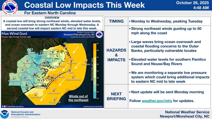
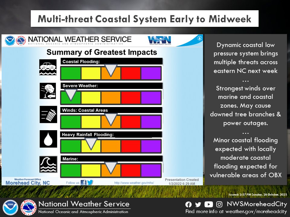
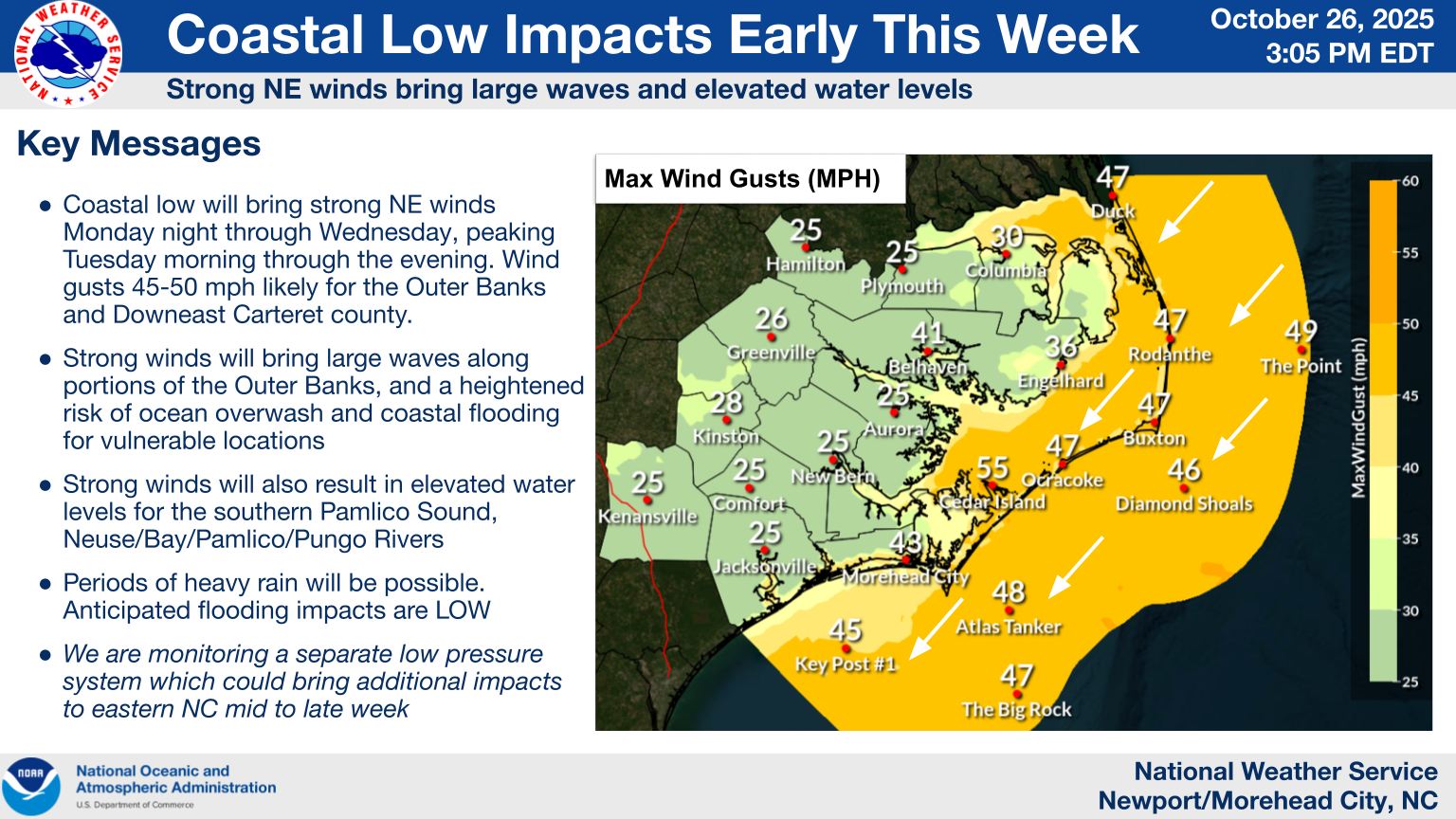
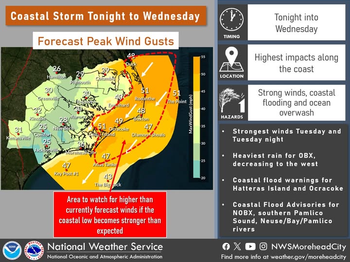
The National Weather Service’s Morehead City office said numerous roads may be closed, and low-lying property — including homes, businesses and some critical infrastructure will be inundated, and some shoreline erosion will take place. It said there would be dangerous swimming and surfing conditons, along with localized beach erosion.
It also said there would be gale-force northeastern winds and a powerful long period swell would begin to impact Hatteras Island later Monday night. It said portions of NC 12 may be inaccessible at times, especially around high tide.
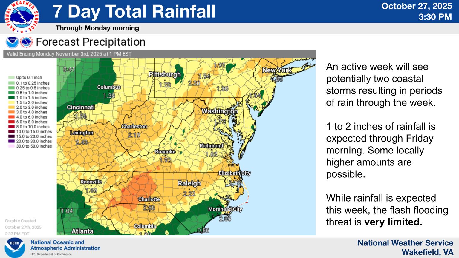
A coastal low is expected to develop along the southeastern U.S. coastline Monday into Tuesday and could bring periods of heavy rain. It’s possible a second low pressure system could bring more impacts in the middle to the latter part of the week.
Cape Hatteras National Seashore issued a warning to visitors for expected hazardous weather conditions. They also reminded visitors of the threat to oceanfront structures collapsing in Rodanthe and Buxton.
With the impending storm, Dare County Schools announced Tuesday would be a remote learning day. Nags Head Police closed beach driving Monday at sunset due to the impending storm, and said it would monitor weather and beach conditions, and it would advise when beach driving would be back open.
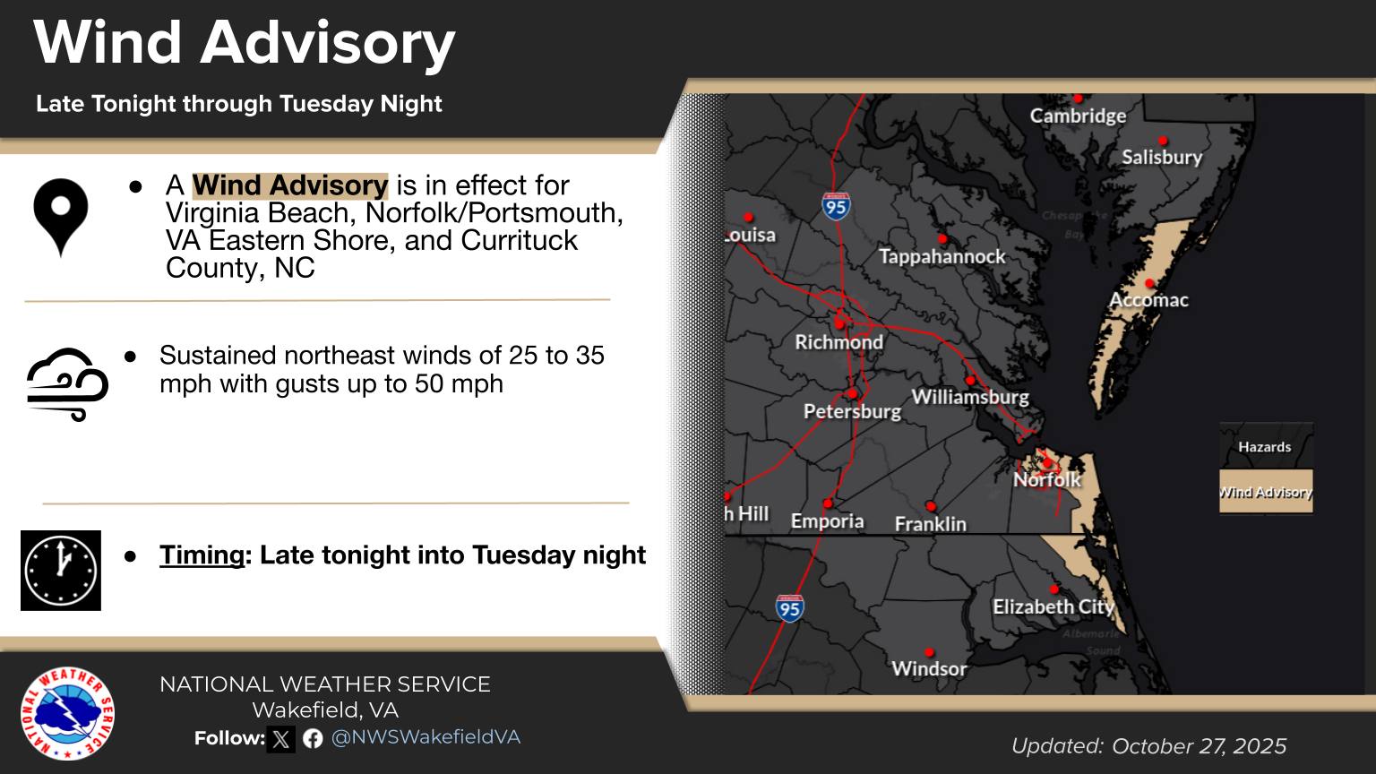
For northern parts of the Outer Banks and in southeastern Virginia, coastal flood, high surf and wind advisories are in effect beginning at 10 p.m. Monday evening. The coastal flood advisory is in effect through 8 p.m. Wednedsay, while the high surf advisory is in effect through 2 a.m. Thursday and the wind advisory is in effect through 11 p.m. Tuesday.

A coastal flood warning will also be in effect for locations on the Peninsula, including Charles City, Surry, James City and Isle of Wight counties, as well as Newport News from 1 p.m. until 7 p.m. Tuesday, according to the National Weather Service’s Wakefield office.
It said widespread flooding of vulnerable areas would result in an elecated threat of property damage to homes and businesses near the waterfront and shoreline, with water one-to-two feet above ground level in some areas enough to close roads and threaten homes and businesses. It said flooding would extend inland from the waterfront along tidal rivers and bays, resulting in some road closures and flooding of vehicles.
Coastal flood, high surf and wind advisories will also be in effect beginning late Monday night and early Tuesday morning for other areas of the Hampton Roads region. The coastal flood advisory will stay in effect through 7 p.m. Tuesday, and the high surf advisory will stay in effect through 7 p.m. Wednesday, and the wind advisory staying in effect through midnight Wednesday.
In Norfolk, the city sent out an alert saying tidal flooding of flood-prone areas is expected Tuesday through Thursday during high tide cycles. The city is opening the York Street Garage at 215 W. York St. at noon Tuesday through 8 a.m. Thursday for people who want to move their vehicles from low-lying areas. The city advises people to use the Waze app to avoid flooded roads when driving.
The storm impacting our region is separate from Hurricane Melissa, which is expected to strike Jamaica as a Category 5 hurricane.


