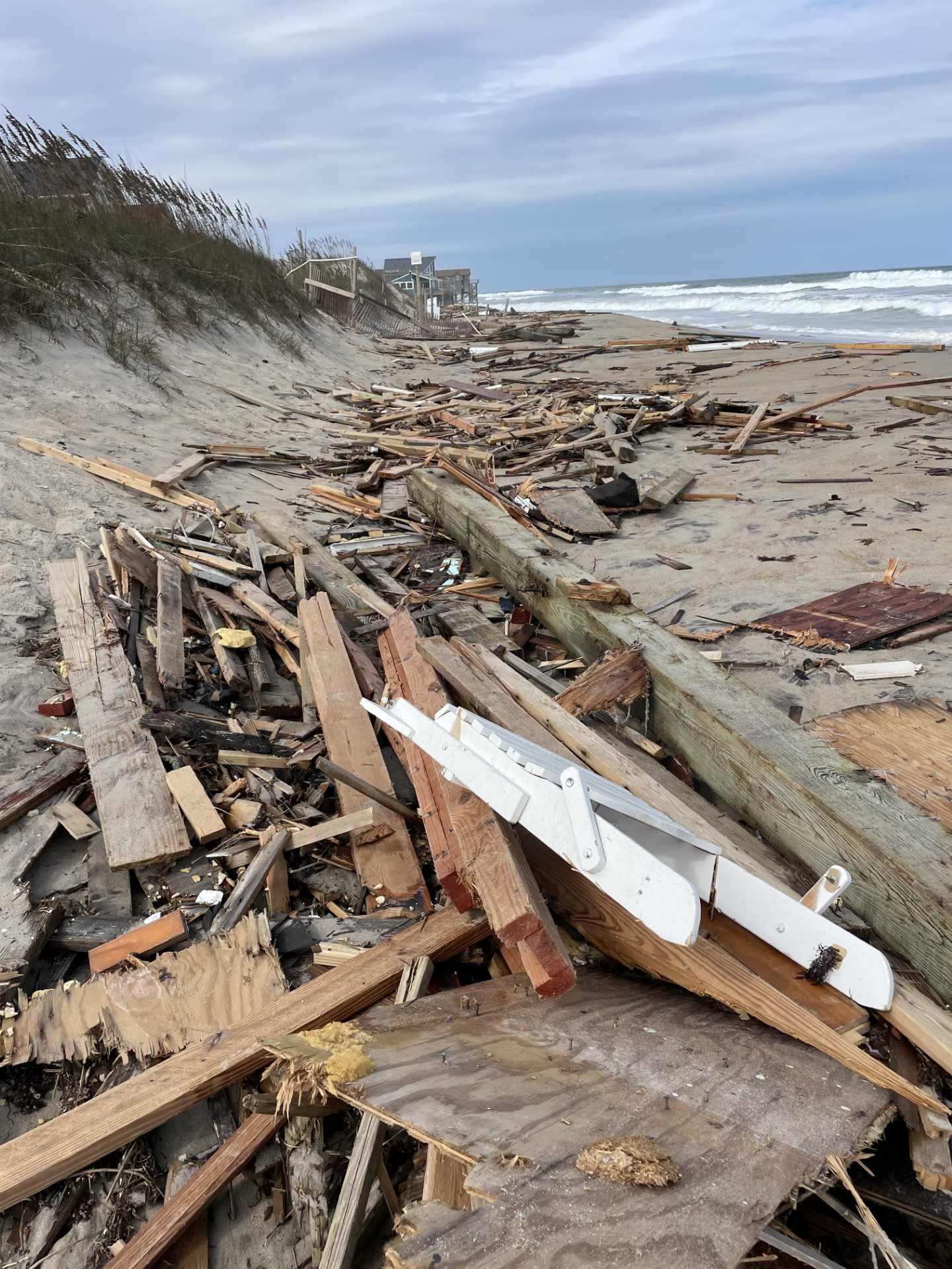
Wind Advisory in effect for most coastal areas until midnight. Especially for the Outer Banks of North Carolina. Wind gusts up to 50mph will be possible for a time.
Today: Cloudy with on and off rain showers. Isolated heavy showers. Cool and windy. Highs will be in the upper 50s to near 60. Winds NE 15-20mph with gusts to 40mph. A few higher gusts near the shore.
Tonight: Cloudy with rain showers. Tapering off late. Lows will be in the low-mid 50s. Winds NE 10-20mph with gusts to 30mph.
Wednesday: Mostly cloudy. Scattered rain showers. Highs will be in the low-mid 60s. Winds NE 10-15mph with gusts to 25mph.
Today we have high pressure to the north with an area of low pressure to our south/southeast (offshore). The low will stay offshore today, but it will get close enough to create a lot of rain. the combination of the low and the high will create strong northeast winds. Gusts will be between 35-40mph in the metro. They will be up to 45mph near the shore. Possibly up to 50mph over the Outer Banks. We’ll have on and off rain showers through the day. There may be some isolated heavy showers. There will also be some minor to near moderate tidal flooding this afternoon between about 1 and 3pm. Poor drainage will be an issue. There may also be some brief ocean overwash along the Outer Banks. By tomorrow the low will push out so sea, but some leftover moisture behind it will create some scattered rain showers. There will still be some breezy northeast winds. That will create a little more minor tidal flooding. On Thursday another area of low pressure will sweep through from the west. We will have more rain, and it could be briefly heavy. Then drier air and a cold front will sweep through before Friday. Friday will be dry, cool, and breezy.
Hurricane Melissa is a major hurricane just south of Jamaica. It is forecast to move over the island as a category 5 hurricane this morning. Unfortunately, this will devastate parts of the island. After impacting Jamaica, it will move over eastern Cuba though slightly weaker. It will then move over parts of the Bahamas and then move northeast. It will stay east of the U.S., but it could impact Bermuda as a weaker hurricane. Stay tuned for updates.


