NORFOLK, Va. (WAVY) — A former councilwoman has launched an app that she hopes can eventually revolutionize how the nation deals with a continual complaint: blocked railroad crossings.
Thursday, Andria McClellan launched Oculus Rail, a digital app aimed at helping drivers dodge the delays caused by trains crossing roadways. Oculus Rail allows a driver to see the real-time status of 40 railroad crossings across the Southside cities of Norfolk, Chesapeake, Portsmouth, and Suffolk.
Using AI-technology, sensors can detect how long the train has actually been crossing a particular roadway, as well as the average time it takes a train to cross a particular location.
While the service is free to drivers, local governments as well as railroad companies themselves can pay to see data from the crossings overtime.
Founder and CEO Andria McClellan hopes the new technology allows drivers to adjust their behavior so they can get where they need to go, while allowing railroads to take the data and evaluate how they might be better partners with their communities.
“The fact that nobody has solved for this problem yet is mind boggling,” McClellan said. “So this is an opportunity with Oculus Rail to be the partner with the municipalities, to be the partner with the railroads, to be the partner with our departments of transportation to solve this.”
McClellan, 55, served on Norfolk City Council from 2016-2024 and said she heard frequently from constituents who were frustrated with trains lengthening their commutes, blocking in their neighborhoods and at times, increasing how long it takes emergency vehicles to respond.
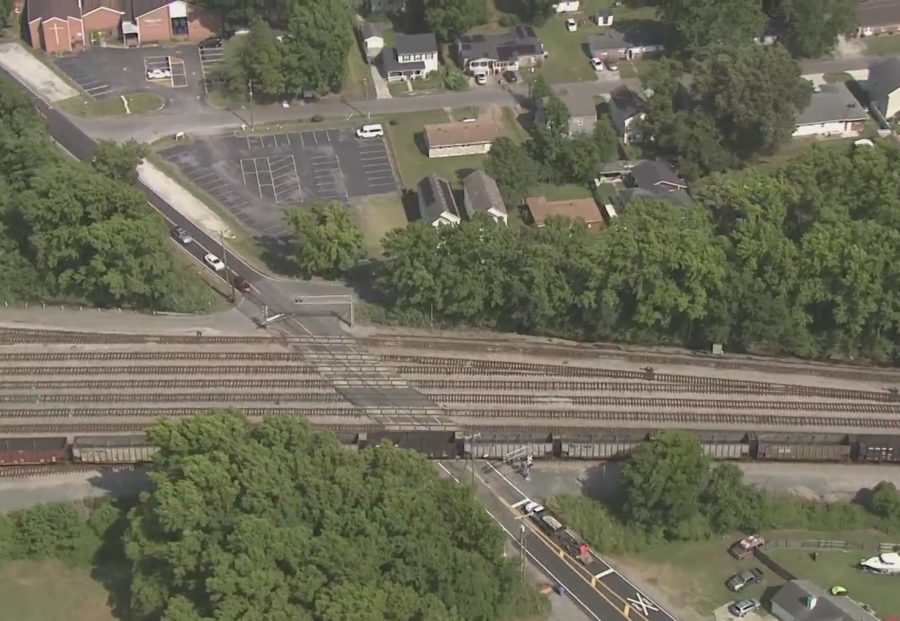
Norfolk led the state in 2024 with more than 1,000 reports of blocked-crossings, according to the Federal Railroad Administration’s Blocked Crossing Indicator. Norfolk leads the region with 73 at-grade rail crossings within its less than 100 square miles, with the Port of Virginia and Norfolk Southern’s Lamberts Point Coal Pier 6 being major customers of freight.
In recent years, changes in the railroad industry have led to longer trains that either take longer to cross streets or stand over the roadway as length prevents them from clearing the crossing during switching operations.
There are more than 212,000 at-grade railroad crossings in the United States, according to the United States Department of Transportation. In 2024, there were nearly 26,000 reports of stopped trains impeding the flow of vehicles and pedestrians alike at railroad tracks for extended periods of time.
Viral videos have shown daring individuals, including children, climbing over stopped trains to reach their destination.
While states have tried to implement laws regulating the amount of time a crossing can be blocked, fining railroads under state law has proved difficult. Courts have ruled exclusive jurisdiction over the speed and movement of trains is left to the federal government.
McClellan knew all of this well. Aside from her role on City Council and various regional boards, she married into a railroad family. Her husband Mike McClellan, who currently serves as Norfolk Southern’s senior vice president and chief strategy officer, has been her “top advisor.”
She said it became clear to her that even the Class I railroads themselves didn’t have a firm grasp on blocked crossing data. The FRA’s tool is strictly based on self-reported accounts.
“I started looking for technology options elsewhere and didn’t find a whole lot there and decided to figure out how we could do this on our own,” McClellan said. “In Norfolk, we already had sensors in place to address flooding and [I] thought, ‘OK, well, that’s going to be similar to addressing block crossings.'”
After forming the company last year, McClellan partnered with Portsmouth-based Port Solution Integrators to design the technology to make Oculus Rail work.
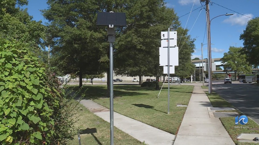
The team designed and built solar-powered, wireless sensors that sit atop 10-foot poles near the crossings local governments wanted monitored, according to McClellan.
“We own the the sensors, we install the sensors, we maintain the sensor,” McClellan said. “So there’s no capital cost to the municipality,” McClellan said.
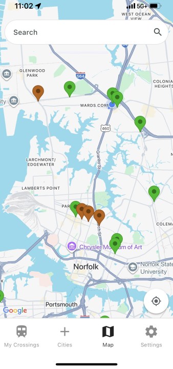
When trains begin to cross the road, the map on the app goes turns color from green to orange to indicate the crossing is now blocked. Once the train clears, the crossing indicator on the app will turn back to green.
“And, that is our first iteration,” McClellan said. “The goal is then in the future to have a predictive analysis as well that says ‘right now it’s blocked … if it’s a Church Street and we know it’s moving in this direction.'”
The dashboard municipalities can subscribe to provides access to the actual pictures of the train, as well as the number of crossing recorded in a day, month and year. McClellan said it provides actionable insights to reduce congestion, improve emergency response, and guide infrastructure investments.
“What we do doesn’t necessarily eliminate the issue, but what it does is it gives data and knowledge to motorists and to cities, which at this point, they don’t have,” McClellan said. “It’s a guessing game. Every time I go across the city of Norfolk, I have no idea if there’s going to be a railroad, or rather, a crossing that is blocked. Now I have that data at my fingertips.”
You can find the FREE app in the Apple Store and Google Play stores. Once you download the app, it allows you to add specific crossings to a list of favorites via a city list or by using an interactive map.
You can also sign up for enews updates on the Oculus Rail website.