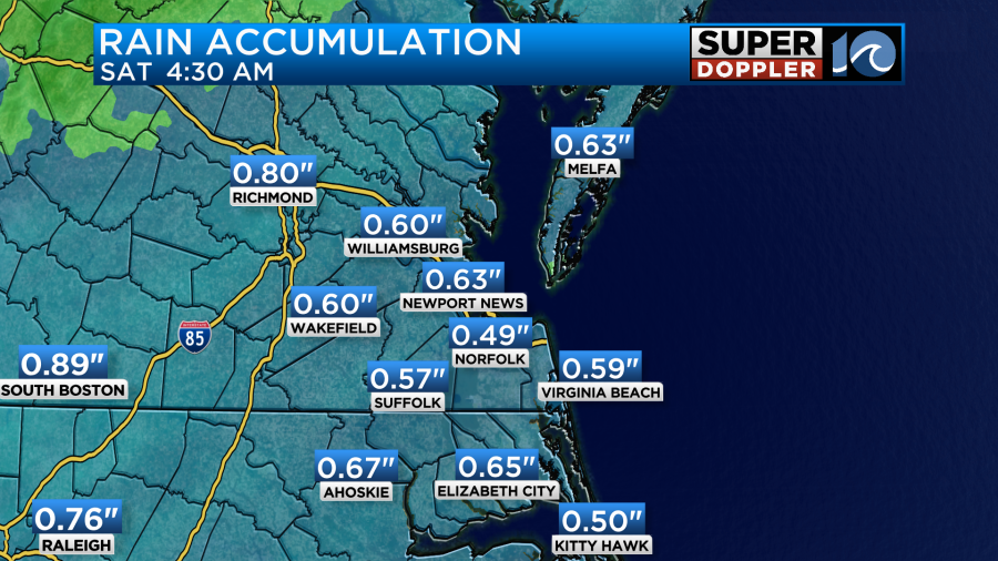
This morning we had a lot of rain over the region. It was a steady soaking rain that slowed down things for the morning commute.
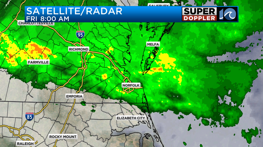
Up until 8am, we had only picked up about a tenth of an inch. The main cause was a warm front coming up from the south and moving into the region.
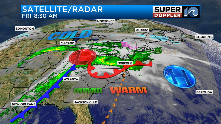
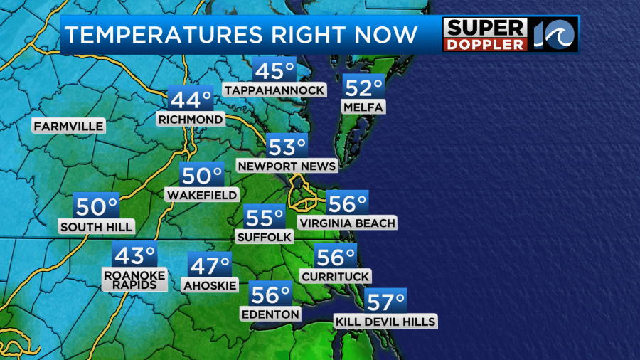
Meanwhile an area of low pressure was off to our west. There was also a cold front stretching to the southwest of the low. Temps started off in the 40s this morning, but they had already risen to the 50s by 8am.
We are going to get a lot warmer than that. Through the day the warm front will lift to our north, and that will put us solidly in the warm zone. The rain should also follow suit and push to the north later today.
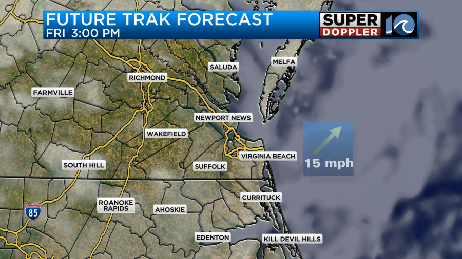
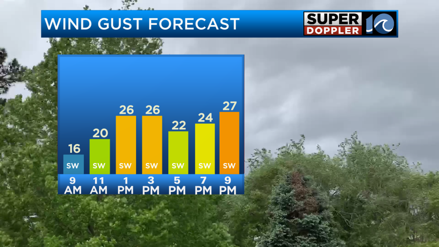
Now I am expecting some clearing this afternoon, but we’ll see how much. Our Future Trak model shows a mix of sun and clouds and the hi-res NAM has a good amount of clearing, but some models have the clouds holding for a while. Either way it will be warm. Winds will run out of the south at 10-15mph with gusts up to 25mph.
That will push the temperatures up to the low 70s.
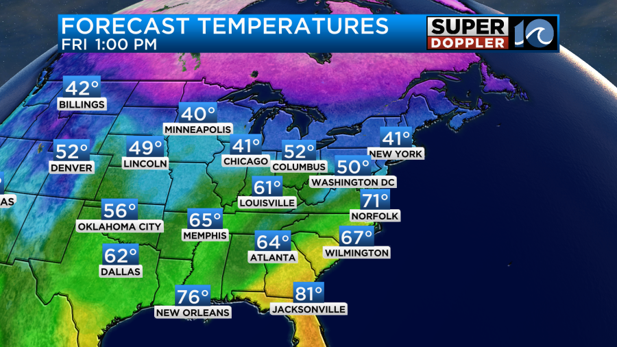
If we get even more clearing then I wouldn’t be surprised if we even got into the low-mid 70s. The record for today is 73 degrees. It’s a long-standing record that goes back to 1914.
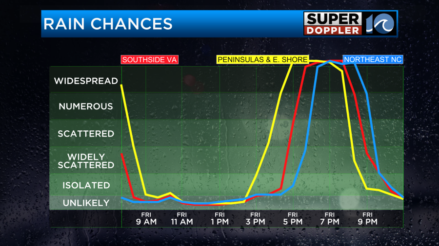
As we go into the evening the cold front will approach from the west. Rain will pick up ahead of it. Some scattered showers will come in from the west in the early evening, but a big line of rain will form and move in later in the night.
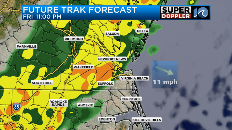
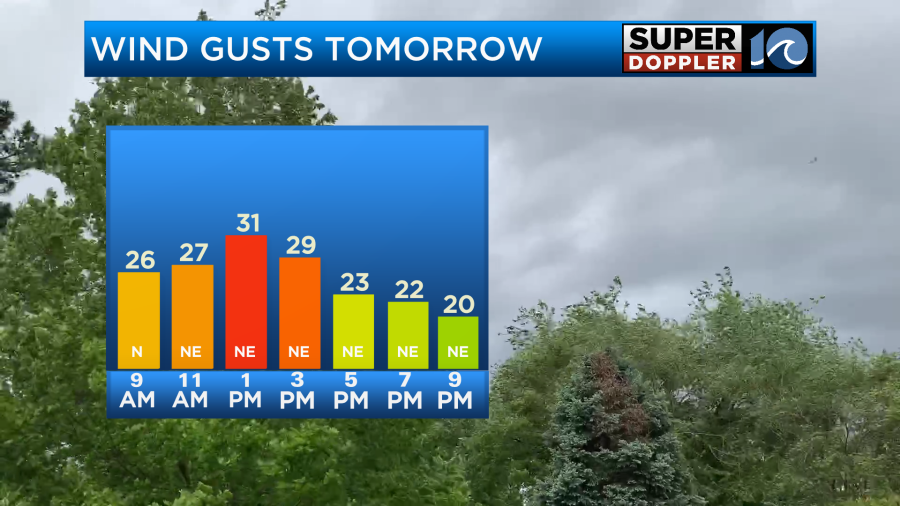
Rain may be heavy for a time. A couple of thunderstorms will even be possible. Rain will continue until about 3-4am. Then most of it should move out. An isolated shower could linger until the 8 or 9 o’clock hours. After that we’ll clear things out. A second mini cold front will drop in about 10am. After that winds will pick up out of the northeast. Gusts will be up to 25 and possibly 30mph.
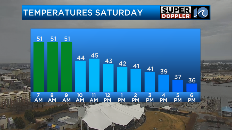
This will drop our temperatures. We’ll top off in the low-mid 50s in the morning, but temps will sink to the 40s during the afternoon.
We’ll be dry and cool on Sunday. High temps will be near 50. Then we’ll warm to the 60s on Monday.
We’ll finish out the month mild, but we did have a long stretch of cold temperatures.
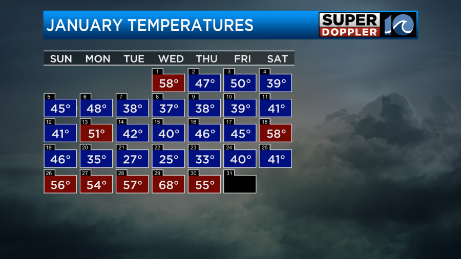
After averaging out all the temps this puts January about 5.6 degrees below average. Believe it or not, that still doesn’t put us in the top 10 coldest Januarys on record.
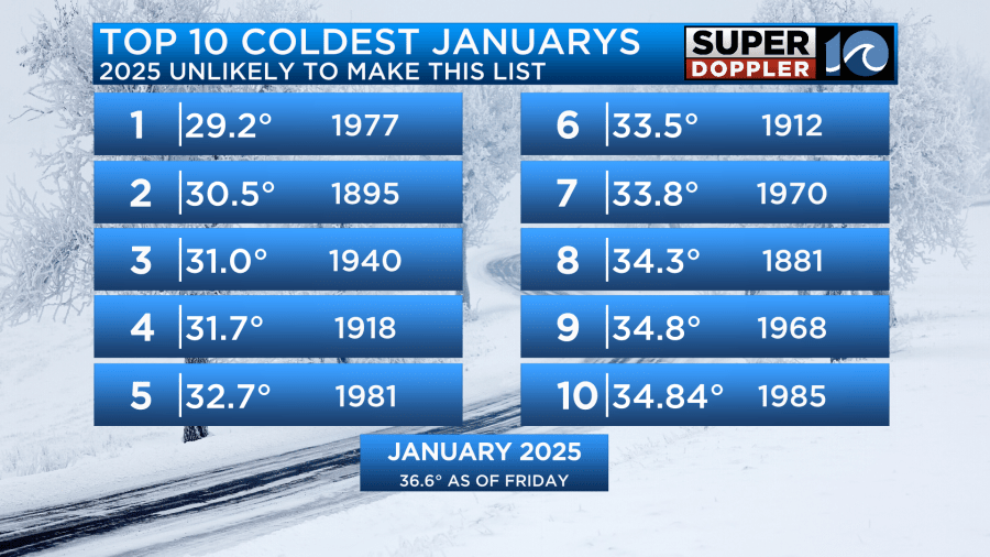
Wow!
We are down for rainfall. We are about 2 inches below average before today.
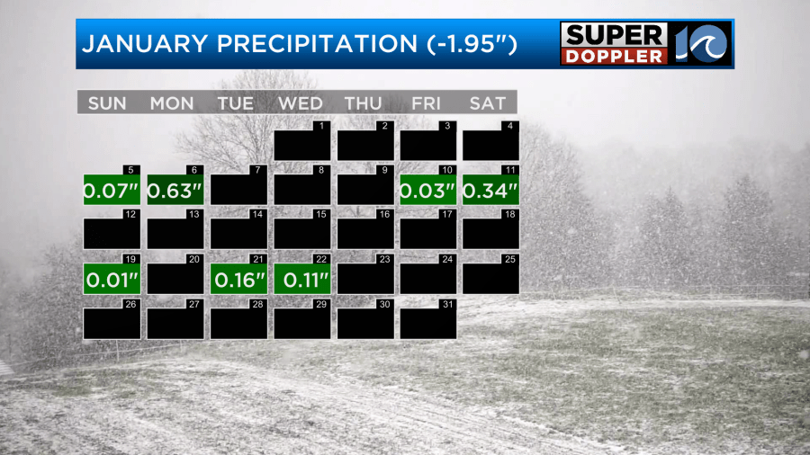
We’ll likely pick up about a quarter to three quarters of an inch. Most of that will be tonight.
It was nice to get the rain to clean off the roads, walks, and vehicles.
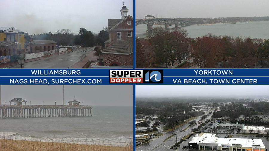
Finally, a neat phenomenon happened this morning, and it could continue for a while. We had some marine fog form in a couple of locations.
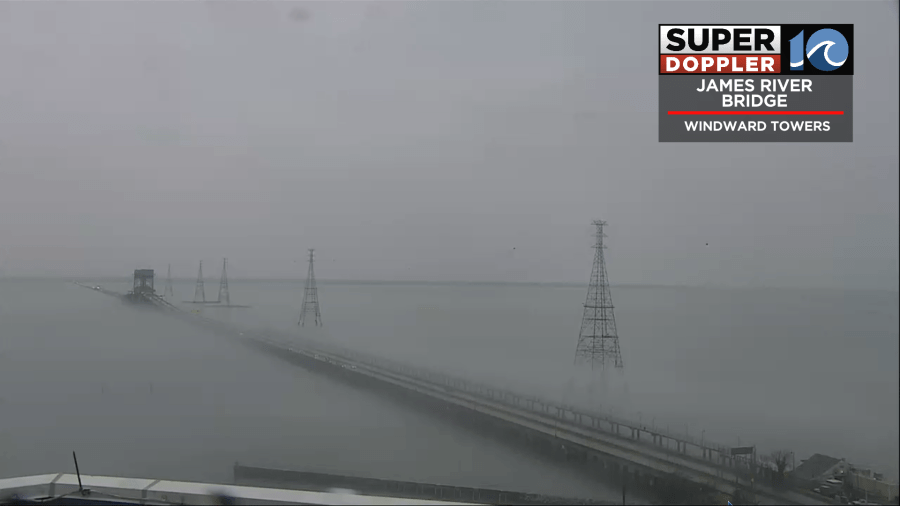
This happens when warm/humid air rolls over a chilly waterway. We’ll see how much fog remains later today because winds are going to be pretty strong, and that could mix out the air.
Oh…. One more thing. I’ll be at the Virginia Living Museum on Sunday for Groundhog Day. This year we are going to have “Lux the Skunk” do the forecast for the rest of Winter. That will be around 10am up in Newport News.
Meteorologist: Jeremy Wheeler