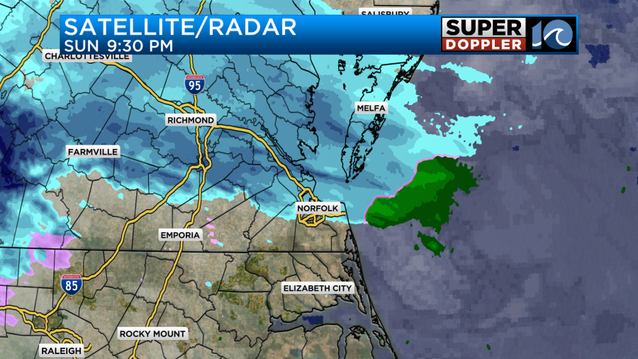
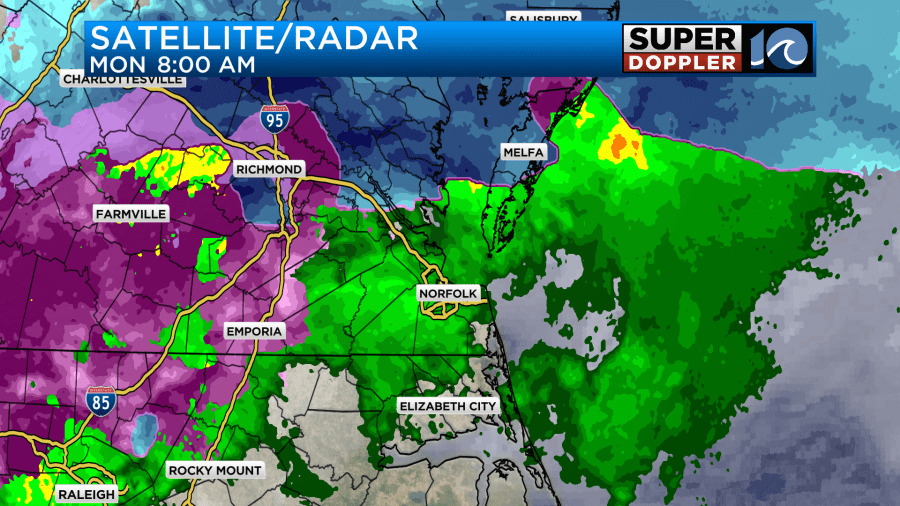
As expected, last night the snow started up over the region.
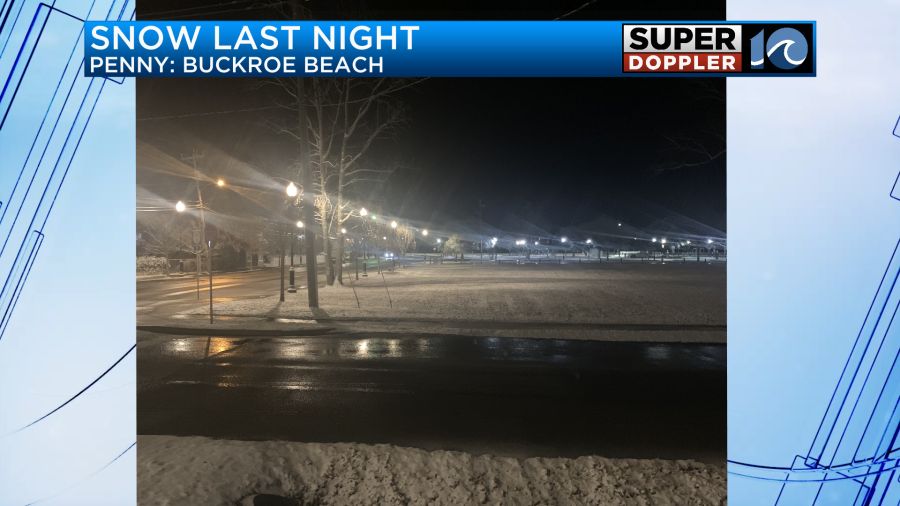
It was a beautiful sight to see at my house. Most of the snow at my house melted, but some locations saw it sticking and adding up. Here is one photo from the Buckroe Beach area courtesy of Penny.
The snow was on the grass, but it also stuck to the roads in some locations. Here is another photo. This one is from Yorktown.
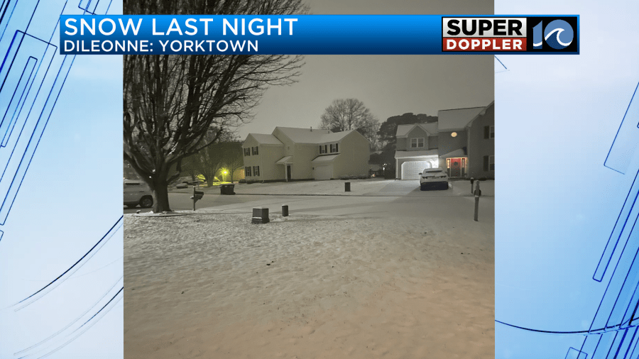
That one came in from Dileonne.
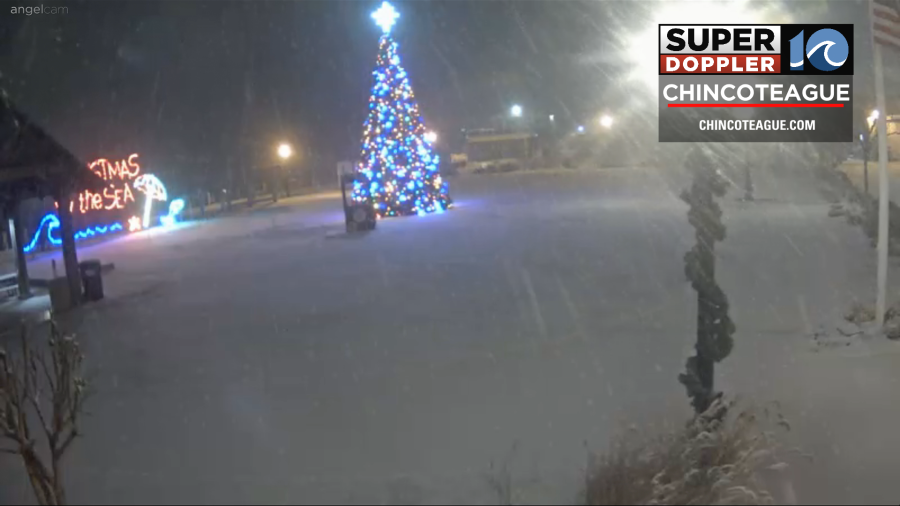
The snowiest area, by far, was up around Chincoteague. The snow there looks like it got up to about 5-7 inches.
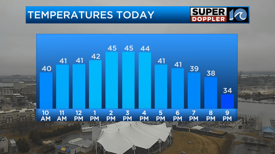
By the late morning a lot of the precip had changed over to cold rain showers. Temps slowly climbed into the upper 30s.
This will become all rain by the late morning. Then we’ll have on and off rain showers through the day.
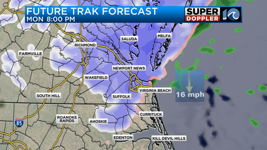
There is an area of low pressure moving in from the west. There is also a warm front coming up from the south.
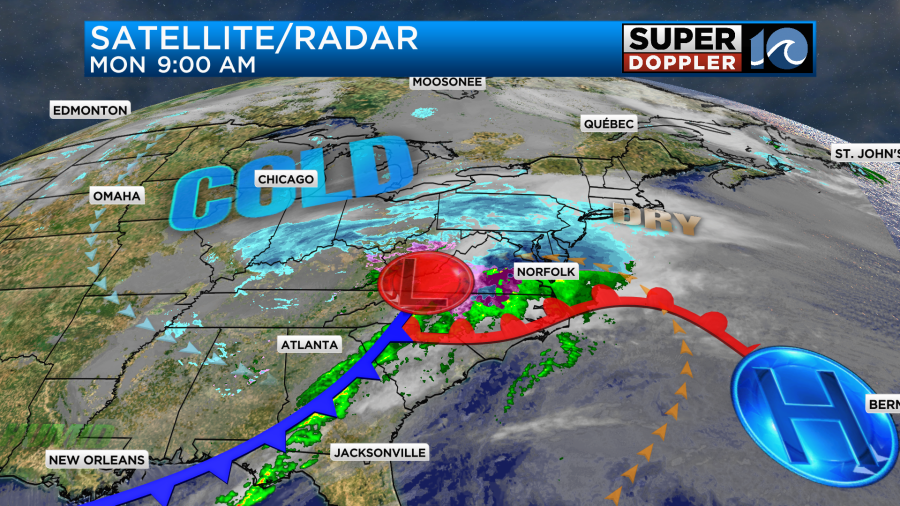
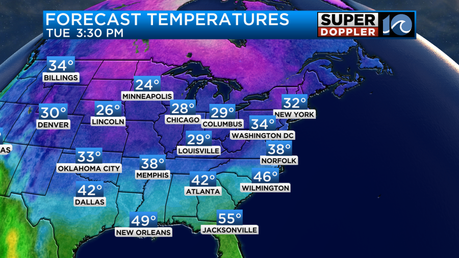
There is a cold front southwest of the low. As the whole system slides east through the region we’ll have lots of rain with a light east wind. High temps will warm to the mid 40s.
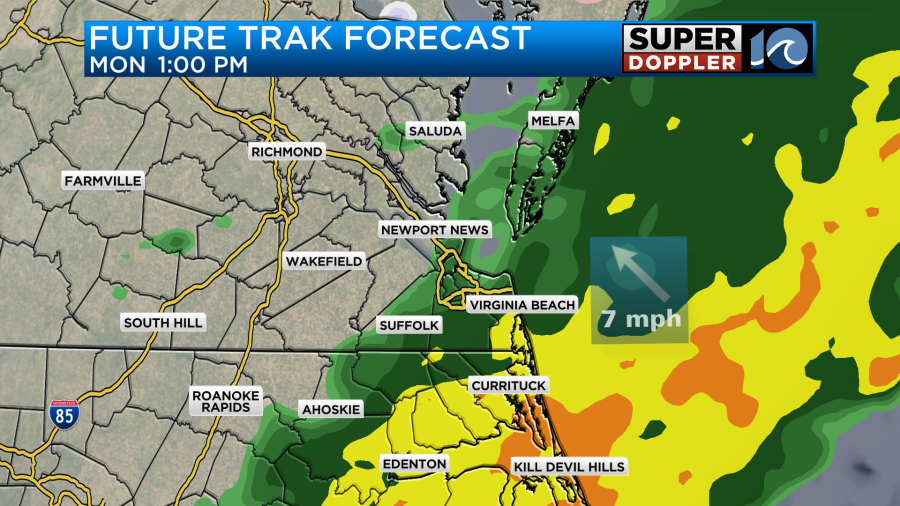
The showers may back off for a time this afternoon. However, the cold front and an upper level disturbance will roll through the region this evening. This will create a melting wintry mix at first. Then it may turn into a brief band of light snow showers.
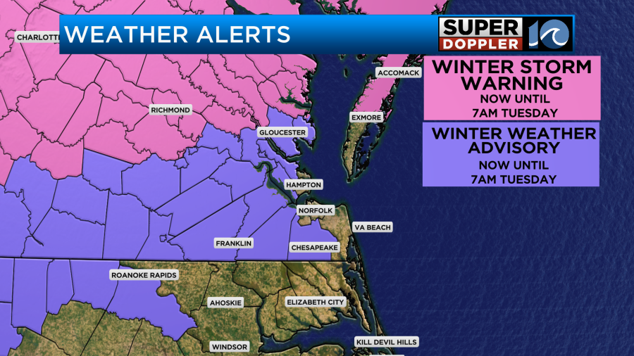
This shouldn’t put down too much snow, but will be enough to keep the weather alerts going through tomorrow morning.
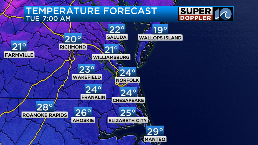
We’ve already had a couple of inches of snow north of the metro with about 5-7 inches (estimated) up towards Chincoteague. Perhaps even more around Reedville and Saluda. Most of that should melt today, but not all of it will. Locations that have had more than 4″ may still have a little snow on the ground before round 2 this evening. The models predict low amounts from this feature this evening.
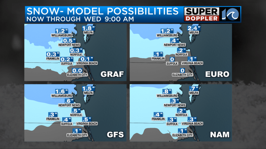
Putting together all of the models this is what I am thinking for snowfall amounts.
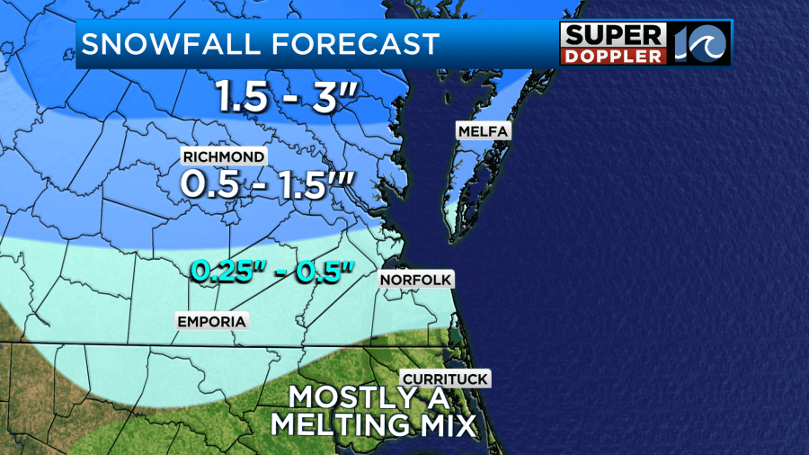
Those numbers will be on top of any snow that has NOT melted, but I would say the majority of the snow from this morning will be gone.
I don’t think there will be a lot of snow on the roads tonight into tomorrow morning, but I do think there will be some problems with ice, black ice, and freezing temps. Temps will drop down to the 30s this evening. However, after the precip there will be quick clearing. Winds will gust up to 30mph out of the northwest. This will drive down the temps. They will drop down to the upper 20s overnight.
If the cold air settles in before things dry out, then we may have some areas of ice. They could be on the untreated roads. It’s hard to say how widespread that will be, but it could be enough to cause more school and work delays tomorrow morning. It could even cause some cancellations north of the metro. Through the day it will stay dry, cold, and windy. High temps will only be in the upper 30s with lots of sunshine.
However, wind gusts will still be up to 30mph. So wind chills will be in the teens in the morning. They’ll be in the 20s in the afternoon.
We’ll be dry and chilly all week. There may be another system next weekend, but we have plenty of time to talk about that after tomorrow.
Meteorologist: Jeremy Wheeler