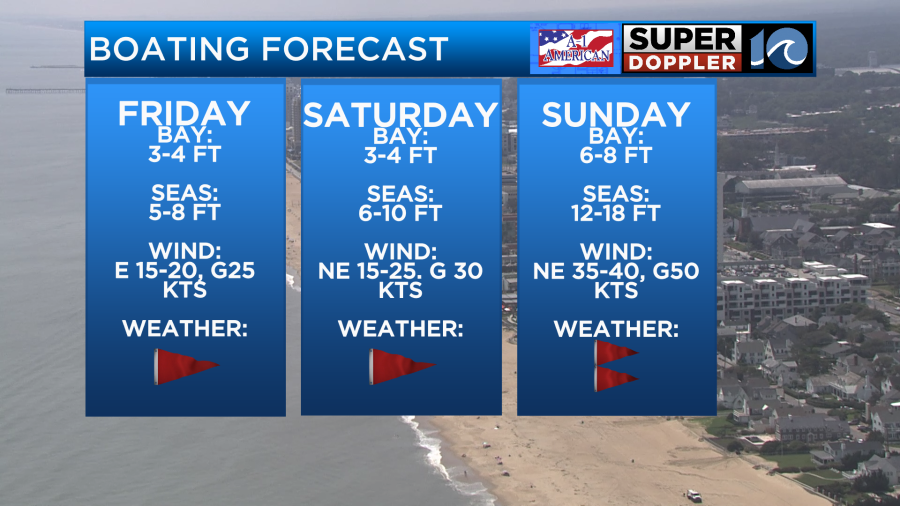
This weekend is going to be a WILD one on the waterways as a powerful coastal storm moves into Hampton Roads. The storm will form off the southeast coast during the day Friday with rainfall not reaching our area until the afternoon hours Saturday. For those along the Outer Banks, impacts can be expected throughout Saturday morning.
The worst of the weather will be on Sunday as wind gusts for most of the region will be around 40-50 mph near the coast. Meanwhile, parts of North Carolina may gust near 60 mph. With winds this strong, coastal flooding, beach erosion, and overwash on NC 12 is to be expected this weekend.
Major tidal flooding is in the forecast across the southside Sunday afternoon as winds will push in water from the Atlantic ocean and down the Chesapeake Bay. As a result, swimming and boating will be highly discouraged due to the dangerous conditions.
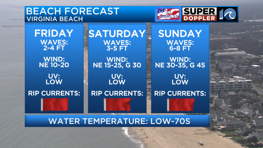
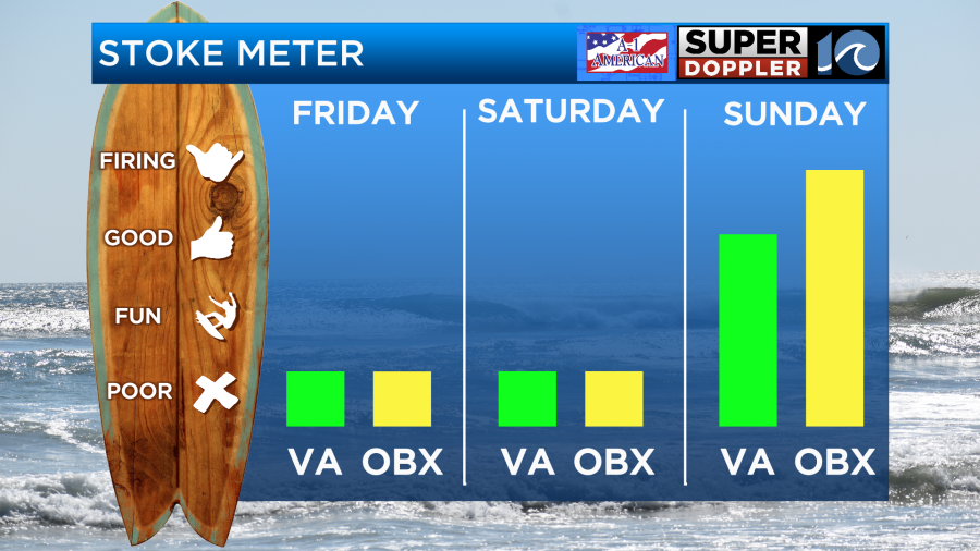
As for surfing, there could be a window to score some of the best surf in a long time for our area ,but it all depends on when the storm moves north and the exact track that it takes. As of now, Friday and Saturday will feature blown out surf that will be far to messy and dangerous to paddle out in. Your best bet for these days will be potentially riding a longboard at some beaches across the Peninsula believe it or not.
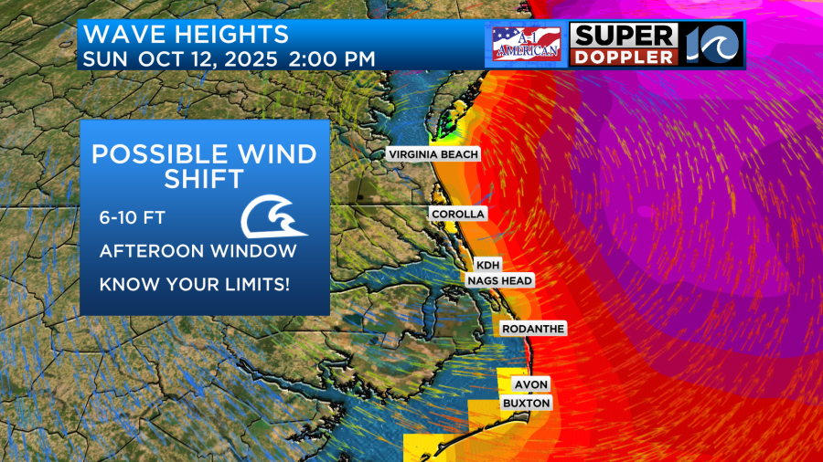
Sunday, the coastal low will be bringing the worst of the weather to our region. During the morning, surf will be massive and blown out with tropical storm force onshore winds. During the afternoon the storm will continue heading north and that is where a window of ridable surf opens up. It will be worth keeping an eye on surf cams across the Outer Banks early Sunday afternoon as winds start to turn offshore. This will help clean up the ocean throughout the rest of the day but make sure you know your limits. Surf will likely be in the 6-10 foot range, meaning the only surfers in the water should be those who are highly experienced. Winds across Virginia Beach will start to turn offshore during the late afternoon hours, allowing for a possible window of opportunity before dark, but this is HIGHLY dependent on the storms timing and strength, so stay up to date with the forecast as we get more information.
See you in the water!
— Meteorologist Brian Michigan