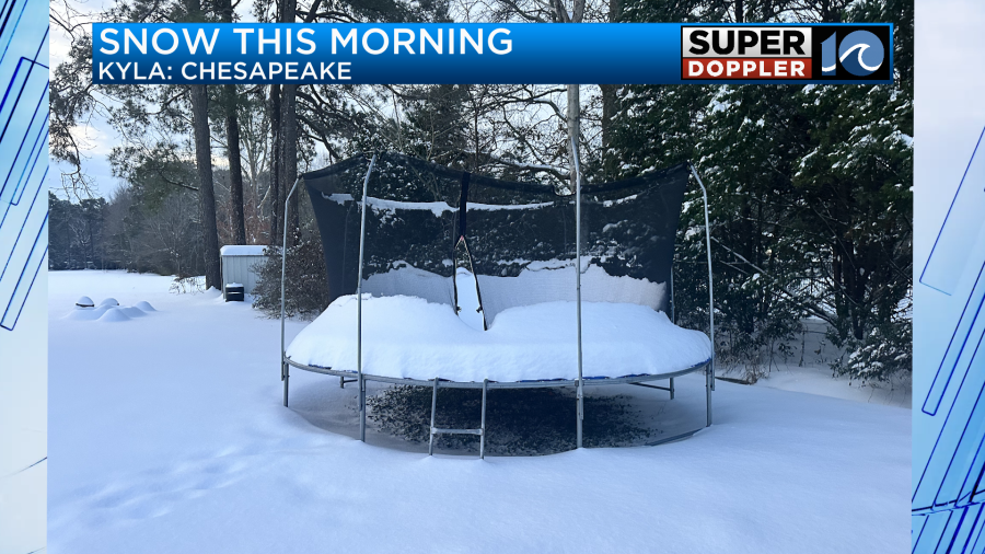
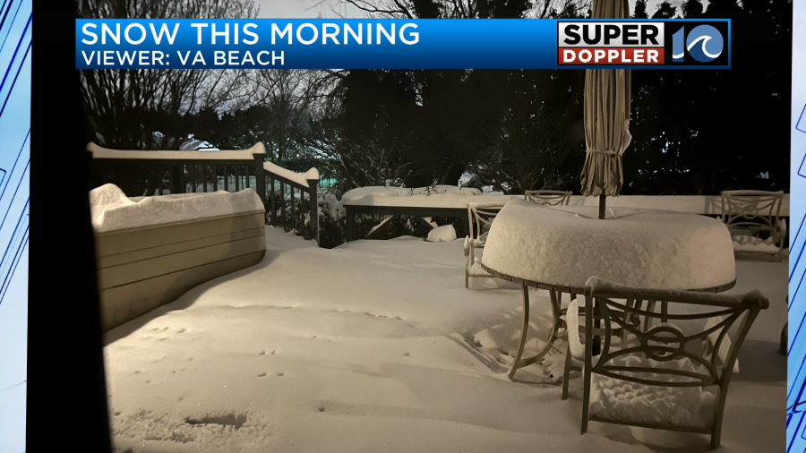
Many folks woke up to a Winter wonderland this morning.
Many viewers sent in photos to the TV station. Here are a couple:
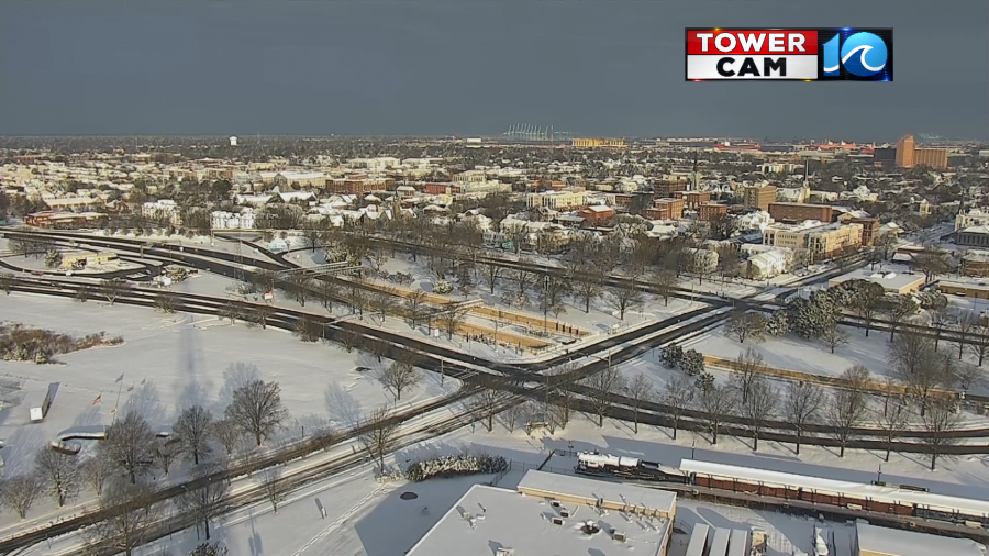
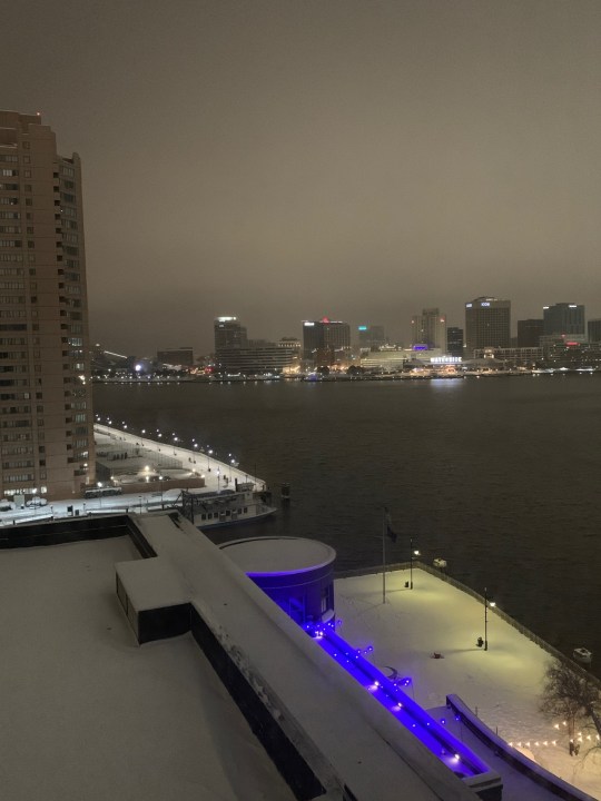
I took a photo from my hotel in Portsmouth. It was a beautiful sight.
As expected, snow came down heavy for a time between yesterday afternoon and yesterday evening.
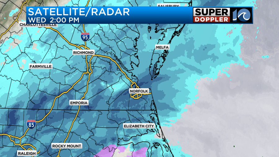
The area of low pressure that caused the snow has now moved out to sea.
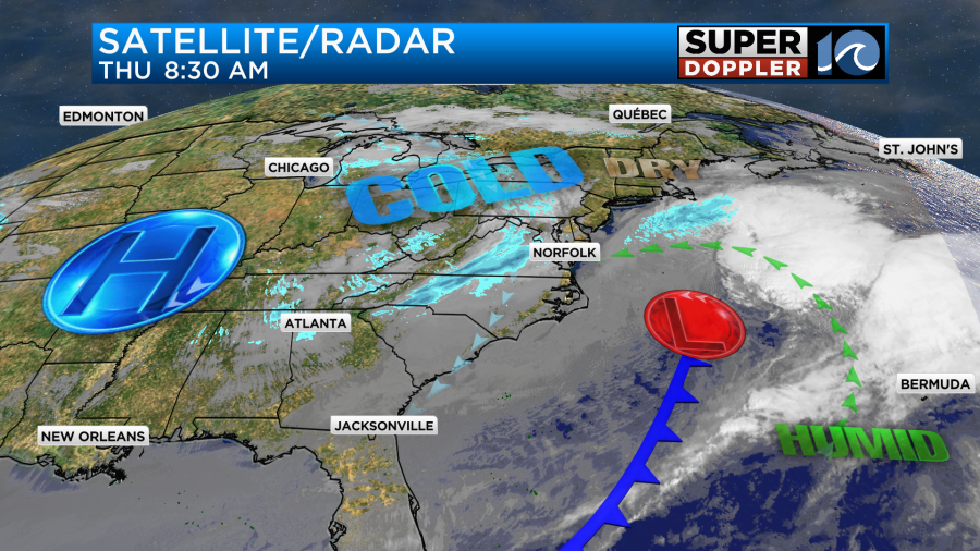
However, there is a weak upper-level disturbance to the west that will bring us a few more snow showers today. This will be anytime from the late morning until the early evening.
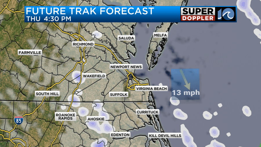
These will be scattered and light, but they could produce a small amount of additional accumulations.
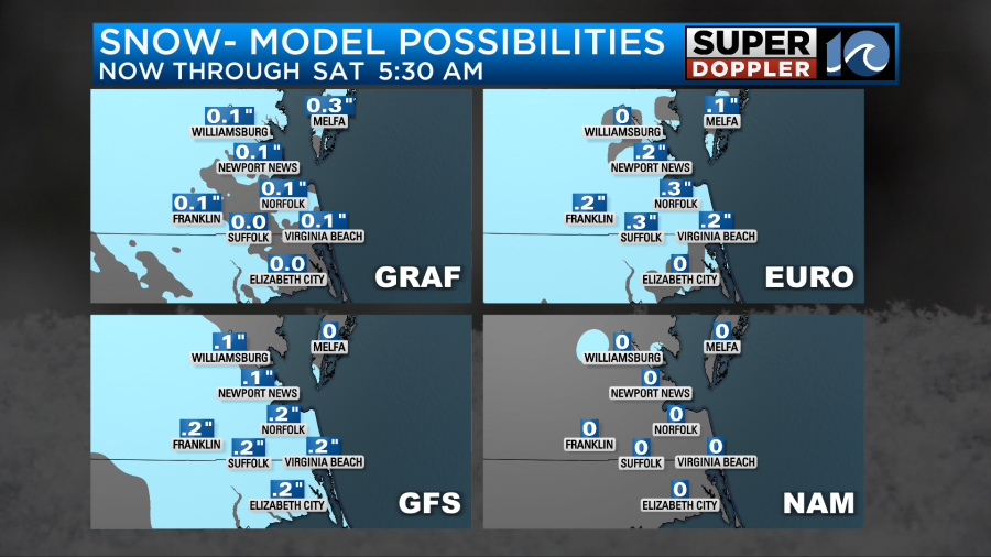
These amounts of a tenth of an inch up to a half an inch should pale in comparison to what fell yesterday.
We did get varying amounts of snowfall with the highest numbers over the Southside to a little south of the state line. Here are some of the reports from viewers:
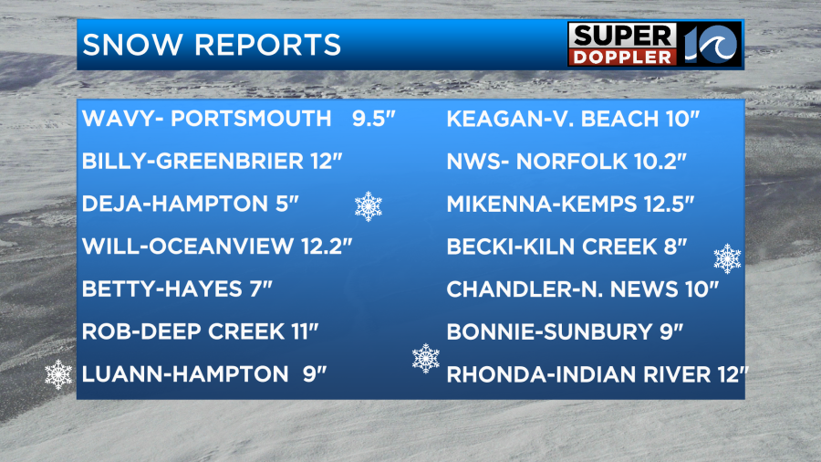
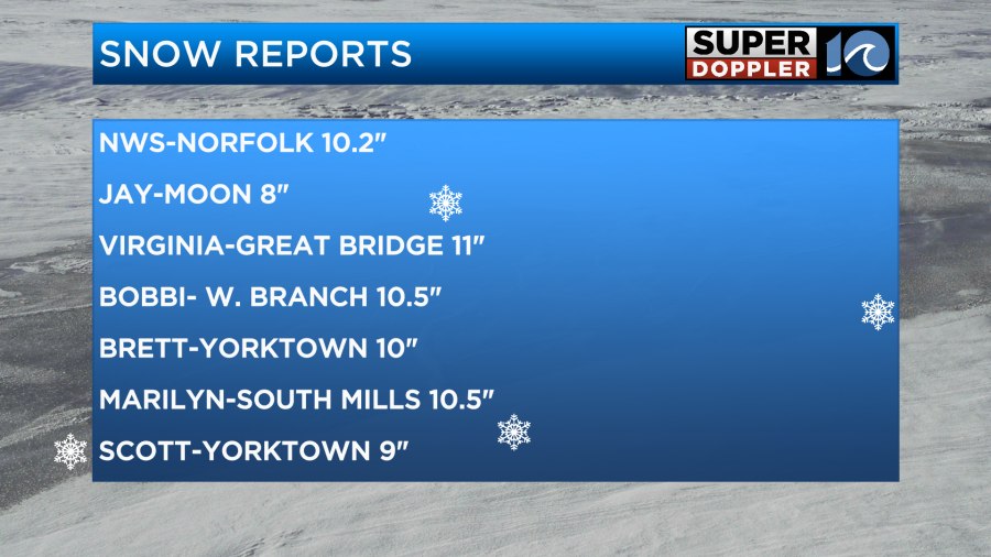
You’ll notice that there is a report from NWS. That’s the National Weather Service in Wakefield. It was a COOP observer. That’s the only official report that I have from them so far, but they will likely put out a full report later today.
I tried to make a map of the snow that fell based off of all the reports and pics.
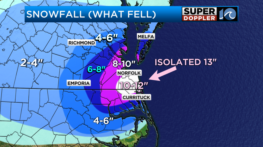
This map needs some more adjustment, but it’s a good rough draft. I didn’t get many reports from the Eastern Shore and parts of North Carolina. Regardless, you can compare it to my forecast map that I made yesterday.
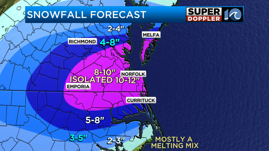
I feel like we did pretty good overall. There was definitely a more consistent area of 10-12″. That small bullseye was starting to become more evident by midday yesterday, but that was coming around more as I was leaving.
The next thing to talk about is the cold. Today our high temps will only rise to the low 30s. However, wind chills will be in the teens and 20s through the day.
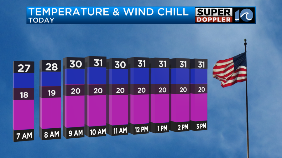
So make sure the kids are bundled up as they head out to play in the snow. Winds will gust between 20 and 25mph out of the northwest. That will also cause some problems with blowing snow. Roads will be difficult to drive on this afternoon, this evening, and tomorrow.
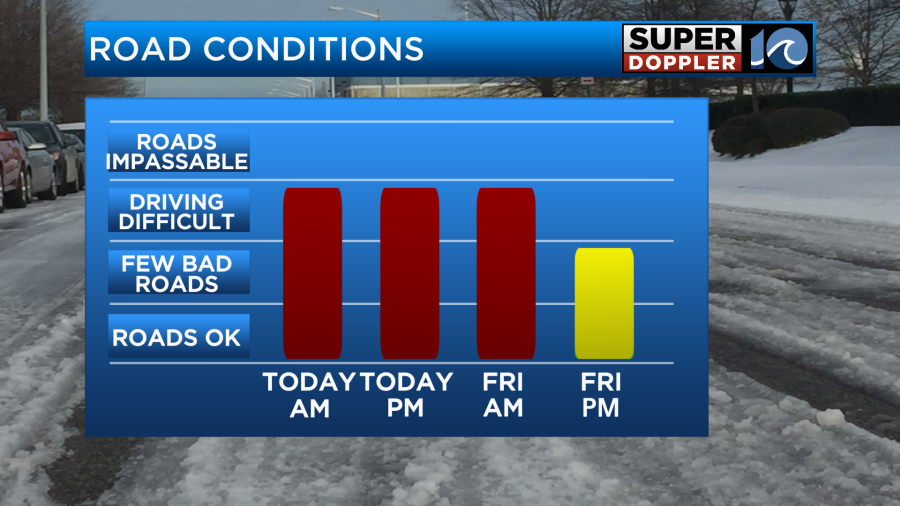
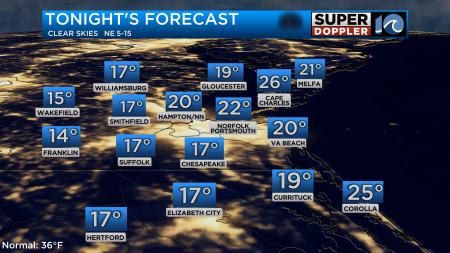
There may even be some impassable roads for a time today. Especially where a foot of snow fell. Tonight will be very cold. Lows will drop down to the teens and 20s.
It will be time to slow-drip the faucets again.
Many of the vehicles will tamp the snow down today and this evening. That will create tracks of melt and ice. These will refreeze tonight. So tomorrow morning there will be a patchwork of snow, ice, and black ice.
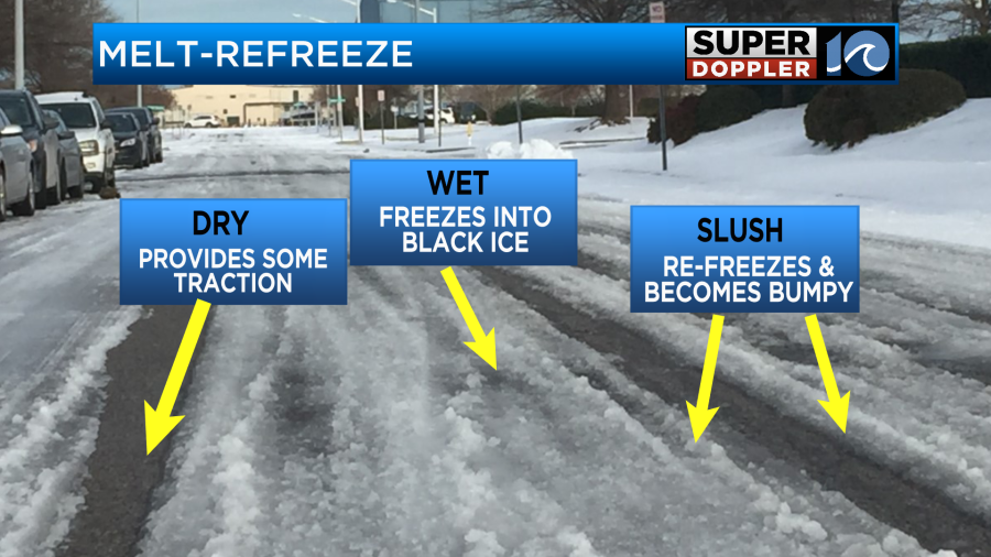
This will create a lot of issues on the roads tomorrow. At least tomorrow we’ll have sunshine return to the area. High temps will be in the upper 30s. So there will be some melt on the roads but not much. There will be more melt on Saturday with high temps near 40 degrees and partly cloudy skies.
We’ll be in the upper 40s by Sunday with dry conditions. Hopefully, that will be enough to melt the roads for the schools to return by Monday. We’ll see.
Be safe on the roads out there. Stay tuned for updates.
Meteorologist: Jeremy Wheeler