Well, I’m back from my trip to northern Arkansas. I was visiting my Dad. It was a nice trip, but I’ve had to hit the ground running this morning upon my return. Things are going to be pretty busy locally over the next few days. Then there’s also major hurricane Melissa down over the Caribbean. That’s where we are going to start the weather blog.
As of 5am this morning hurricane Melissa was upgraded to a category 5 hurricane. It had a very sharp eye on satellite.
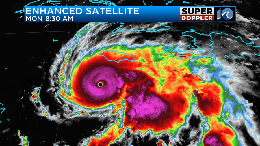
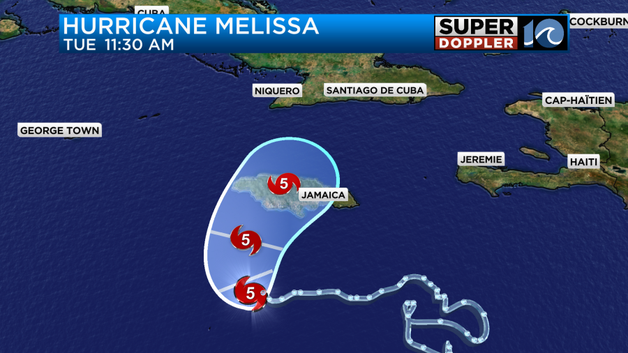
The storm was slowly roaming to the west. However, it is forecast to turn to the northeast soon. Sustained winds were up to 160mph. Between late tonight and early tomorrow morning Melissa is forecast to make landfall somewhere over western or central Jamaica as a category 5 storm.
The model has a big portion of the island getting hit with hurricane-forced winds.
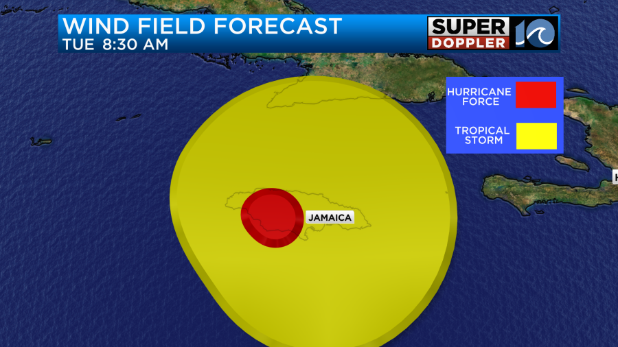
I feel like the area of 74mph or greater (red area) will be bigger than the model shows. So damaging winds of 160+ mph will affect parts of the island. It’s unofficial, but a typical storm surge with storms like these often reach up to 20ft. Also, localized rainfall could reach up to 30″ or higher over some parts of the island.
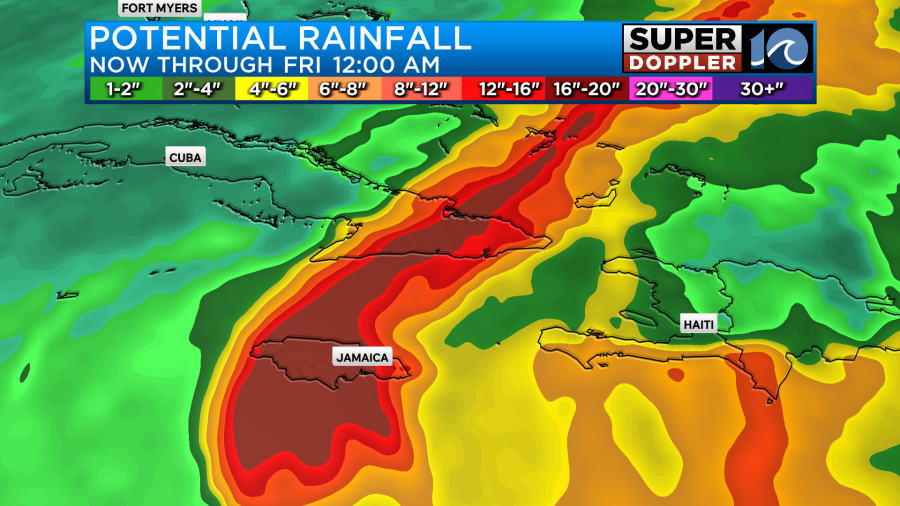
Part of that is from the hurricane alone. However, some of that is due to “orographic lift”. Jamaica has a lot of mountainous terrain. When air blows in horizontally towards a mountain then it will get pushed upward.
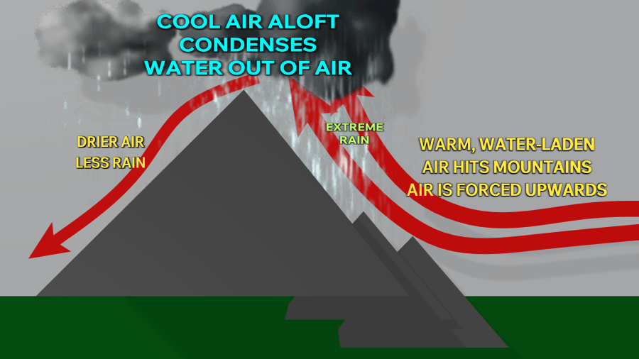
This can enhance rainfall over an area. Especially when it is water loaded. The heavy rain and higher terrain will create dangerous mudslides. A large part of the infrastructure will be damaged, and it could stay damaged for a long time. So say a prayer for folks down that way.
After Jamaica the hurricane will move northeast and weaken a bit. It is forecast to move over eastern Cuba as a category 3 hurricane. They will also have some big impacts, but less than Jamaica. Then Melissa will move towards the Bahamas as a category 2.
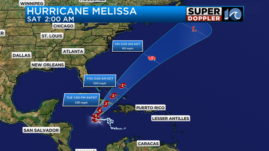
It could also affect Bermuda, but there is less certainty in that scenario. The models are in good agreement as to the track.
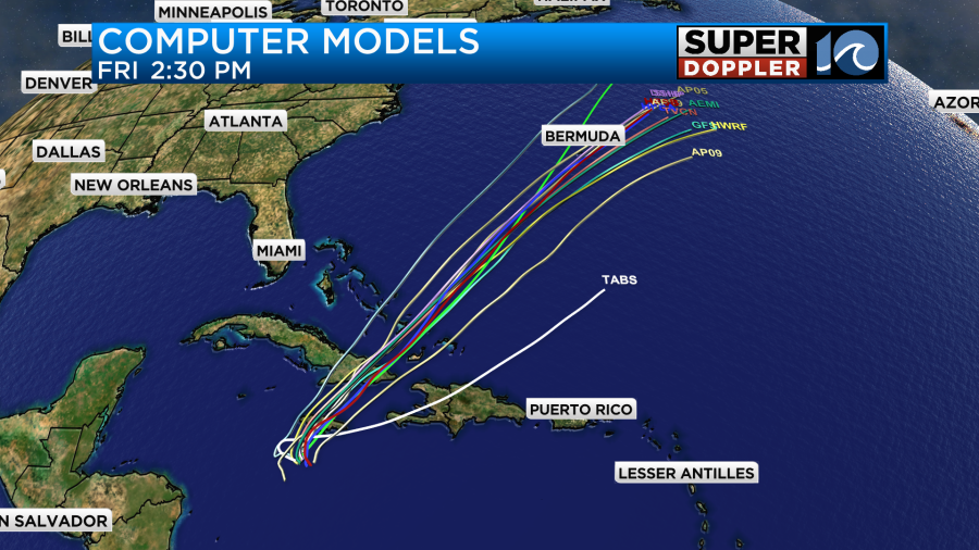
Luckily, Melissa will stay away from the United States. However… We will have our own problems here. Not so much today, but wind and rain will dominate tomorrow.
Today we have high pressure to the north with an area of low pressure developing to our south.
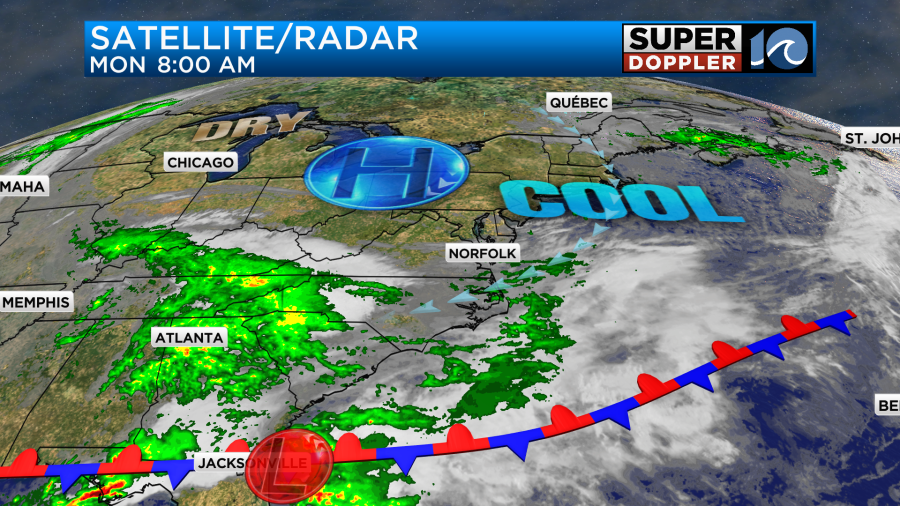
This is along a stationary front. We had a few rain showers try and move up this way, but a lot of the rain dried up before it hit the ground. Moisture did push north, but we still have some fairly dry air at the surface. Hence, we had a lot of virga this morning despite a lot of green on the radar.
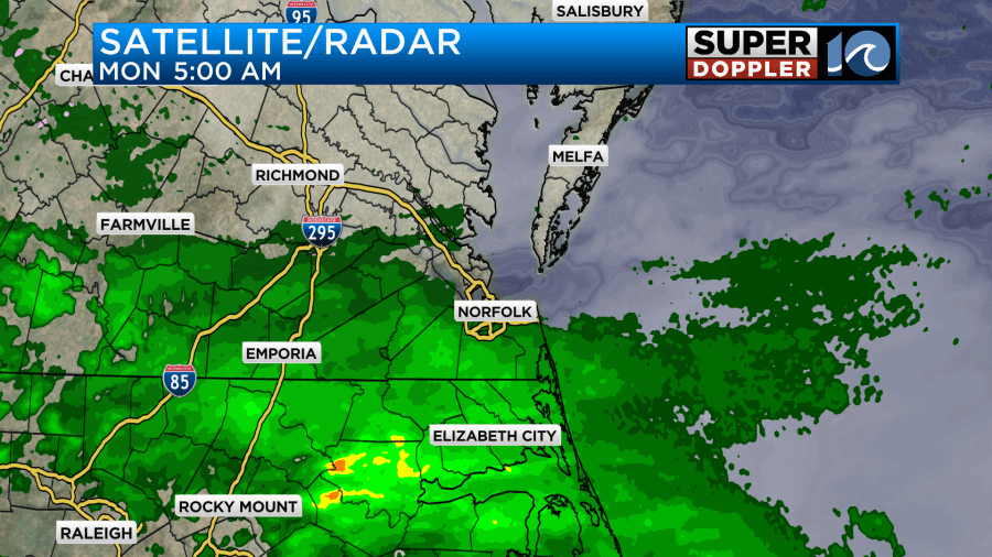
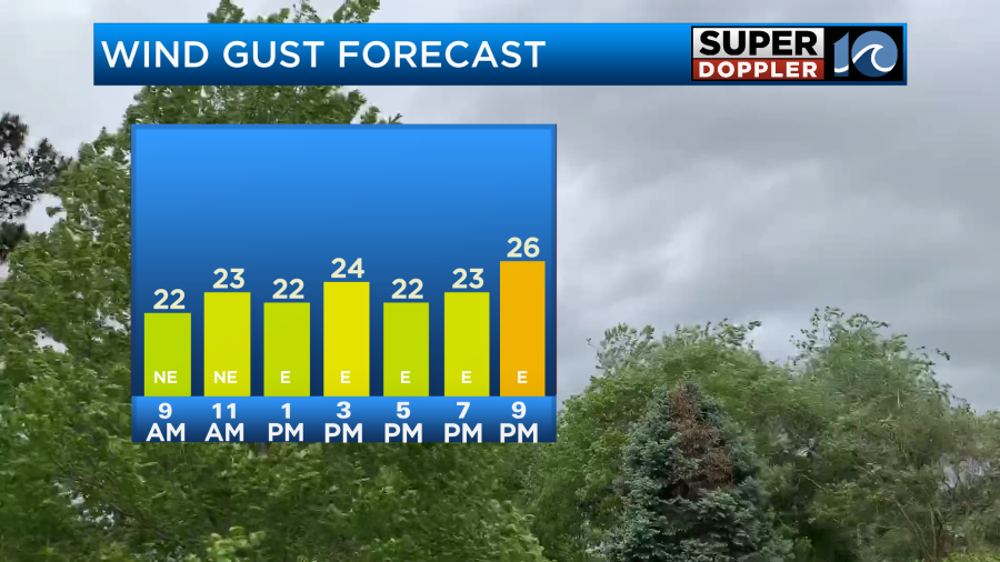
There won’t be much rain today. We’ll be mostly cloudy with only some isolated showers or sprinkles through the late afternoon. High temps will be in the low-mid 60s. Winds will be out of the northeast gusting to 25mph.
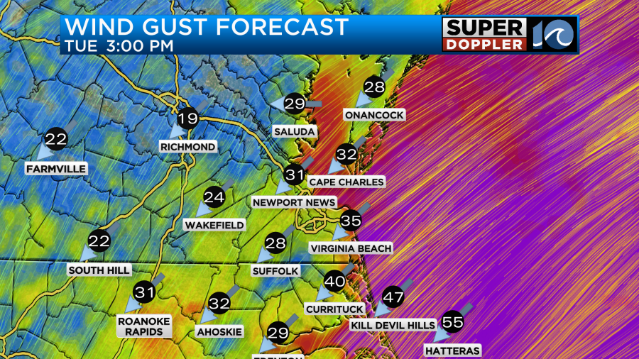
Tomorrow the low will move to the northeast. It will pass offshore, but we’ll have another combo of an offshore low and an area of high pressure to our northwest. Therefore, we’ll have strong northeast winds between the two systems.
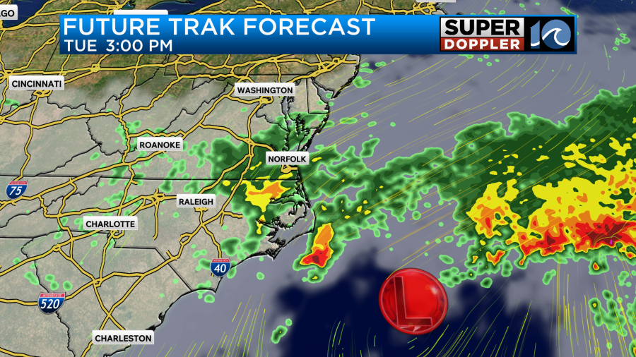
Winds will gust up to 35-40mph in the metro with gusts to 40-45mph near the shore.
Rain will be on and off through the day. Though I think it will be more on than off.
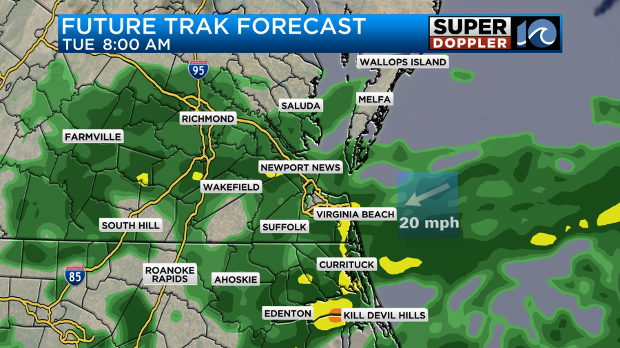
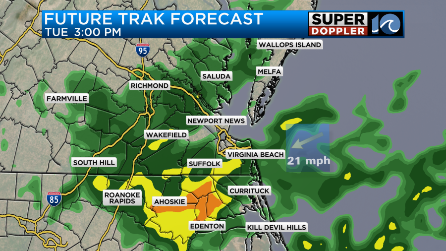
High temps will be held down in the upper 50s to near 60 degrees. The increasing winds will create some minor to possibly moderate tidal flooding over the area Tuesday afternoon.

There may be a little bit of ocean overwash along the Outer Banks on Tuesday. The tides and waves definitely won’t be as bad as the last coastal system. That was during the King Tide, and that played a role. However, this time the rainfall will be much bigger. Rain will continue into Tuesday night. Then we’ll have a few more scattered showers on Wednesday as the system pushes out to sea. Rain totals are aiming for about an inch to an inch and a half.
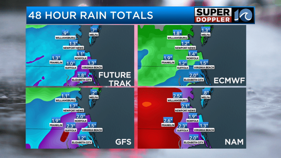
Some areas could see up to 2 inches. I will say that recent systems have promised a lot of rain, and then they have rarely panned out. However, I think this time will be different. We really do need the rain.
We’ll have less of a chance for rain on Wednesday, but rain will increase again on Thursday as another area of low pressure moves in from the west. There will also be a large upper level trough (dip in the jetstream).

It could be a very wet day. Luckily, dry air is forecast to sweep in from the west by Friday. This should dry us out for Halloween. Early indications are that we’ll be cool, dry, and breezy for the holiday. Stay tuned for updates.
Meteorologist: Jeremy Wheeler


