I went to the walk for MS in Virginia Beach yesterday. It was warm, humid, and very windy. Temps managed to hit the upper 80s to low 90s.
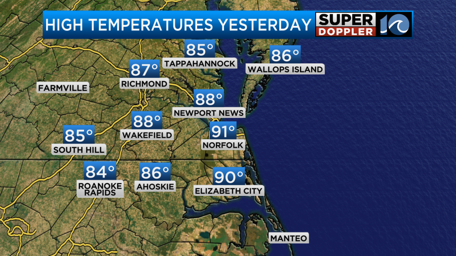
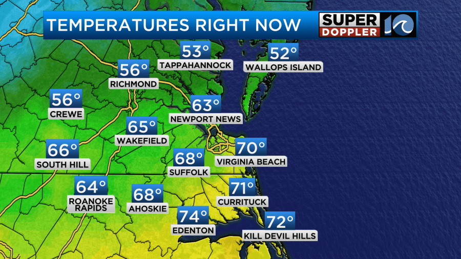
We were just shy of the record in Norfolk, but the heat index was probably in the low-mid 90s. The strong wind offset how it felt. Temps warmed for a while, but then a cold front sank through the region during the evening. I went to the grocery store at 6:30. When I left the temperature was 86 degrees. When I returned 20 minutes later the temp was 68. That front stalled out just to our south last night, but then it started moving north this morning. Temps were split with 50s and 60s north with 60s and 70s south.
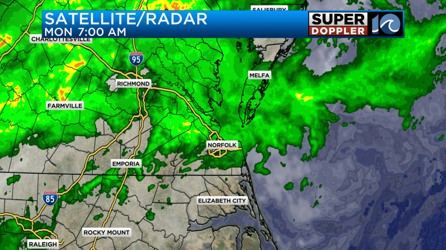
There were also rain showers along and north of the front.
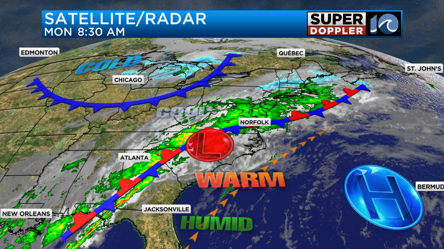
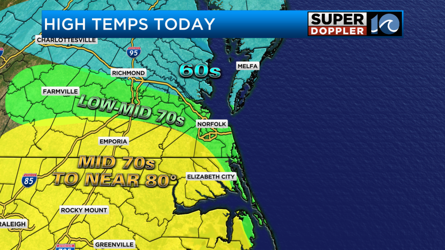
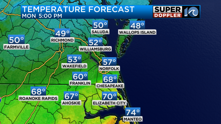
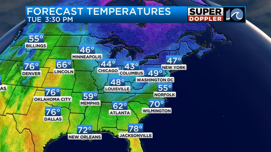
As we go through the day the front will lift north (briefly) as a warm front. After a weak area of low pressure swings through then the front will drift back south as a cold front. This is making for a wild and tricky temperature forecast. We will all warm up as we go into the afternoon. Some more than others. Here is my maximum temperature forecast for the day.
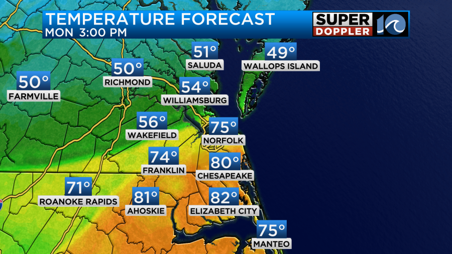
That is my forecast. Here is the model at 3pm:
During that time our rain chances will be increasing.
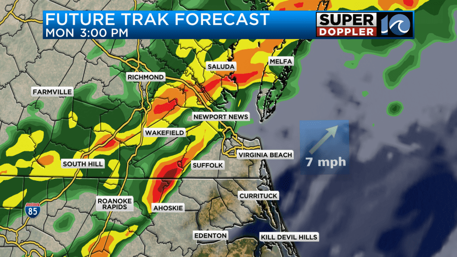
As the warming happens near and south of the front there will be some instability created. This will allow for thunderstorms to form, and there may be a few strong to severe storms between the mid-afternoon and early evening.
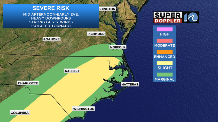
Heavy downpours will be the main threat. There could be some brief standing water.
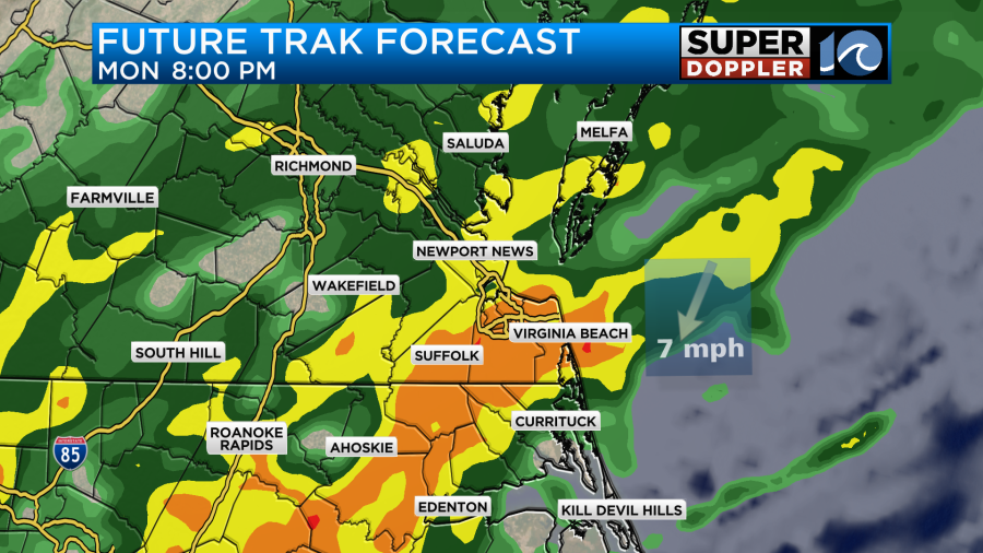
Luckily the ground is pretty dry. So a lot of the rain will soak into the ground. There may also be some strong gusty winds and isolated tornadoes.
The rain will continue into the later evening, but it should mostly end after 2am. Some lingering sprinkles or isolated showers could continue until 7am tomorrow as the second front sinks south. Then we’ll have clearing skies tomorrow.
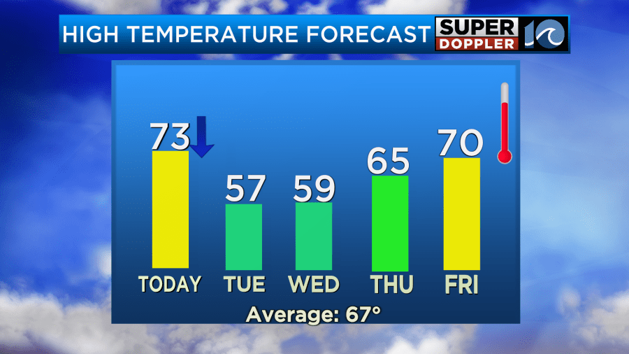
Now let’s get back to the temperatures… Temps will fall as the first front sinks southward this afternoon. For now our model has that happening in the metro between about 3 and 4pm.
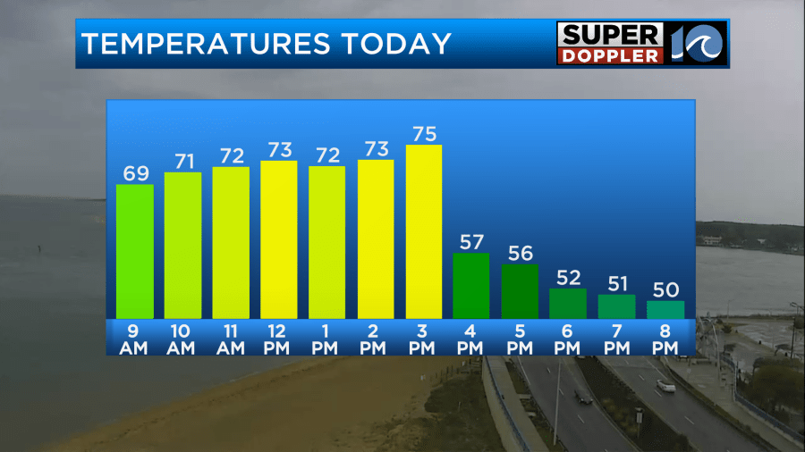
Temps could fall into the 60s AND 50s.
Winds will be out of the south/southwest for a while. Then they will turn out of the north. There will be some gusts to 20mph, but they won’t be as strong as yesterday. Rain will also act to cool things down. Before the rain ends we will likely pick up a solid 1-2″ of rainfall.
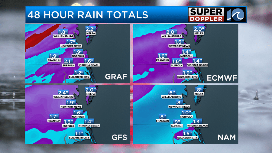
We really need the rain. It will help to wash out the pollen. However, the ground, grass, and trees all really need it as well.
Tomorrow the forecast gets a lot easier. After some clouds and some spotty showers & sprinkles in the morning we’ll have clearing skies through the day. High temps will only be in the mid-upper 50s with some low 50s north.
Winds will stay up out of the north for a while. There will be some gusts to 25mph. Temps will go back to cold again Wednesday morning. Lows will be in the 30s. It’s possible that some frost could form in some inland areas. So plan accordingly. High temps will be in the upper 50s in the afternoon with lots of sunshine.
We’ll have some more rain later this week Thursday into Friday as the temps warm up. I’ll talk more about that in tomorrow’s weather blog.
Meteorologist: Jeremy Wheeler