Over the last couple of weeks we had a stretch of colder air followed by a stretch of milder temps.
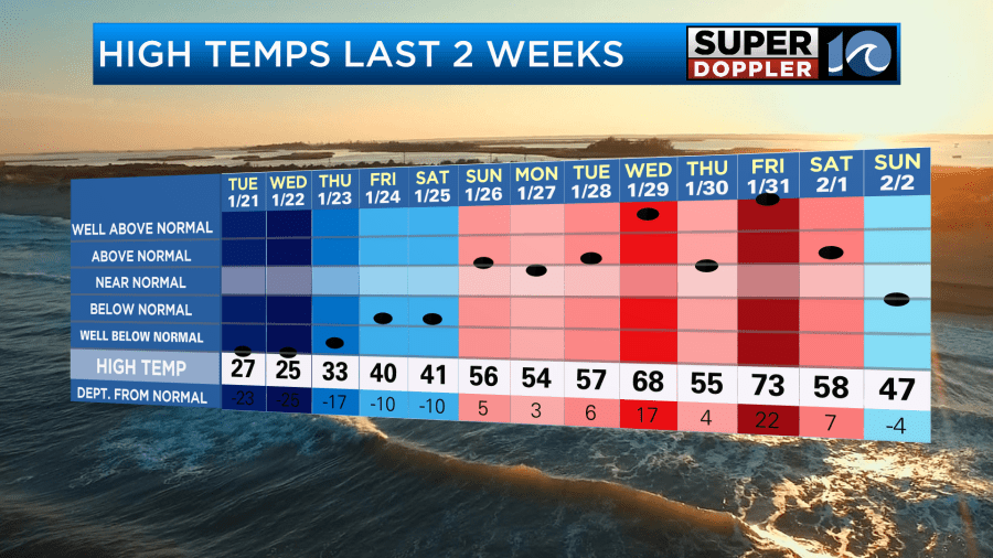
While temps did change over time, it wasn’t a daily bounce of temps. That will be different this week.
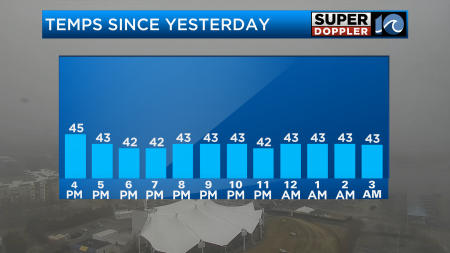
Yesterday, temps only topped off in the 40s. Clouds hung tough through the day. It led to the local prognosticator “Lux the Skunk” to not see his shadow. Hence an early Spring was forecast for our region. Since yesterday temps have pretty much stalled.
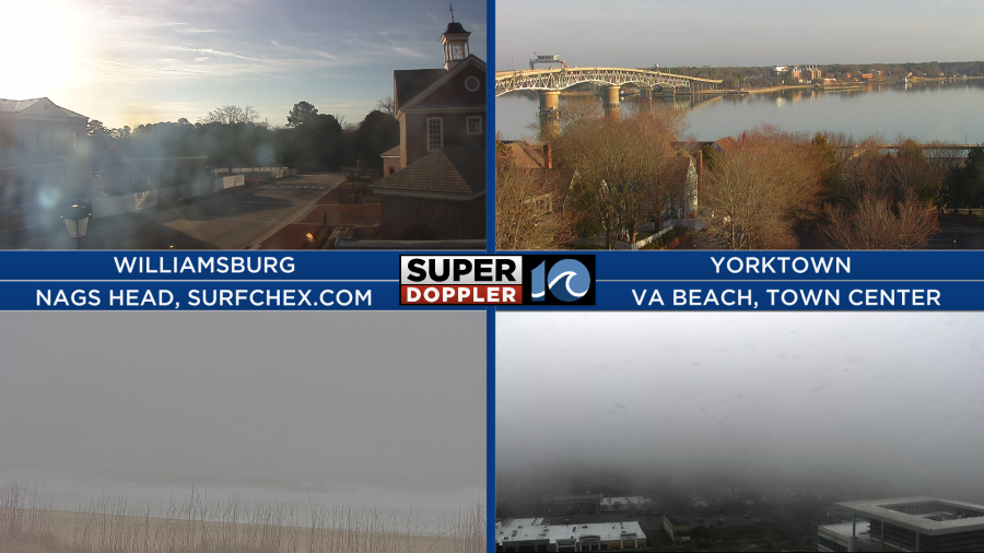
We started with lots of clouds and fog over much of the region.
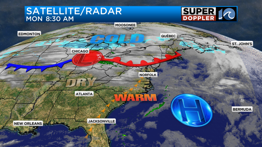
After the fog burns off this morning, then the clouds should also break up some more. A warm front has lifted to our north with high pressure offshore.
Winds will be light and out of the southwest. This should allow us to warm up nicely today. High temps will be in the mid 60s with some 50s near the shore.
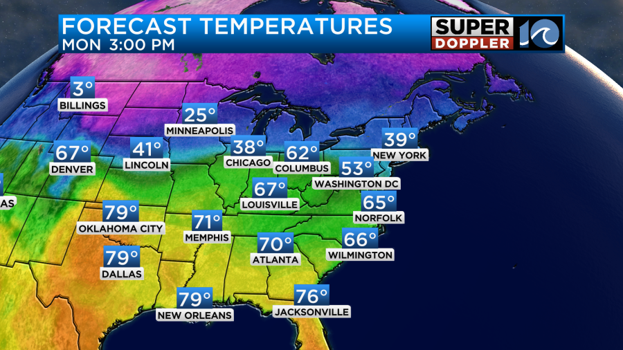
Tomorrow we’ll start off mild. Low temps will only be near 50 degrees in the morning. So we’ll quickly jump to the low-mid 60s by the late morning.
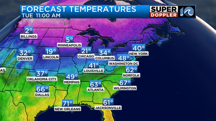
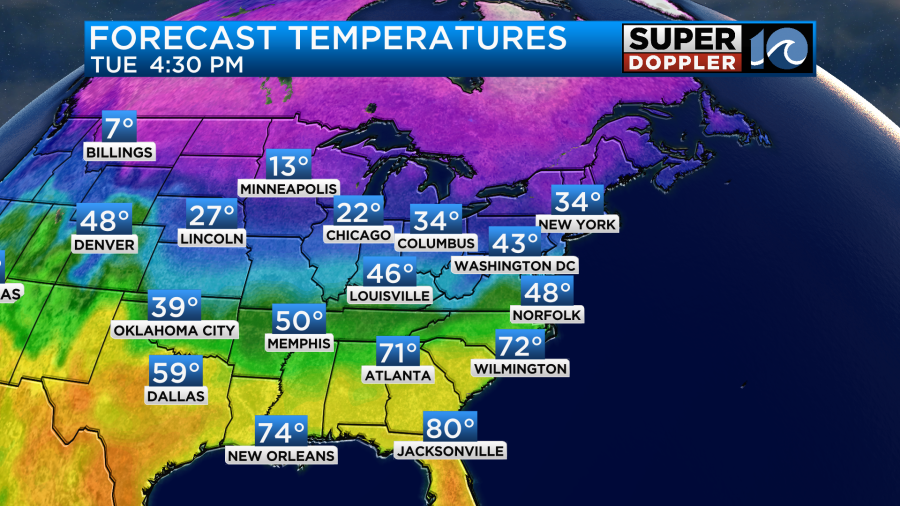
However…… A strong cold front will slice through the area around midday. Winds will flip around out of the north/northeast, and they will gust up to 20mph. That will act to drop the temperatures to the upper 40s by the late afternoon.
We should stay dry through the day, but I can’t rule out some sprinkles as the front slides through.
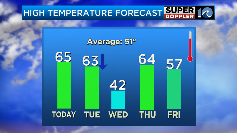
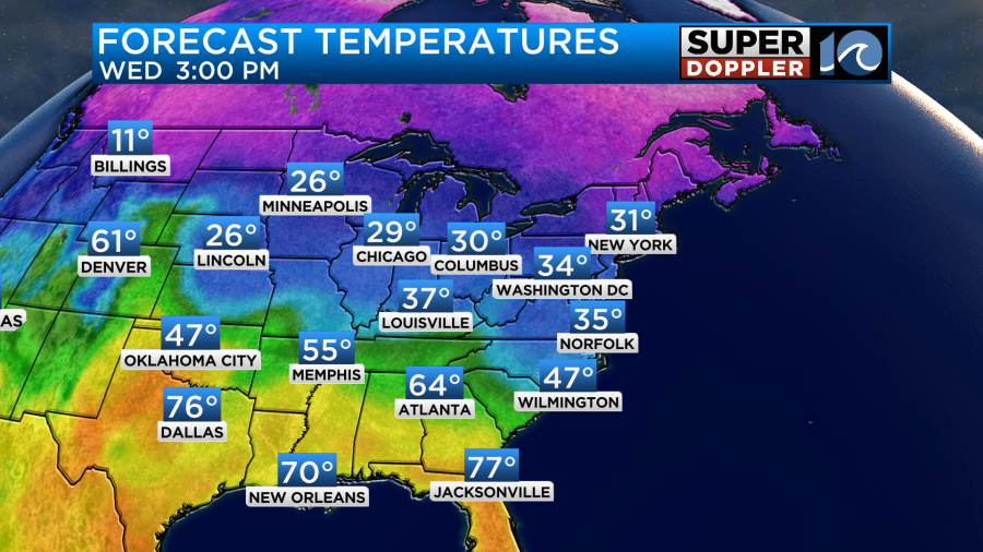
By Wednesday the cold front will still be to our south. We’ll be much colder. I have high temps in the low 40s. However, our Future Trak model only has highs in the upper 30s.
Either way we’ll have a lot of clouds as milder/more humid air tries to push back north aloft. This will create some overunning clouds. It may also create a few showers later in the day. There may even be a couple of spots of a wintry mix near the area.
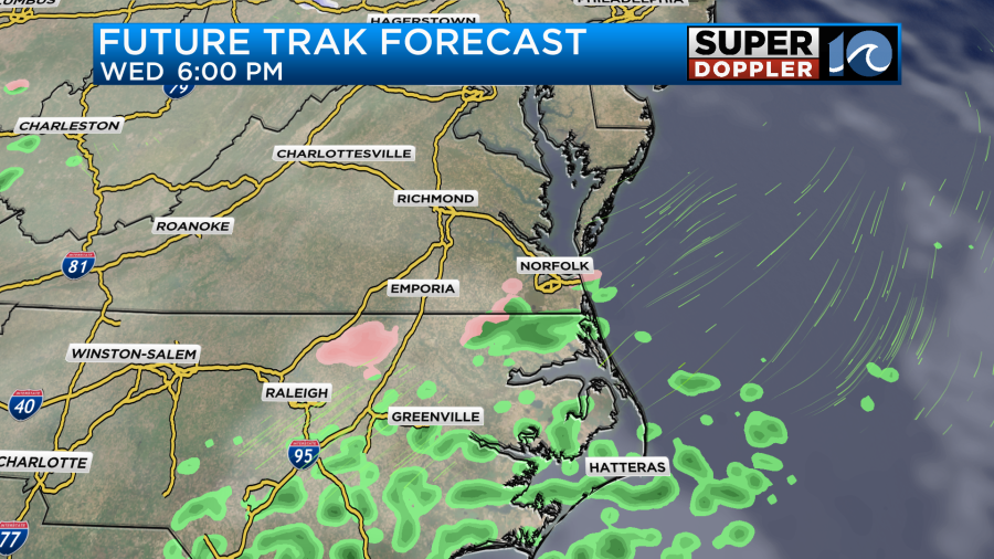
Rain is forecast to pick up Wednesday night as the overunning increases. Then we’ll have even more rain showers on Thursday as a warm front lifts up from the south. This front should push our high temperatures up to the 60s, but we’ll see. I won’t talk about much past that point. I have a somewhat low confidence in the temperatures beyond tomorrow. However, I’ll have plenty of updates in tomorrow’s weather blog.
Meteorologist: Jeremy Wheeler