We just enjoyed some great weather for this Mother’s Day weekend. The air was still dry, and most of the rain stayed away except for a couple of stray showers south. However, we are definitely going to go into a wetter pattern this week. Also, temps will start out cool/mild, but they will end hot by next weekend. Let’s talk about it.
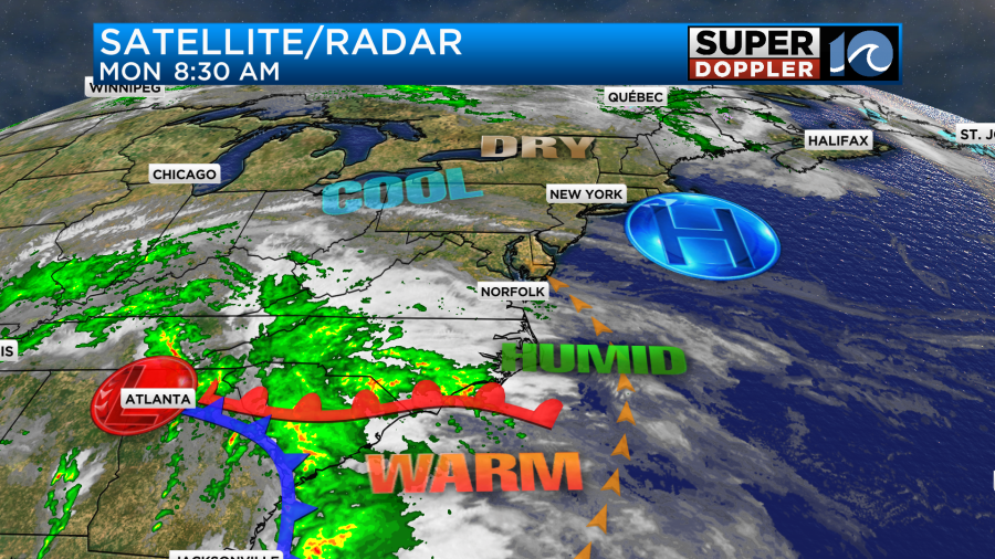
Today we have a warm front to our south. It is slowly pushing north. There is an area of high pressure to the northeast that is slipping farther away. An area of low pressure is spinning over the Tennessee River Valley.
There were a few rain showers around during the morning commute. They were scattered and light, but they did have a light impact on the morning commute.
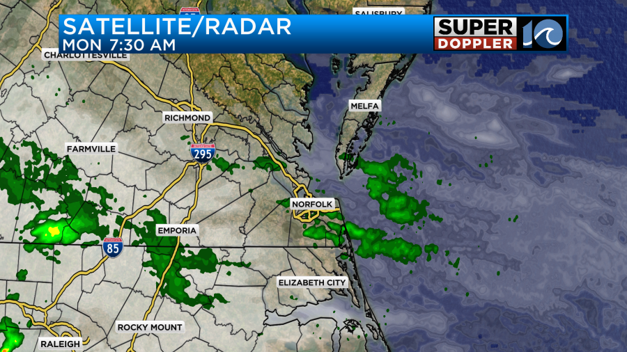
Those rain showers will move out. Then we’ll only have some isolated showers from the late morning until the early afternoon. We’ll be mostly cloudy today with a few peeks of sun once in a while. During the mid-late afternoon a few rain showers will return.
They should be light and scattered. There may be a little more pick up by the evening.
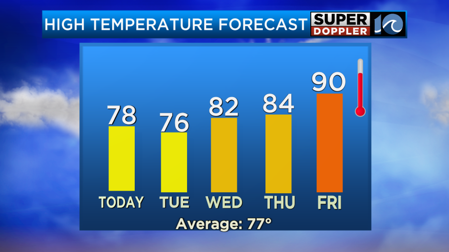
It does look like there will be a little better chance for rain inland/west comparted to the coast. We’ll see. Either way we’ll have a southeast breeze running at 5-15mph. High temps will aim for the upper 70s.
By tomorrow the surface low and the 2 fronts will be closer. There is also an upper-level low that will be spinning overhead. We already have a lot of humidity, but the deeper moisture will be here tomorrow.
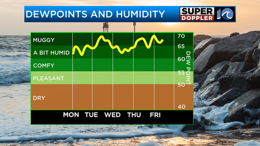
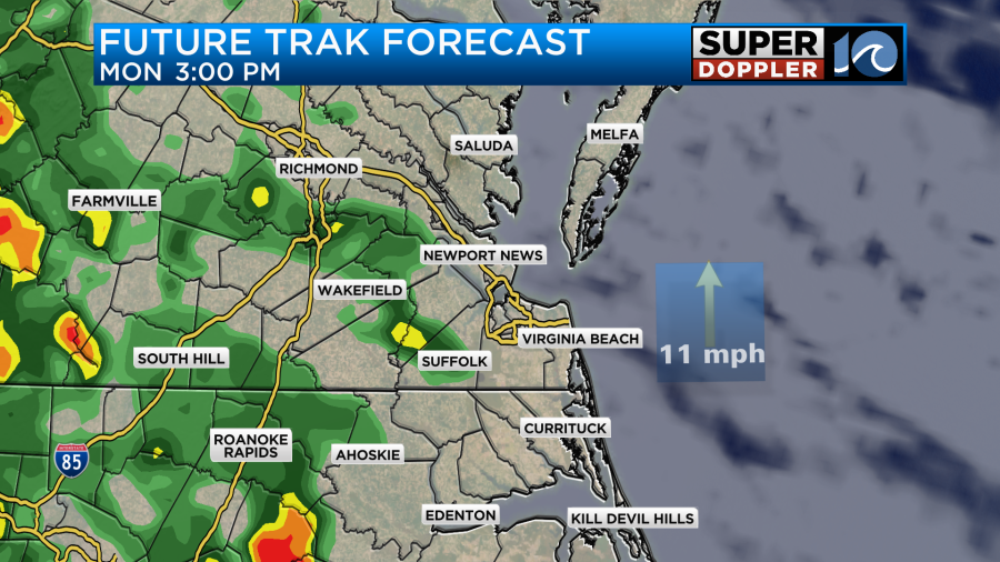
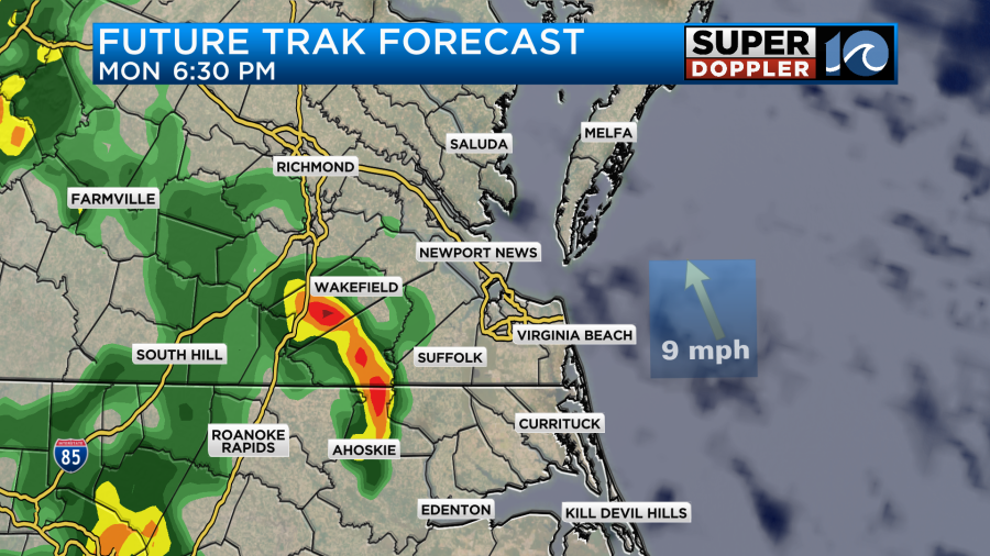
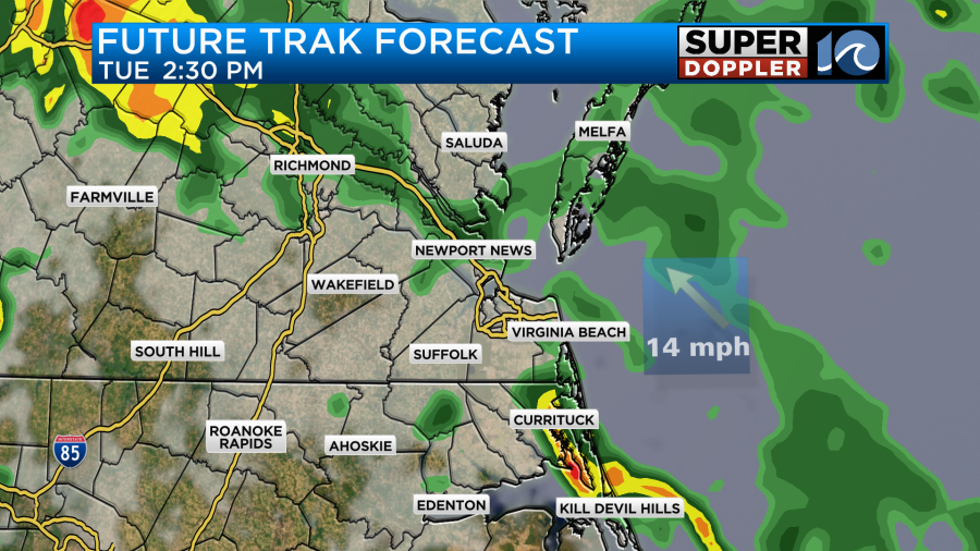
The humidity will actually stay up all week. With the combination of all of these factors tomorrow we are looking at possibly a washout. At a minimum there will be on-and-off showers through the day. Here is what Future trak shows:
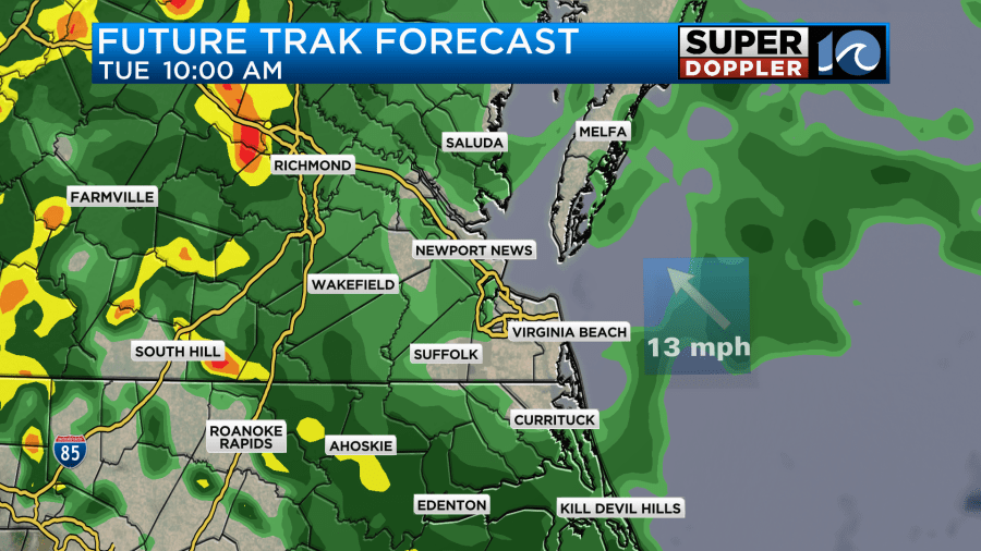
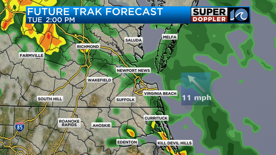
The GFS model has hardly any breaks. So it is pretty much wet all day.
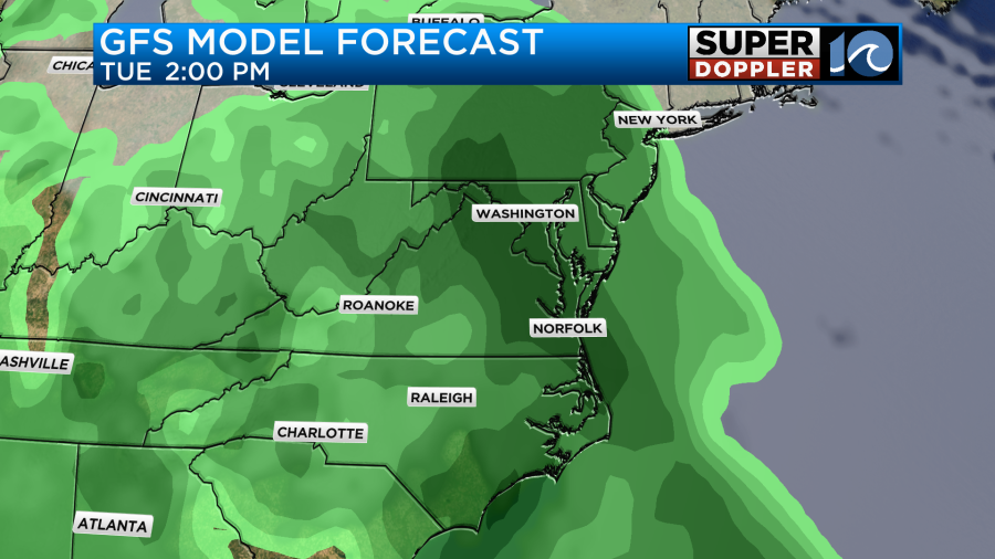
I will say that the higher resolution models like our Future Trak and the hi-res NAM have more breaks between the rain. The regular NAM also has that. So they have much less rain predicted compared to the GFS.
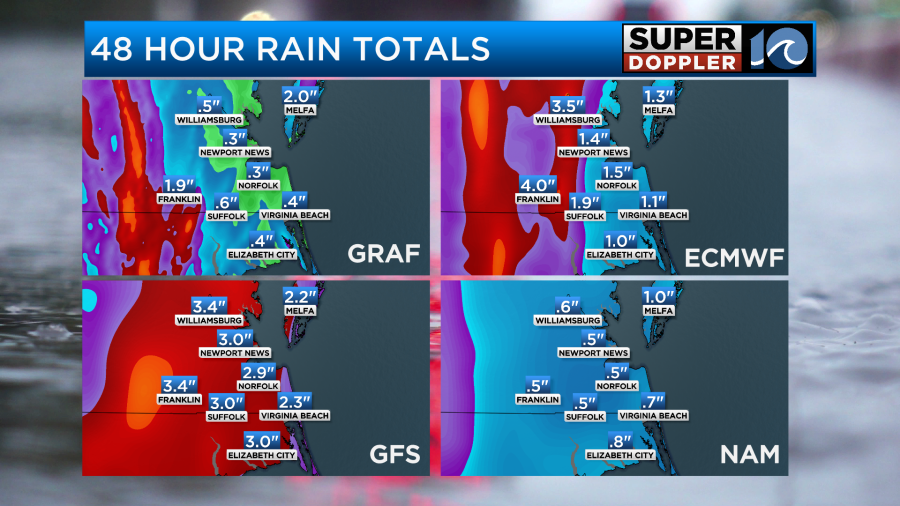
The main threats tomorrow will be heavy downpours and isolated flooding. There may be some isolated strong gusts of wind. I doubt there will be much hail or tornadoes, but the chance isn’t zero either.
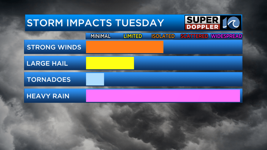
The clouds and the rain should keep high temps in the 70s. However, there will be a strengthening southeast wind.
The forecast for Wednesday is a little more tricky. The upper-level low will be overhead, but the surface low should start to pass to our northeast. A cool front will slowly slide in from the west. This may bring in some slightly drier air to the region, but it’s hard to tell how dry air it will be. We’ll probably have some more clearing, but there will also be some scattered showers and storms again.
After that we’ll have decreasing rain chances to end the week. However, the high temps are going to shoot up. We may hit 90 by Friday.
This Summer type heat and humidity could pose some problems for after-school sports. I’ll talk more about that forecast in tomorrow’s weather blog.
Meteorologist: Jeremy Wheeler


