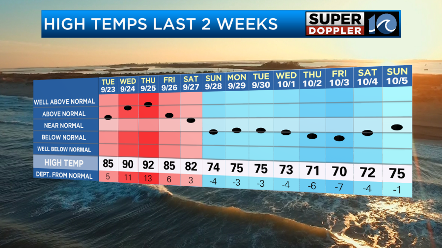
This last weekend was nice! We had cool mornings and mild afternoons. It was also pretty dry with lots of sunshine. Over the last 2 weeks we had one warm streak followed by a longer cool streak.
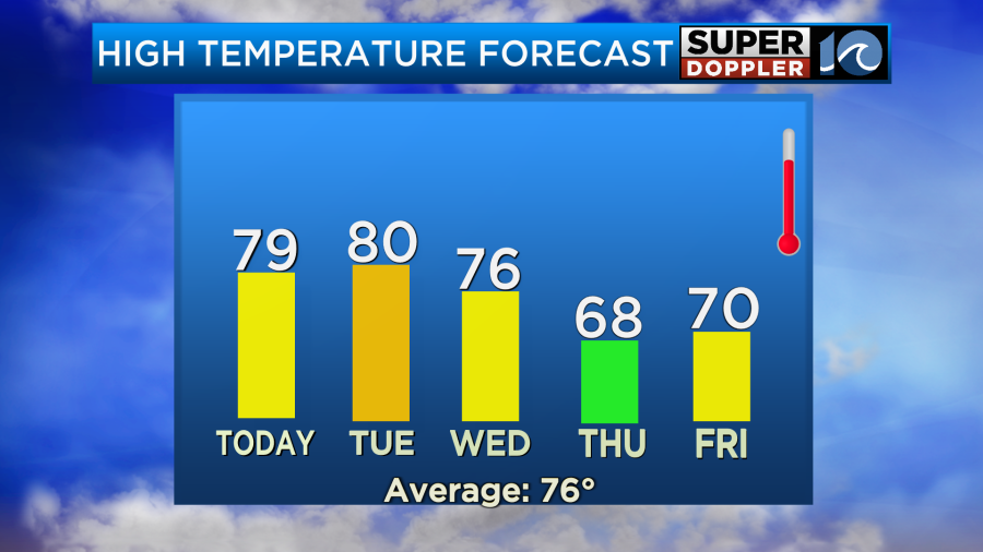
The below average temperatures will come to an end today. We aren’t going into a heat wave, but we will warm up for a couple of days. The humidity will also go up. High pressure is still around, but it has slid offshore.

We’ll have a very light easterly breeze today. We’ll also have lots of sunshine. High temps will rise to the upper 70s this afternoon with some 80s inland and south.
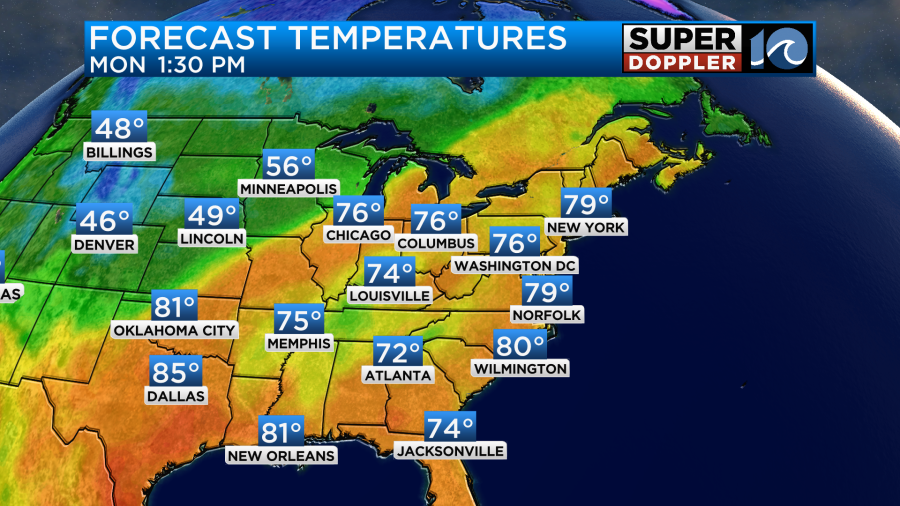
Recently, there was record heat across the Midwest, but some of those areas (like Minnesota) will cool down today. Chicago will still hit about 80, but they were in the 80s and 90s out that way recently.
Anyway, locally we’ll heat up a little more tomorrow. Highs temps will be near 80 or even in the low 80s.
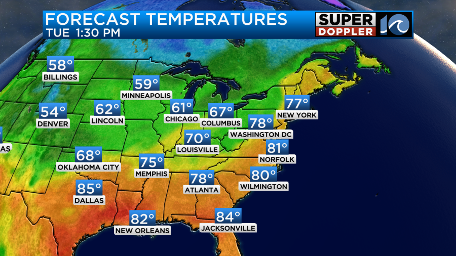
We’ll be mostly to partly sunny on Tuesday. Plus, the wind will be light and out of the south. So we’ll heat up a little bit more. As mentioned, the humidity will also increase.
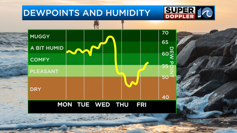
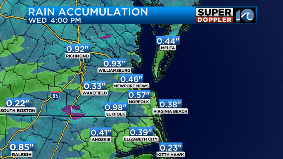
The humidity will go up even more by Wednesday. It will become pretty muggy actually. This will be as the cold front enters our region. This combination will bring us some much-needed rainfall for the region. We’ll start with some spotty showers in the morning, but the rain coverage will increase quite a bit by the afternoon.
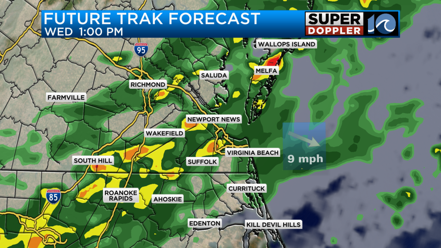
There may be some heavy showers and a few thunderstorms mixing in as well. The rain should end by Wednesday night as the front sinks to the south. We could see a quarter of an inch up to a little more than an inch of rainfall over the region.
High temps will be in the 70s.
We’ll cool down Thursday and Friday as the humidity drops. Highs will be in the upper 60s to around 70.
There may be an offshore low next weekend. This could impact the area with some rain and wind. It’s still very early though. Too early for any good details. I will say that it won’t be a tropical system. There is a tropical disturbance in the eastern Atlantic that is moving generally to the northwest. It has a high chance of formation over the next few days.
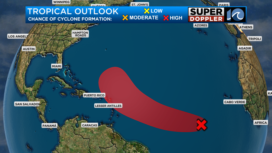
Most of the stuff I’m seeing is showing that feature staying out to sea. Either way we’ll keep tracking it over the next few days.
Meteorologist: Jeremy Wheeler


