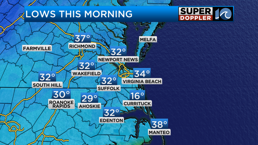
We are now entering a warmer period for weather. Yesterday was very nice out! We had high temps in the upper 50s with a couple of 60s even popping up. Right now temps are rising and falling quickly. This morning we had temps near 40 along the shore, but inland temps dropped down to near 30.
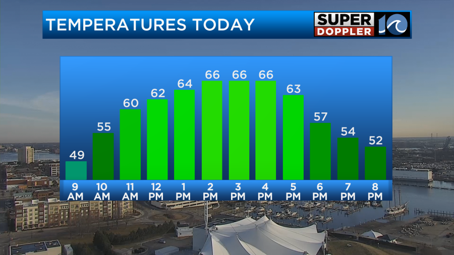
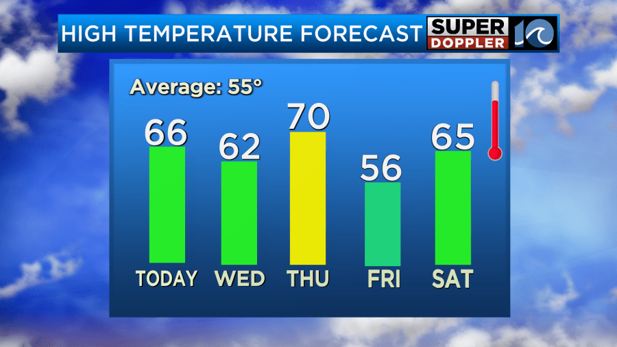
Today we’ll have more of that quick warming. We’ll have fair skies with a light southwest wind. So high temps will rise in the mid-upper 60s.
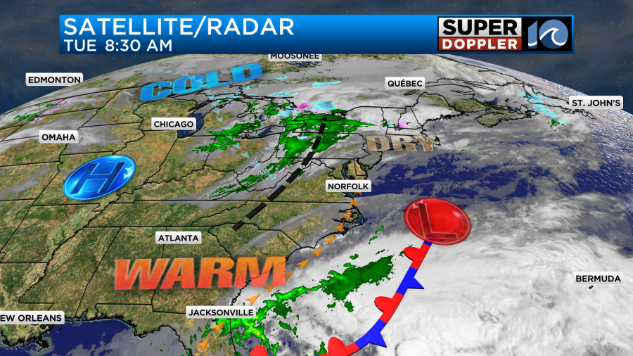
We’ll be dry all day. There’s no big weather features around our area. High pressure is to the west. There is a weak low and a stationary front offshore.
There is a small wind-shift just to our northwest. We’ll have a light southwest today that will help to warm things up, but the winds will turn out of the northwest by the early evening. Tomorrow we’ll have the wind out of the northwest for a time. This will cool us down a little bit but not too much. High temps will be in the low 60s.
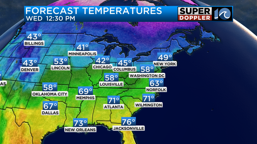
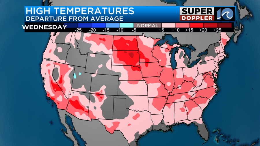
The temps over the next 48 hours will be above average for almost the entire country.
We’ll have lots of sunshine again tomorrow with a few thin clouds. It should be nice again. Just a bit cooler. By Thursday the winds will pick up out of the southwest. We’ll increase the temps and the moisture. High temps will push up to near 70 or possibly even the low 70s.
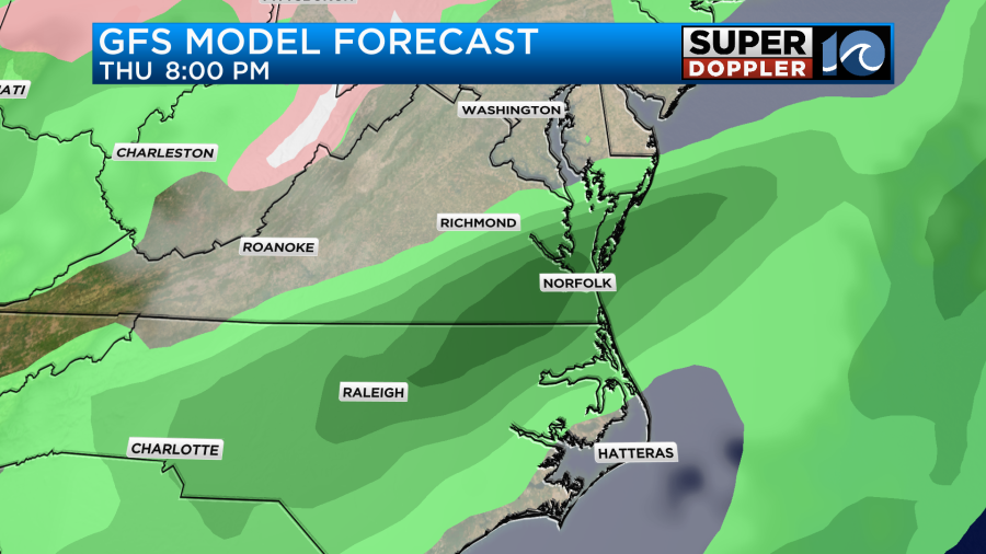
The models show some isolated or widely scattered showers by Thursday afternoon.
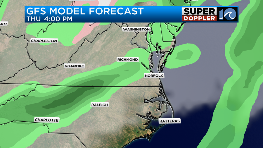
However, they still show a big area of rain developing by Thursday evening.
Yes…There is a long-term drought over the region. Technically, part of the area is in a “moderate drought” (level 2).
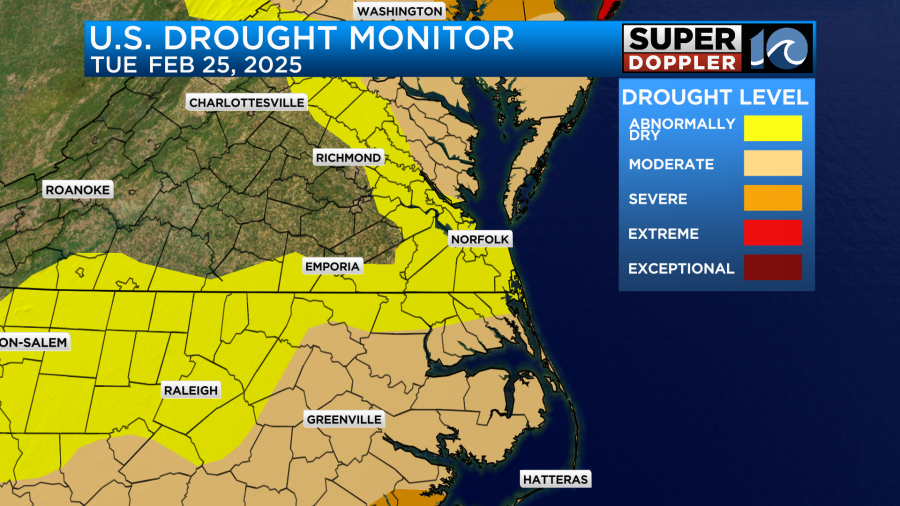
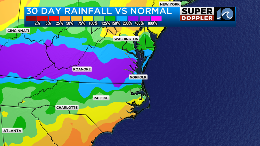
However, the short-term climate has been very wet. We’ve been running about 200-400% above average when you factor in the recent snow and the rain.
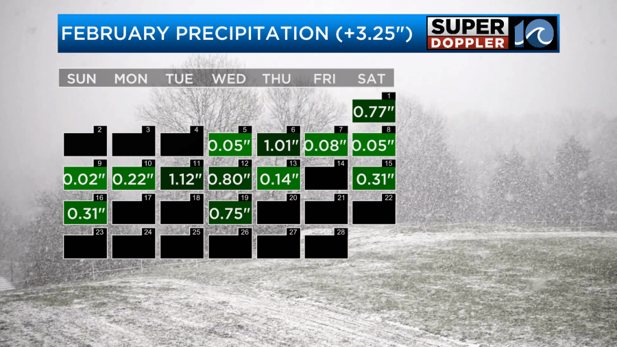
We’ve had over 5 and a half inches of rainfall so far this month. So the next update for the Drought monitor on Thursday should improve the official map.
We will be dry Friday through the weekend. High temps will drop to the 50s on Friday. We’ll be in the 60s Saturday. However, we will drop to the 40s on Sunday. At least it looks like that cool down will only last for a day or two.
I mentioned rainfall. When you factor in the rainfall for the month along with the snow melt, then we are over 3 inches above average for the month.
It’s been very wet here lately, but it’s been nothing compared to some flooding over other parts of the country. Yesterday, there was some really bad flooding over the Florida Keys.
I didn’t have a chance to talk about it last week, but the flooding in Kentucky was historic and deadly. Not only did they have really bad flooding, but then they had a blast of Arctic air that turned it into ice.
Hopefully, we won’t have anything like that going into March and April. However, I do expect there to be a lot of bad storms. It just seems like we have an active pattern. If we get some warming, then it could be a wild severe weather season. We’ll see. Hopefully, I’m wrong.
Meteorologist: Jeremy Wheeler


