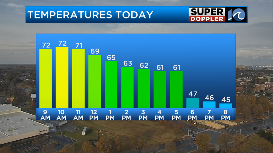
Today is going to feel like a warm Spring day with thunderstorms. In fact we may get close to a record high. High temps will aim for the low-mid 70s around midday.
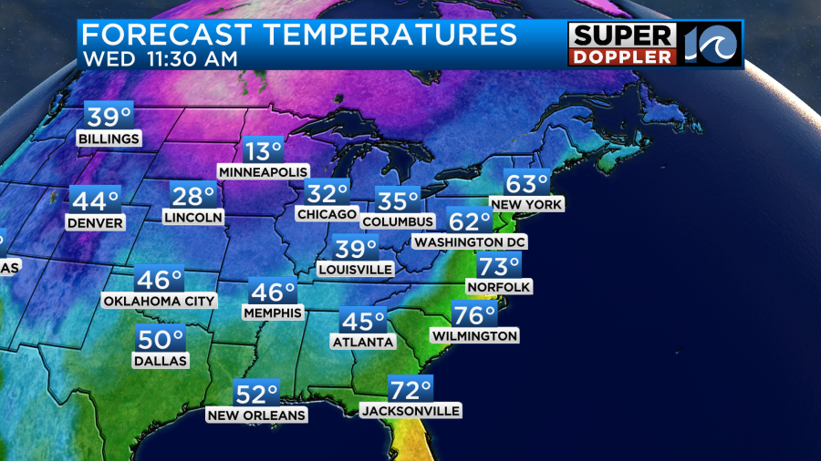
Then temps will fall during the afternoon to the 60s. Then the 50s.
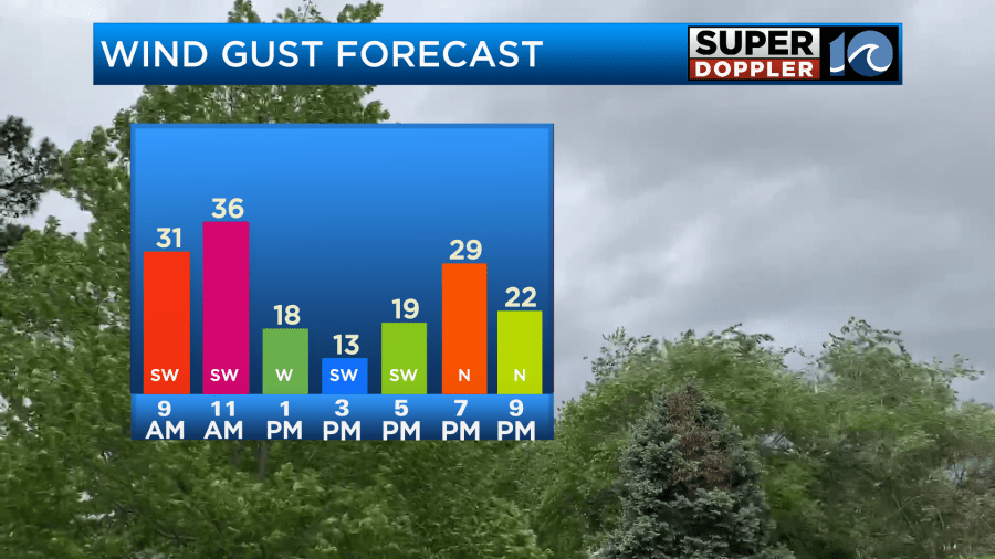
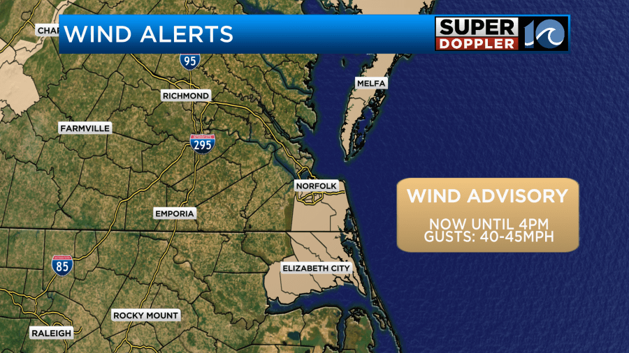
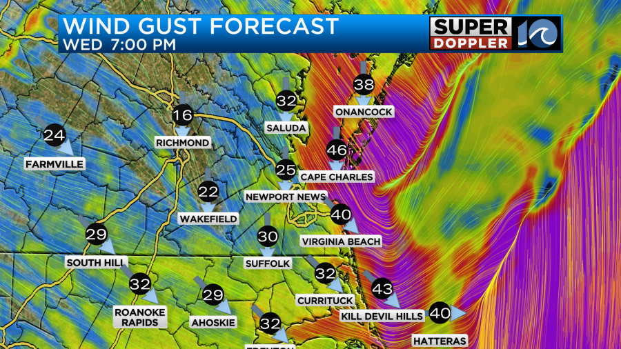
The strong southwest winds are the main drivers for the warming temps. Winds will gust up to 35mph for a time with some gusts between 40-45 possible near the shore.
Wind Advisories are in effect for some areas along the coast. These may get extended later today.
There is a strong cold front to the west that is steadily closing-in.
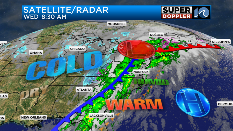
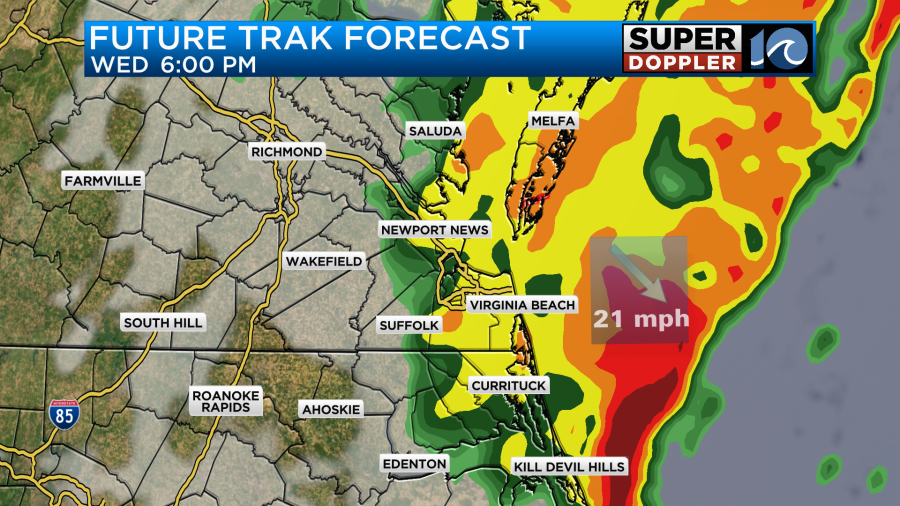
We’ll have cloudy skies with on and off rain showers through midday.
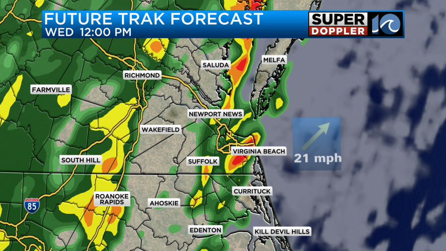
There may be a few heavy showers through that time, but the showers will be passing through. However, during the afternoon there will be a large/wide line of rain and storms that will steadily move through.
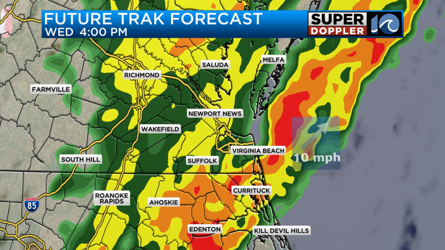
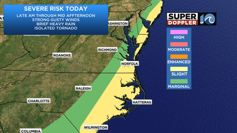
There is a slight risk for severe weather from the late morning through the mid-afternoon. Strong gusty winds and heavy rain will be the main threats, but an isolated tornado will be possible in the region.
After that temps should drop, and we should stabilize. The chance for storms will end. However, the rain will keep falling behind the front until the evening.
Winds may temporarily drop-off for a bit, but then they will rapidly increase again during the evening as the front sinks faster to our south.
By the later evening we’ll really start drying out. Then we’ll have clearing skies tonight. Low temps will drop down to the 30s, but we should stay above freezing. So I don’t expect iciness to be a problem except for a few locations north of the metro.
Tomorrow the front will sink far to our south, and colder drier air will push in. High temps will only be in the upper 40s despite lots of sunshine.
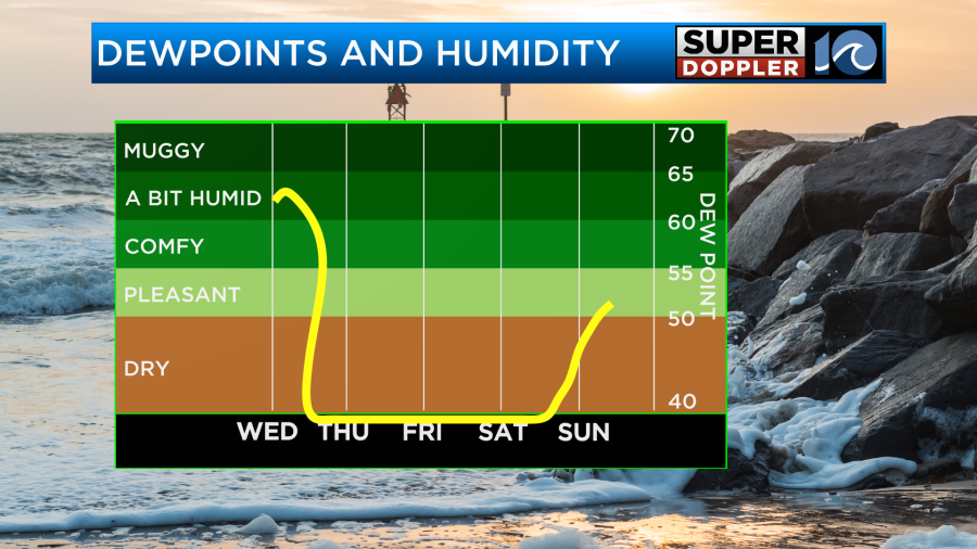
The humidity will also drop big-time as well. Dew points will go from the 60s today to the 20s and 30s tomorrow.
There will be some breeziness out of the west tomorrow, but it won’t be nearly as bad as today. Winds will gust out of the west/northwest up to 20mph.
We’ll be dry and chilly on Friday, but there will be less wind. Low temps will be in the 20s and 30s. High temps will be in the upper 40s.
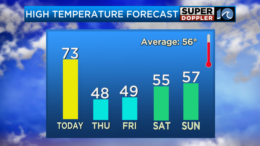
There may be a couple of 50s if we are lucky. Either way it will be nice on Saturday. We’ll be partly cloudy with highs in the 50s. There may be a few showers returning on Sunday, but the chance for rain is much lower. High temps will be in the 50s.
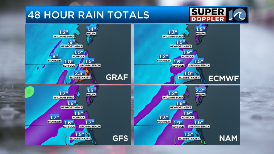
Over the last few days I talked about how much we need some rainfall. We are down about an inch for the month. Well, finally we have a good shot at rain today. In total we could see an inch to an inch and a half. Some locations may get over two inches.
Stay tuned for updates.
Meteorologist: Jerem Wheeler