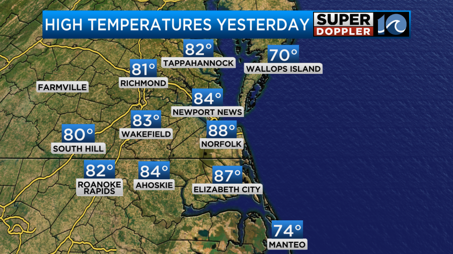
When you are in the casino, sometimes you can get into what’s called a “hot streak”. That is a streak of winning whether on a table game or a slot machine. We’ll be on a hot streak this weekend, but I don’t know if that will be considered winning. Yesterday our high temps made it into the mid-upper 80s.
It was also humid, but the breeze made it feel ok. Today we’ll have similar weather, but there will be one big difference. Temps are going to fall later today. A back-door cold front is to our north.
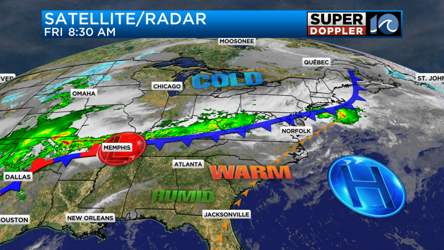
It is the same front that extends out to the Tennessee River Valley. The front won’t bring us any bad weather, but it may create some isolated shower or storms this afternoon as it drops in.
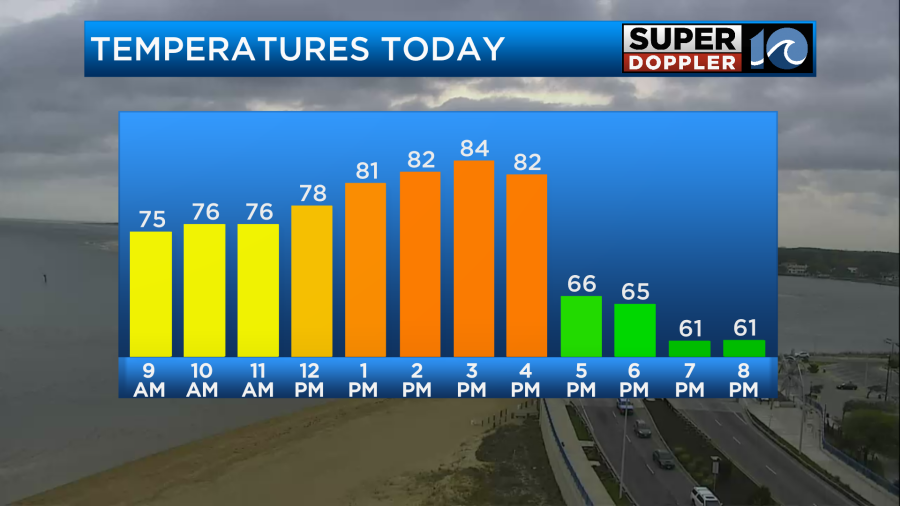
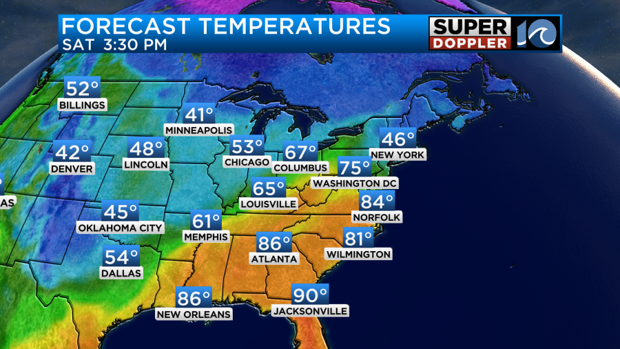
As far as the temperatures go… We’ll warm to the mid 80s this afternoon with mid-upper 80s inland/south.
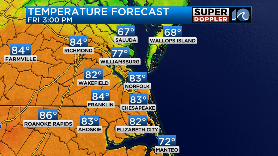
However, as the front sinks to the south we’ll cool down to the upper 60s this evening. It may even drop to the mid 60s for some.
We’ll have a mix of sun and clouds for the day.
Meanwhile, the severe storms will continue again out over towards the Mid-Mississippi and Tennessee River Valleys.
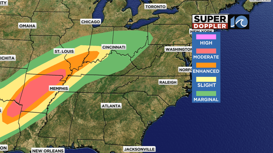
They have already had a lot of rainfall in that region. There are a lot of areas of flooding. Some locations have had close to a foot of rainfall.
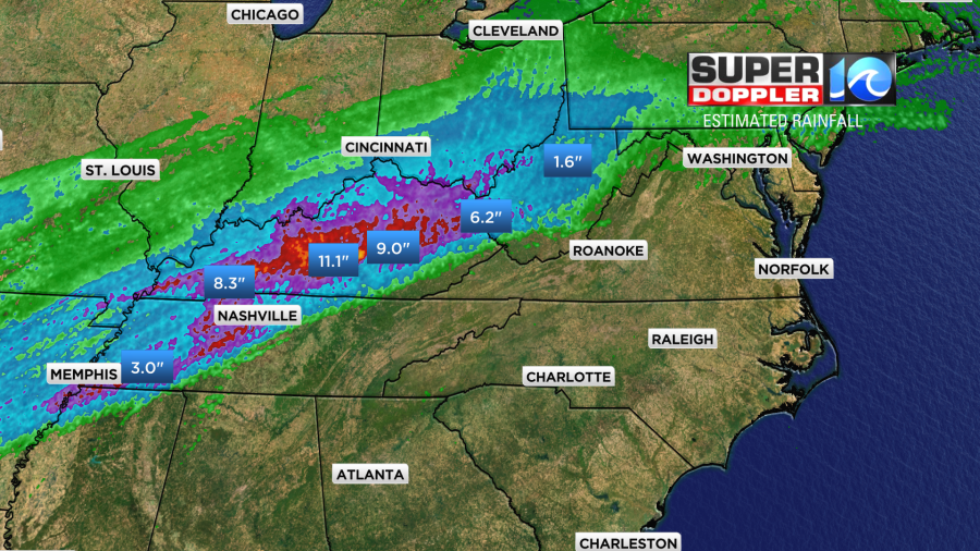
More heavy rain is expected today and tomorrow. Some of the totals could rival the amounts during hurricane Helene before it’s all done. At least the current rain will be spread out more over time.
We need some rain here. We won’t get much this weekend, but there will be some low rain chances.
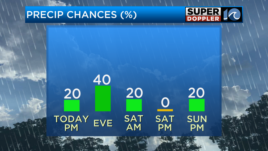
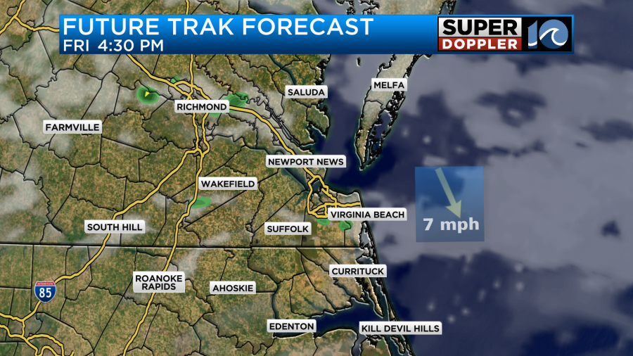
The highest chance for rain (before Monday) is this evening. As the cool front sinks more to the south, we’ll develop some scattered showers with some isolated thunderstorms.
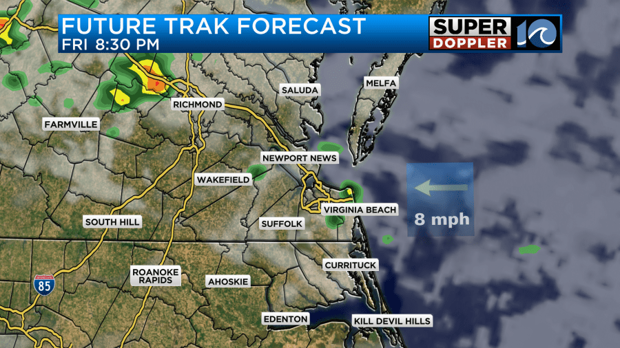
These should decrease before midnight, but an isolated shower could continue until early tomorrow morning. Low temps will be in the 50s and 60s tonight.
Tomorrow the front will lift back north as a warm front. We’ll warm up on Saturday back into the mid 80s.
We’ll be partly cloudy for the bulk of the day. We’ll be partly cloudy for most of Sunday, but clouds will increase later in the day. There may be some isolated rain showers forming between the late afternoon and evening. Winds will be pretty gusty out of the southwest. They could reach up to 30mph for a time. This will push the high temps up to the upper 80s.
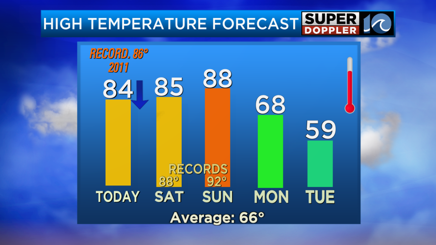
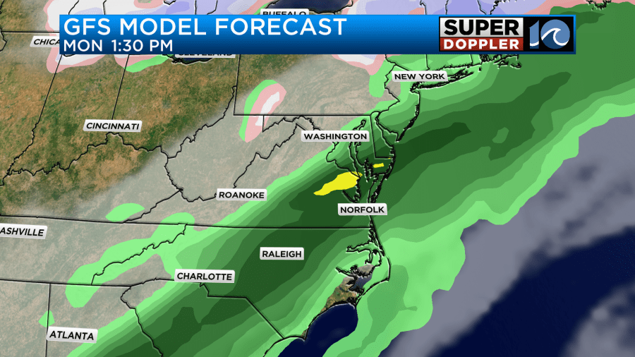
Some of the high temps this weekend will be flirting with a few records. It will be way above the average of 66 degrees. Some folks may love this type of heat, but I am really hoping we get back to some 60s and 70s for a while. It’s too early to be running the A.C. for days on end. Luckily we will cool down on Monday. A strong cold front will move into the region. It will drop the highs into the 60s. Monday could be a washout.
We need it though. We need a good soaking rain now that everything is growing like crazy. This will also wash out all the pollen. Tree pollen levels will stay very high through the weekend. Grass will be moderate. Even if it is brief, the widespread rain should help the pollen levels for a little while.
We’ll be even cooler on Tuesday with high temps aiming for the upper 50s. There will be some lingering showers in the morning. Then we’ll dry out. Stay tuned for updates on the rain over the weekend. I’m hoping that the forecast doesn’t dry up before we get there. We just finished out last month over 2 inches below average.
Meteorologist; Jeremy Wheeler


