The weekend looks rather unsettled across Hampton Roads with daily chances for showers and thunderstorms as well as continued heat and humidity! Let’s break it down.
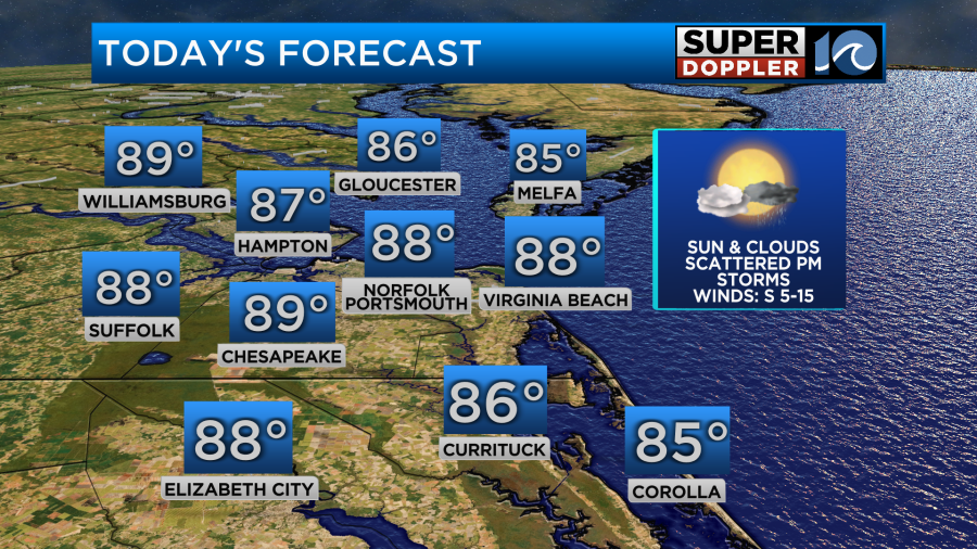
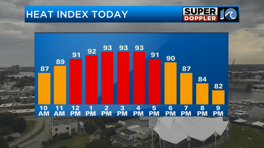
As we head through the day today, south winds will allow for a moist and unstable airmass to move into the area. This will allow for scattered showers and thunderstorms to form later in the day as we heat up during the afternoon.
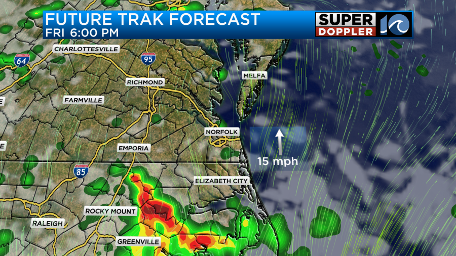
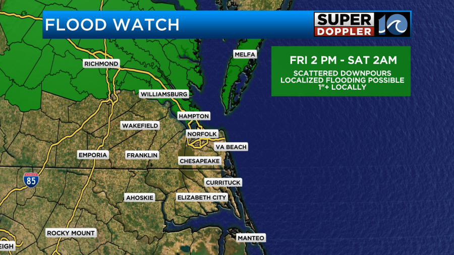
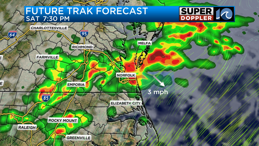
In anticipation for today’s storms, the National Weather Service has issued a flood watch for the peninsulas and eastern shore. It is set to begin at 2pm and run until 2am tomorrow morning.
High temperatures will be near 90 degrees for some locations but when factoring in the humidity it will feel closer to 95 degrees.
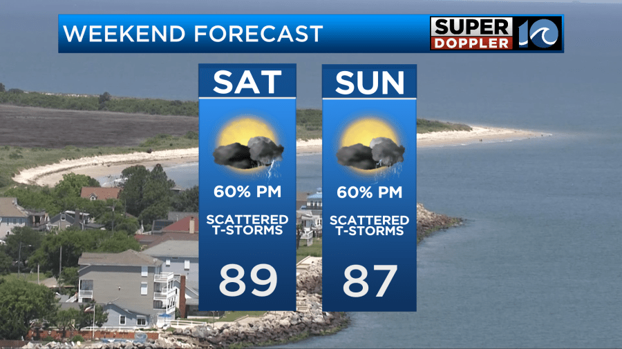
As we head into the weekend, high pressure offshore will allow for winds to remain out of the south and southwest. This will allow for the sticky air to remain across the area and provide our next system with fuel for afternoon showers and thunderstorms.
While there may be a chance for a few quick downpours Saturday morning, the more widespread chance for storms will come during the afternoon hours. Some strong storms could even be possible but the primary focus will be heavy rainfall. Some areas may pick up 1-3 inches of rain wherever the heaviest cells set up which is enough to cause localized flooding for areas with poor drainage.
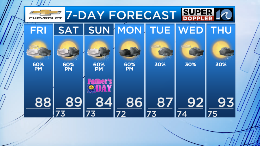
On Father’s Day we will once again have to dodge some afternoon showers and thunderstorms. The main threat will once again be heavy rainfall but severe weather also cannot be ruled out on Sunday. Keep an eye to the sky if you have any plans with dad!
It will be important to note that most of the morning and midday hours on Saturday and Sunday will be dry with a mixture of sun and clouds. So it will not be a weekend washout.
-Meteorologist Brian Michigan