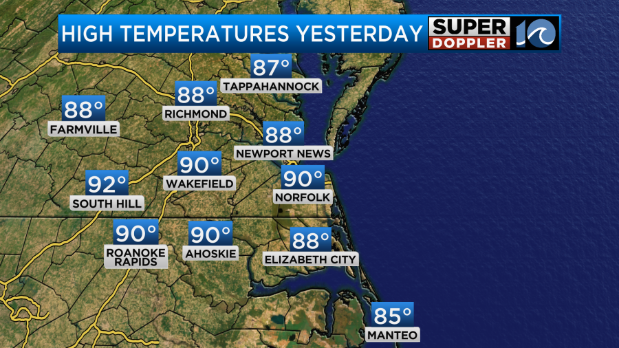
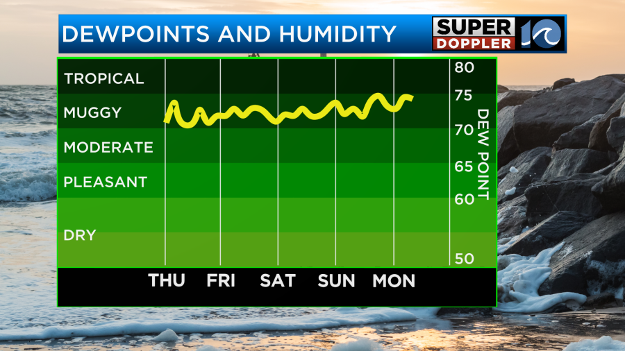
It almost feels like the months flipped. We are experiencing some pretty hot and humid conditions lately after a very cool August. Course we are now getting into late September. It’s a little late (but not unheard of) to have high temps around 90 degrees. Yesterday, we did hit 90 in Norfolk. It was definitely a hot and humid day.
Today we are aiming for 90 degrees again.
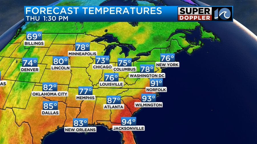
There has definitely been a cool down over the Midwest. There is a front to our west today, but it will not arrive until tomorrow.
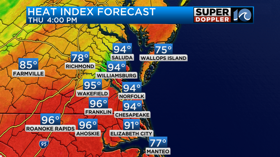
High pressure is just offshore. We’ll be in the hot zone today with a southwest breeze. We need a breeze. Because the heat indices will be in the low-mid 90s this afternoon.
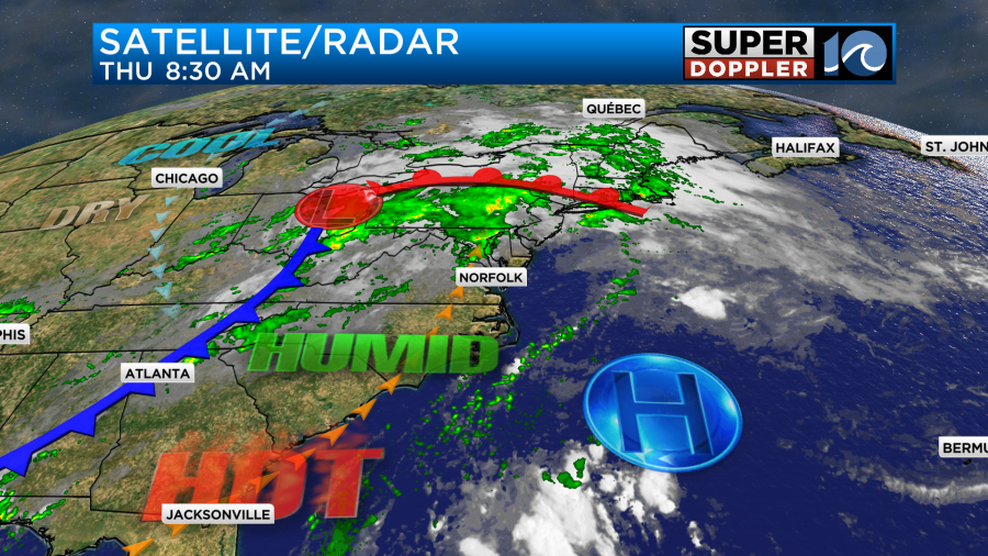
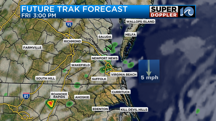
We’ll be partly cloudy through the day. There will be some isolated (pop-up) showers and storms this afternoon. There may be a few more by the evening.
Tomorrow the cool front will slowly slide into the region. We’ll still be warm and humid with highs in the mid-upper 80s.

However, tomorrow we’ll have a higher chance for scattered showers and storms during the day.
Unfortunately, the front now looks like it will stall out over the weekend. Plus, the moisture will keep coming up from the south.
This means that we are going to have scattered rain showers and a few storms both Saturday and Sunday.
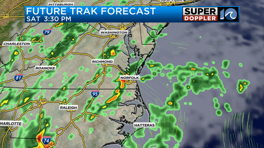
This will impact the Neptune Festival. There’s still time for the forecast to change, but the Sunday forecast will depend (in-part) on what happens in the tropics.
Things have really picked up in the Atlantic. There are 2 systems out there right now and potentially a third.
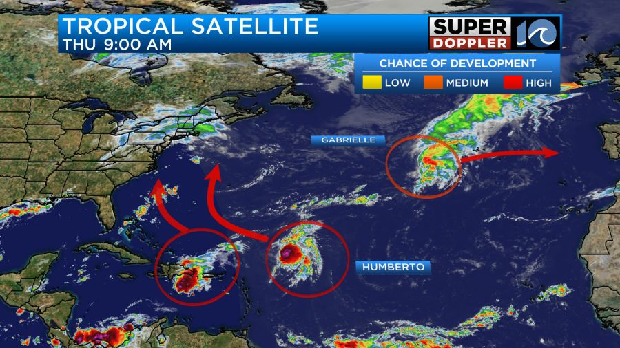
Hurricane Gabrielle has weakened over the last couple of days. It is still on an easterly track. It is forecast to hit the Azores islands tomorrow morning as a minimal hurricane or strong tropical storm.
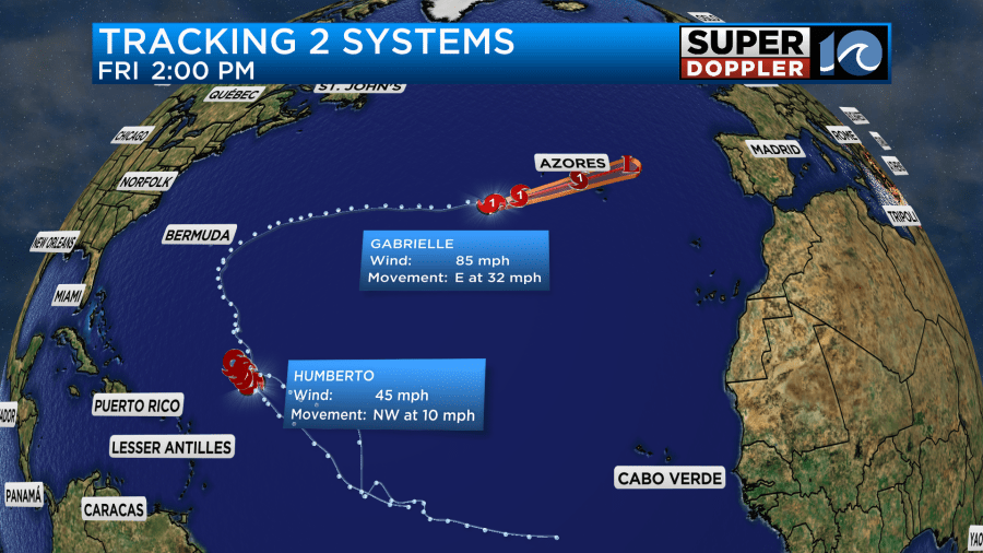
Then there’s Humberto. This is a tropical storm a few hundred miles south/southeast of Bermuda. It is moving to the northwest. It is forecast to move to the northwest over the next few days and gradually strengthen.
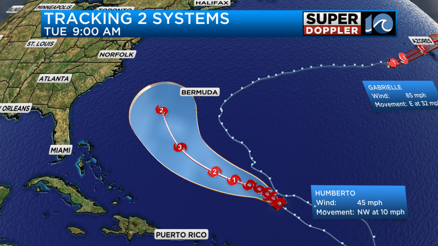
It may even become a major hurricane by Monday. The latest track has it to the southwest of Bermuda by day 5. the models are in fair agreement on this scenario. Although there are some differences in the timing and placement.
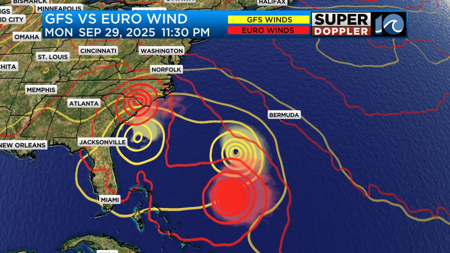
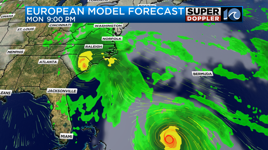
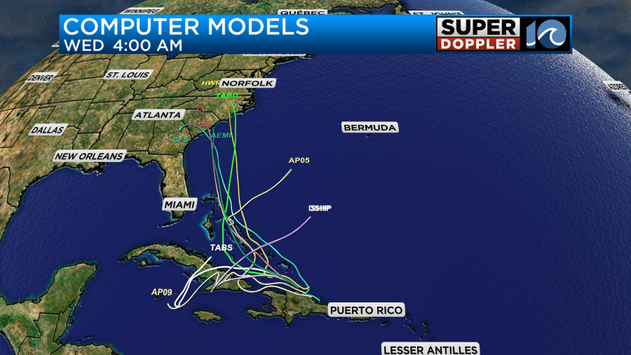
The potential 3rd system is right now near the Puerto Rico area. It is a cluster of showers and storms, but the storms are growing in size. This feature will probably snake it’s way to the north/northwest over the next couple of days. This will put it over some very warm ocean water. The GFS and European models have this feature (Invest 94) turning into a tropical storm and heading towards the South/North Carolina coasts in a few days. (See above)
They then have it pushing west/inland and weakening. The Euro has been fairly consistent with this feature, but the GFS has been bouncing around quite a bit. Keep in mind that even if the center of (potentially Imelda) is to our south, that it will still push a lot of moisture up into our region.
The thing is that stationary front will probably still be nearby. So there’s a chance that it pushes that feature out to sea. Not every model agrees with the GFS and Euro positions, but there is better agreement now.
It is highly possible that the potential system and Humberto will interact with each other. Some meteorologists are talking about the Fujiwara effect where two tropical systems can impact each other, and then they influence each other’s paths. This is possible, but the systems would have to get closer for that to happen. Which is also possible. The bottom line is that we’ll have to wait for a few more updates, but we will want to watch things closely. At a minimum we could get some more big waves and beach erosion. On the high end we could get some strong winds in the area along with some heavy rain next Sunday into Monday. Stay tuned for updates.
At the same time there is a supertyphoon that is impacting China. Ragasa has already created a lot of damage along its path. It is the strongest storm this year. China Typhoon Ragasa.
Meteorologist: Jeremy Wheeler