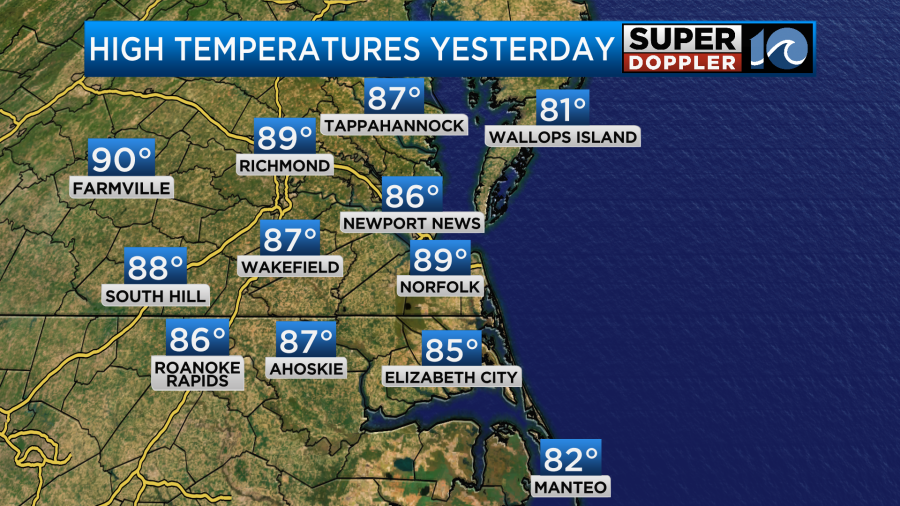
Yesterday we started to heat things up. During the afternoon most temperatures made it into the 80s.
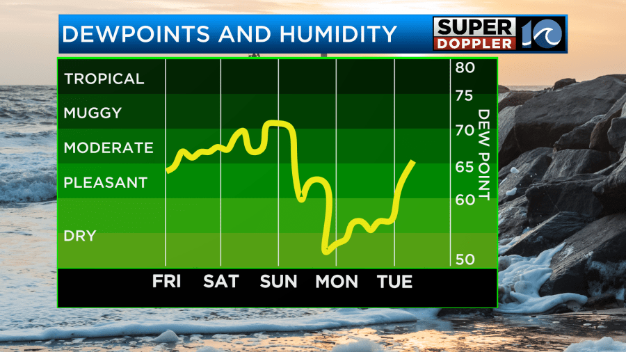
It was still fairly nice out as the humidity wasn’t too bad, but it was definitely warmer. Today I am calling it HOT and humid. High temps are going to aim for the low 90s this afternoon.
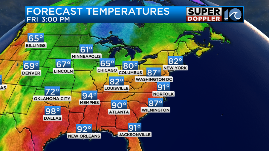
On top of that. The humidity will be a little higher. So the heat indices will be in the low-mid 90s.

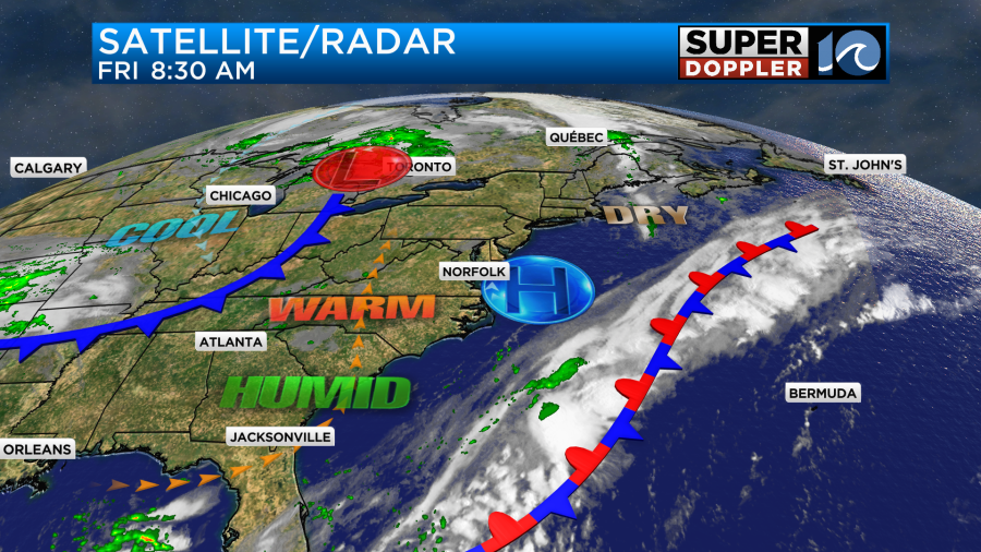
We’ll be mostly to partly sunny with a light southwest wind. High pressure is just offshore with a stationary front farther to the southeast. The cool front is still slowly drifting over the Midwest.
Tomorrow the cool front will move closer to the area, but it won’t move through yet. So we’ll have another hot and humid day. High temps will run up into the low 90s again.
The heat index will be in the mid 90s. We’ll be partly cloudy with only some isolated showers or storms during the afternoon. By the evening the front will be creeping closer to us from the northwest. There will be a cluster of showers and storms closing in as well. HOWEVER… Some of the models have the rain showers and storms falling apart as they move into the region.
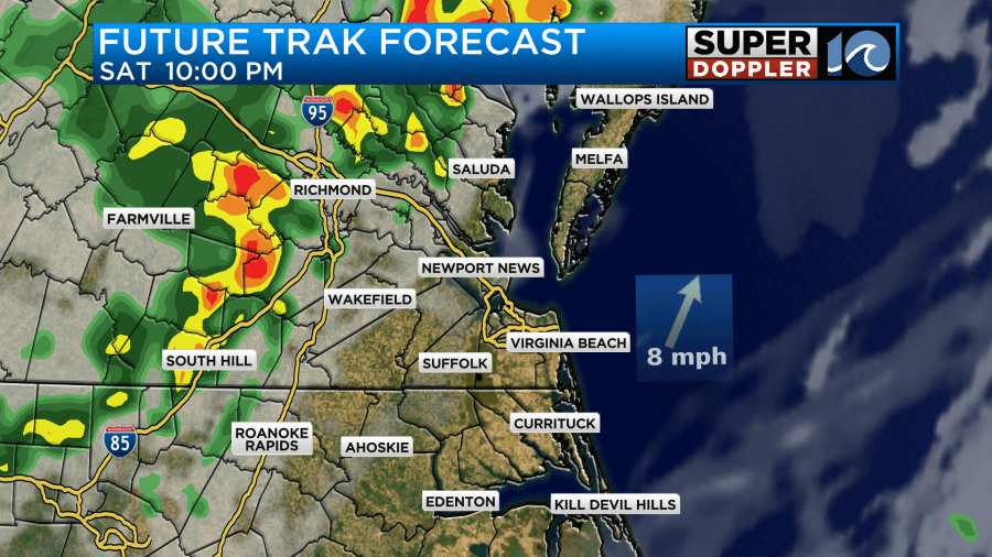
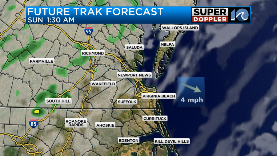
I disagree with this scenario a little bit. I think at least a few of the showers and storms will survive tomorrow night. However, I do think they will decrease. The front will then move southeast a little bit. It may meet up with the offshore front. Between now and Sunday morning that boundary will turn into a warm front and will land along the coast. Rain will fall where these 2 fronts land. For now it looks like the warm front will be just offshore while the cool front hovers over Hampton Roads for a bit.
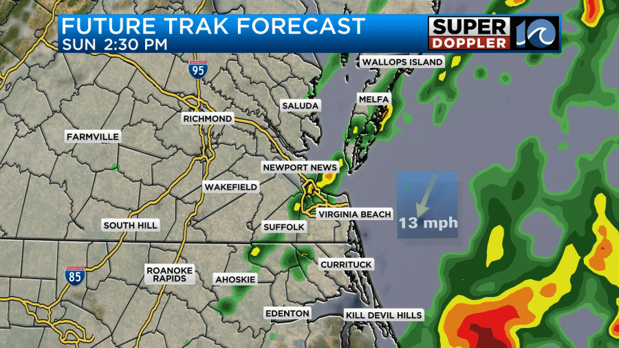
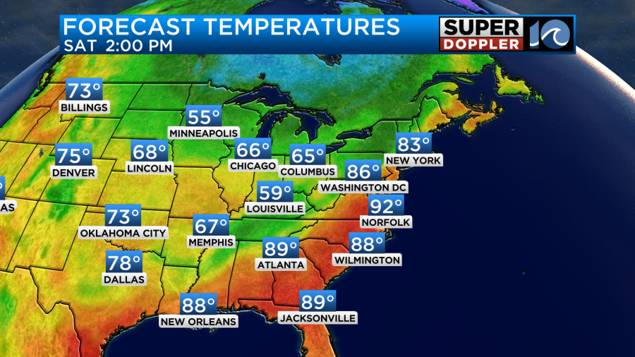
If the warm front gets a little closer, then it could put more rain down over the region. Perhaps some heavy rain even. We’ll see. The chance for rain is not huge, but hopefully we get some rain. We really need it. Either way we will cool down. High temps will drop to the 70s.
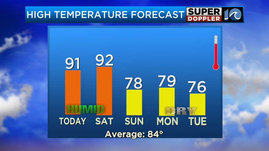
We’ll also dry out as we go between Sunday and Monday.
We are still watching that tropical disturbance in the Atlantic. It is still on a westerly track
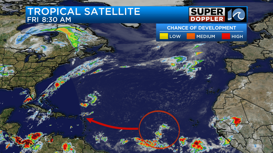
It will continue to track west this weekend, and it will probably become a tropical depression or tropical storm. However, the models are not as set as to what it’s gonna do. The GFS keep bouncing around all over the place after day 5. It still has it heading towards the Lesser Antilles in several days. However, the European model now basically kills-it-off. Here are the two models in about 7 days.
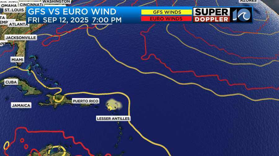
This is still a long ways out. We’ll have updates on it over the weekend. Meanwhile, there is some good news for the folks in Hawaii. Hurricane Kiko continues to weaken. It is now forecast to become a tropical storm in about 5 days as it moves towards the islands. However, the most likely path has it just north of the islands.
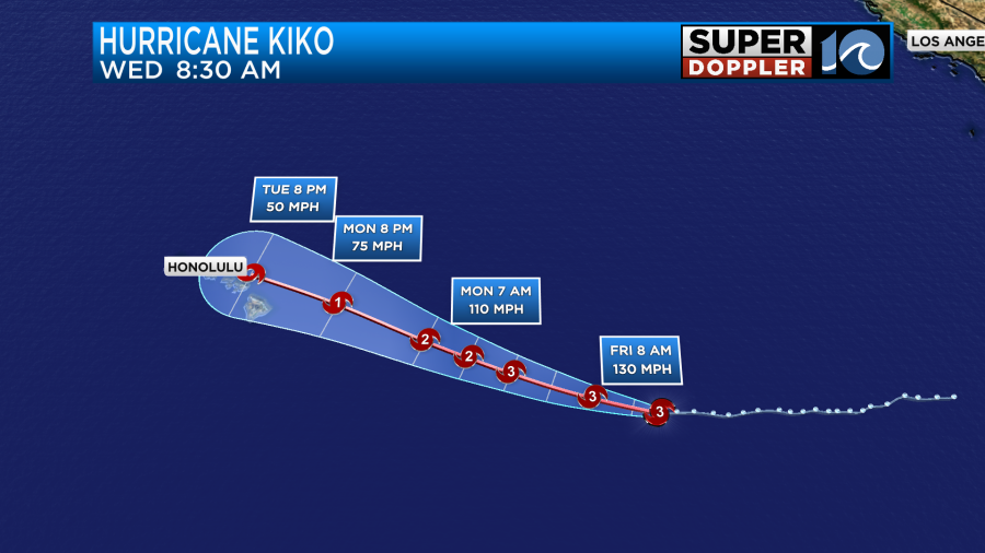
They will definitely have some impacts, but the exact track will determine how bad they will be. We’ll also have updates on that over the weekend. Meanwhile post-tropical storm Lorenzo is bringing some heavy rain to the western coast of Mexico. Lorenzo flooding.
Meteorologist: Jeremy Wheeler