
We had another nice day yesterday. We had lots of sunshine with high temps in the 60s. I took advantage of the weather. I took a bike ride in the afternoon, and I washed my vehicle in the evening. The pollen is increasing in the air. Plus, many folks have those dusty spots from last weekend’s showers. So if you need to wash your car, then we’ll have some nice conditions for it over the next 3 days.

Temps should be mild enough to do that or any outdoor activities. However, temps are truly going to be TRICKY over the next 3 days. Today a cold front is slowly sliding into the region from the north.
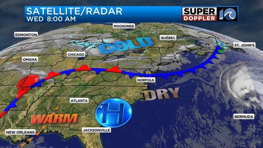
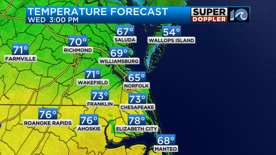
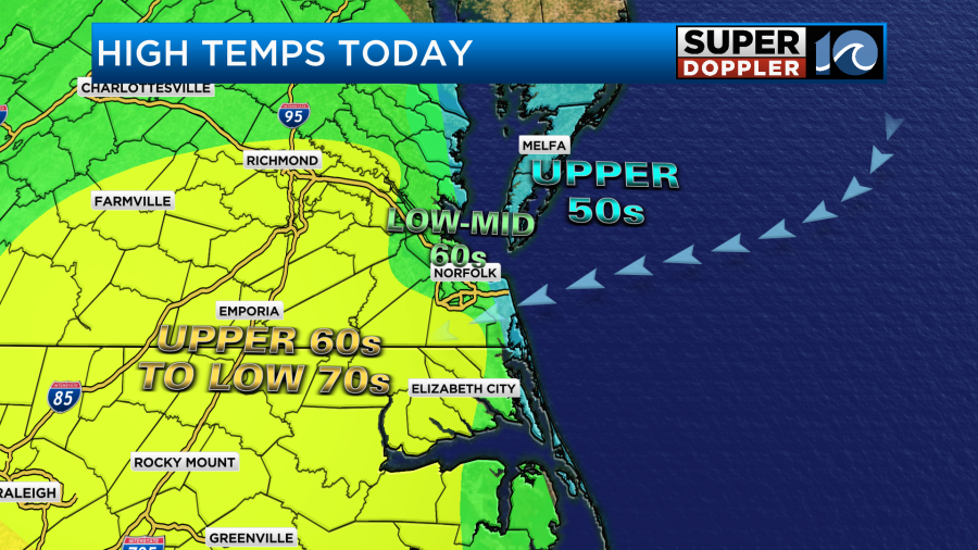
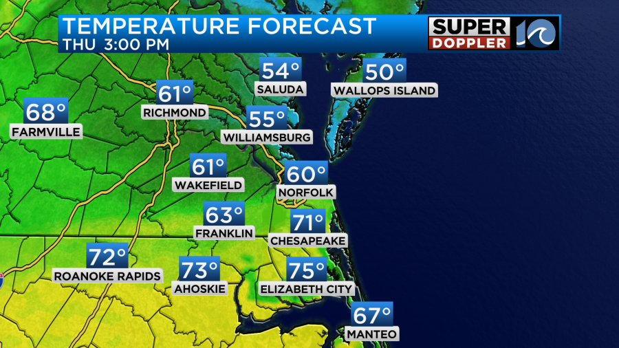
That front is forecast to move into the region and stall out today. It will probably stall out right on top of us. This is going to create mixed temps for the local area. We’ll probably top off in the low-mid 60s in the metro area. However, it will possibly only be in the upper 50s near the shore. Temps will likely hit the 70s inland and south. Here is our Future Trak model’s temperature forecast:
Here is my more general forecast:
Despite the front moving in we’ll stay very dry. We’ll have lots of sunshine with a few PM clouds. Winds will be out of the northeast at 8-12mph.
Our local temps will be above average. However, there are some very warm (if not hot) temperatures to our west.
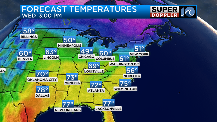
Parts of southern Texas will probably hit the 90s. There’s even been mention that a small area down there could briefly hit the triple digits.
Tomorrow our region will have a similar situation to today. The boundary will sit across the area. It may be a little more to the south. A weak area of low pressure will scoot east along the front. This will be able to drag it a little more to the south on the back side of it as it slides offshore. So here is what Future Trak shows for tomorrow for temps:
If the boundary stalls out a little earlier or later, then that could dramatically change the temps. Temps may even swing a bit during the day which is common for this time of year. It’s not just the air mass by itself. Water temps are in the upper 40s to around 50 right now. So a wind off of the water can make for a chilly breeze. Luckily, we will be dry again tomorrow. We’ll have light northeast winds.
The models have trended much cooler for Friday now. I currently have 60 degrees for a high, but some things are suggesting highs more in the upper 50s.
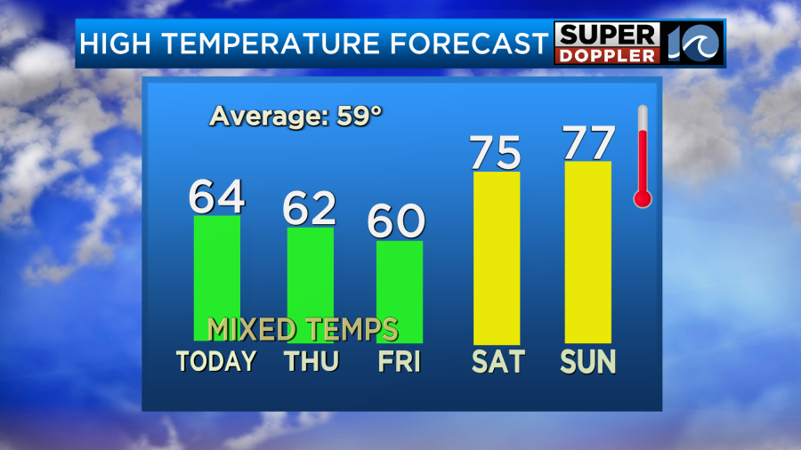
We’ll be partly cloudy on Friday. The good news is that the weekend still looks warm, and I don’t see that trend changing. High temps will be in the mid-upper 70s both days. We should stay dry on Saturday. On Sunday during the day a cold front will be moving in from the west, but we should stay well ahead of it in our region. So there may be a few showers late in the day, but the bulk of the rain looks like it will arrive more during the evening and overnight.
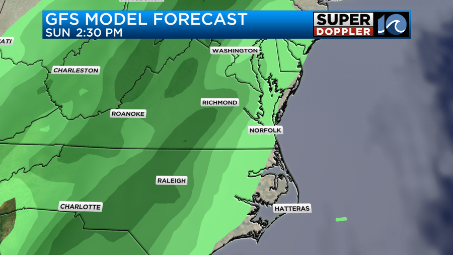
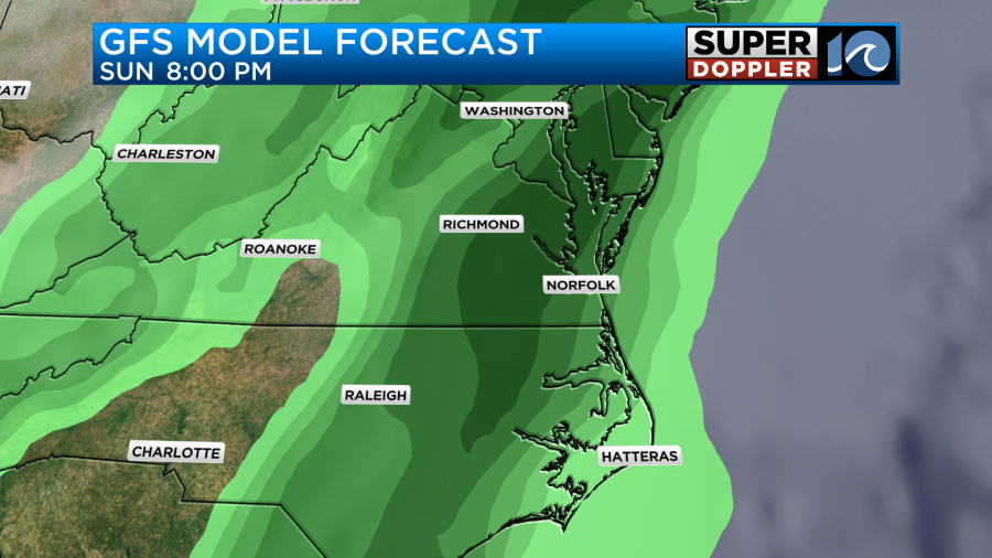
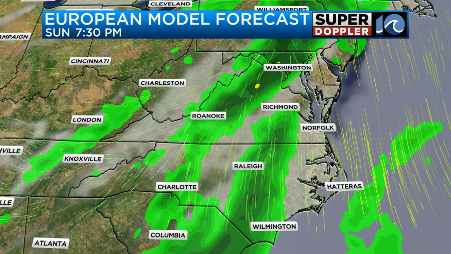
There will probably be some thunderstorms with these rain showers. However, with the focus more in the evening and overnight there will be some cooling as the line arrives. So we’ll see how strong the storms get. There will definitely be some strong winds during the day and evening ahead of the front. The rain will likely linger into Monday morning. This could affect some St. Patrick’s day parades. I’ll talk more about that in tomorrow’s weather blog.
Meteorologist: Jeremy Wheeler


