
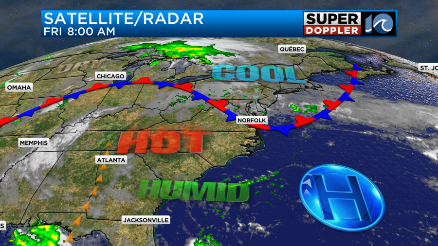
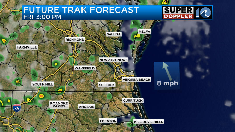
As I write this blog I am adjusting the forecast a bit. We have a tricky day for temperatures as a cool front has slowly sunk to the south. The front has already reached northern Virginia Beach. Clouds have increased there. Some drizzle was falling there and at Chincoteague north of the front.
I have it as a stationary front because it is slow-moving. Also, it will stall out pretty soon. However, it is definitely a boundary between the hot and the cool weather.
Temps will still rise for some inland and south this morning. However, they will fall for a time later this morning into midday. They will probably stay down in the metro from the early morning until the early afternoon (at least).
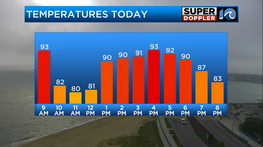
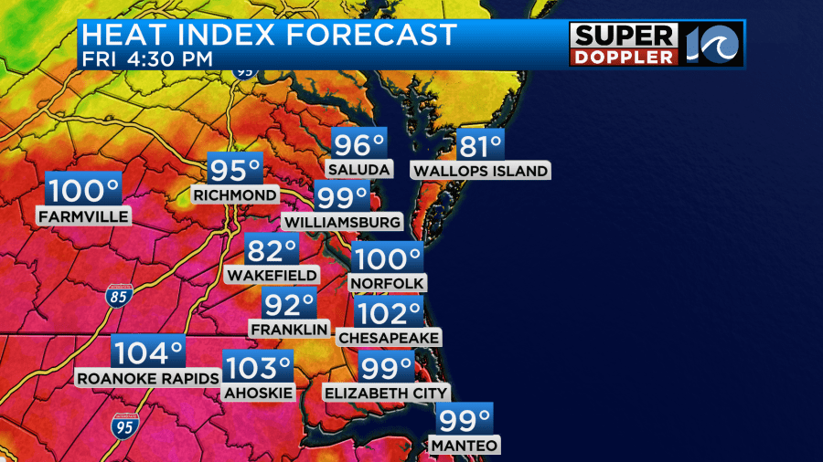
Keep in mind that we will likely heat up this afternoon as the front is forecast to rise back up to north. That’s when temps will aim for the low 90s. That is also when the heat index could reach up to over 100.
However, I wonder how fast that front will lift to the north. I’ve seen cool air linger sometimes during events like these. Course this is almost more of a cool season event than a warm season one. So we’ll see. There are heat advisories for (part) of the region. I won’t show them though because I think they will have to be adjusted for today.
We’ll have a mix of sun and clouds through the day. There will be some drizzle for a time. Then there may a few thunderstorms this afternoon near the front.
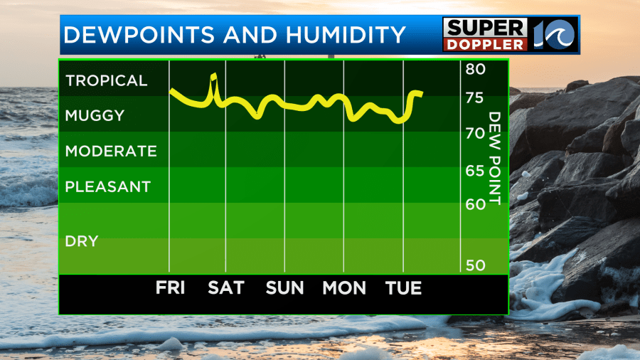
Over the weekend the forecast gets much easier. The front will lift north as a warm front. It will be hot and humid both Saturday and Sunday.
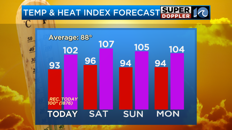
Highs will be in the mid 90s. The heat index will probably be over 105. Tomorrow will be fairly quiet. We’ll be partly cloudy with only some isolated showers or storms. However, on Sunday a cool front will try to get close to the region. I think it will stall out just to our north. However, that will (probably) increase our chance for some scattered showers and storms.
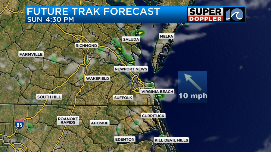
It will depend heavily on how close that front stalls out.
After that we’ll stay hot and humid through Tuesday. Highs will stay in the 90s.
We may have a cool down on Wednesday. Highs may drop to the 80s for a day. That’s a few days out. So we’ll see.
Finally, there is a weak disturbance over the southern Bay of Campeche. It has a low chance of formation.
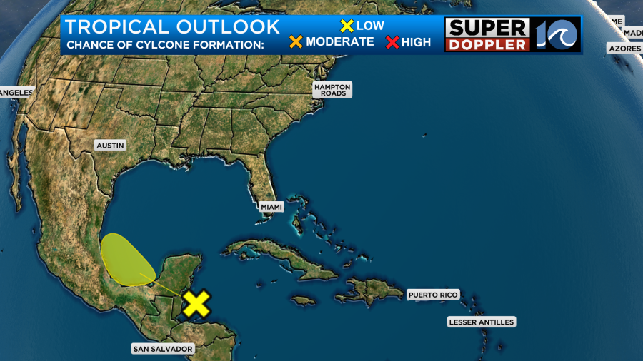
If it does form, then it would probably affect the coast of Mexico. There’s a low chance that it would affect south Texas. Stay tuned for updates.
Meteorologist: Jeremy Wheeler


