The Midwest and the South have been affected by the severe storms for the past 24 to 48 hours. Now it’s our turn. Thankfully, we don’t have all of the ingredients available for widespread severe storms, but we could still see a few. This morning will be dry with increasing clouds, but expect the wind to pick up. We should see wind speeds at 10-20 mph this mid-morning, then by noon. We should see 20-30 mph wind speeds with gusts getting close to 40 mph. That wind will stick around this afternoon as the thunderstorms get closer.
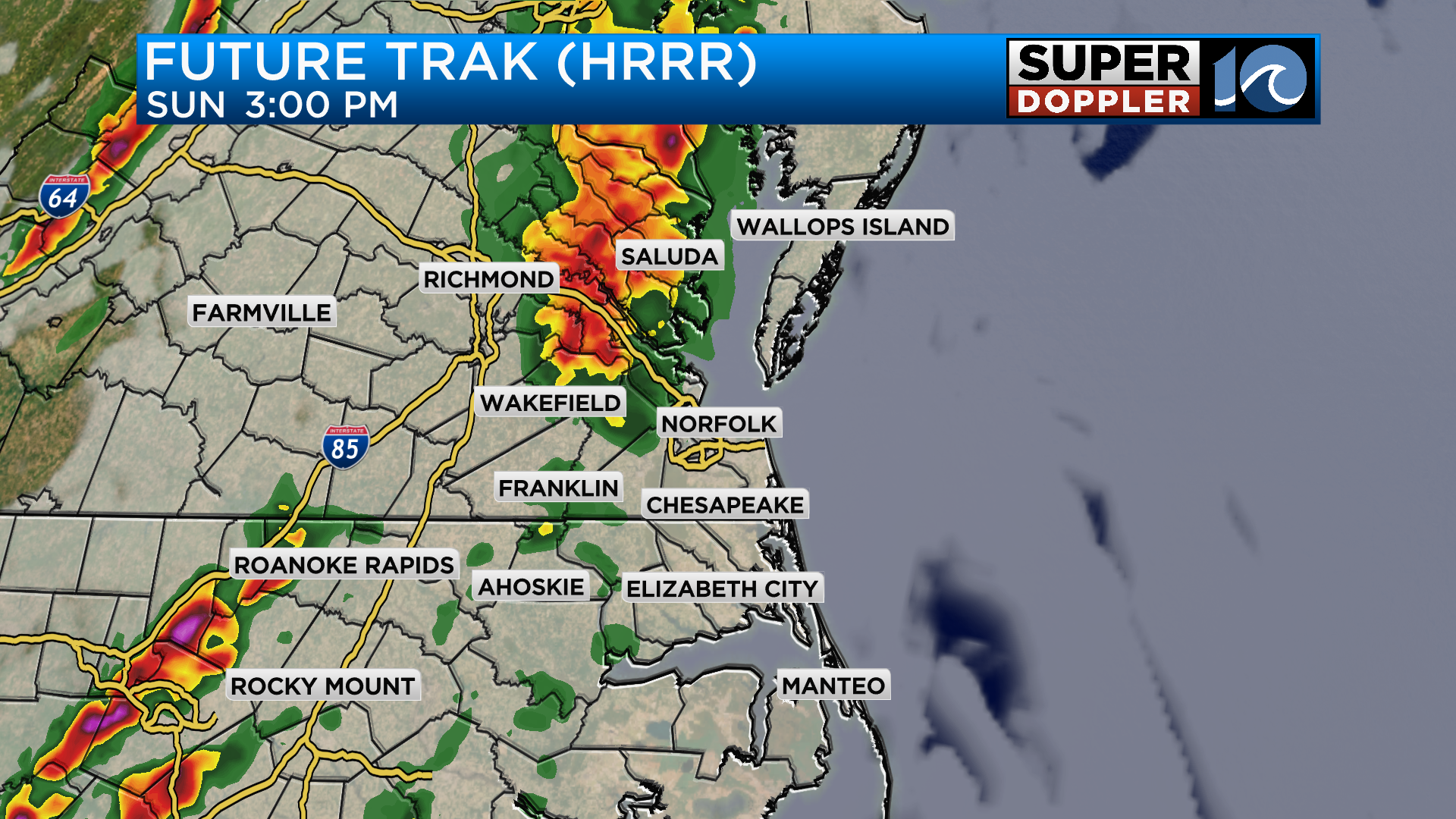
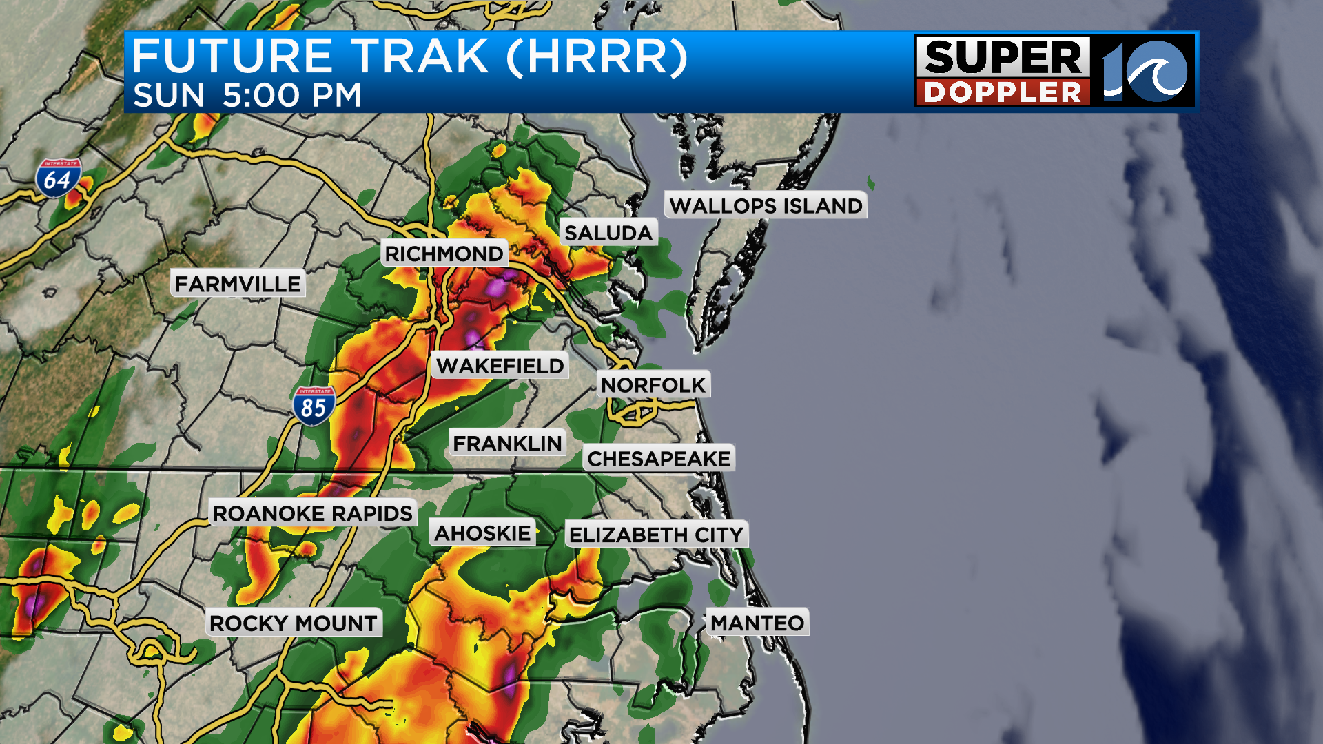
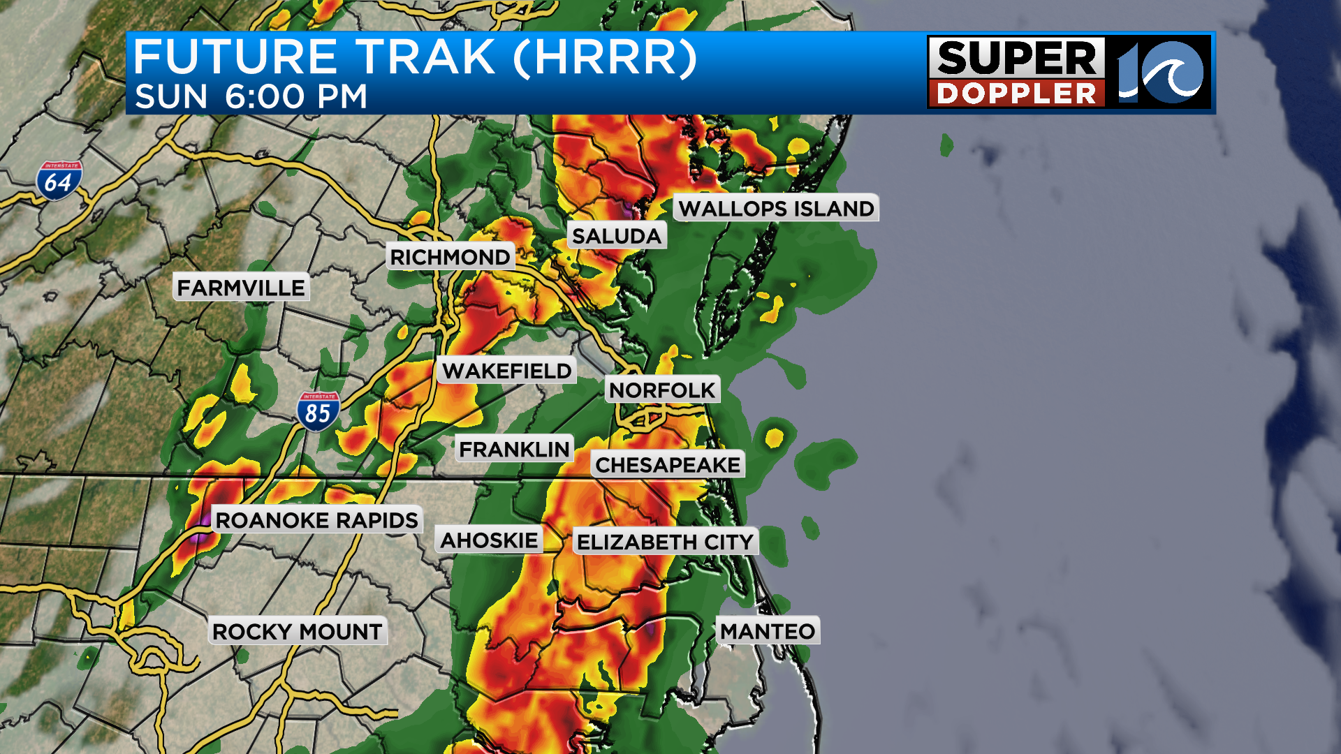
A few thunderstorms could push into the Peninsula and Middle Peninsula around 3pm today. The rest of the area should still be dry and windy. By 5pm, we will have to watch for storms to move in from the south for the rest of Tidewater.
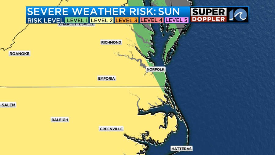
From the Storm Prediction Center, most of us are in a Level 2 risk for storms today, but farther north and East the risk level drops a bit to a Level 1. The takeaway, we will all see rain, but a few of us could see strong storms.
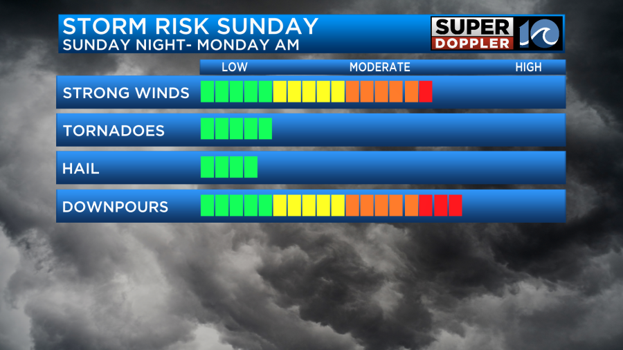
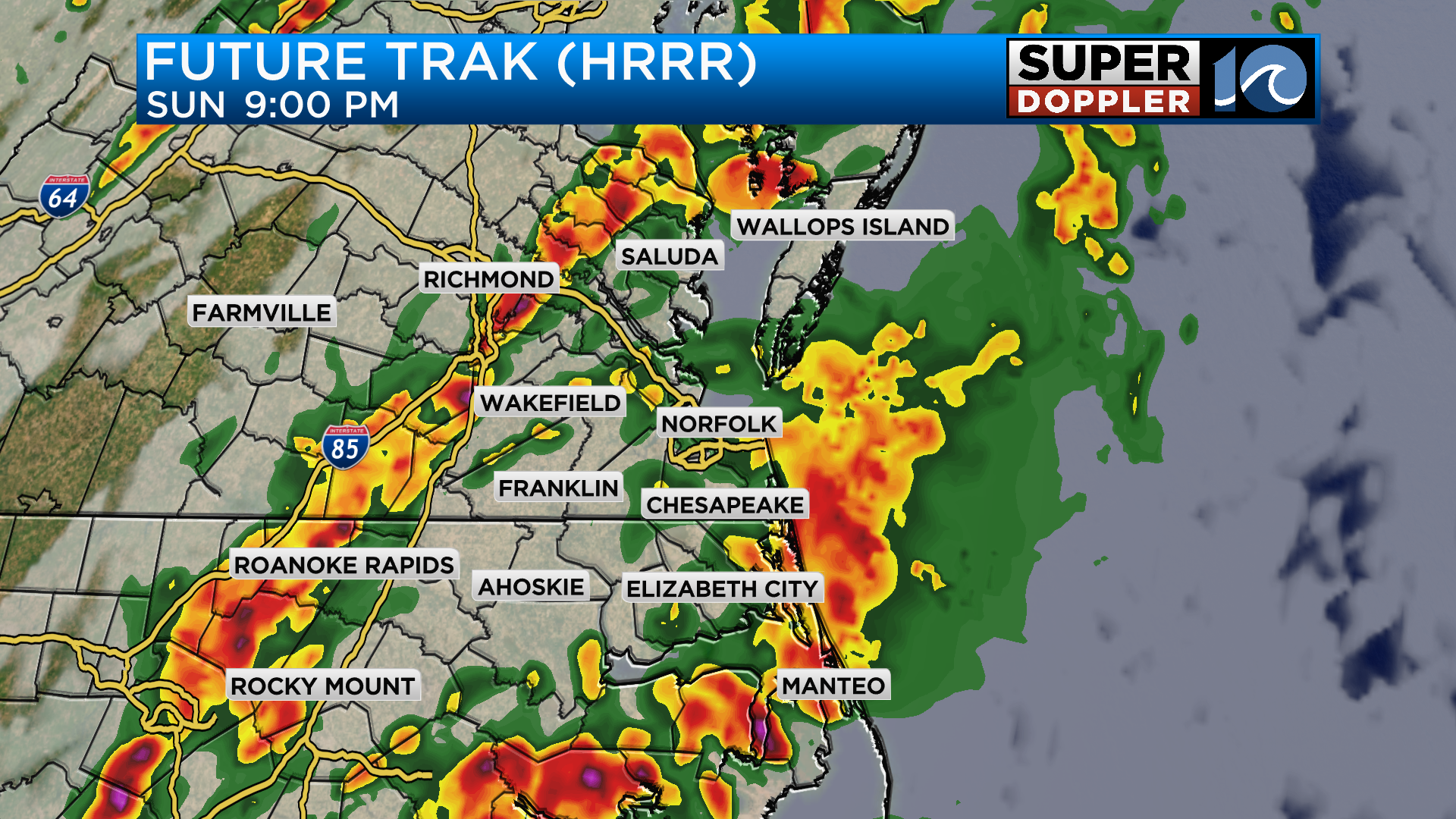
The rain will continue overnight, totals should be around 1″-2″, but if the thunderstorms are intense, totals could get close to 3″. Stay tuned for updates on WAVY during the afternoon especially if any watches or warning are issued.


