The heat and humidity is going to get turned up a little bit more during the day today and as we head into the start of the work week it’s only going to keep going up. A ridge of high pressure is settling in over the eastern half of the country. At the surface, high pressure centered across the spine of the Appalachians will lead to an extended period of heat, humidity, and minimal rainfall.
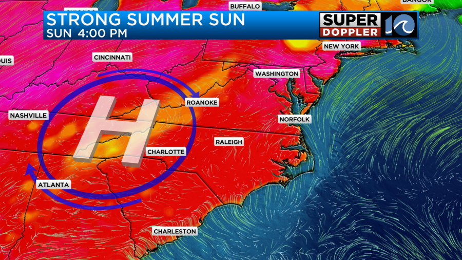
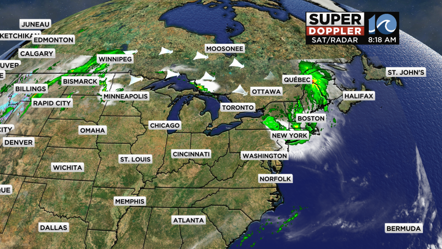
This area of high pressure will divert any incoming storm systems to our north and away from us locally. We call these storms “ridge riders” and across the northeast states they are dealing with heavy rain while Hampton Roads has abundant sunshine.
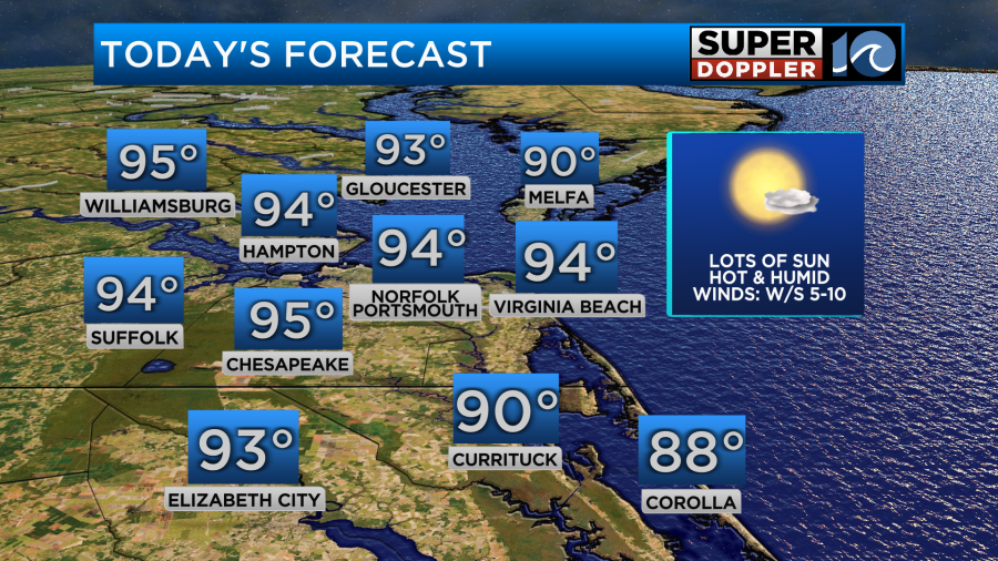
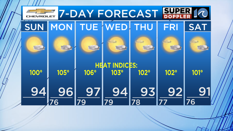
For today, we will have a lot of sunshine and increased humidity. This will be especially true throughout the afternoon as winds turn south and dew points rise into the lower 70s. High temperatures will be in the lower and middle 90s for most areas away from the water. Near the coast we will in the upper 80s to around 90 depending on when the sea breeze comes ashore.
As for the humidity today, we will feel like 100 degrees as dew points will be a little higher than yesterday.
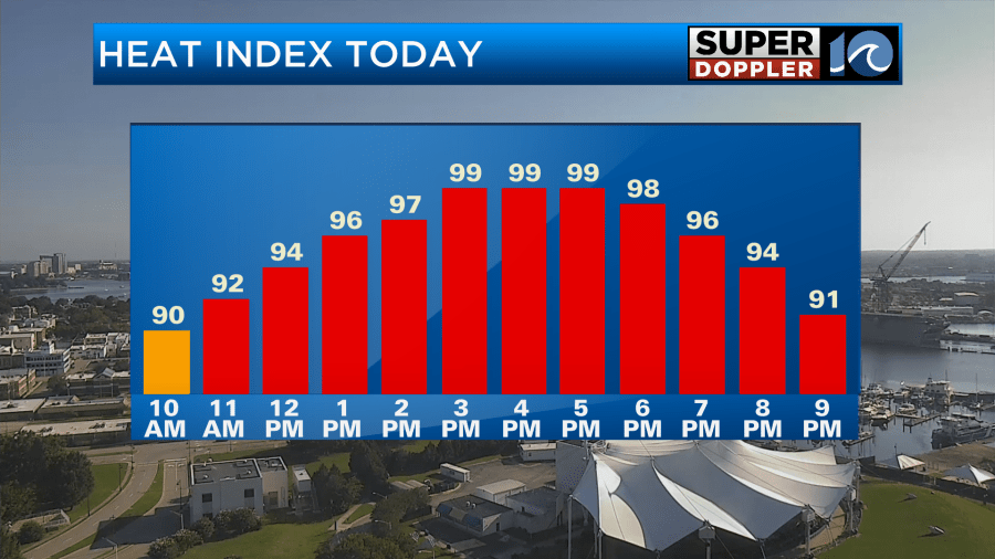
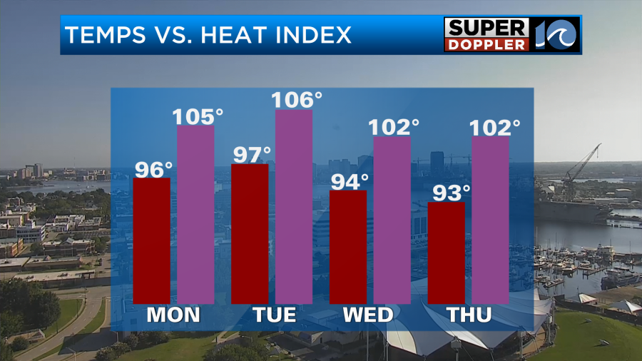
With the heat dome remaining in place and the humidity climbing a little bit higher each day, our heat indices will climb during the start of the work week to dangerous levels for sensitive groups. These sensitive groups include the elderly, young children, and pets as it is difficult for their bodies to regulate their body temperatures with heat indices around 105 degrees. Be sure to check in on one another and drink plenty of water!
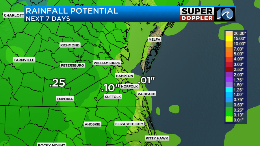
Rain will be hard to come by over the next 7 days with our best chances potentially being late in the week with the sea breeze. Rainfall amounts will span from zero to a tenth of an inch depending on location.
Make sure your A/C units are functioning properly and if you are spending extended time outdoors be sure to seek some time in the shade. Stay cool!
– Meteorologist Brian Michigan 🤙