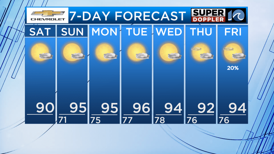
Mother Nature may have taken this “start of summer” thing a little to seriously. As of last night at 10:42 pm, the summer season has begun and tis weekend, high pressure will settle in across the eastern half of the country allowing our hottest stretch of weather so far this year.
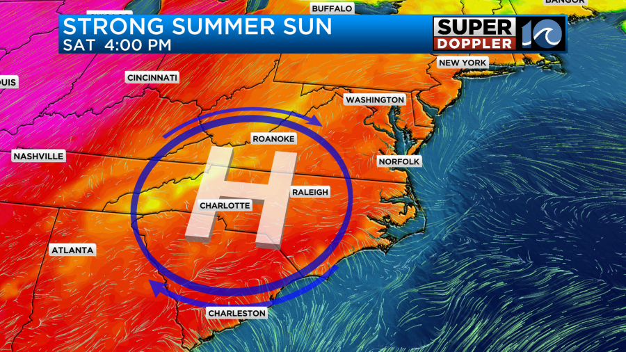
With all that strong sunshine overhead, high temperatures will get into the lower 90s across the area with a light south and southwest breeze at 5-10mph.
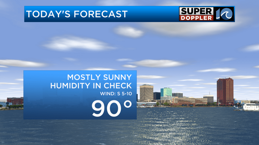
This breeze will allow for a bit more humidity today, but overall it will be tolerable.
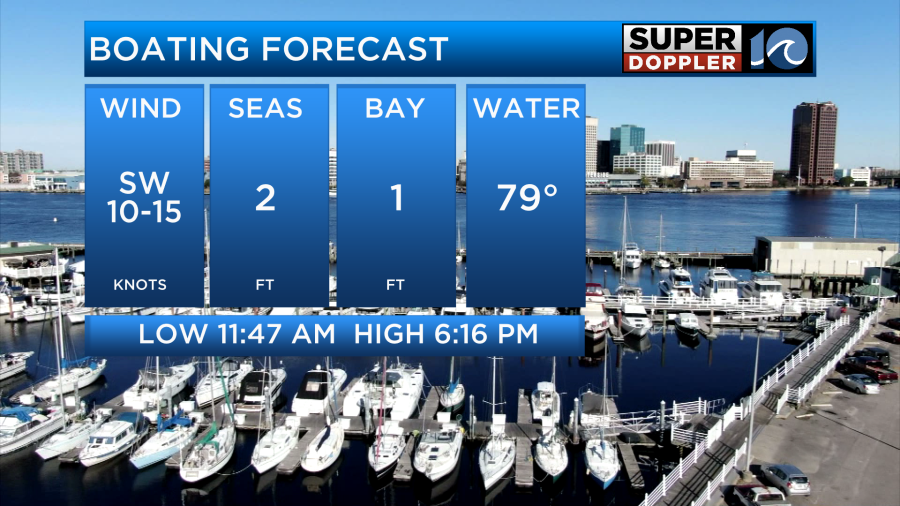
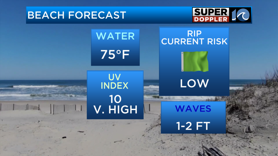
It will be a nice day to cool off at the beach or out on the water boating. Water temperatures due to the recent warmth have jumped in the middle and upper 70s across our region. The rip current risk and wave heights will be low today due to a lack of storm activity offshore so for swimmers this is a good day to take advantage. As for the surfers, we will have to wait awhile for our next swell.
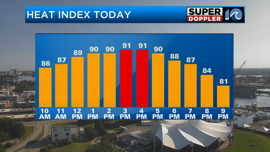
As I mentioned before the humidity, which was down yesterday, will go back up as the weekend goes along. For today, it will be a bit humid during the afternoon but the real difference will be felt on Sunday as dew points reach the low 70s.
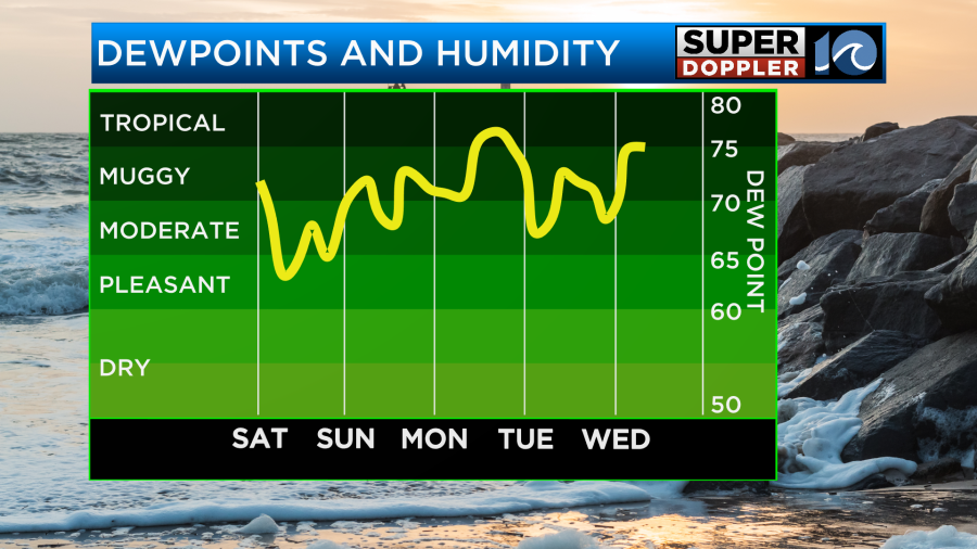
The dew points will continue to climb through the beginning of the upcoming work week. Eventually, we will reach the tropical category for a time, this is the kind of heat that can be potentially dangerous to vulnerable groups like the elderly, young kids, and even pets.
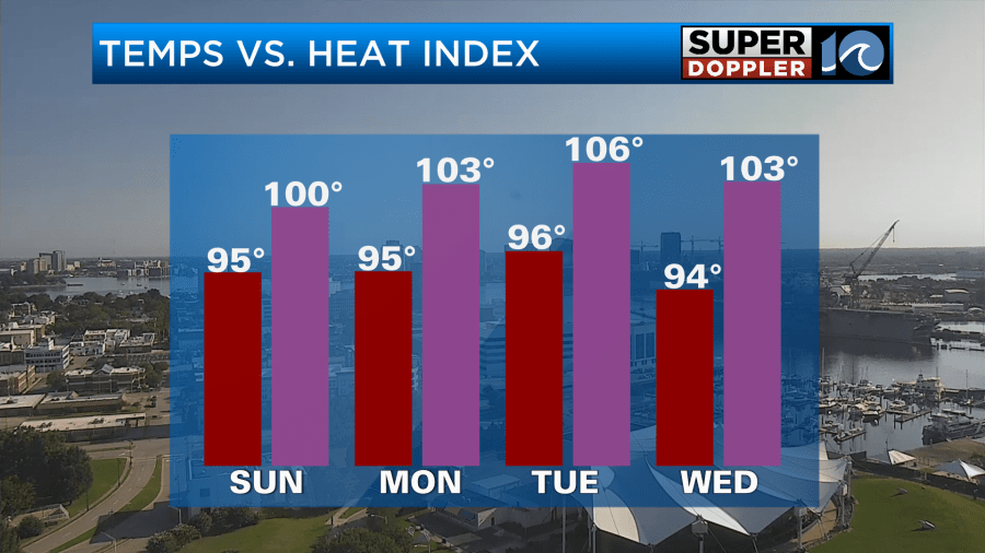
With high humidity, we will have to add on around 5-10 degrees from our actual air temperature to figure out what it will feel like outside. As of now, heat indices will be around 105 degrees for most days this week.
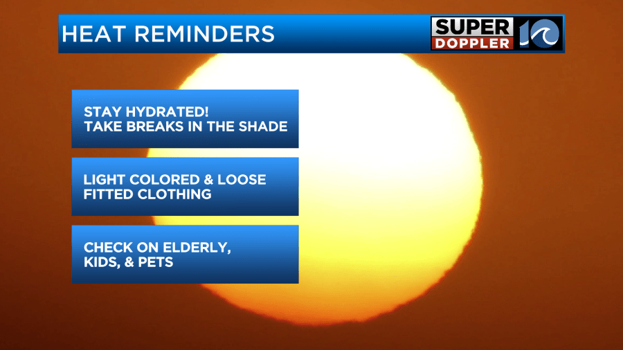
It will be important to remember to stay hydrated and drink plenty of water during this hot stretch of weather. If you are outside for long periods of time, take regular breaks in the shade to cool off and wear loose fitted clothing to avoid overheating.
-Meteorologist Brian Michigan 🤙


