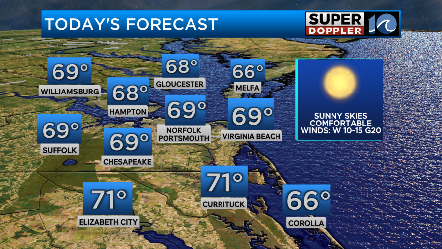
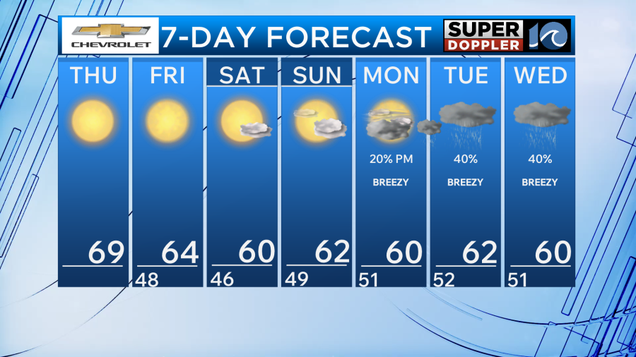
Another day of beautiful weather is in store across Hampton Roads. High pressure will be over head and sunshine will allow for our temperatures to reach the upper 60s for most of the area. North Carolina will be in the lower 70s. Winds will be a little breezy once again with gusts up to 20-25mph.
With this breeze and low humidity the fire danger will be elevated today. This means it will be best to avoid burning material until we get some more rainfall into the area.
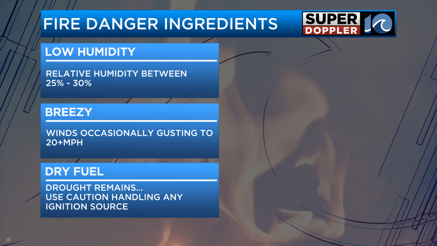
Speaking of needing rain, the latest drought monitor which updated today shows moderate to severe drought in North Carolina.

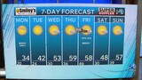
This dry weather is likely to continue as we head throughout the weekend as high pressure remains across the region. Additionally, high pressure will set up to our northwest allowing for north winds to develop. This will drop temperatures this weekend into the low 60s for highs while low temperatures fall generally into the 40s. Inland areas will be in the 30s with the chance for frost during the early morning hours. Other than the cool weather, the sunshine will be great for homecoming activities for some of our local colleges as well as any fall activities.
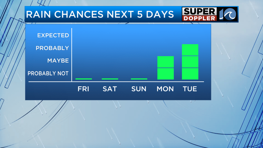
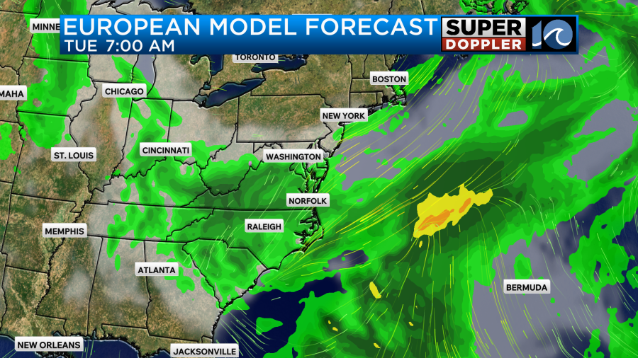
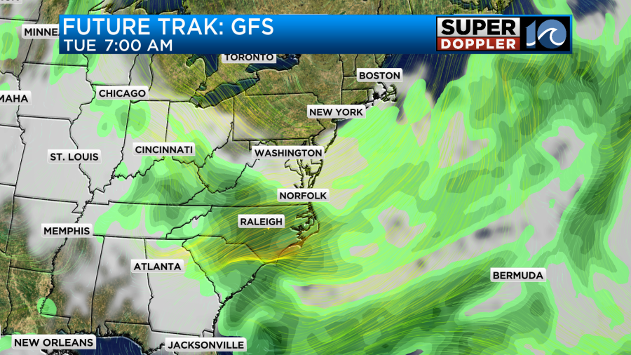
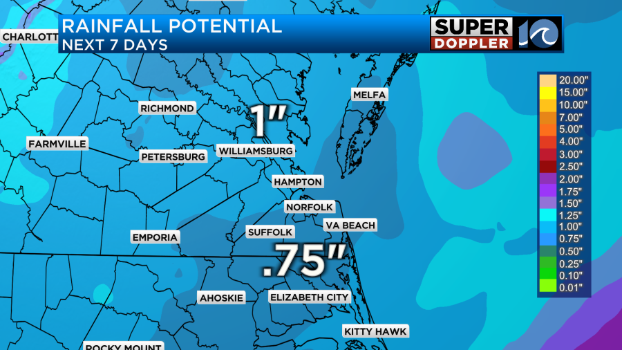
Monday and Tuesday is when our weather pattern will go through some changes as our next low pressure system moves in. This system has the potential to provide the rainfall that we need across parts of the area. As of now both the GFS and the EURO are on board with a widespread chance for rain. The exact amounts are still to be determined but as of now expect around an inch of rain across the area.
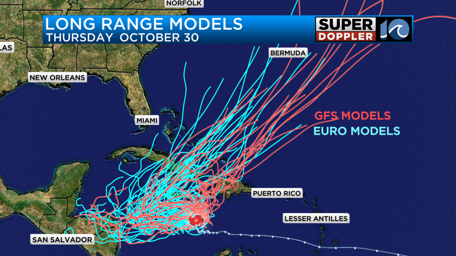
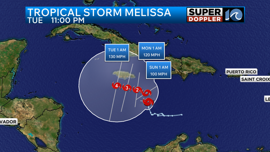
In the tropics, new data from the National Hurricane Center shows that Melissa now has the opportunity to rapidly intensify into a major hurricane early next week. There are still questions when it comes to the exact track of the storm though and which islands across the Caribbean does the storm impact the most. Stay tuned for updates.
Have a great Thursday!
-Meteorologist Brian Michigan