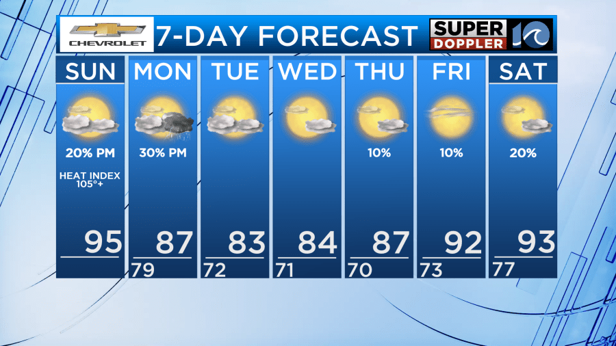
Good Sunday morning! It will be very hot and humid today, but a cold front arrives Monday bringing with it some much needed relief from the heat, humidity, and storms.
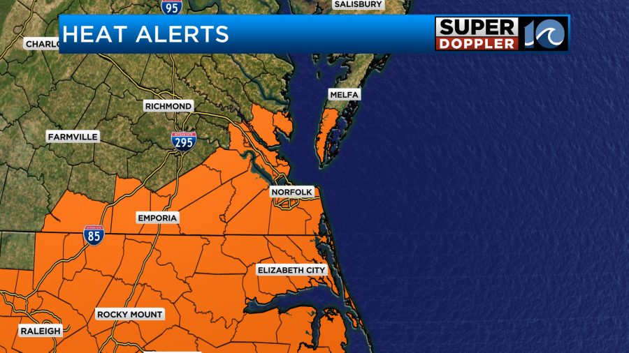
High temperatures today will be in the mid 90s, feeling like 105-110°. We are under a Heat Advisory from 11 AM – 8 PM Sunday. Stay cool and hydrated!
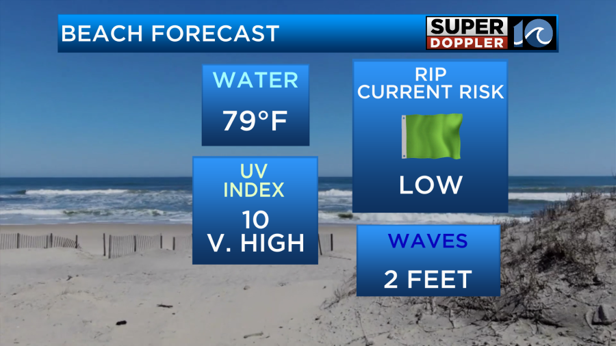
The beach looks nice to take a dip in the water and cool off. A low rip current risk with 2 foot waves.
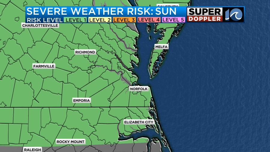
This afternoon, a few isolated storms could pop-up, but most areas should remain dry. In any storm that does develop, it could become strong to severe. We are under a level 1 of 5 risk for severe storms today.
Monday is when the cold front arrives. Monday will still be hot and humid, just not quite as bad. High temperatures in the upper 80s will feel like the mid 90s. Around the front, we could have isolated to scattered showers and storms in the afternoon and evening hours. No severe threat though.
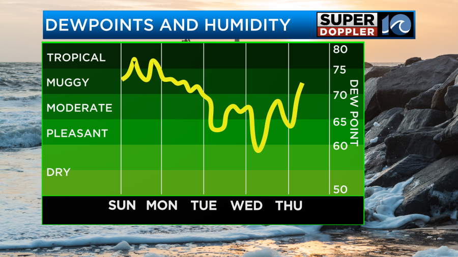
We notice the cooling impacts from this cold front Tuesday through Thursday. High temperatures will be in the low to mid 80s with dew points in the mid 60s. Dew points that low is when we hardly feel the humidity, so we have some great eat-lunch-outdoors weather the middle of the week! We’ll also be dry with lots of sunshine those days.
We stay dry with plenty of sunshine Friday into the weekend, but temperatures will be back on the rise. Highs return to the low 90s and humidity will likely begin creeping up again.
-Meteorologist Kristy Steward


