Our weather has been a bit unsettled for the past few days across Hampton Roads with everything from clouds to rain and wind and even damage on the Outer Banks due to storm surge! However, today we will start the processes of calming things down as high pressure starts to fill into the area.
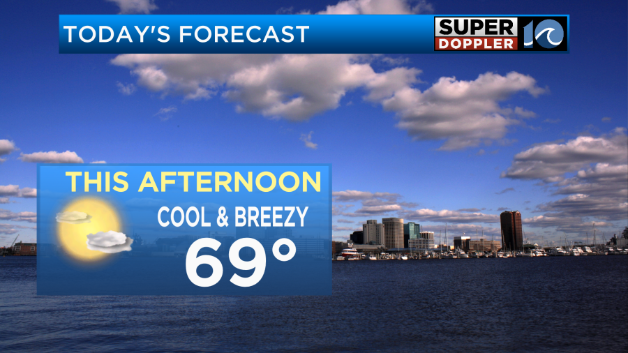
With this dome of high pressure we will have partly cloudy to mostly sunny skies today. Despite this increase in sun, northeast winds will keep highs below normal by about 5-10 degrees. Coastal areas will be in the upper 60s while inland communities reach around 70 degrees.
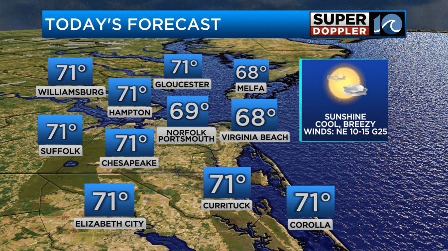
Winds will be strong still out of the northeast at 10-20 mph for the coastline with gusts up to 25mph. Inland areas will experience much calmer winds.
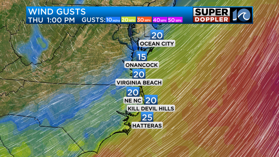
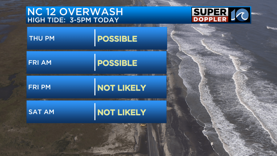
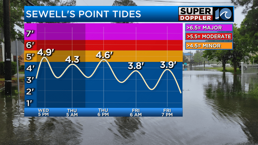
This onshore wind will remain through the day tomorrow. As a result, coastal flooding will be a concern again for the southside this afternoon during high tide. Some minor coastal flooding is expected but some more vulnerable areas may get close to moderate coastal flooding. Along NC 12, overwash will remain possible today and into tomorrow morning before the ocean begins to relax heading into the weekend as winds calm down.
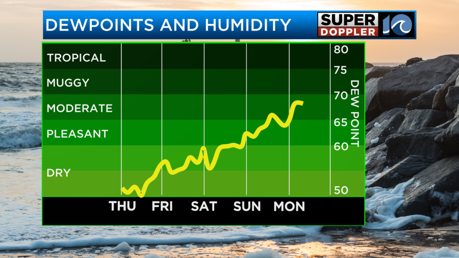
As for the weekend expect more sunshine as high pressure will be nearby. It will also remain dry with dew points generally in the 50s across the area. There may be a bit of an increase on Sunday but still manageable to be outside.
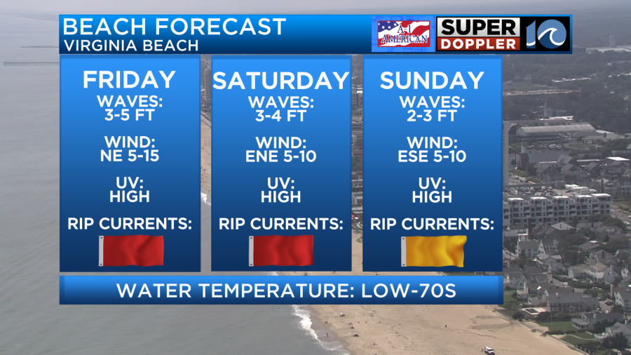
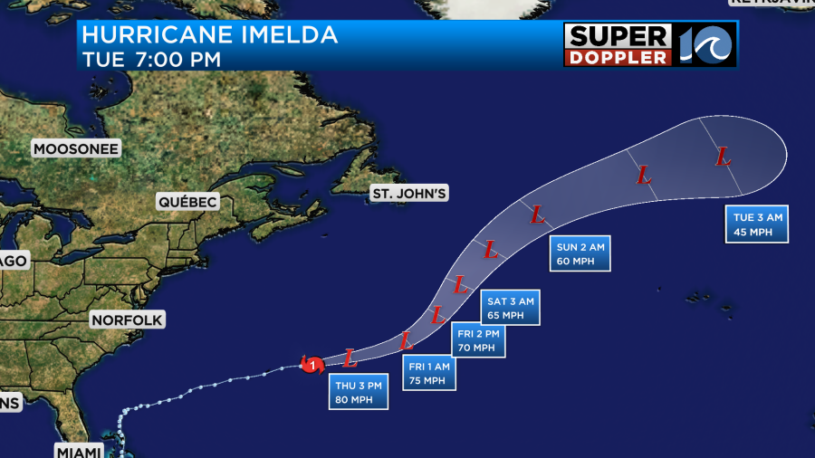
For those planning on heading to the beach, be aware that the leftover swell from Humberto and Imelda will be in the water so the rip current risk will remain high through Sunday. For the surfers, this will be a time to target for potential fun windows of surf as winds should be calm in the morning.
This increase in humidity early next week is a sign of things to come as our next cold front will work its way in during the middle of next week. This front will bring showers and thunderstorms along with breezy conditions. After the front passes, another shot of cooler air will move in.
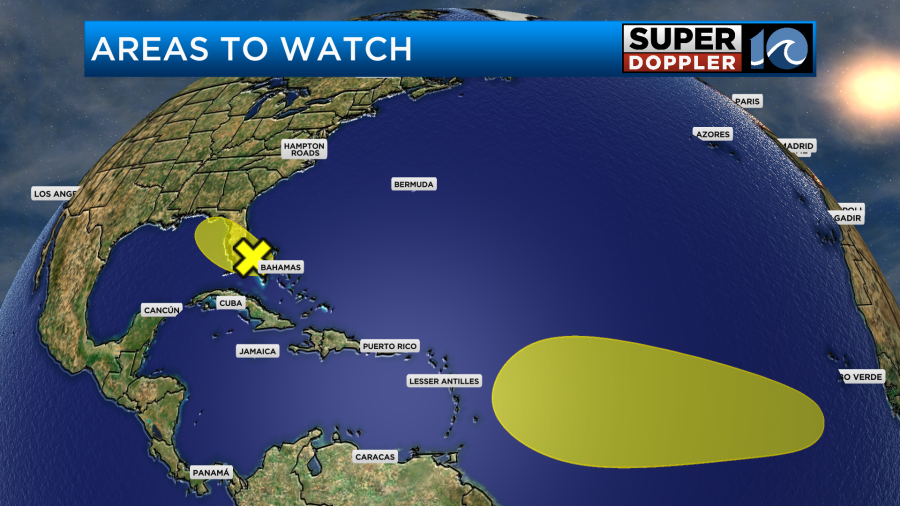
In the tropics we have a couple areas that we are watching for development. Both have low chances for development but over the coming days, stay tuned for changes as the timing is still a long ways out from any development.
We are also still watching Imelda as it moved over the island of Bermuda last night as a category 2 hurricane. No direct impacts are expected for Hampton Roads over the next 7 days but rough surf will remain through the weekend.
Have a great day!
-Meteorologist Brian Michigan