Its Spring, so temperatures will continue to go up and down. Today we are back down with highs in the 50s. Then tomorrow, back to 70 degrees. If you want to figure out which day is warmer, or colder, just look at the wind direction. If it’s from the south to west. Likely warmer. North to East, then colder. The onshore breeze is keeping us chilly today. We will see sunny skies today, but tomorrow a cold front will move in during the afternoon bringing some rain with it.
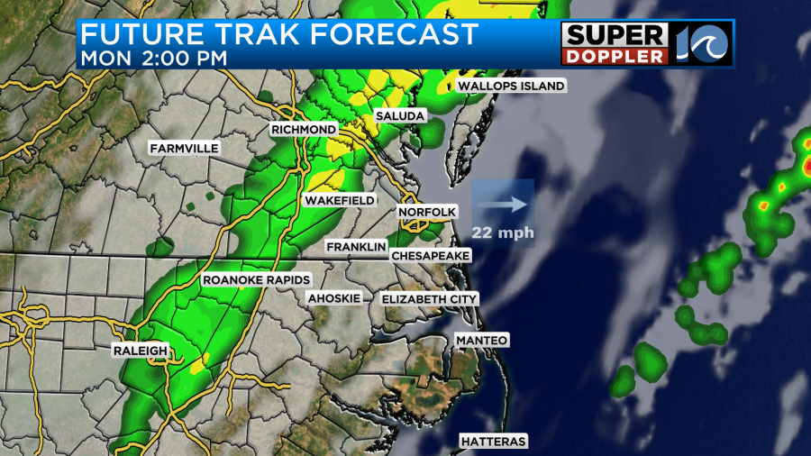
The rain will start in Northern Virgnia in the morning, then in the afternoon we should see it move in to our area. The models are hinting at a start time after 1pm.
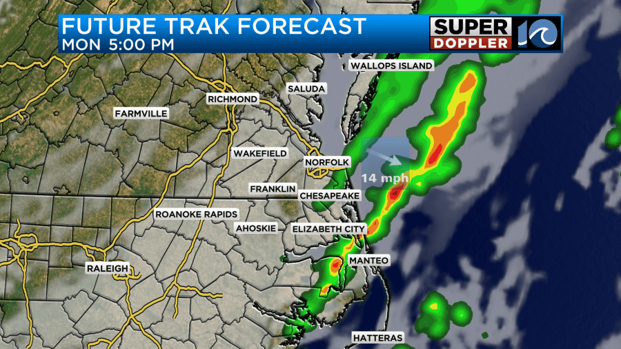
The rain should move offshore by 8pm and we will see clearing skies and sunshine return on Tuesday.
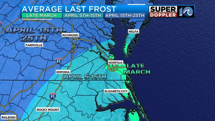
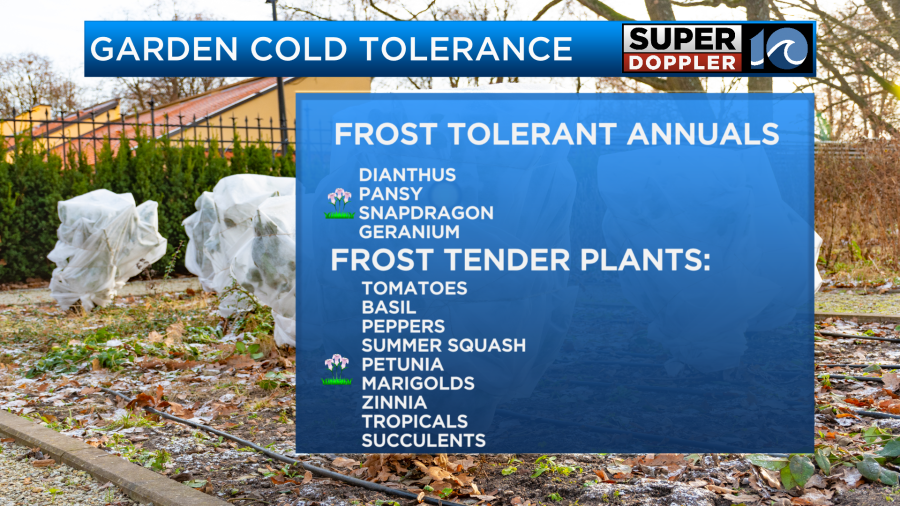
If you are excited to get back in the garden, remember Frosts can still occur this time of year. The average last frost for many Hampton Roads cities is late March into Early April.
There are plants that can take a frost, so if you want to put something in flower pots or in the ground, consider some of the following plants:
In the long range forecast, there could be a big push of colder air on Wednesday night and Thursday morning that could drop our highs into the 30s and possible upper 20s inland. Stay tuned for updates. Enjoy your Sunday!