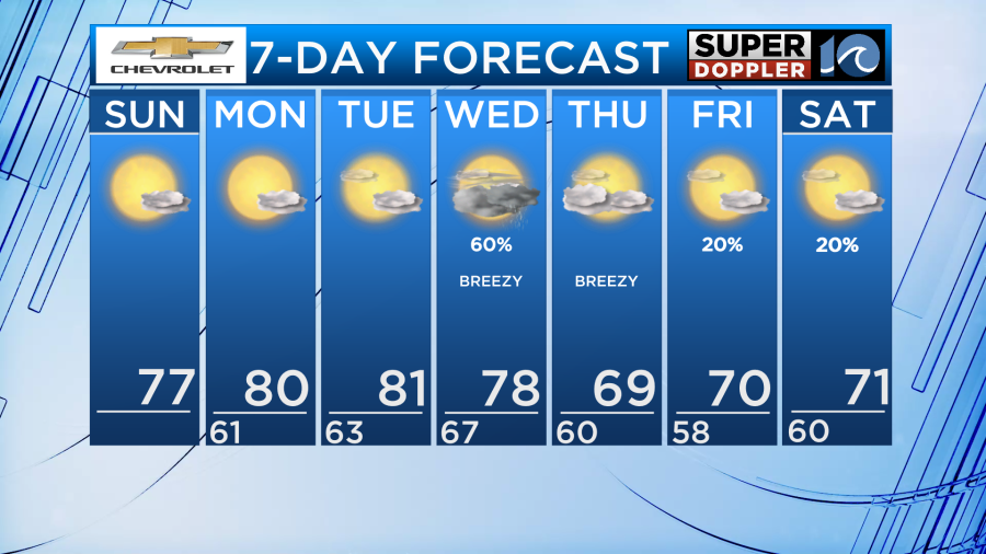
Happy Sunday! High pressure remains until Tuesday, keeping us dry with sunshine. Then a cold front will bring us rain and a cool down midweek.
Today will be very similar to what we saw Saturday. Lots of sunshine continues with light winds. High temperatures will get a couple degrees warmer into the mid to upper 70s. There is still a high rip current risk at the beach with 3-4′ waves.
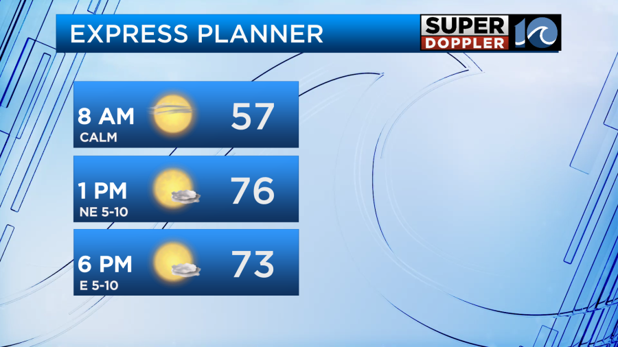
Tonight, patchy fog could develop again. Overnight lows will be a bit warmer, dropping into the upper 50s and low 60s.
Monday and Tuesday will be a little warmer and a little more humid. Highs in the low 80s with dew points in the mid 60s. Still dry with plenty of sun both days. Increasing clouds later Tuesday ahead of the approaching cold front.
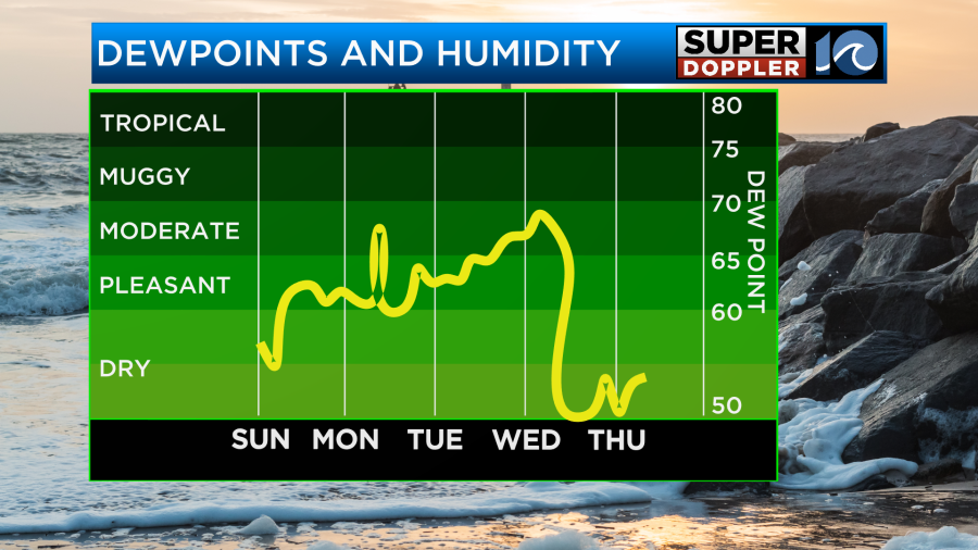
This cold front will pass through Wednesday evening. Around it, expect scattered rain showers. Behind it, breezy winds and rapidly dropping humidity. High temperatures Thursday and the rest of the week will be around 70°. Friday and Saturday look mostly dry, but a disturbance could bring a few showers with it. Otherwise, we go back under the influence of high pressure to our north and that will bring us more sunshine and drier weather.
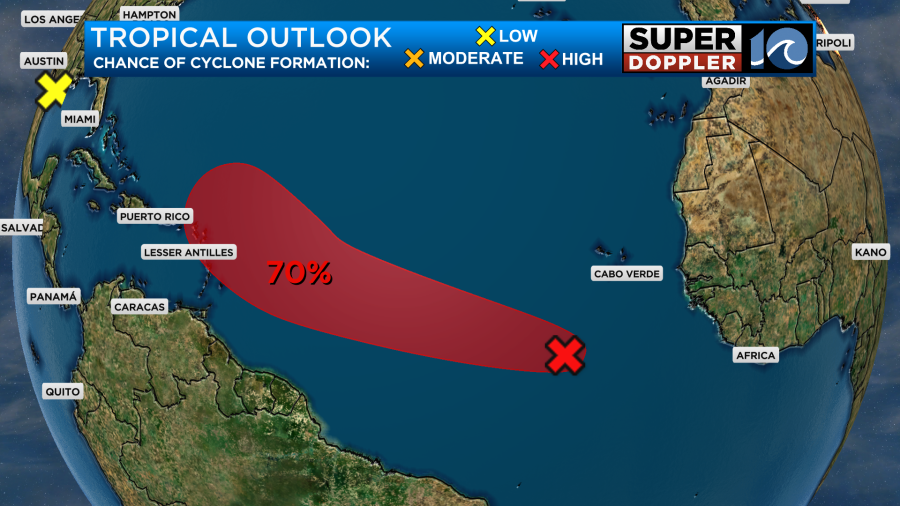
In the Atlantic, the wave that originated off the coast of Africa now has a a 40% chance of formation in the next 2 days and 70% chance in the next 5 days. The next name on the list is Jerry. We will continue to watch this development and keep you updated.
Enjoy the rest of your weekend!
– Meteorologist Kristy Steward