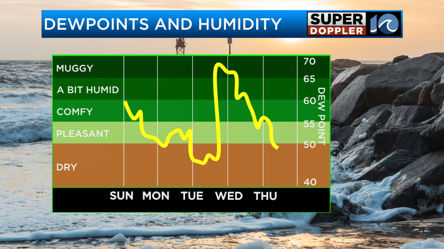
Yesterday was a hot and humid day as southwesterly winds made conditions feel like the mid-summer months. Today we are in for a change as some drier air is filling in which is dropping our humidity. It will be a beautiful day to get outside and enjoy the quiet weather as we end the weekend.
With winds out of the west and northwest over the next couple days, it will feel nice and refreshing through Tuesday afternoon. After that, a warm front moves north through the region late on Tuesday which will bring the humidity back up.
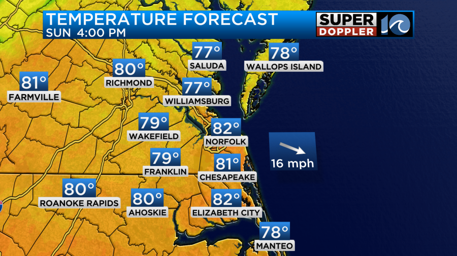
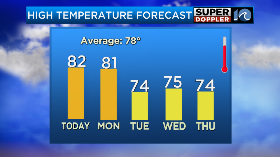
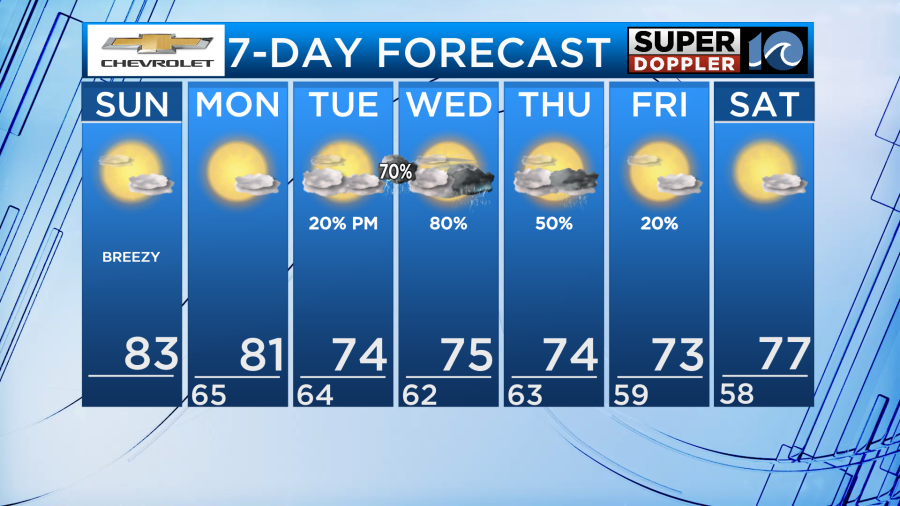
High temperatures throughout Sunday afternoon will be around 5-10 degrees above normal in the lower 80s for most. A few spots may hang out in the upper 70s but that will mostly be for areas near the water. Winds will also remain breezy out of the west at 10-15mph with gusts as high as 25mph during the afternoon.
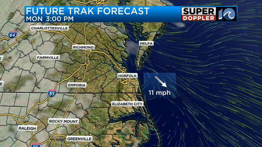
As winds turn more out of the northwest on Monday our air will remain dry allowing for lots of sunshine from start to finish. High temperatures will remain a couple degrees above average in the lower 80s.
Clouds may start to move in late in the day ahead of our next system and that will set the stage for more clouds on Tuesday.
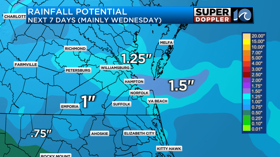
Speaking of rainfall, the models have been holding off a little more on Tuesday’s rain chance. I think most of Tuesday will have sunshine mixed within the clouds and the rain won’t arrive until late overnight. Heading into Wednesday the rain will become widespread as a low pressure system moves in, rain could be heavy at times and it’s still a little far out to know for sure but a few stronger storms cannot be ruled out. Especially during this time of year.
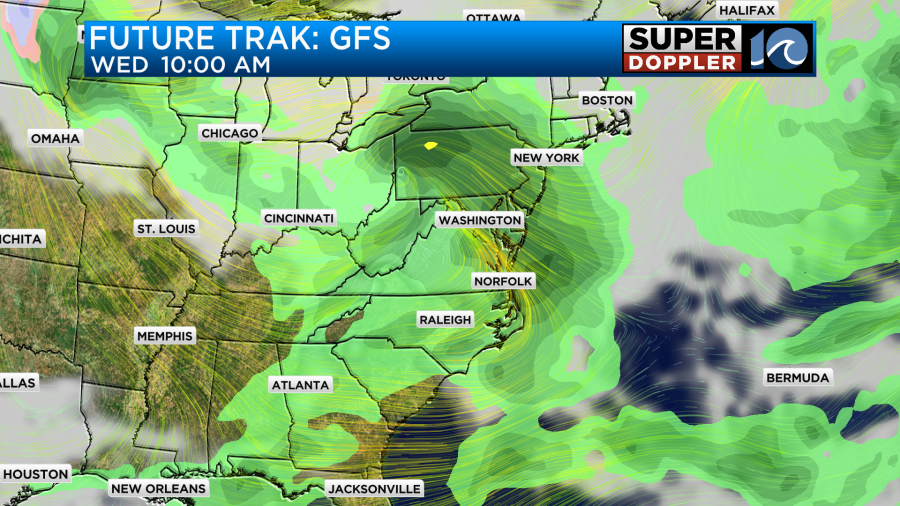

The bulk of our rainfall over the next seven days will fall during the day on Wednesday. Depending on where the heaviest downpours setup we could see areas that receive over an inch of rainfall.
On the backside of this mid-week storm temperatures are going to be back below average with highs in the 70s as we head into next weekend.
Enjoy the day!
-Meteorologist Brian Michigan