
Over the last few days we have had some nice/dry weather. That will change today as the dew points rise and temperatures increase. This morning we already started off in the 60s. It was warm and a bit humid, but the breeze helped. Today we’ll have high pressure offshore with a weak cool front creeping closer from the north.
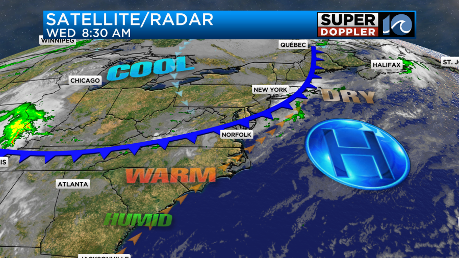
The front will slowly slide in today. then it will stall out over the region. Winds will run out of the southwest for a while at 10-15mph. Then they will turn out of the northwest late. We’ll be able to heat up today before any potential cooling happens. So high temps are aiming for the mid-upper 80s.
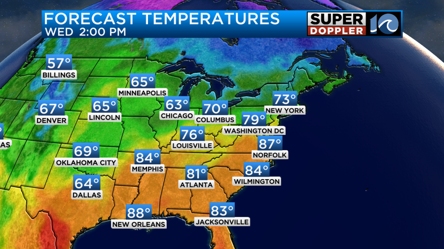
With dewpoints climbing into the 60s today the heat index actually might feel like it’s close to 90 degrees. This will create some fuel for a few thunderstorms this afternoon. They will pick up between 2 and 5pm.
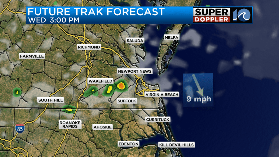
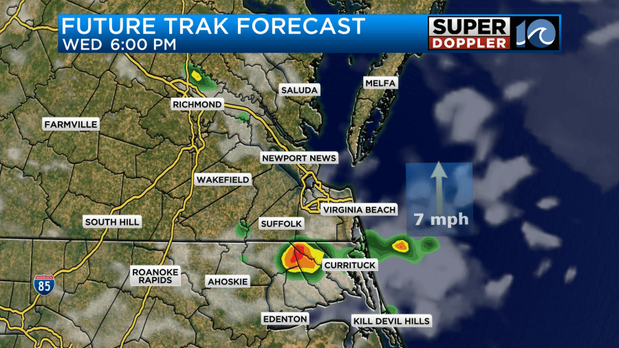
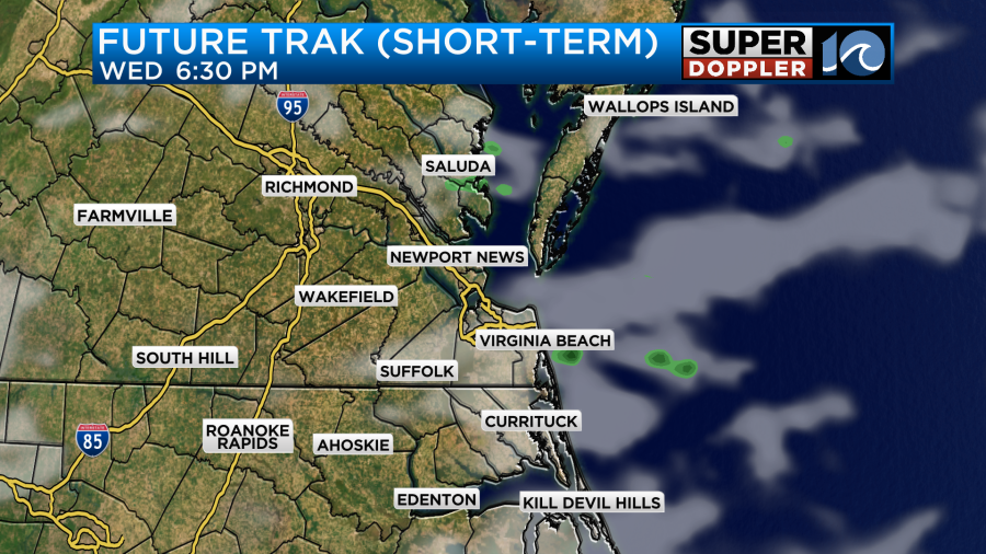
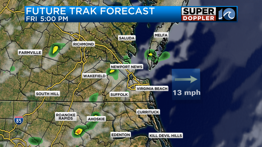
There will be a few more during the evening, but the placement will depend on the front. Here is what our Future Trak shows and the HRRR model.
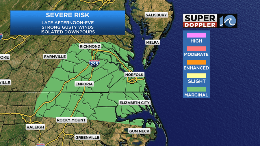
Regardless of the timing there could be a few strong to severe storms our there late in the day. We do have a marginal risk for severe weather.
These should move out by the later evening hours.
Tomorrow the front will slowly lift north through the day. Some isolated showers and storms will pop-up along the front, but they will also lift to the north. So there shouldn’t be too much rain in the region.
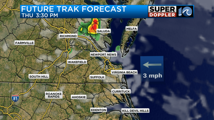
That is UNLESS, the front stalls out a bit more to the south today. Either way it will be another warm and humid day with high temps in the mid-upper 80s.
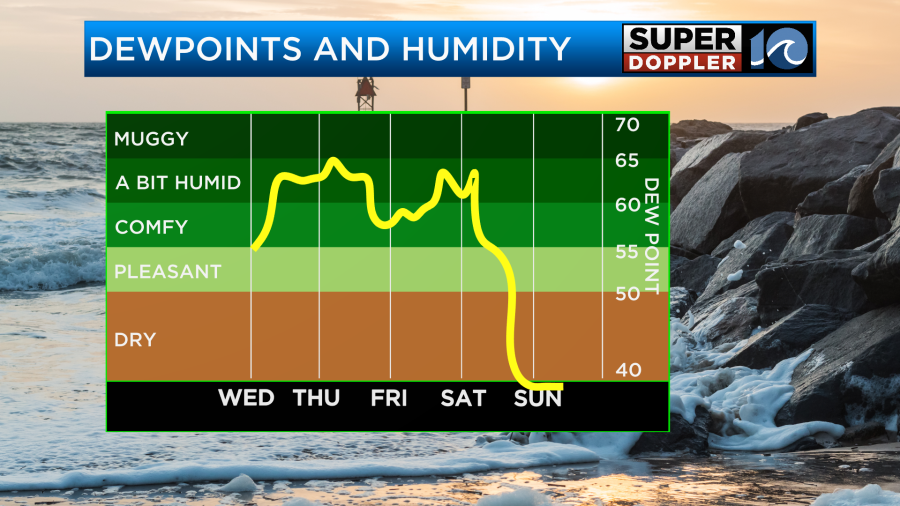
The heat and humidity will continue through Friday. Highs will be in the mid-upper 80s again. We’ll be partly cloudy. There will be some isolated showers and storms in the afternoon again with a little more by the evening.
By Saturday big changes start to move in. A strong cold front will enter the region slowly from the west and northwest. We’ll have an increasing chance for rain through the day.
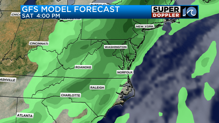
High temps will be in the 70s. After that the forecast gets very tricky. The GFS model has the front dropping well to our south. So it has clearing skies on Sunday with highs near 70 degrees or even in the upper 60s.
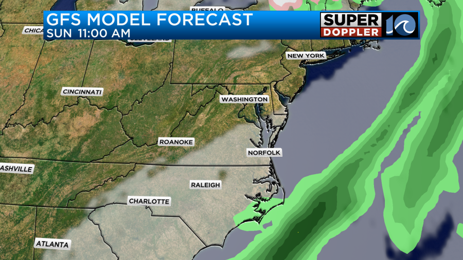
Meanwhile the European model has the front stalling out farther north. So it keeps the rain in the region all day Sunday and for most of Monday.
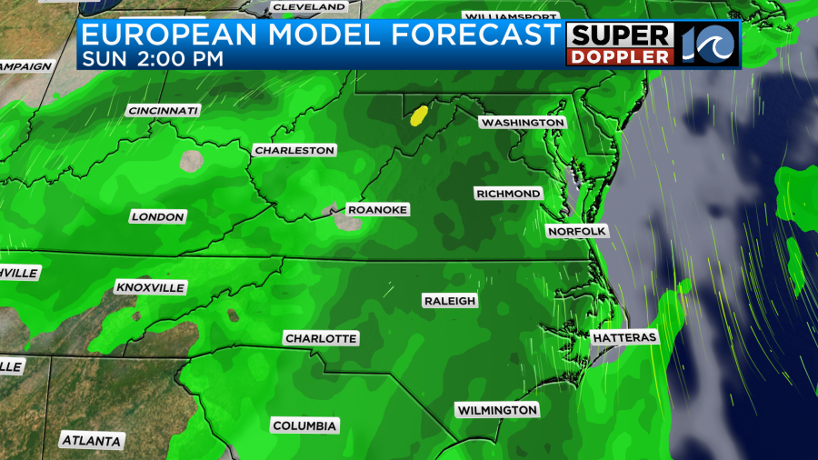
We’ll have to wait and see which model has the better idea as to what will actually happen. Stay tuned for updates.
Over the next 3 days we’ll have widely varying amounts of rain. Through that time it could add up to about a quarter to a half an inch.
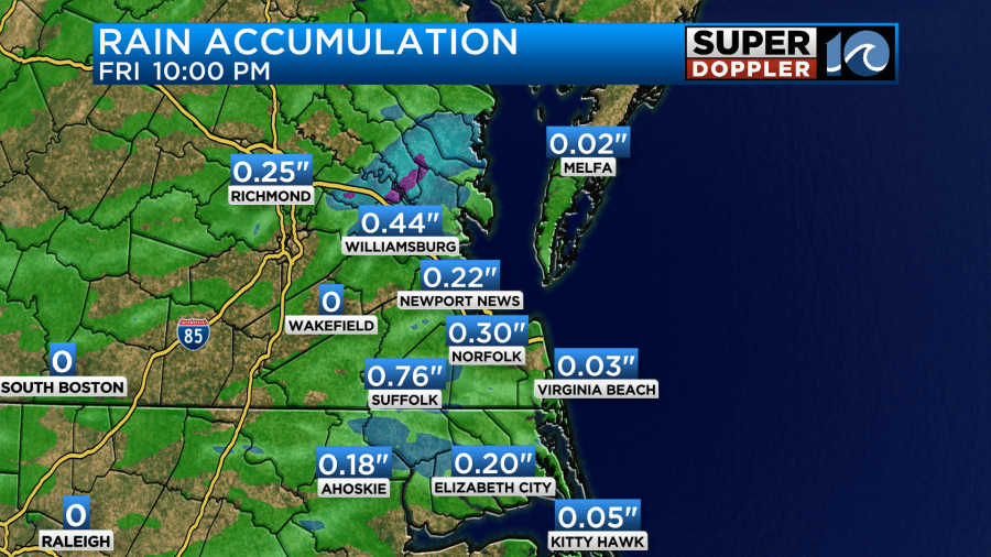
There could be some isolated higher amounts, but it’s also possible that some cities get missed completely. At least we have a lot of coverage expected for Saturday. Problem is… the timing stinks!
Finally, there is a major heat wave overseas. Parts of Pakistan may hit 120 degrees over the next couple of days. Wow! It’s only April. Here’s an article with more information: Middle East heat wave.
Meteorologist: Jeremy Wheeler


