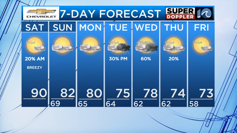
Yesterday we had some strong storms move through the region with some areas experiencing wind gusts over 50mph. Luckily, we are not expecting an more severe weather throughout the weekend. The only chance for rain will be during the late morning hours today in North Carolina but coverage will be very isolated.
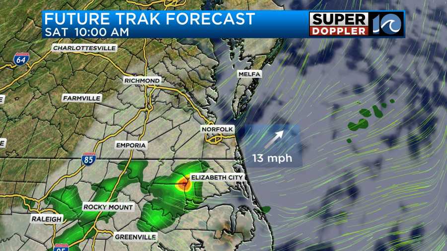
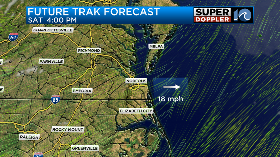
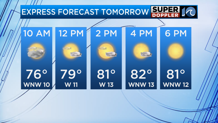
Rain chances drop and cloud cover moves out as we head into the afternoon hours allow for a big time warm up in temperatures.
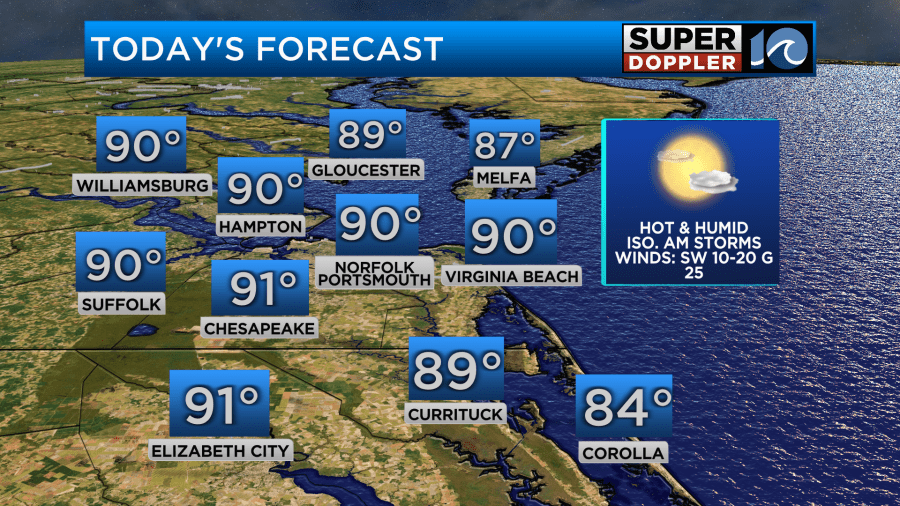
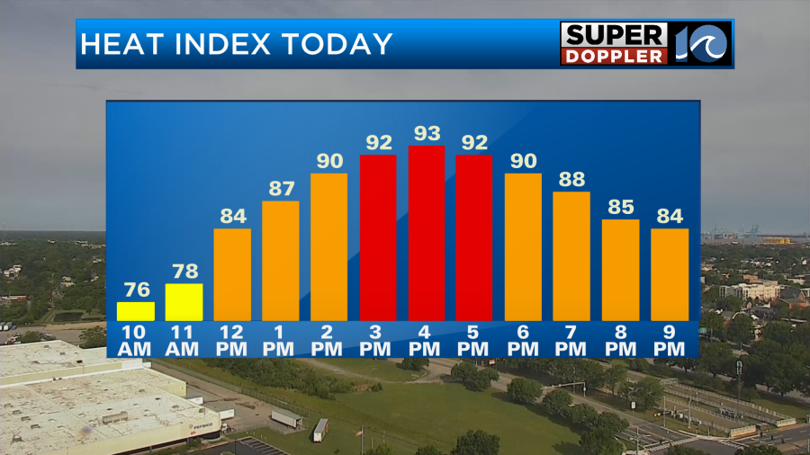
Most of the region will be feeling like the mid-summer months with highs near 90 degrees! When factoring in the humidity today it could feel more like the mid 90s for a few locations so if you plan on being out and about stay hydrated!
With how warm it will be, it will be a great day for the beach. If you plan on going bring lots of water and an umbrella. Sunscreen will also be beneficial due to how strong the sun is during this time of year.
After a cold front moves through late tonight, temperatures and humidity levels drop for Sunday. Highs Sunday afternoon will be in the lower 80s with dry air filling in due to a northwest breeze. This will cause dew points to drop into the 50s which will feel refreshing.
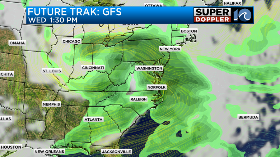
Rain chances will stay low to start the work week on Monday as a ridge of high pressure will be overhead. This does not last long however as another storm looks to move into the region during the middle of the week. As of now the timing looks to be late Tuesday and throughout the day Wednesday but there is still time for changes so stay tuned for updates.
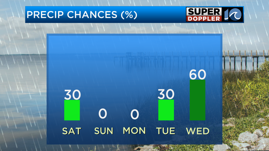
Some of the rain could be heavy and widespread on Wednesday. It is too early to tell whether storms will become severe but we will keep an eye out.
Have a wonderful weekend!
-Meteorologist Brian Michigan 🤙