
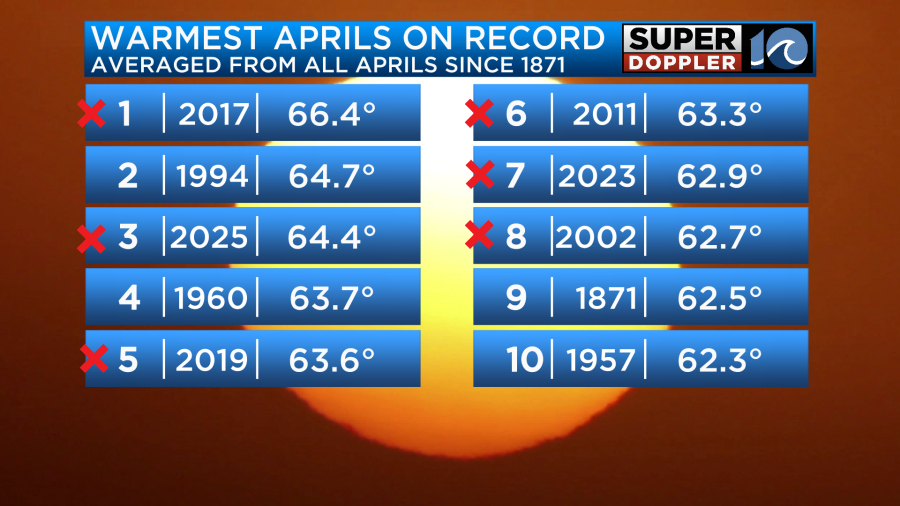
Before I go into the short-term weather, I want to take another look back at April. It just came out the other day that April (2025) was the third warmest on record.
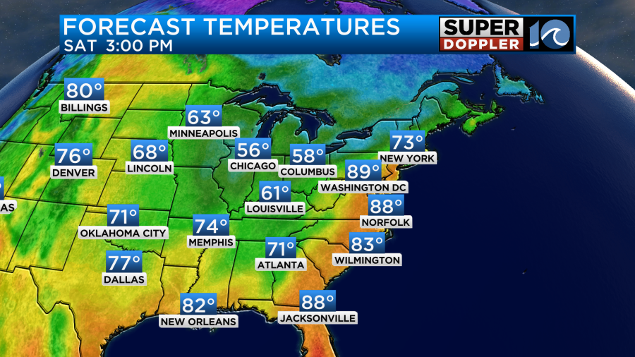
It adds weight to my statement that we skipped Spring and went straight into Summer this year. We had that heat momentum into early May. So yesterday we topped off around 90 degrees in Norfolk.
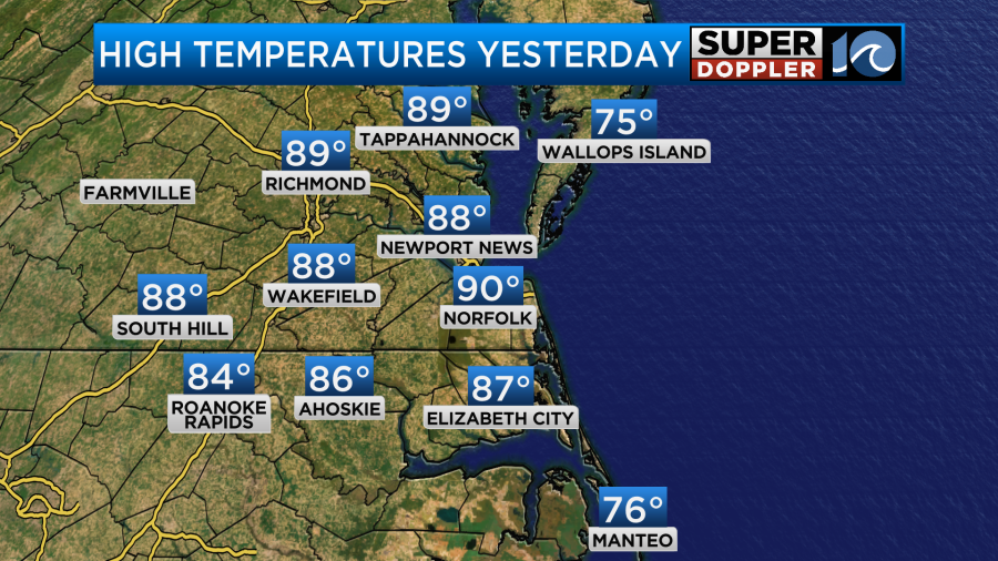
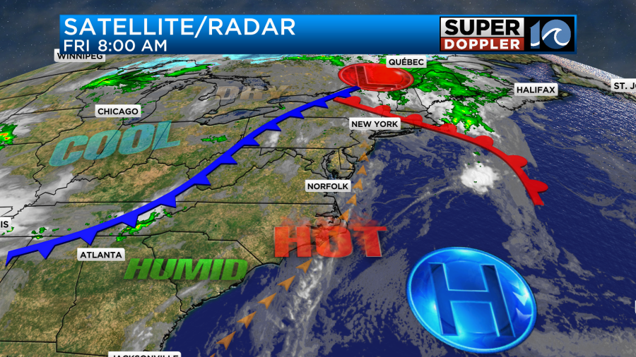
There were a few sites that were close to 90 degrees. It was ok when the breeze blew, but as soon as the breeze stopped you could feel the heat. Today won’t be much different. We are well into the hot zone. A warm front is to our north with a cold front to the west.
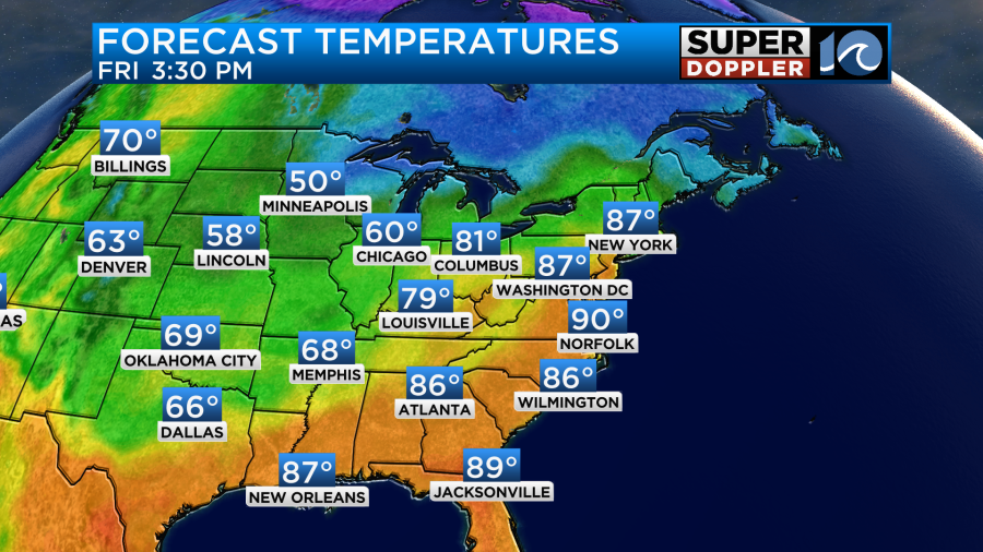
We’ll be partly cloudy with a southwest breeze through the day. Gusts will be up to 20mph with a few higher gusts near the shore. This will push our high temperatures back up to around 90 degrees.
The chance for rain looks pretty low. I only see some isolated showers or storms this afternoon. There may be a few more showers or storms during the evening, but it’s only a little better chance for rain.
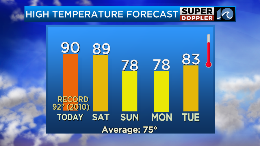
Tomorrow’s forecast has really dried up (in terms of rainfall). We’ll be partly cloudy with only some isolated rain showers during the day. We’ll be partly cloudy again with a steady southwest breeze. There will probably be a few more clouds compared to today. So for now, I have high temps aiming for the upper 80s to near 90 degrees.
Dew points will be above 60 today and most of tomorrow. They will stay above 60 for a while.
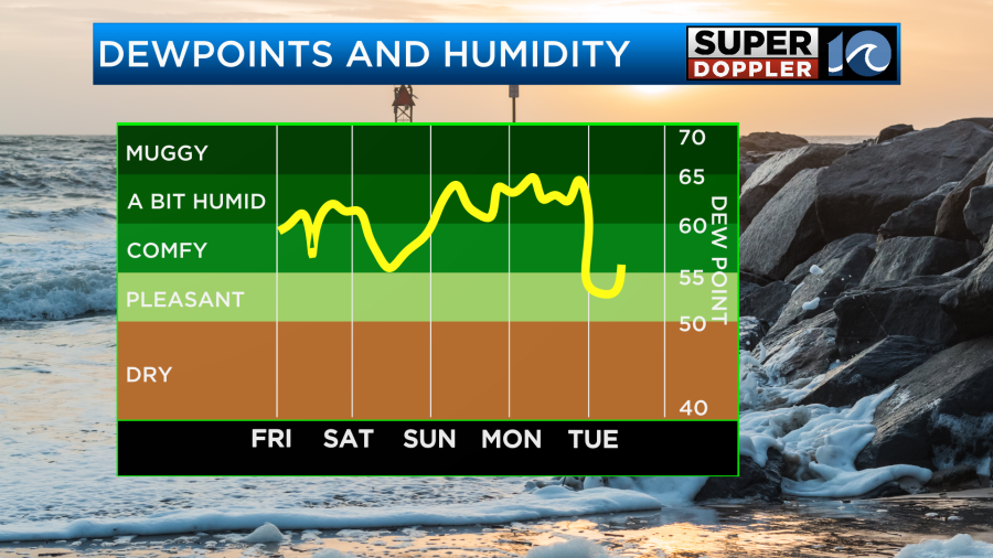
Even though the humidity will stay up on Sunday and Monday we will cool down. High temps will drop to the upper 70s.
As of this time the models have an increasing chance for rain on Sunday. Our model shows a line of showers and a few storms inland early Sunday morning.
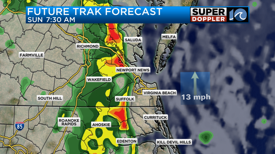
The other models have some rain in the morning as well, but they have an increasing chance as we go into the afternoon.
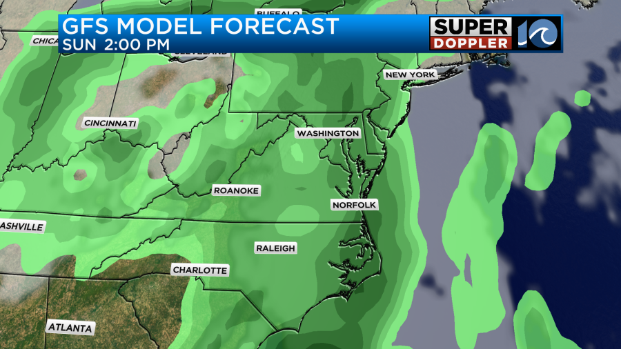
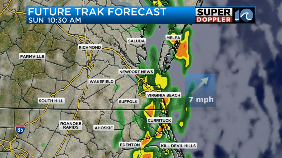
Our model is a little different. It focuses a column of showers and storms between the late morning until the midday hours:
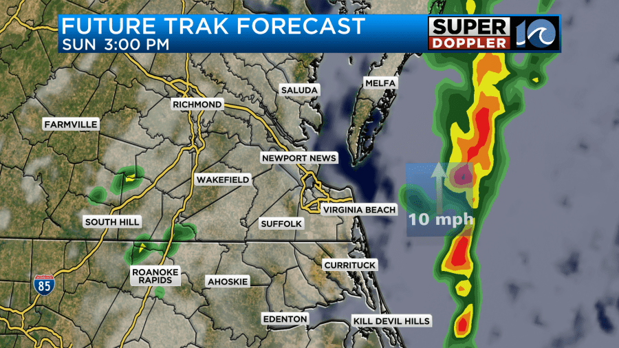
After that main line then it has a few more showers and storms during the afternoon.
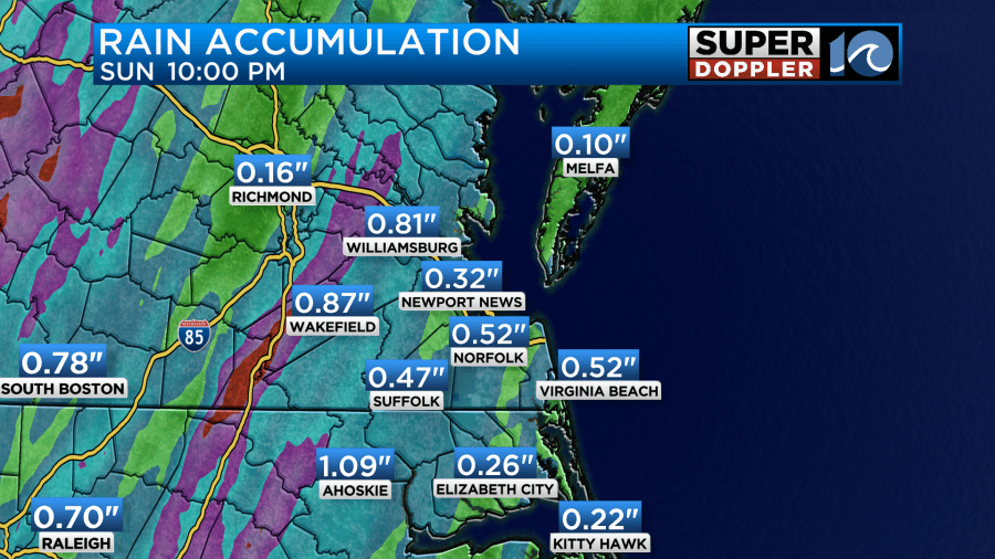
Up through that time our Future Trak model shows about a quarter of an inch up to an inch with higher amounts just to the west.
The long-range models have more rain on Monday with a big upper-level low slowly rolling over the Mid=Atlantic.
This feature may still bring us more rain on Tuesday. The rest of next week looks drier with highs in the 70s and 80s.
We really need some rainfall. Look at how much of the area is in a drought.
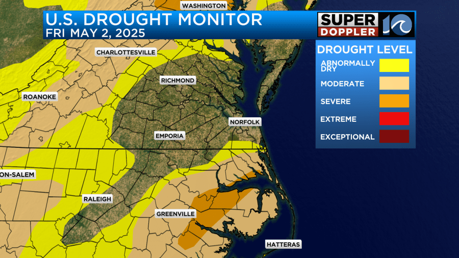
I would argue that more of southeast Virginia should be in the first category, but vegetation health is doing ok (for now). So maybe that’s why.
One last thing. The other day a “derecho” happened over the Midwest. It caused a lot of damage and even a few deaths. A derecho is a severe wind event that covers a large area. Here is an article with more information. It has the criteria as well: Midwest Derecho.
Meteorologist: Jeremy Wheeler


