
Yesterday was a rough day across the central United States. As predicted, there were widespread strong to severe storms. There were numerous tornadoes as well.
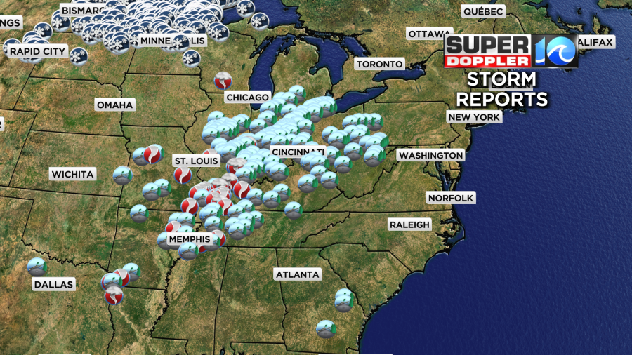
It’s amazing to not only see the high amount of tornadoes and wind damage, but to also see the snow reports on the same map not all that far away. Unfortunately, the storms have been deadly as well as destructive.
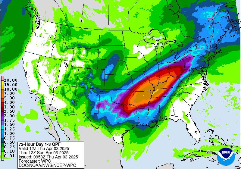
The rain and storms will keep going over the same area over the next 24 hours (but a bit more to the east). Some locations could see 7-10 inches of rainfall with isolated areas possible receiving a foot.
Today those storms will slide east a bit, but they will stay away from the Mid-Atlantic. These are ahead of a cold front that is slowing down.
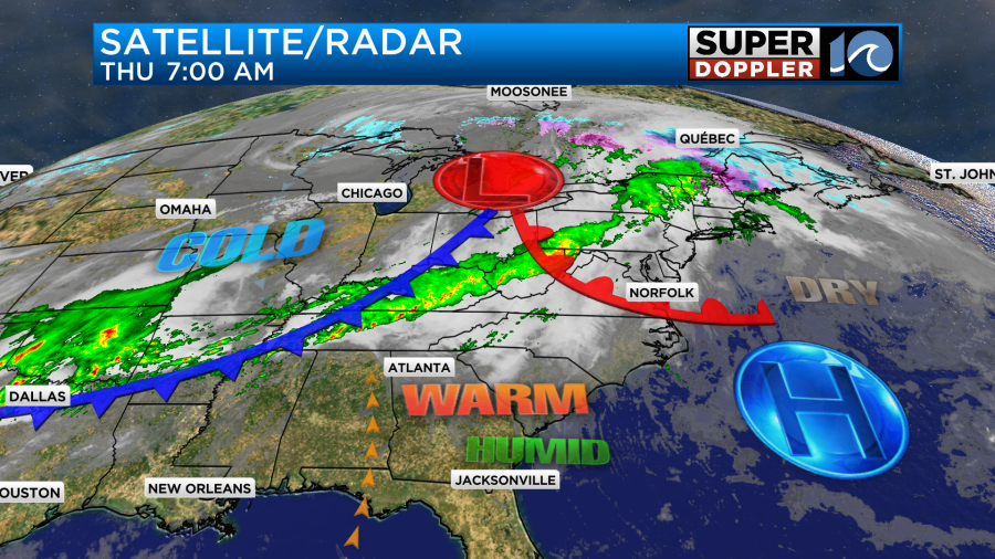
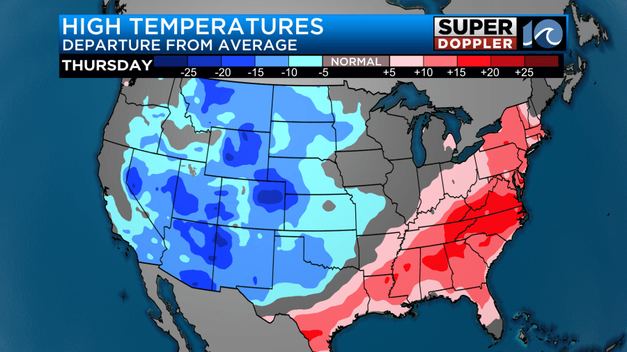
That cold front won’t get here any time soon. However, the warm front has moved through the region. The front will lift to our north today with high pressure offshore. We’ll have some gradual clearing as we head into the afternoon. Temps are going to be unseasonably warm. In fact the eastern/southeastern half of the country will be super warm while the norther and western U.S. will be well below average.
Locally our high temps will rise to the mid 80s.
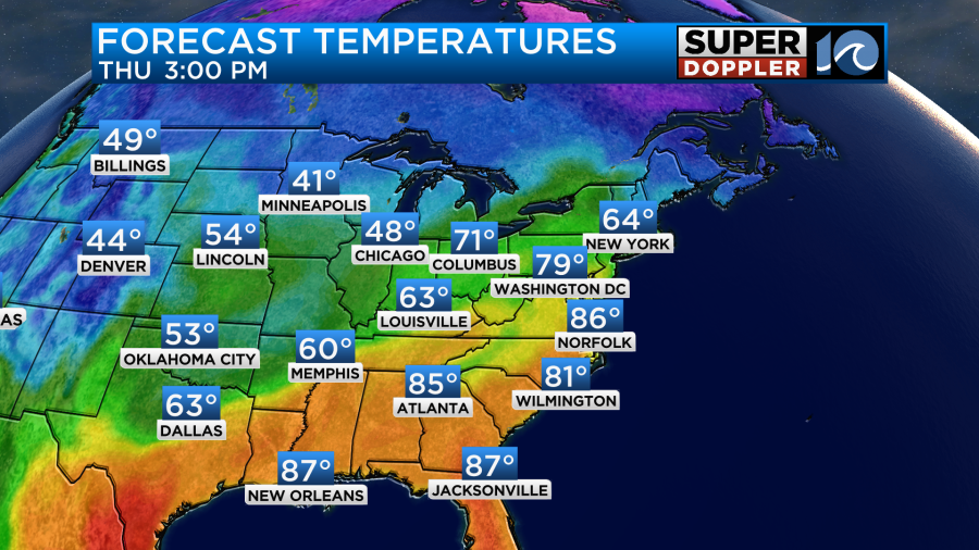
There will be some mid-upper 80s inland and south. This well above the average which is in the mid 60s this time of year. It will be in the 70s on the Eastern Shore and probably over the Outer Banks. The extra factor that will make it feel Summery outside is the humidity. Dew points have risen into the low 60s.
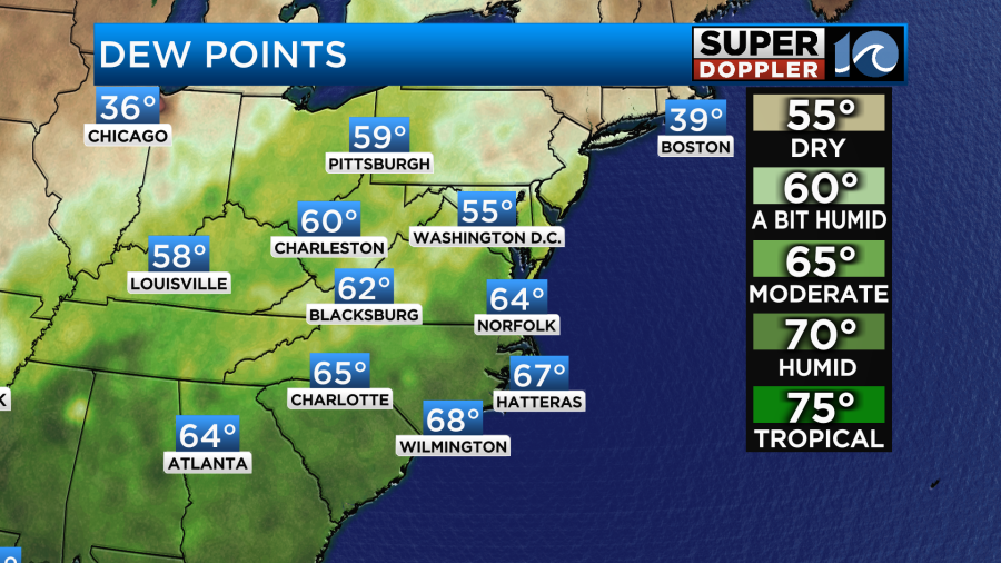
These dew points will stay up for the next few days.
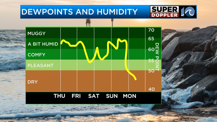
Temps will stay up as well. However, tomorrow temps may dip slightly. There will be a back door cool front that will slide south into the region, but it may not arrive until late in the day. For now I have highs in the low 80s, but falling to the 70s by the early evening.
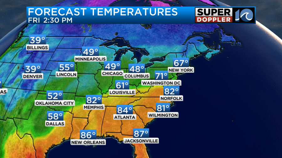
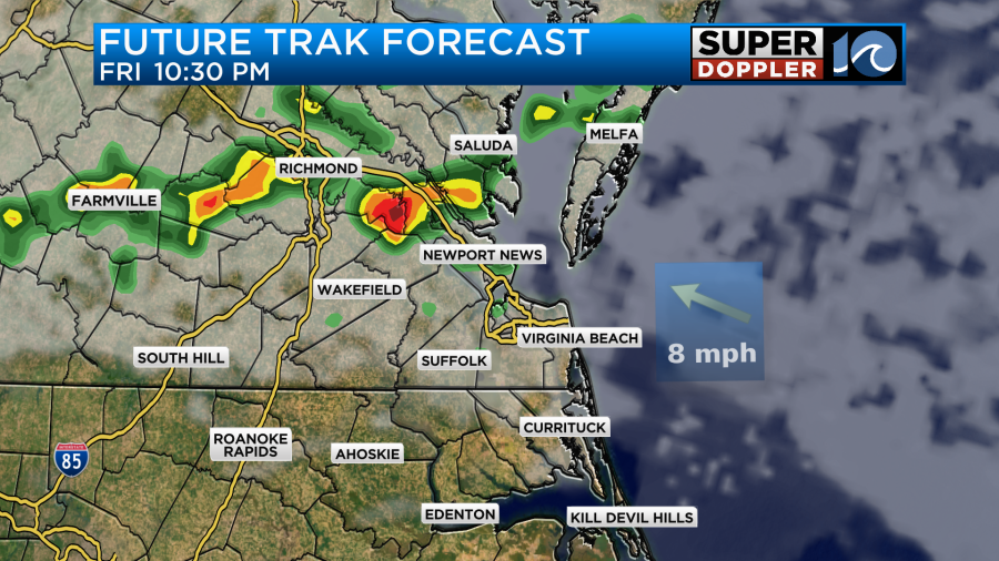
We’ll have a mix of sun and clouds on Friday. There may be some isolated showers in the afternoon. However, there will be a few showers and storms as we go into the evening as that front stalls out.
We’ll have clearing skies on Saturday as the front lifts back north as a warm front. So temps will push back up to the mid 80s.
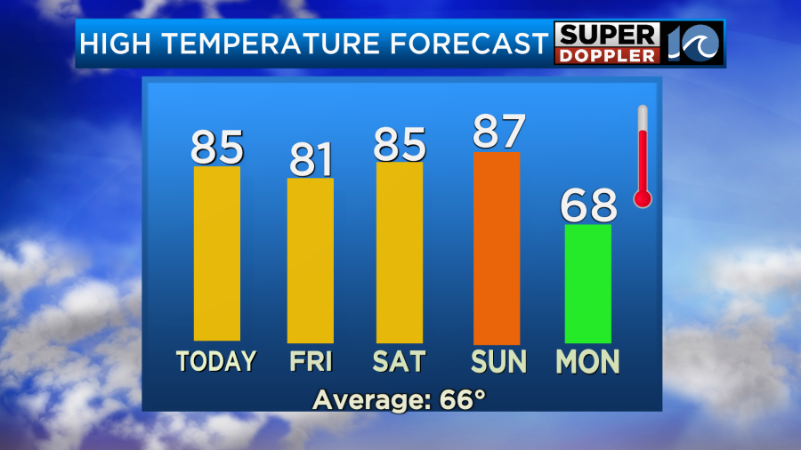
We’ll have partly cloudy skies on Sunday with no rain expected. A strong cold front will approach from the west, but we’ll be well ahead of it. So high temps will push up into the upper 80s. We’ll have a southwest breeze. A strong cold front will arrive then on Monday. It will cool down our high temps to the 60s. However, it will also bring us some much-needed rainfall.
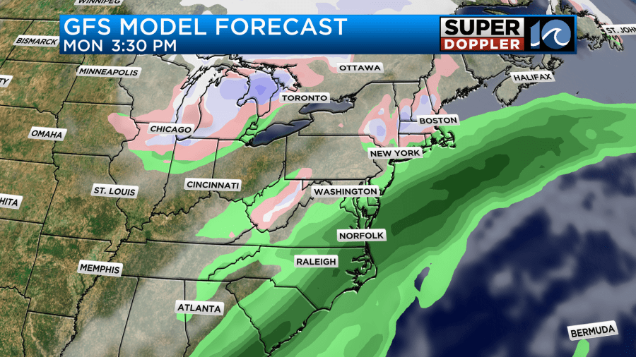
It could be a washout which would actually be a good thing. For starters this will help to keep the temps cool. Also, the whole area needs a good soaking rain as we are now rushing into the growing season. Also, the looming clouds of pollen need to get washed out. Tree pollen is high today with grass pollen at moderate levels. It will stay about the same for the next couple of days. Hang in there allergy sufferers.
Meteorologist: Jeremy Wheeler


