Good Saturday morning! We’ve got the best of both worlds this weekend! If you like Summer, Saturday is your day. If you like Fall, Sunday is your day.
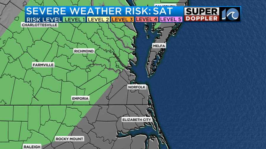
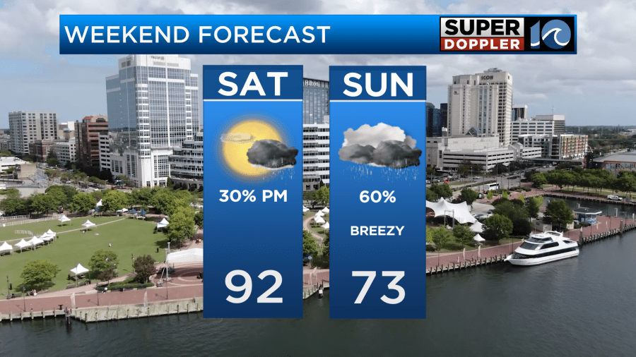
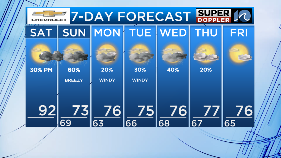
High temperatures will be in the low 90s with humidity making it feel like the mid 90s Saturday. Gradually increasing cloud cover ahead of a powerful cold front. Isolated to scattered showers and storms start impacting our inland communities after 4PM. Isolated storms could produce damaging wind gusts, so our inland communities are under a Level 1 of 5 severe risk this evening.
Scattered showers and storms continue around the front tonight and Sunday. Not a washout, but rain will be around. Sunday will be breezy and cooler. Highs in the low to mid 70s with falling humidity throughout the day.
Following the front, winds will pick up. A full moon plus 10-20 MPH northeasterly winds gusting to 30 MPH make for the perfect conditions to see some tidal flooding during Monday’s and potentially Tuesday’s high tide cycles.
As the front will stall just offshore and high pressure remains to our north for the start of the workweek, we will stay mostly cloudy through Wednesday. We also will have a chance to see isolated to scattered showers through Wednesday. Then, a reinforcing cold front passes through Friday with high pressure following it, allowing the clouds to begin clearing out late week.
The entire workweek, high temperatures will be in the mid 70s and overnight lows will be around the mid 60s.
Have a nice weekend!
– Meteorologist Kristy Steward