Yesterday was pretty hot and humid, but at least it was quiet. There were hardly any storms in the area. However, today we’ll have the heat and some storms. A cool front is going to slowly sink in from the north today. It will stall out over part of the region this afternoon.
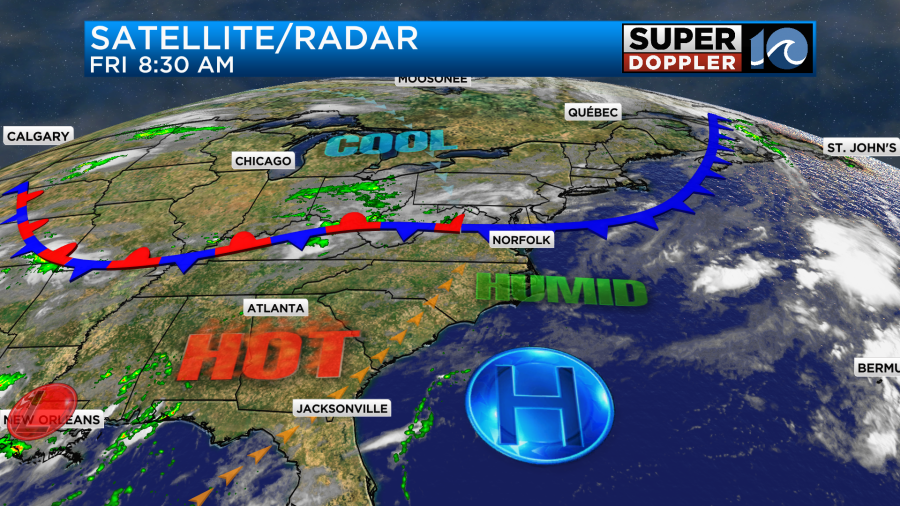
It will run into a very humid air mass. This has happened recently, and it did cause a lot of heavy rain over the area. The first half of the day looks quiet, but scattered showers and storms will fire up towards the afternoon.
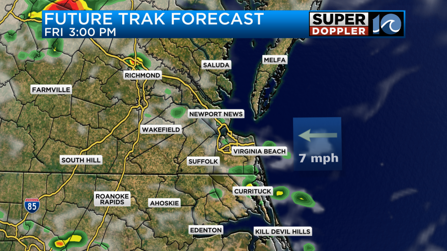
These scattered storms will increase going into the evening hours.
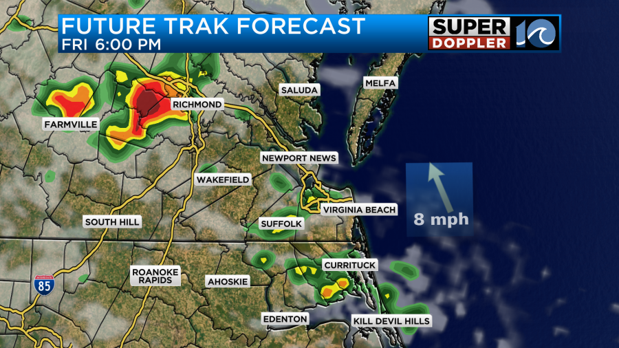
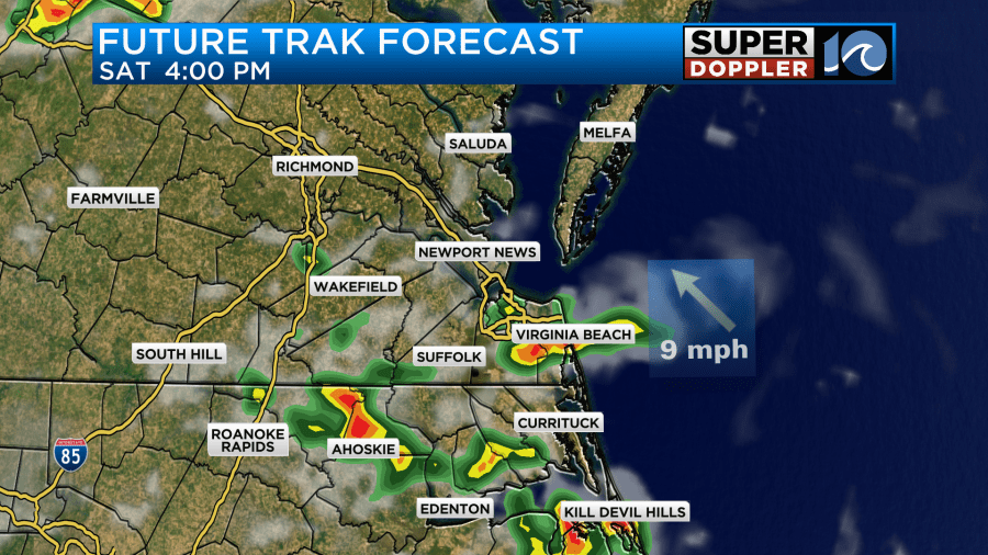
In fact…Our Future Trak model has a very large thunderstorm dropping in from northwest to southeast between about 6 and 9pm.
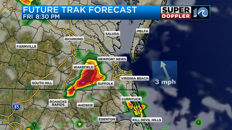
Don’t take the position too literally, but the model is probably trying to tell us that a large/strong storm will be possible during that time. We do have a slight risk (level 2) over most of the region.
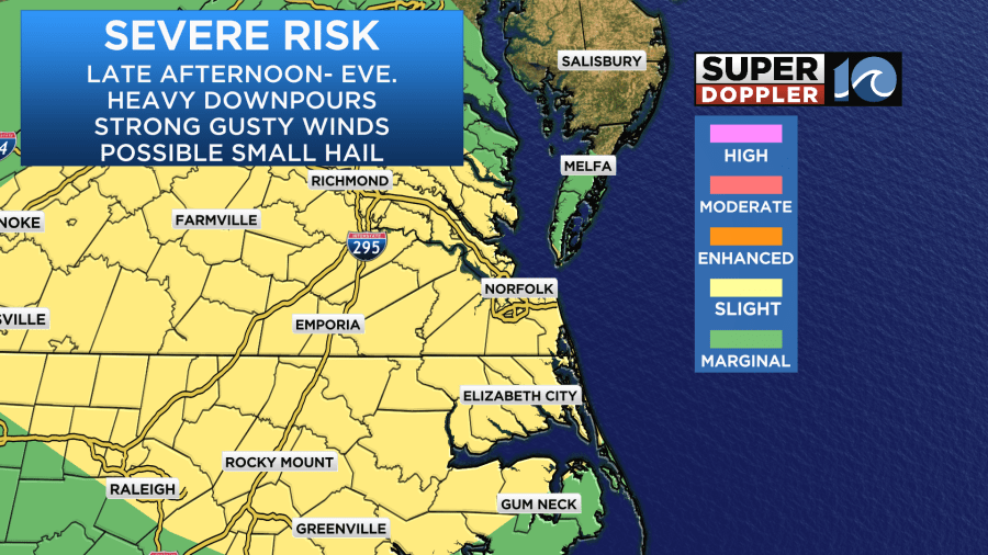
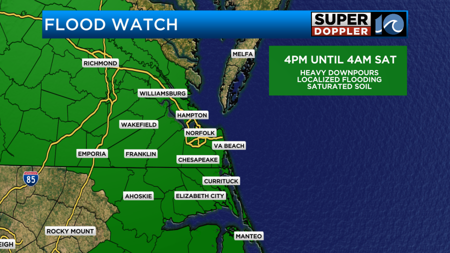
There may be some strong gusty winds and large hail. However, the threat for flooding will be higher. In fact there is a Flood Watch up for most of the region from the late afternoon until the overnight hours.
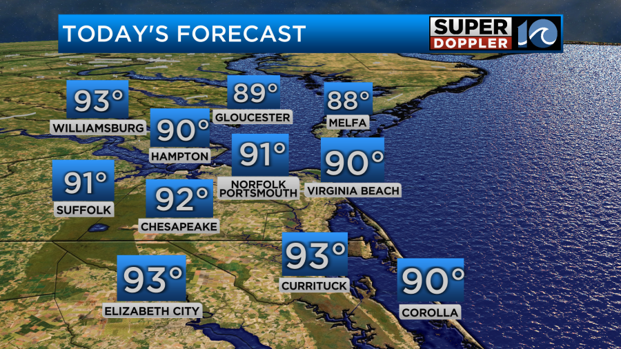
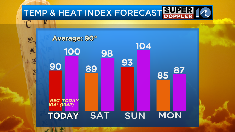
Temperatures will heat up before the storms and the front arrive. We’ll aim for near 90 degrees in Hampton Roads. We’ll be in the 80s north of Hampton Roads with some low-mid 90s over North Carolina and near the state line.
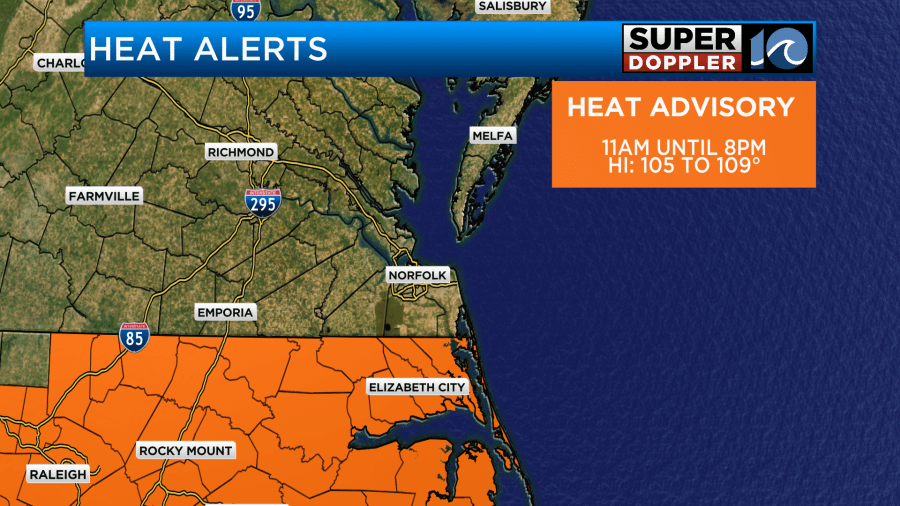
The heat index will be around 101 in the metro. It will be near 105 in northeast North Carolina.
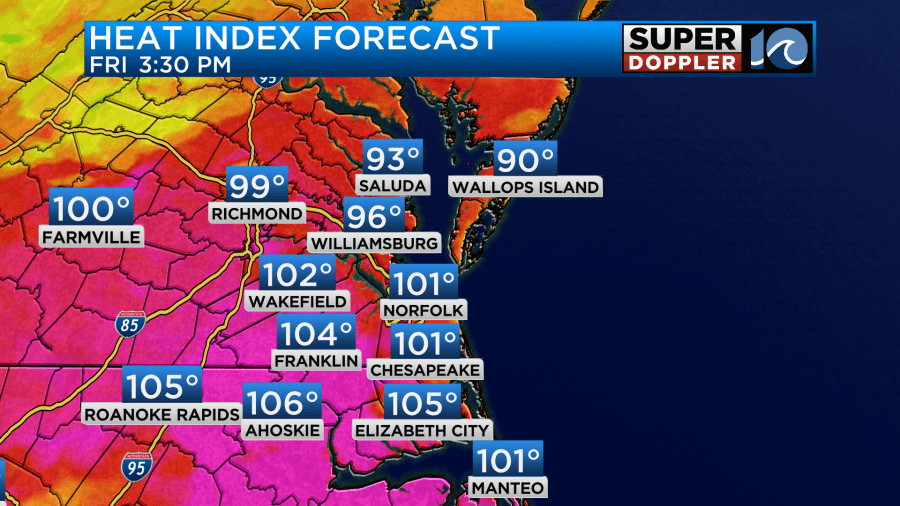
This is why there is a Heat Advisory for all of northeast North Carolina.
As you can see it will be less hot north of the metro. High temps will be more in the mid-upper 80s there, but it will still be pretty humid. Winds will be variable at about 10mph.
Tomorrow the front will be stalled out for a time. Then it should start to move to the north. There will be some scattered showers and storms developing along this boundary.
There could be some more heavy rain and a few strong storms, but for now I have a little less chance for the rain compared to today. Scattered storms will probably continue into Saturday evening. We could see a lot of rain over the area over the next 48 hours. The amounts depend on which model you believe.
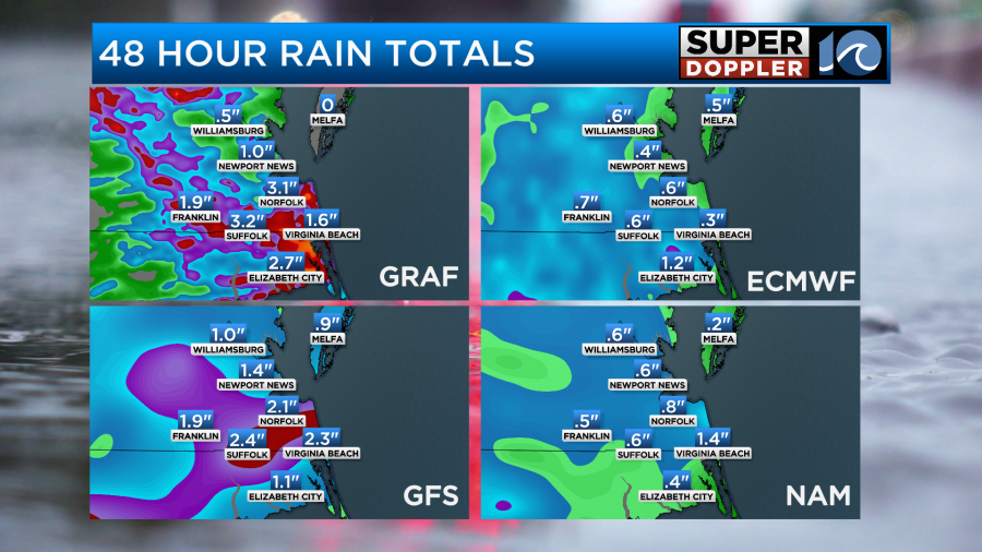
Notice that future Trak (GRAF) and the GFS models have quite a bit of rain, but the NAM doesn’t have too much. I don’t use the Euro for short term rainfall forecasts.
We’ll have increasing clouds tomorrow. High temps will be in the upper 80s to near 90. By Sunday the front should rise back pretty far to the north as a warm front. We’ll be partly cloudy with some spotty showers or storms in the afternoon. High temps will push back up to the low-mid 90s. The heat index will be over 100.
Notice though that we’ll cool down on Monday. Yes, as of today the models are starting to show a cold front dropping to our south early next week. This would not only cool us down a bit, but it would also dry us out. Take a look at the Muggy Meter!
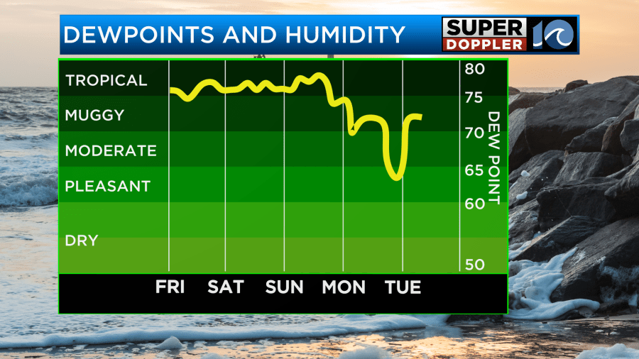
This is great news! I don’t want to get my hopes up too high, but if this is right then we may be looking at high temps in the low-mid 80s for about 3-4 days with lows in the 60s and 70s. We may also have a lot of sunshine. So check back for updates on that.
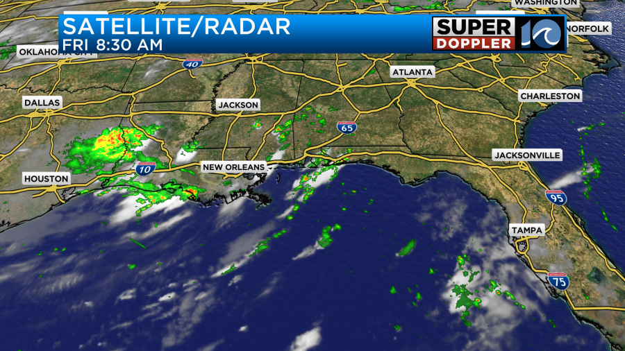
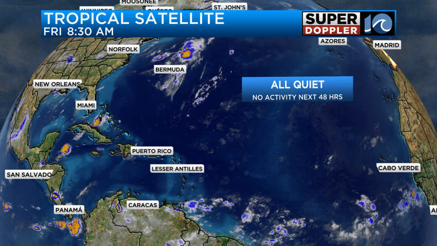
The tropical update is that the area of low pressure along the gulf coast never did form into a tropical system. It did create some heavy rain down there though.
The rest of the Atlantic Basin is quiet, and it should be quiet through at least the weekend.
Meteorologist: Jeremy Wheeler