(WAVY) — Thursday night, there were some strong storms moving through the region. I came into work early to monitor the storms.
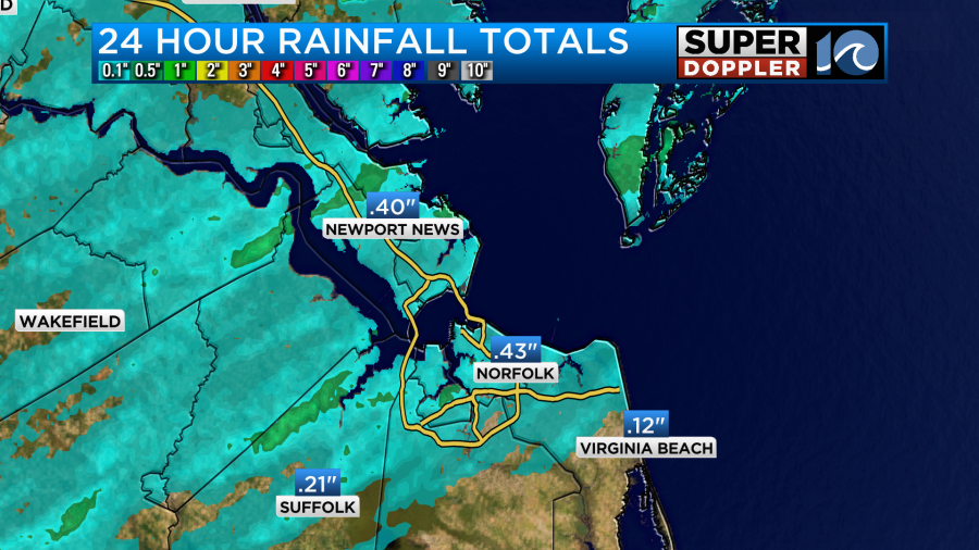
I was impressed with how much lightning they contained. They dropped a quick quarter to a half an inch of rain over the Metro area.
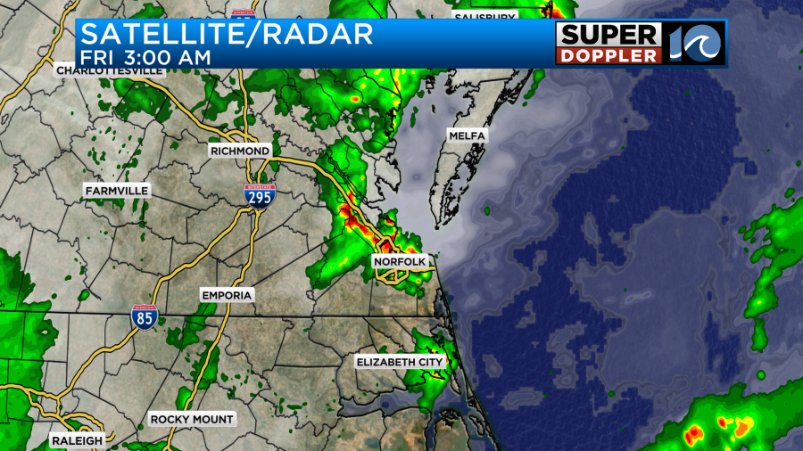
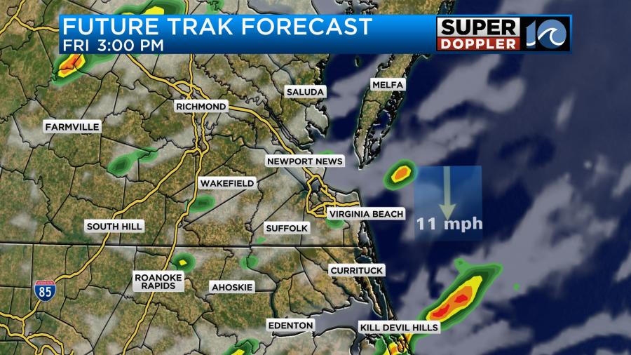
These storms moved northeast through the Eastern Shore. Then they moved out of the area. We then had some spotty showers through the mid-morning. Friday, we had a couple of cold fronts merging to our northwest.
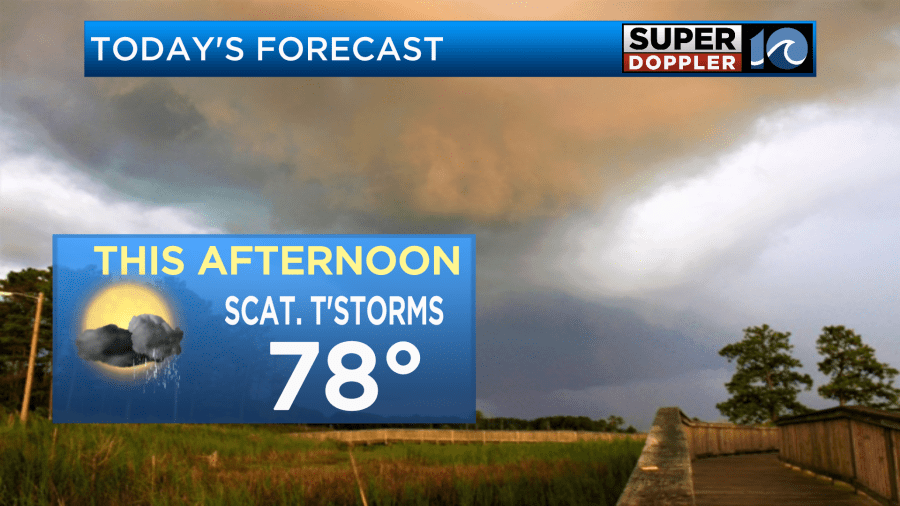
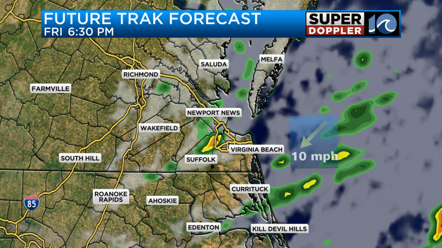
They wrapped-in and move through the region as we go into the afternoon. There was also a weak area of low pressure moving in from the west, and we had a mix of sun and clouds for a while with some spotty showers. Then during the afternoon we had some scattered thunderstorms flaring up over the region.
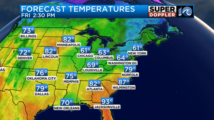
It was possible with a little sun popping out to heat up to the low 80s Friday, but we mostly had for the upper 70s with just a few 80s over North Carolina.
Winds were out of the southwest for a bit. Then they turned out of the northwest. Along with the surface features sliding through there was also a small pocket of energy (shortwave) in the upper levels passing overhead. These features helped combine to create a few strong to severe storms between the afternoon and evening.
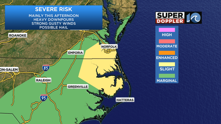
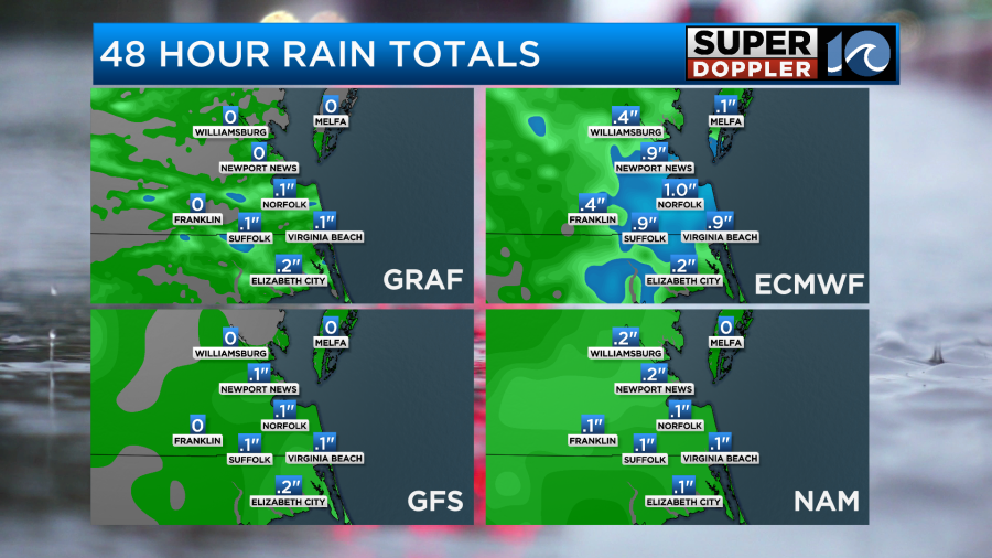
Rain amounts varied quite a bit, and parts of the region saw a lot of hail. It’s possible some areas got a tenth of an inch up to about three quarters of an inch of rain.
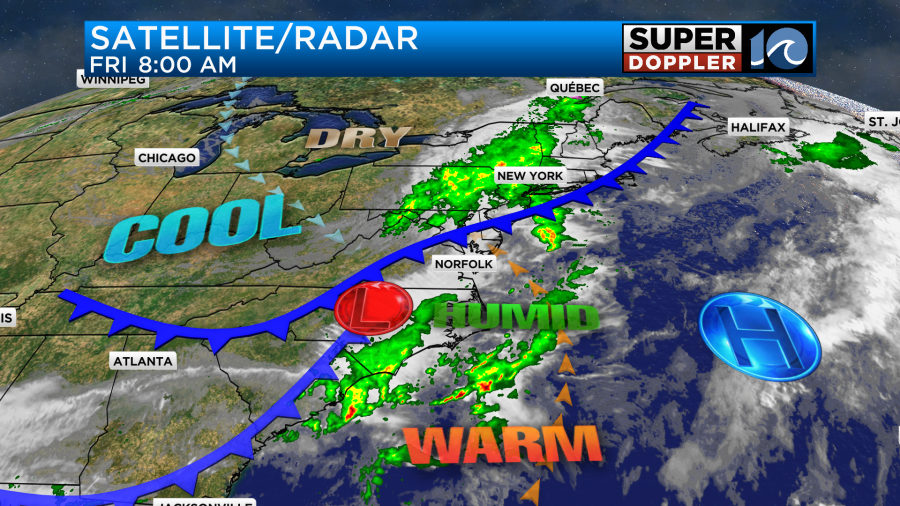
The good news is that we will dry out just in time for Mother’s Day weekend.
So the weekend looks good. High temps will be in the low-mid 70s. We’ll be dry both days.
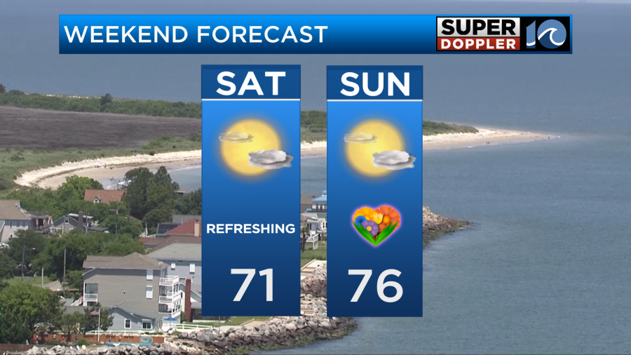
Keep in mind that there may be some spotty showers close to the region on Sunday. I’m optimistic for now that they will stay away. We’ll be partly cloudy on Monday with some isolated showers later in the day. High temps will be in the 70s.
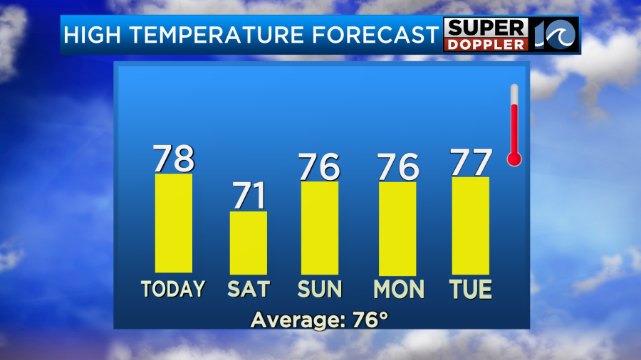
We’ll have scattered rain showers and probably some storms returning next Tuesday and Wednesday.
Meteorologist: Jeremy Wheeler