During the day yesterday it was very hot, humid, and breezy… as expected. High temps ended up hitting the low-mid 90s.
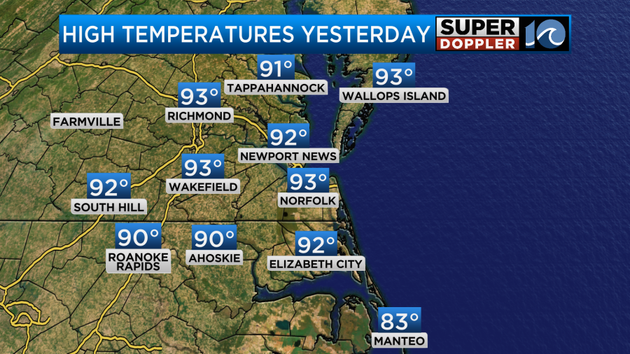
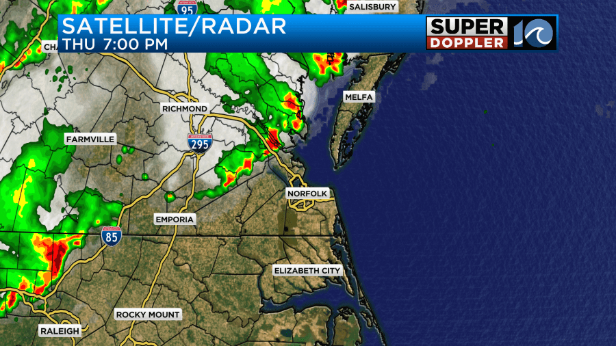
It came in a little under forecast as some clouds did end up rolling in. However, it did still feel like it was over 100 degrees with the heat index. It was quiet during the day. However, last night the line of storms (that was expected) rolled in. The first wave hit north/northwest of Hampton Roads around 6-7pm.
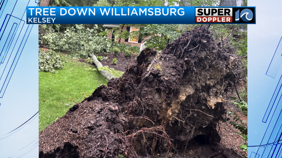
This produced very strong winds and some damage. Here was one photo of a tree down in Williamsburg from around that time.
Then the second wave formed over the Southside and North Carolina around 9-10pm.

That one also had some severe winds. Wind gusts were over 50mph in a few areas.
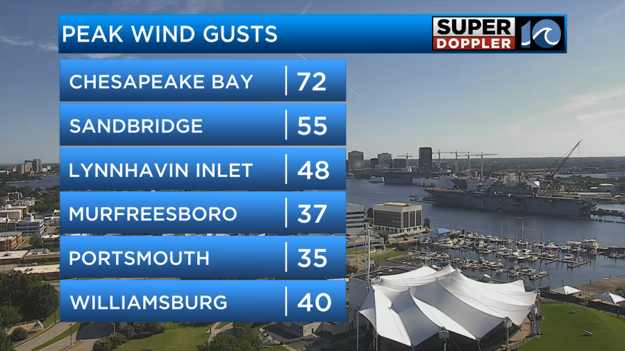
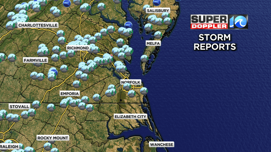
These caused a lot of damage reports.
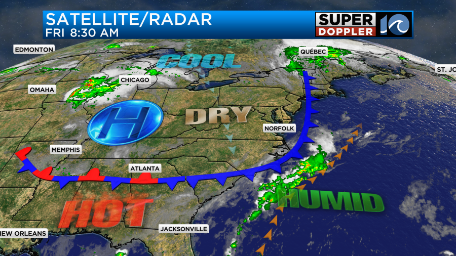
These were all out ahead of a cool front. Now that front has passed to our south.
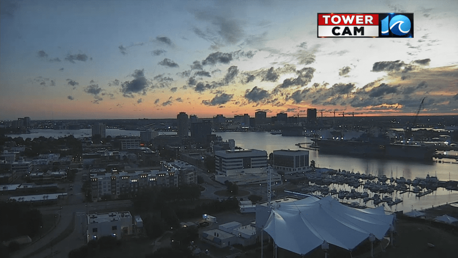
We already had some clearing this morning. Some of the early pictures from our tower cams were great!
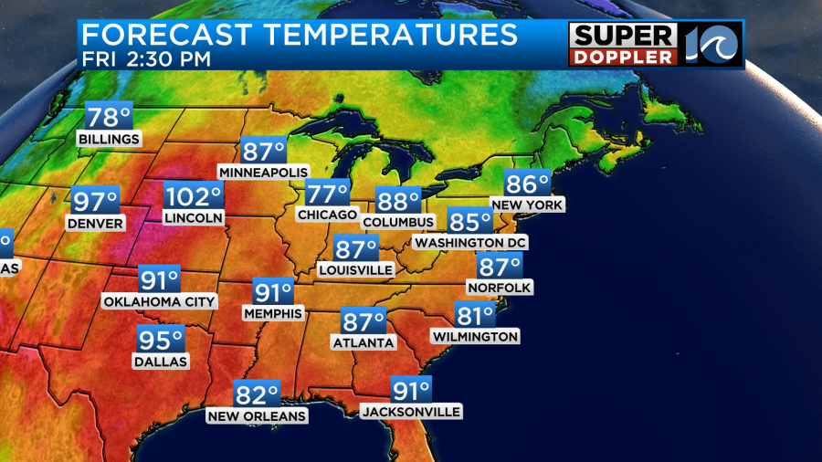
We’ll have lots of sunshine today. The breeze will be steady out of the northeast. It will run at 8-12mph. High temps will be in the mid-upper 80s this afternoon.
The dew points will be dropping down to the upper 50s. That will create a very nice day! Ironically, we are cooling down for the first day of Summer.
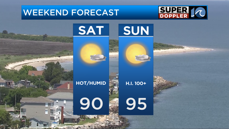
Over the weekend we’ll be rain-free. That is the first time in a long time. However, temps will heat up as the winds start to turn out of the south again. High temps will be near 90 tomorrow. The humidity will creep up a bit.

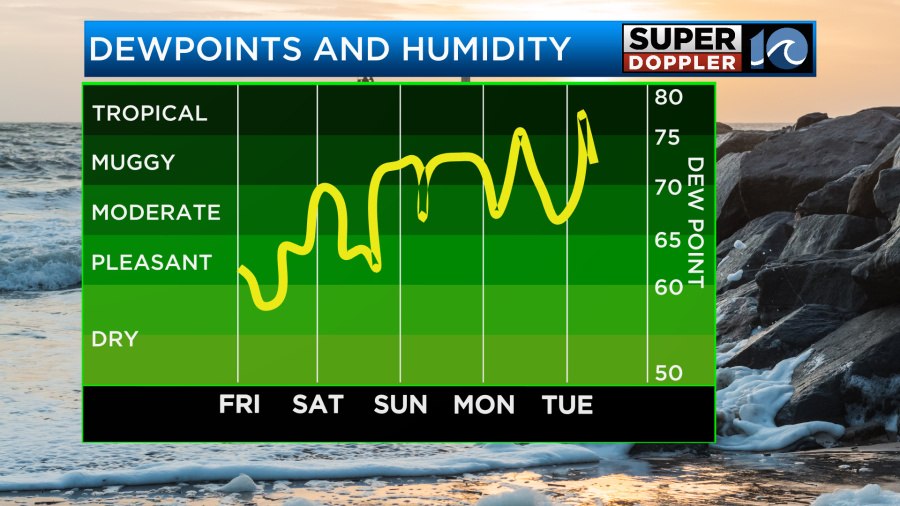
We’ll still have lots of sunshine. It will be a typical June Summer day. However, by Sunday the heat and humidity will be rough again. High temps will aim for the mid 90s. The heat index will be over 100.
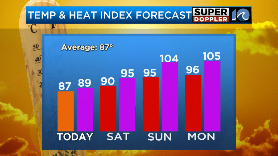
This type of heat and humidity will continue during the first half of next week. So enjoy the break from the heat while you can.
Have a good weekend! Be sure to stay hydrated.
Meteorologist: Jeremy Wheeler