
I’ll start this weather blog talking about Dexter. Then I’ll talk more about our local weather. Finally, I’ll hit the tropics again. So I’ll be doing a tropical sandwich today.
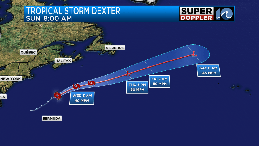
First off, tropical storm Dexter is behaving itself. It is still out to sea and moving away from the U.S.
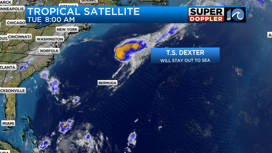
It actually weakened a bit since yesterday. At the time of this writing it was a very weak tropical storm with sustained winds of 40mph.
Dexter is forecast to remain a weak tropical storm for the next day or two. After that point it is expected to become post-tropical.
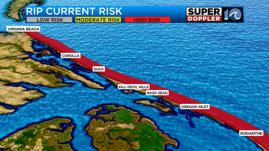
The only impact we have here is that the rip current threat is still high today along the beaches.
Meanwhile closer to home we have high pressure to the north with a stationary front to the south.
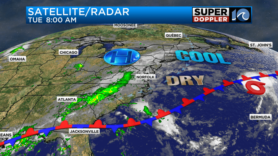
We’ll have a mix of sun and clouds today (partly to mostly cloudy skies). There will be a couple of spotty showers and sprinkles, but overall we’ll have a dry day. We’ll have another cool day with high temps in the low 80s.
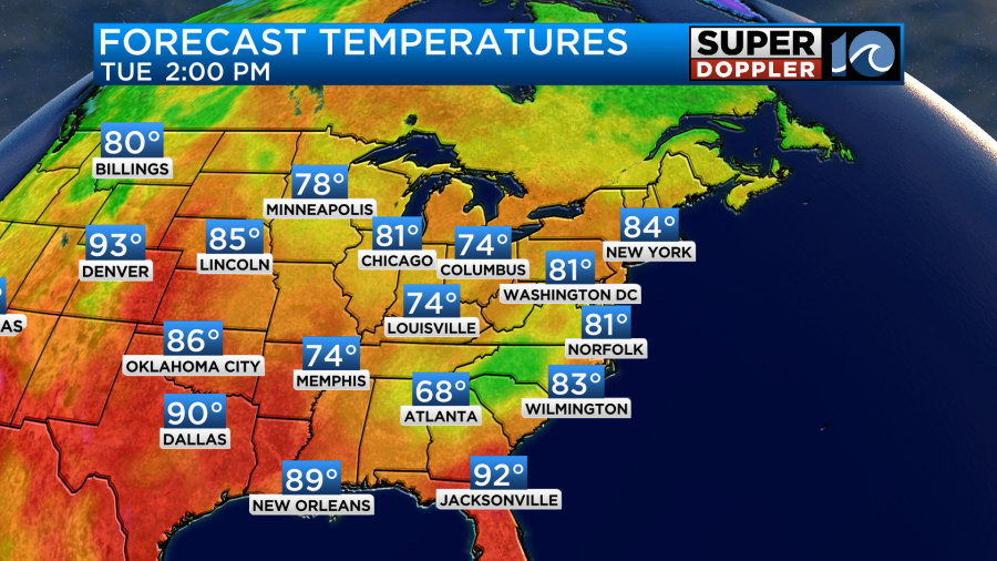
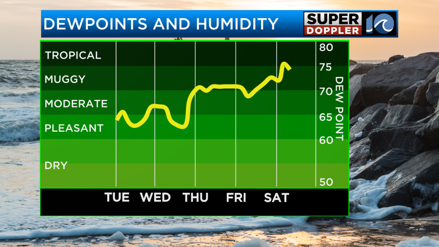
The dew points are still down in the 60s. So we’ll have one more day of comfortable humidity. Winds will be out of the northeast at 8-12mph.
Tomorrow we’ll have more moisture move into the region. We’ll be mostly cloudy with scattered rain showers.
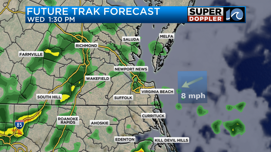
We’ll have a stronger breeze out of the northeast. Gusts will be up to about 20mph. High temps will probably be near 80 degrees, but remember… The humidity will start to increase.
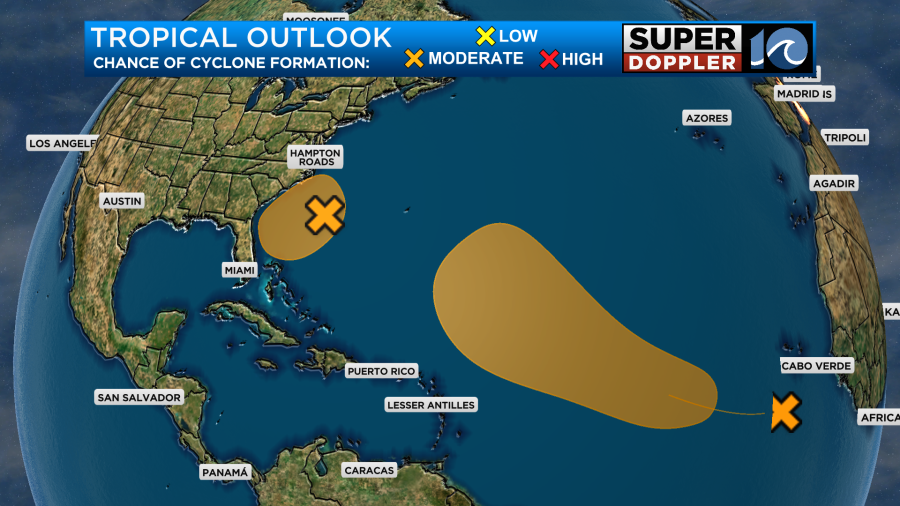
Beyond tomorrow things get tricky. It’s due to an area of low pressure that is forecast to form along the coast. It could become tropical. This morning the National Hurricane Center upgraded this area of formation from low to medium.
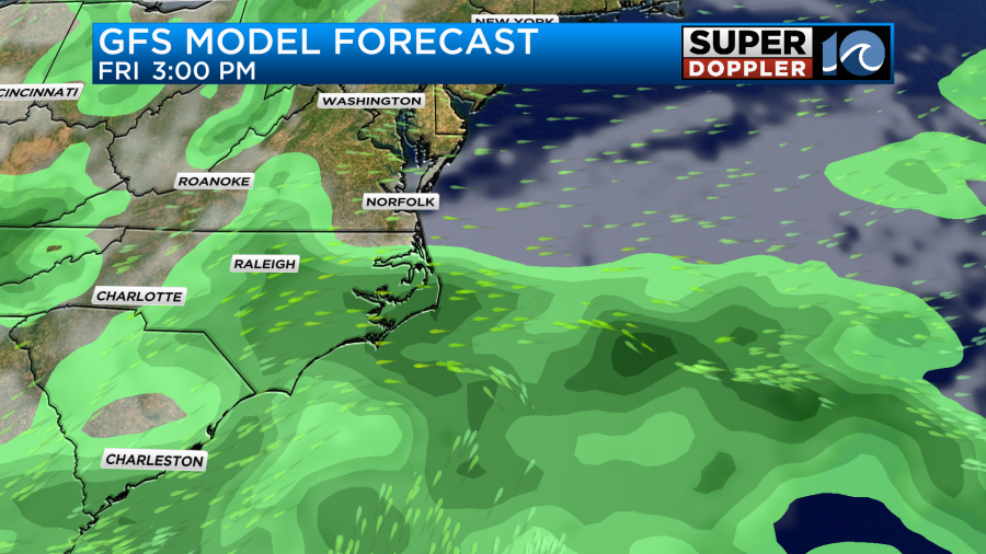
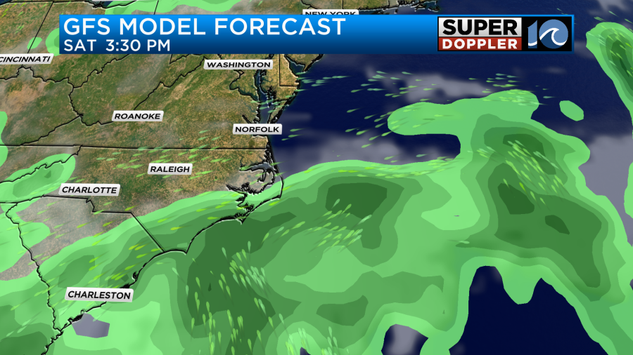
The models are very split in how this low is going to behave. They agree in the short term about some rain between Wednesday and Thursday. However, by Friday the models split. The GFS has a drier scenario with the low pretty far to our south and weak. So it doesn’t have much rain over southeast Virginia, but it does have some over northeast North Carolina.
Then by Saturday it has the low moving south and possibly even falling apart.
Meanwhile, the European model has the low a little closer on Friday with lots of moisture getting push into our region north of the low.

It then has the low sitting near Hatteras on Saturday.
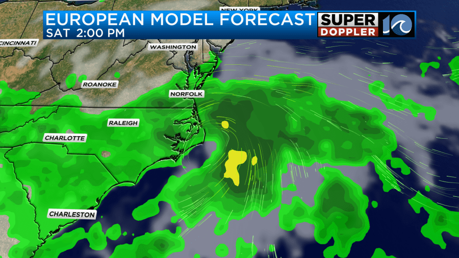
This creates a lot of rain for our whole region.
Which model is right? Too early to tell. For now I have split the difference and gone with low rain chances for Friday through Sunday. Hopefully, by tomorrow the models will start to come together. Hopefully, this is not setting the tone for the rest of the tropical season.
There is another feature coming off of Africa. This tropical disturbance has a medium chance of formation. (See tropical weather outlook above). My gut says it would stay out to sea looking at the latest info. However, that is definitely not a guarantee. Some models do have it aiming for the U.S. Coast, but that forecast is very far out. So we’ll see.
I’ll have more updates on all of this in tomorrow’s weather blog. Check back for updates.
Meteorologist: Jeremy Wheeler


