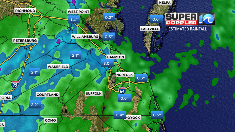
We had more rain and more big storms yesterday over parts of the region. There was some flooding and standing water reported in some inland areas over to the Peninsula.
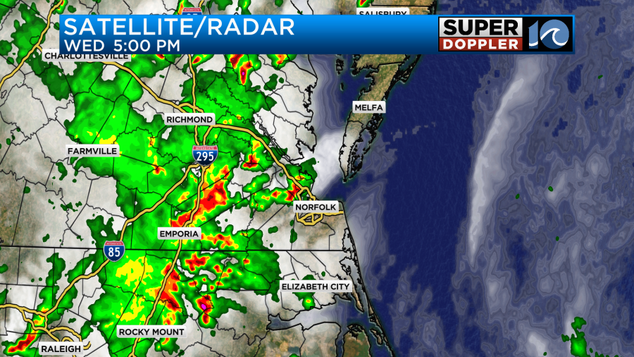
Rain added up to 1-3″ in the heavier areas. However, the bulk of the region had much less.
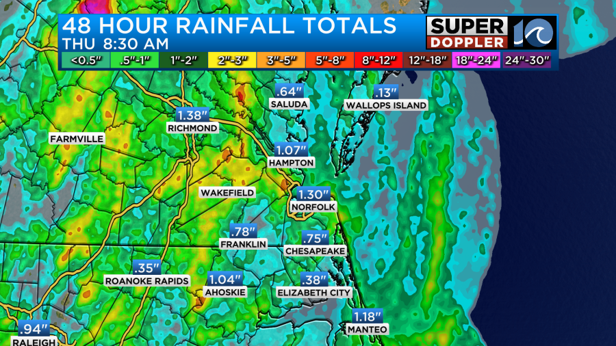
Here’s some of the official 48 hour rainfall totals:
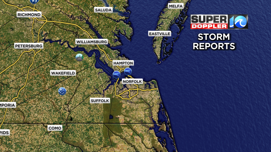
There were several reports of standing water. There were also a couple reports of large hail and wind damage, but there weren’t too many of those.
Over the last few days we have dealt with 2 weather systems that have created all the rain and storms. These were a surface low and a big upper level low. Today the surface low is drifting more to the north. There is a warm front to our north as well.
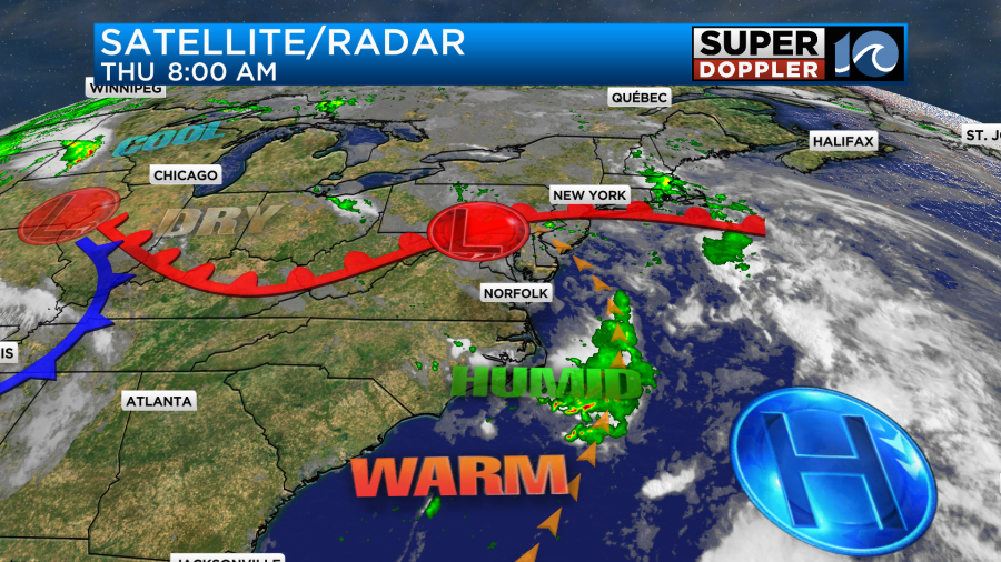
The upper-level low is still there, but it is drifting slowly offshore.
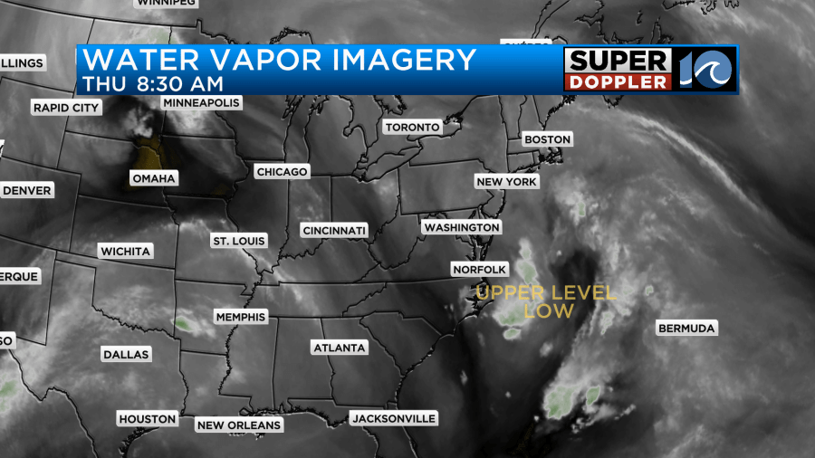
You can also see this morning that there’s not much activity to our west. These systems are losing their influence, but they aren’t gone yet. So today we’ll be partly cloudy for a long stretch. Then we’ll have a few showers and storms popping up this afternoon.
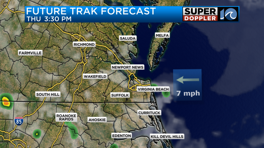
The coverage will likely be less than the last couple of days (though probably more than Future Trak shows). However, there still could be a couple of strong storms out there during the afternoon. The SPC just upgraded more of the region to a slight risk. I do think that’s overdone for the coverage expected.
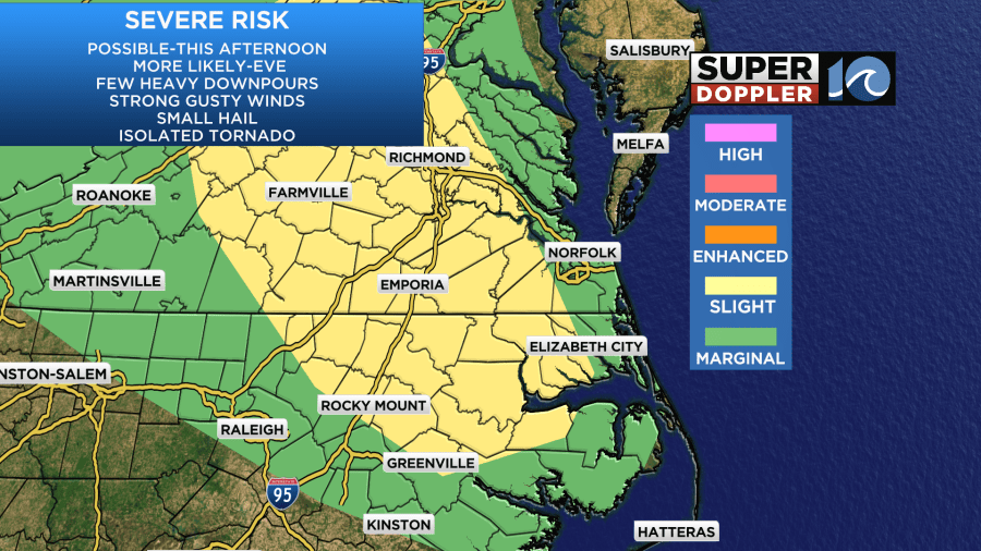
Having said that. I do think that things will pick up a bit more as we go into the evening.
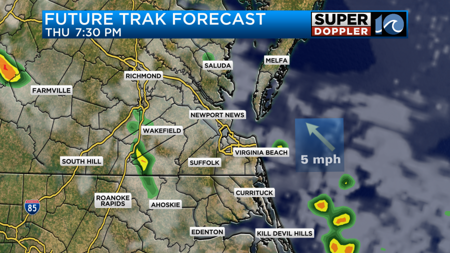
So there may be a little higher risk for a few severe storms during that time. We could see a quarter to a half an inch of rain over parts of the area. A couple of isolated downpours could create another inch, but I do think this area will be limited.
We’ll have a light southwest wind through the day. This should help to push our high temperatures up to the mid 80s this afternoon.
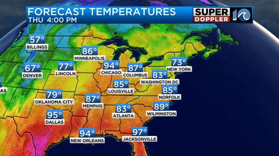
It will feel like the upper 80s to near 90 with the heat index. Tomorrow the heat builds in even more. High temps will rise to the low 90s.
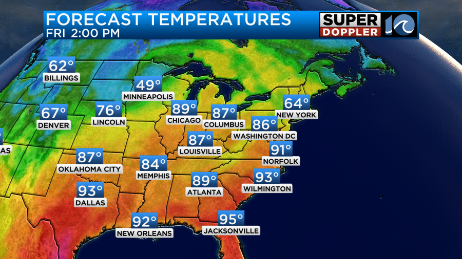
The heat index will probably be up in the mid 90s. We’ll be partly cloudy most of the day. There will be a few showers and storms in the afternoon.
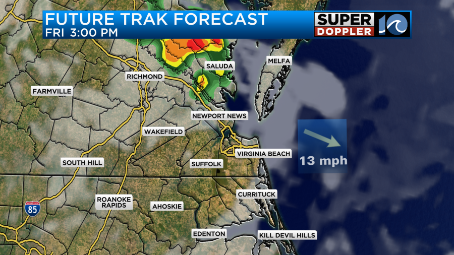
I don’t know if I buy the one big cluster on our model. I think instead it will be a few smaller clusters of showers or storms.
By Saturday those features should move out, and high pressure will build in behind it. We’ll have decreasing clouds with only some isolated showers or storms possible. However, it will still be hot. High temps will be in the low 90s again. The heat index will be in the mid 90s.
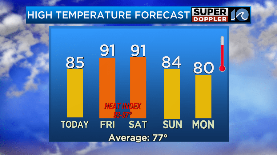
Be sure to stay hydrated if you go out to the many outdoor events this weekend. That won’t be as imperative on Sunday as we’ll dry out and cool down.
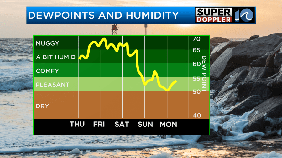
It should be very nice out Sunday and Monday with that lower humidity. We might even drop to the upper 70s next Tuesday, but we’ll see.
Meteorologist: Jeremy Wheeler


