
It was another nice day yesterday. We had lots of sunshine again with high temps in the mid-upper 60s.
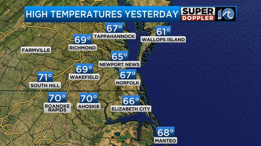
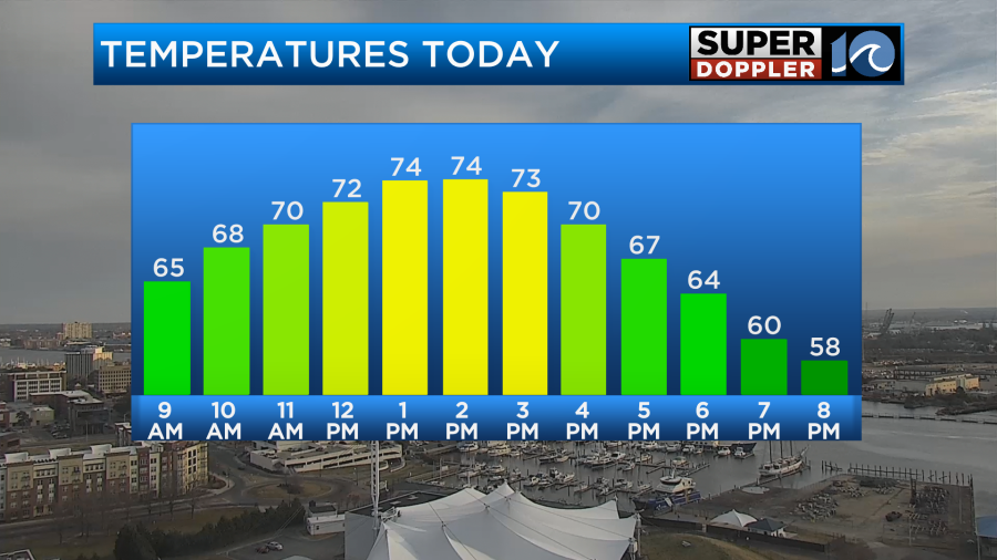
There were a few 70s to the south/southwest. These temps were well above the average which is in the mid-upper 50s this time of year. Interestingly enough…That’s where we started our temps this morning. Overnight we had building cloud cover and a southwest breeze. So it was definitely a mild start. We are going to warm up much more today. High temps will aim for the low-mid 70s with some mid-upper 70s in a few locations.
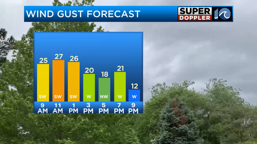
This is despite a lot more clouds in the region. Winds will gust up to 25mph for most of the day.
This will help to push up those temps. We had partly to mostly cloudy skies this morning with a sprinkle or two. We’ll have thicker clouds this afternoon with some isolated showers.
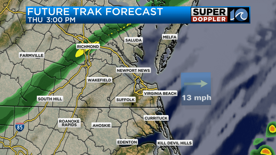
High pressure is offshore today. We have a warm front to our north with a cold front to our west.
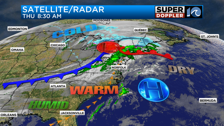
However, that cold front will arrive by the early evening hours. During that time we’ll have a line of rain showers develop and move through the region.
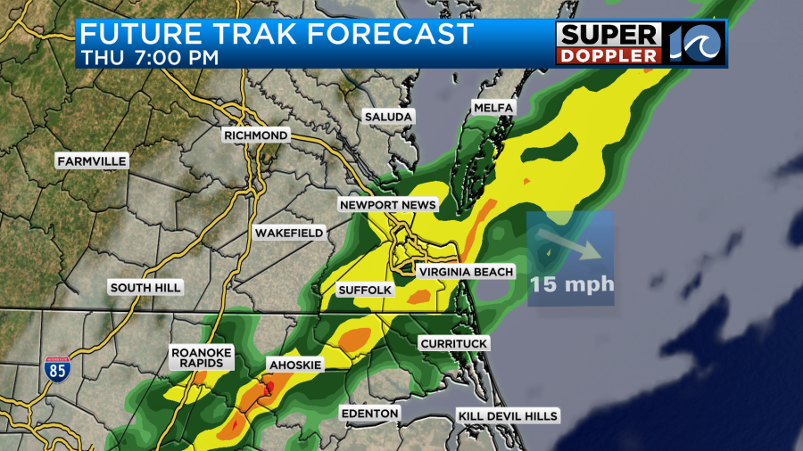
There will be some moderate to heavy rain for a time. There might also be a couple of thunderstorms.
The rain should drop to our south by 10-11pm. Then we’ll dry out overnight. Low temps will be in the 40s.
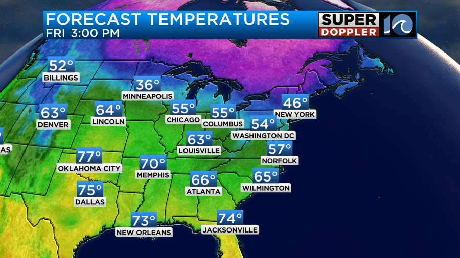
We’ll be dry and cooler on Friday. High temps will be in the mid-upper 50s.
We’ll be dry over the weekend, but temps will bounce around A LOT! We’ll rise to the upper 60s on Saturday. We may even hit 70 degrees. Then high temps will crash down to the low 40s on Sunday.
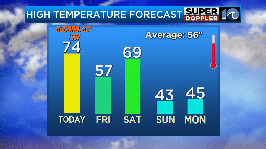
At least we should warm up again going into the rest of next week. I don’t see any snow on the horizon. At least not for the next 7-10 days.
Meteorologist: Jeremy Wheeler


