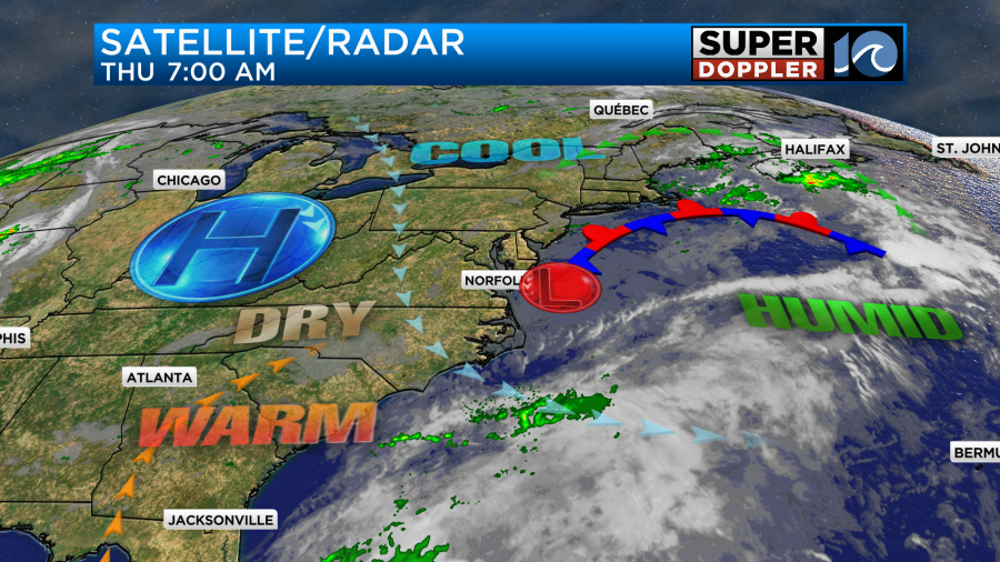
Over the last 24 hours we have had lots of clouds, drizzle, and some scattered rain showers. The area of low pressure that affected us over the last couple of days will finally scoot offshore today. There were still a lot of clouds and some drizzle this morning over some locations.
The low was already moving out to sea this morning, but there was still a good amount of moisture wrapping in behind it.
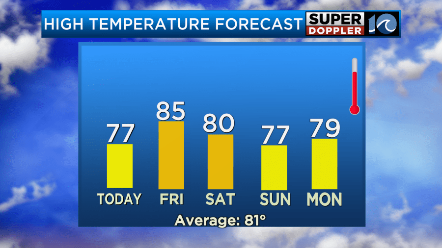
We’ll have gradual clearing as we go into the afternoon. It should turn into a pretty nice day. We’ll have a light northwest breeze. High temps will aim for the mid-upper 70s.
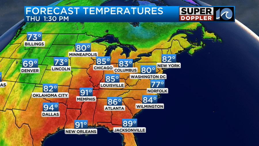
Humidity will be moderate.
By tomorrow high pressure will build in a little stronger. We’ll have lots of sunshine through the entire day. Winds will be light and out of the southwest. This will allow the temps to heat up into the mid 80s.
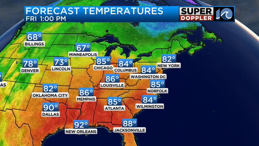
A cool front will slide through on Saturday. Winds will pick up a bit out of the northeast. Temps will drop to the upper 70s to low 80s.
Skies will be partly cloudy. It should be another nice day.
We’ll have some decent weather on Sunday. However, the front will probably stall out offshore. This might produce some isolated showers, but we’ll see. High temps will be in the 70s.
Meanwhile, tropical storm Gabrielle has been struggling over the last several hours. It has been fighting some dry air and moderate wind shear. So it was even tough to find the rotation on the satellite this morning.
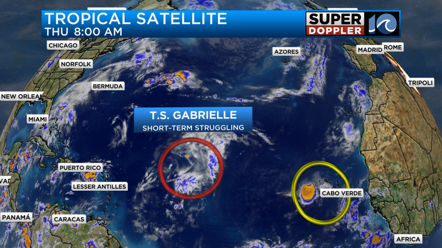
Despite this the National Hurricane Center put Gabrielle’s sustained winds at 50mph this morning. The storm is on a northwest track. This will allow it to eventually get into a more favorable environment for development. The storm is forecast to stay on a northwest track and then take a northerly turn in a couple of days.
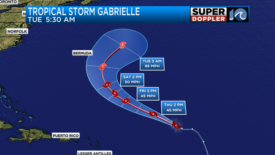
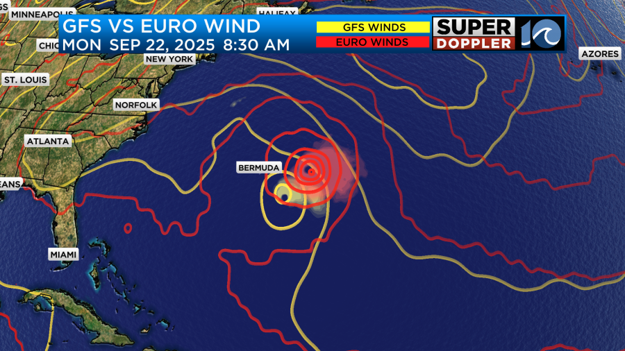
Gabrielle is then expected to move more to the northeast by the end of the weekend. It could become a hurricane by that point as well. Luckily, the forecast keeps Gabrielle out to sea. It now even keeps it east of Bermuda. There is a growing confidence in this as the models are starting to cluster out that way.
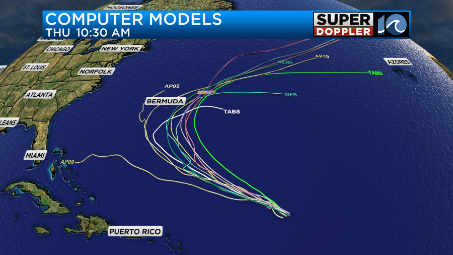
The GFS and European models now follow that path (east of Bermuda). The GFS is coming in-line with the Euro which has been more steady over the past couple of days.
There is a weak disturbance in the eastern Atlantic. It is moving to the west. For now it has a low chance of formation, but there was a bit of a flare up out that way.
Meteorologist: Jeremy Wheler