Across the country and across the world there have been quite a few flooding events recently. The updates keep coming in from Texas. Some of the sad stories have been tough to take. Though there have been a few good stories of rescues as well. However, over 100 people are dead. There are still many missing. Texas Flooding update.
I posted about the flooding in North Carolina the other day. Then a new area had flooding just happened in the west. Some more severe flooding happened recently in New Mexico. Small streams turned into raging rivers near the Ruidiso area. Unfortunately, that flooding was also deadly.
Locally, we didn’t have any flooding like that, but there was some heavy rain and flash flood warnings last night near Richmond.
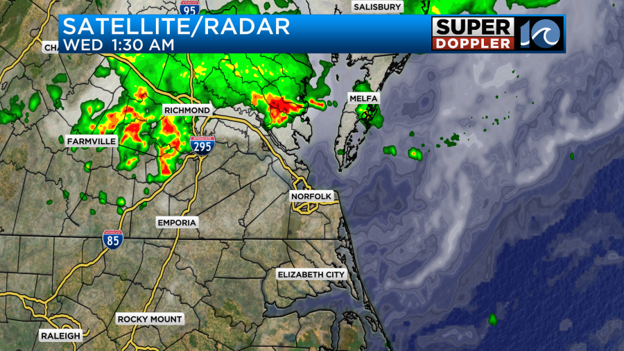
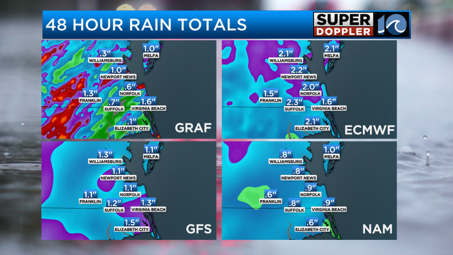
There has been some heavy rain there over the last 48 hours.
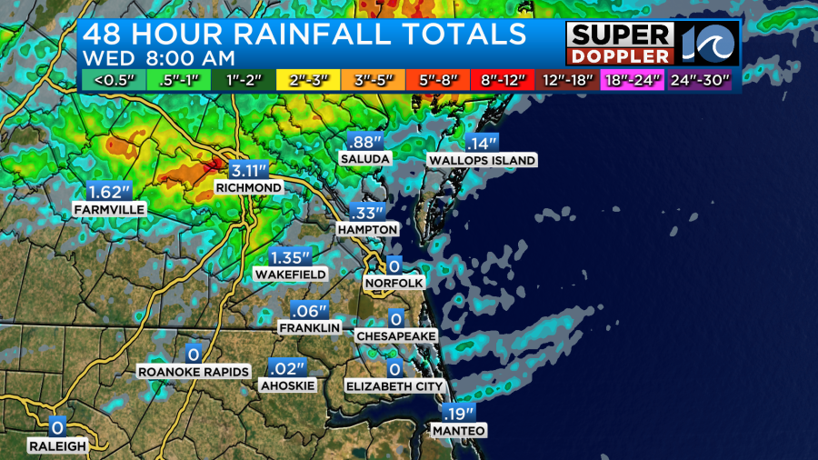
A few of these heavy thunderstorms moved east and affected the Middle Peninsula and the Eastern Shore last night, but it was on a smaller scale. The scattered nature of thunderstorms recently has created a large difference between the have’s and have not’s. Take a look at the 30 day rainfall compared to average.
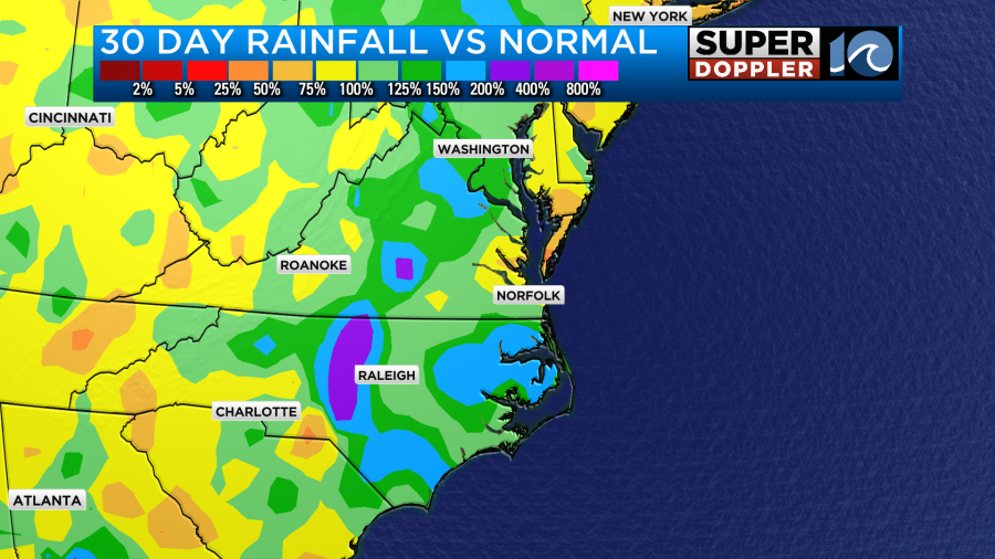
Some folks in the area need rain quite a bit. Some others don’t need much at all. So going forward today we will have a few more showers and storms, but I think the bulk of them will fall in the evening. There’s no big weather features near our area. There is high pressure offshore with a stationary front well to the north.
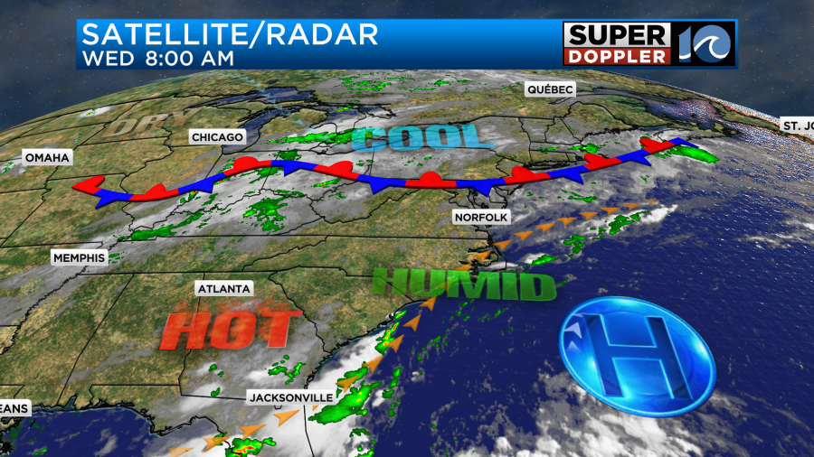
There is a large amount of deep moisture in the region. This afternoon I think we’ll have a few showers and storms popping up, but the models don’t show too much.
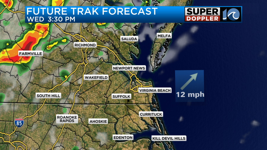
However, they do show a lot of rain and storms moving in during the evening.
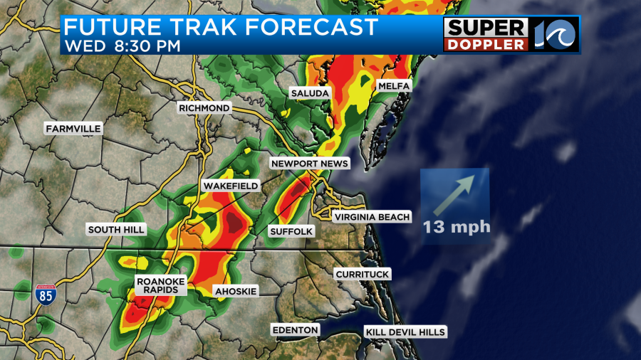
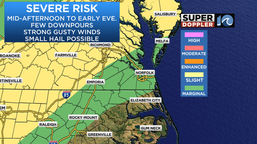
Between about 6 and 10pm there may be some strong storms with heavy rain. There may even be some severe weather.
Then they will calm down during the overnight. I didn’t forget about temps. Since the models put off most of the thunderstorms until late I upped the temperature a bit. High temps will aim for the mid 90s.
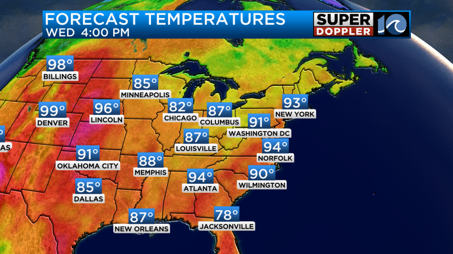
The heat index will be between 101 and 106 degrees.

Tomorrow the weather pattern will be about the same. However, the models start the thunderstorms up more into the afternoon compared to today.
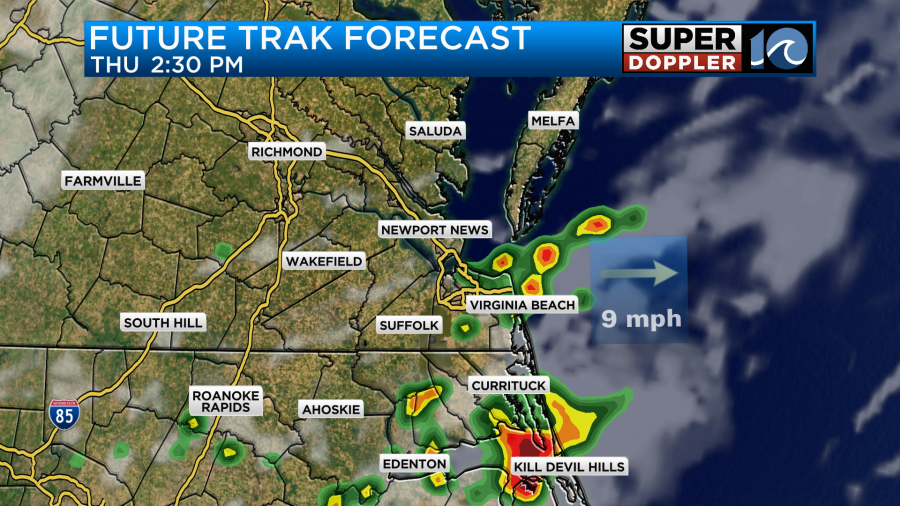
Once again there may be a few strong storms with heavy downpours between Thursday afternoon and evening. We could see a wide range of rainfall. Some folks may miss out. However, some areas could get 1-2″ of rainfall in the next 48 hours.
High temps may be held down a little compared to today. They are aiming more for the lower 90s.
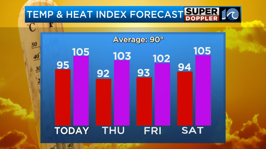
However, the heat index will still be over 100. There’s basically no breaks coming down the pike from the heat and humidity. The potential good news is that there looks to be a little less rain over the weekend. I’ll talk more about that in tomorrow’s weather blog.
Luckily things are still quiet in the tropics.
Meteorologist: Jeremy Wheeler


