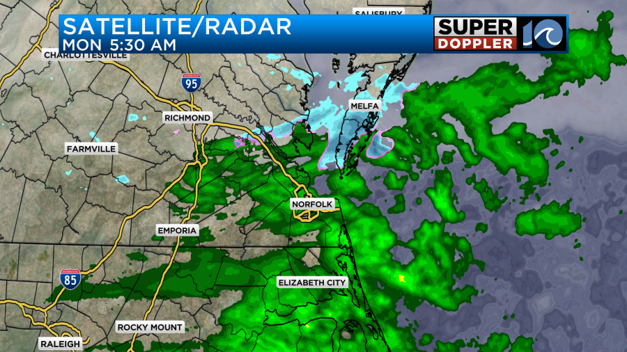
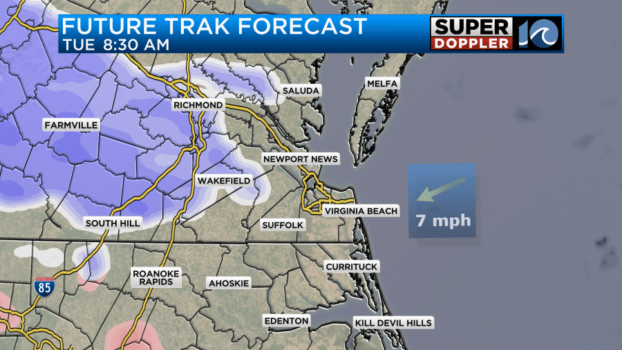
The models did a pretty good job at predicting the forecast for this morning. A cold front was sinking to the south along with a weak area of low pressure. However, moisture in the upper levels was pushing up north of the boundary into the colder air mass.
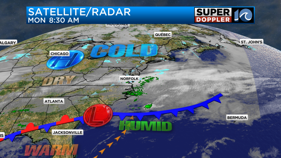
This produced lots of rain with a wintry mix in the area for a time.
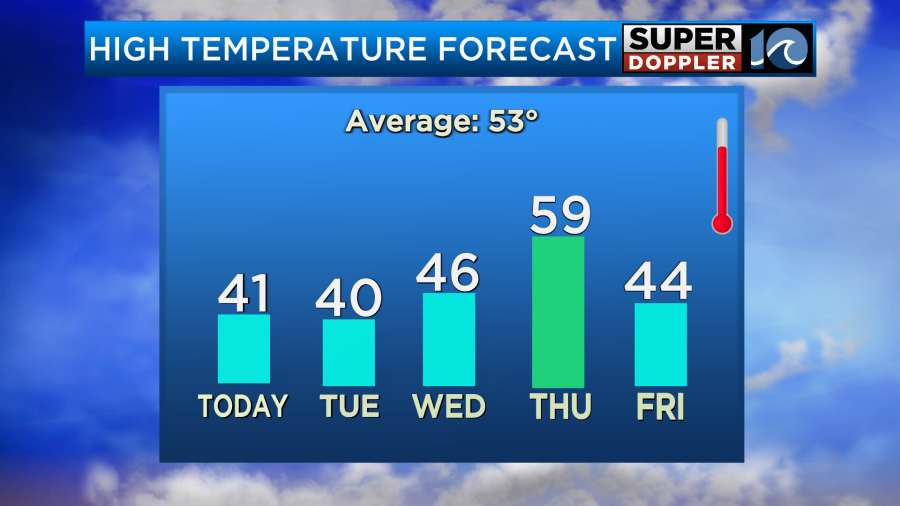
The precipitation won’t last too long though. As the front sinks a bit more to the south today, the drier air should take over. We should have some clearing this afternoon, but we’ll see how much we get. We will have a northeast wind running at 8-12mph through the day. High temps will probably make it to the low 40s. Some locations may even make it to the mid 40s.
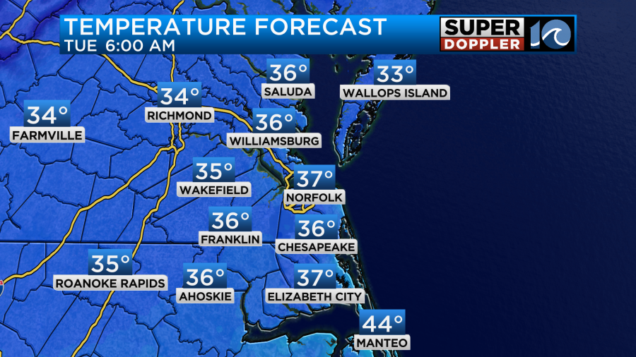
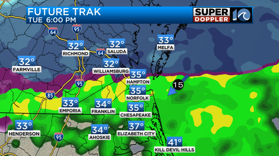
The amount of clearing is in question for the afternoon. It’s also in question for the evening and overnight. Some models hold on to a good amount of clouds through that time. That could impact the overnight low temperatures. Remember, clouds can act like a blanket and keep temps up during the overnight hours. What we are looking at is probably low-mid 30s with the clearing scenario up until after midnight. It will probably be more in the mid-upper 30s if we hold the clouds overnight. For now Future Trak puts our low temps in the mid-upper 30s despite some clearing for a time.
By tomorrow morning the front will be stalled out to our south, but a weak area of low pressure will form along the front. It will try to push the front north just a bit. However, overunning moisture will happen again Tuesday. So by the mid-morning the models have precipitation returning to the area. It may start as a mix for some with pockets of snow over parts of southeast Virginia as well.
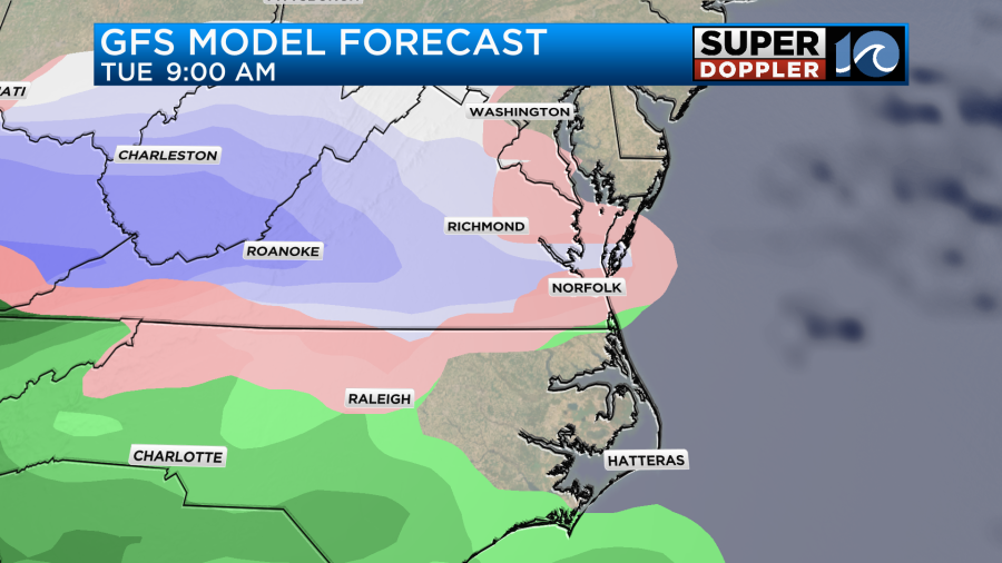
The majority of precipitation will be a melting mix and rain over northeast North Carolina through this event. Having said that… Precipitation is forecast to increase through the late morning and midday hours as the moisture increases.
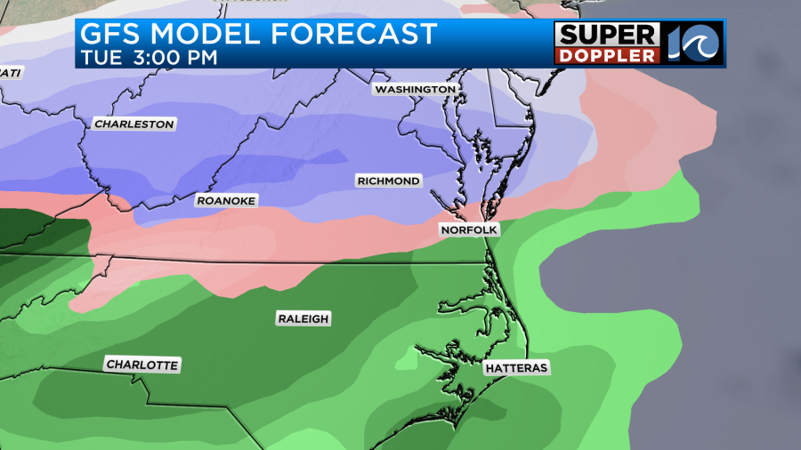
UPDATE: The new run of Future Trak is starting to come in line with the other models with the rain/snow line pushing north at a quicker pace.
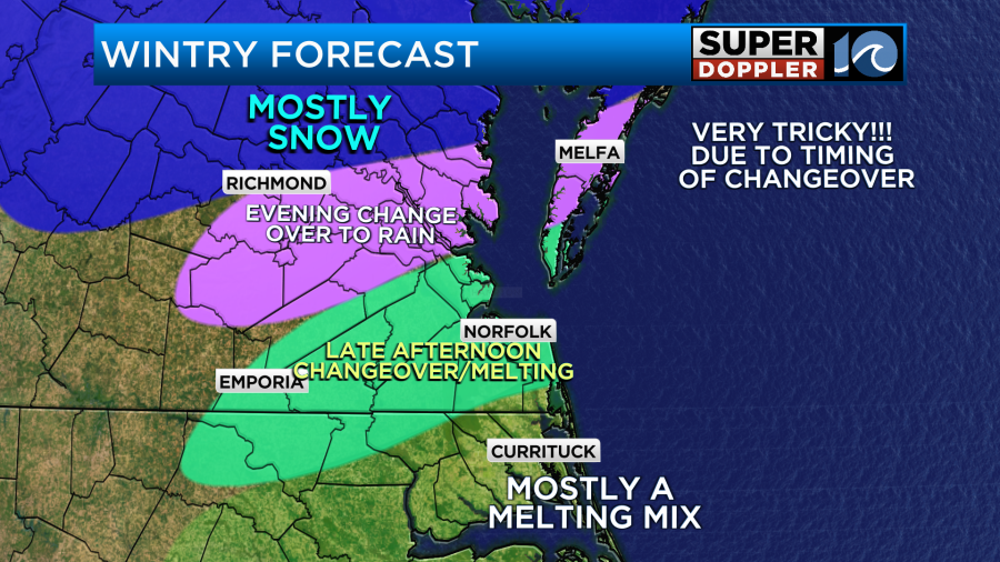
This is where the forecast starts getting very tricky. Surface temps are forecast to be above freezing. That alone would promote some melting. Also, the models vary as to where the rain/snow line will be around midday.
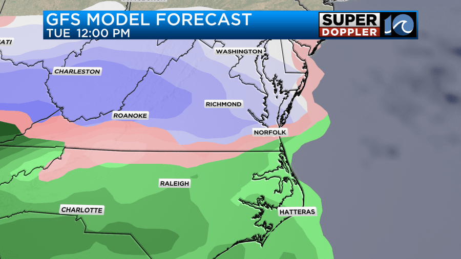
The hi-res NAM (not shown) has only rain for the Southside and North Carolina with a large band of a mix over the Peninsula, Middle Peninsula, and lower Eastern Shore. It does have mainly snow north of that zone for a time. So it has hardly any snow for our region with a lot just north of the viewing area.
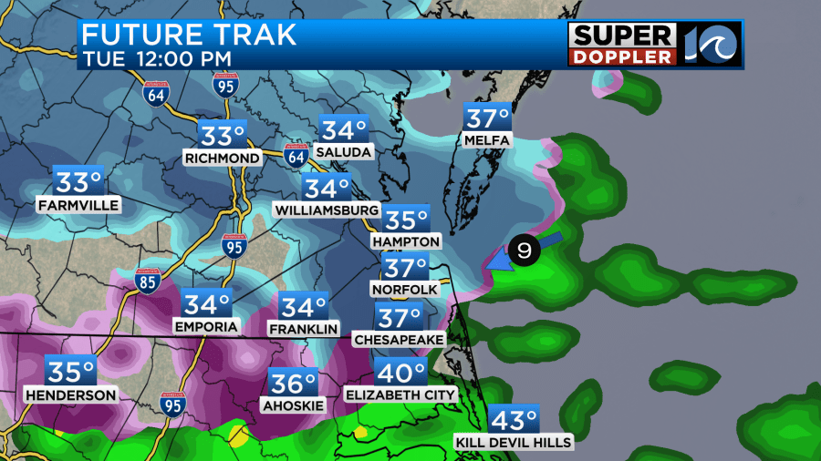
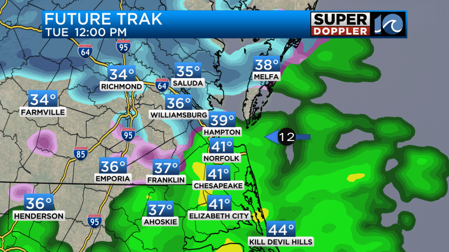
Back to Future Trak. It does have the rain/snow line moving north through the day, but veeeerrry slowly. So it doesn’t have the rain/snow line actually reaching the Middle Peninsula until the early evening.

Even the GFS is a little sooner for that to happen.
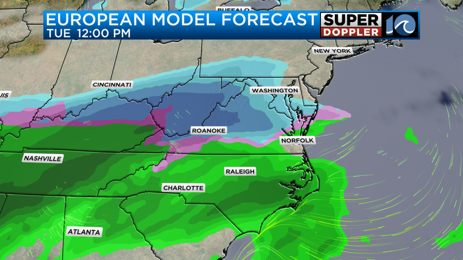
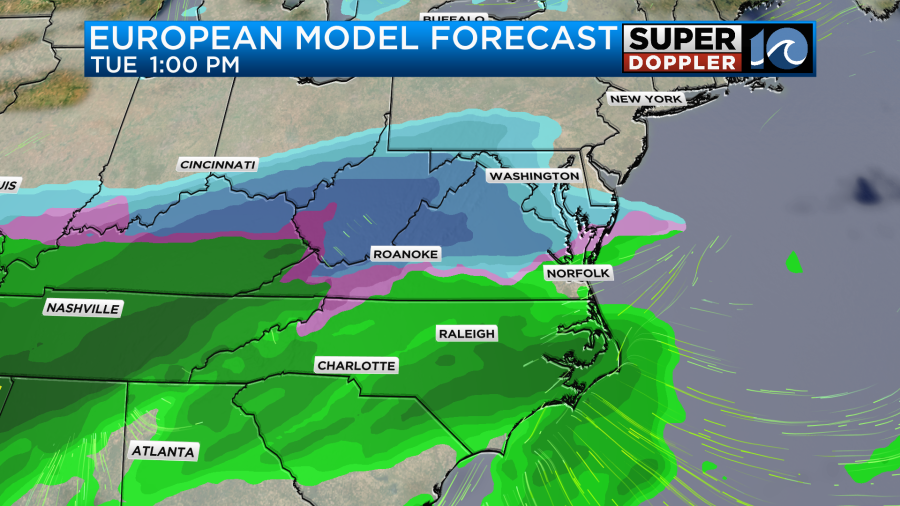
The Euro model is even earlier with this push north of that line.
Future Trak does have the rain/snow line up to the Northern Neck eventually, but only towards the later evening hours.
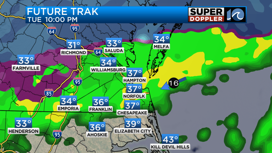
When that rain moves north it should create a lot of melting. Even though it will be overnight for some. The changeover is due to the milder temperatures coming up from the south aloft. Again, Future Trak does have temps above freezing for the metro for almost the entire event but close to freezing for some. Some models forecast high temps near 40 while others (like Future Trak) are more in the mid-upper 30s. Have a headache yet? I do.
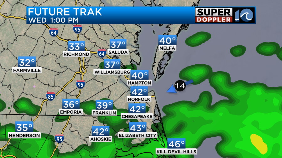
So the forecast gets easier then on Wednesday. We’ll have scattered rain showers with high temps in the 50s.
So now let’s talk snow totals… Future Trak (GRAF) has the highest amounts of snow totals compared to the rest.
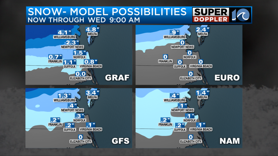
Since I showed the updated GRAF model above I thought I’d show the updated snow forecasts (late morning). Wow! What a change from this morning:
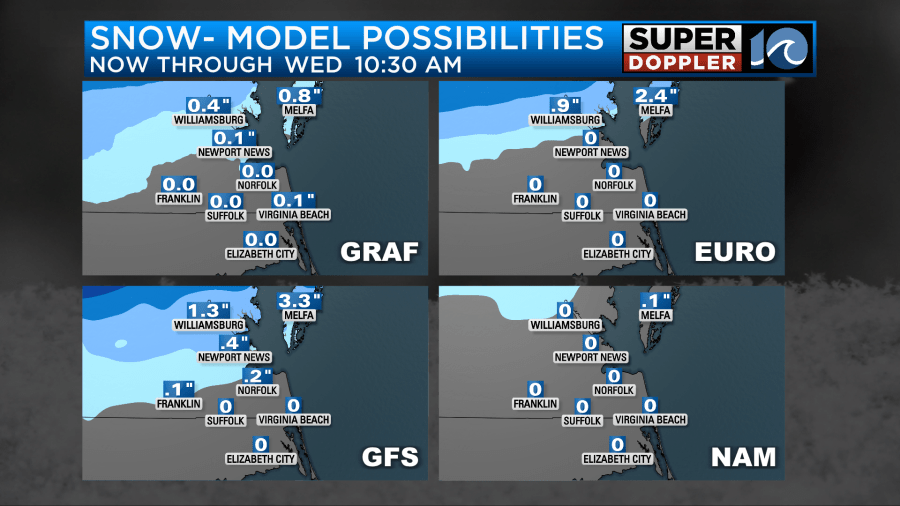
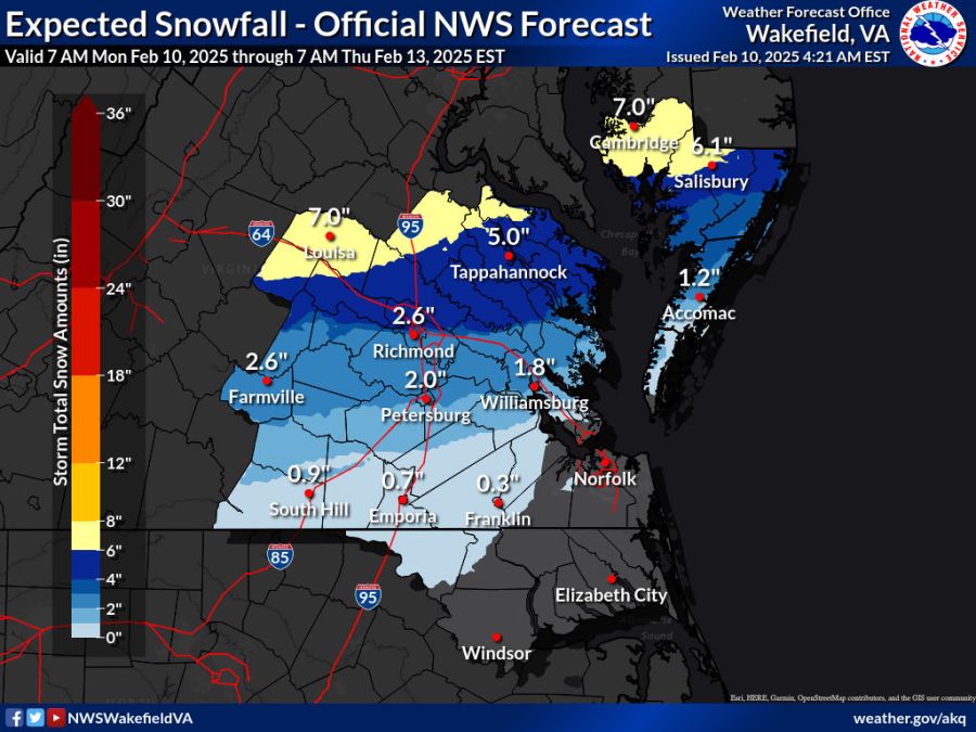
I will say that it’s not too far off from the National Weather Service’s forecast this morning with the exception being the Southside.
The Euro, NAM, and hi res NAM really don’t have much for Hampton Roads, but they all do show higher amounts north of a line from Williamsburg to Gloucester. There may actually be some very high amounts up there to the D.C. and Fredericksburg area. Some models suggest possibly over 10 inches up that way. Even the models that have less snow for us still have some high amounts up that way. So with all the models together I put together a forecast. Here you go:
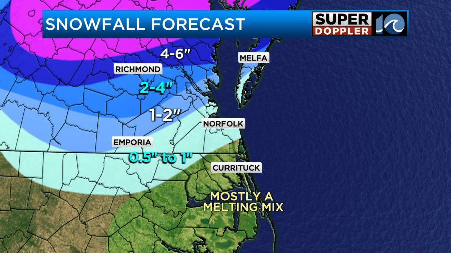
Update: With our model going with lesser snow totals. I will likely lower the totals on the snow map for tomorrow. The evening mets are already updating.
I have the pink area as a general “more than 6″ for now. It could be much higher than that in that zone. If our model is right, then I may have to drag the 2-4” zone a bit more south which would include Williamsburg, more of Gloucester, and more of the Eastern Shore. We’ll see. The Southside up to Hampton will be even trickier as melting may get rid of all the snow by late in the day. So the tricky part of this forecast all comes from the timing of the rain/snow line pushing north.
There’s so much to take-in about that part of the forecast. So I won’t go into the longer range much. Wednesday and Thursday will have more rain with highs in the 40s Wednesday. We’ll be in the 50s Thursday.
Stay tuned for updates. I think our Future Trak model will shift towards the other models a bit later today. Hopefully, they’ll all agree more by the afternoon model runs. If you find this forecast very frustrating, then all I can say is sorry. And….welcome to Hampton Roads…
Meteorologist: Jeremy Wheeler


