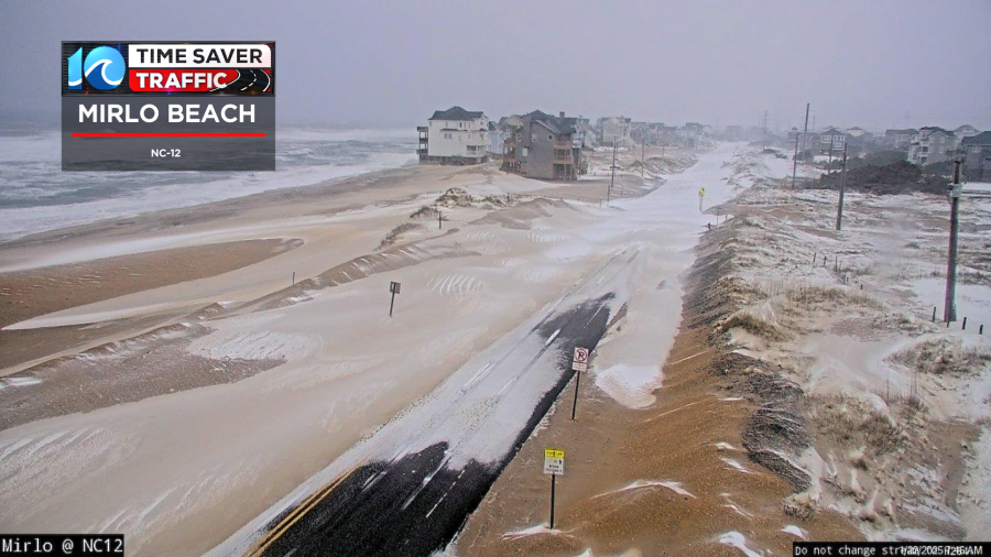
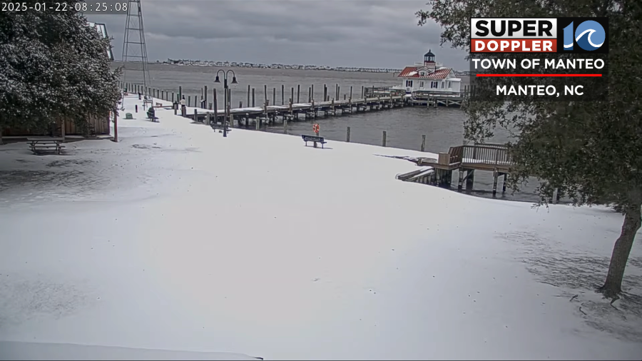
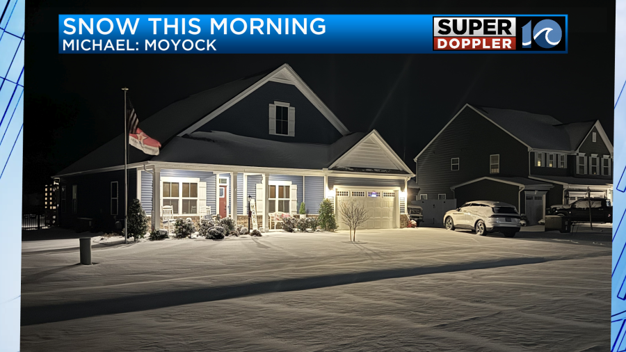
This morning the area woke up to a Winter Wonderland. Even residents along the Outer Banks had a very snowy scene!
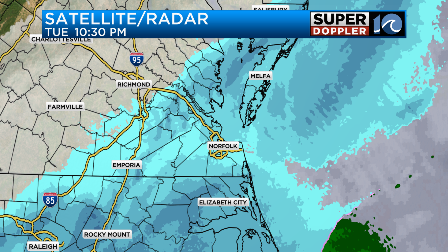
Last night an offshore low passed to our south, but it pushed a lot of moisture up into our region. This pushed up into a very dry air mass at the surface, but the moisture won out. It allowed the snow to get a little farther north than forecast.
We had some great photos sent it. Here are a couple:
Most of the snow ended by 8am, but it lingered for a while over the southern Outer Banks. The low is now pushing out to sea. High pressure is building in.
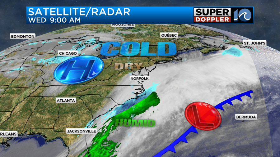
The drier air will sink back to the south through the day.
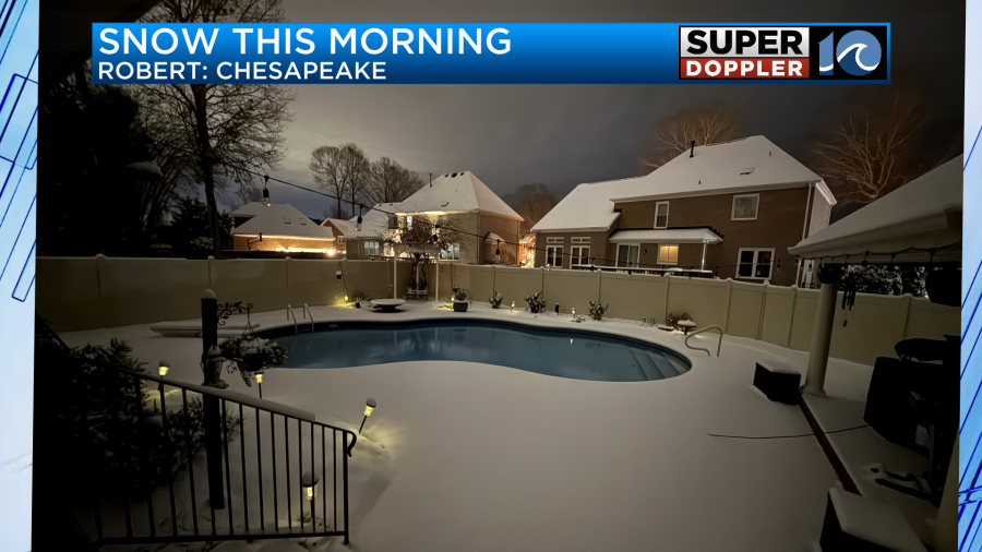
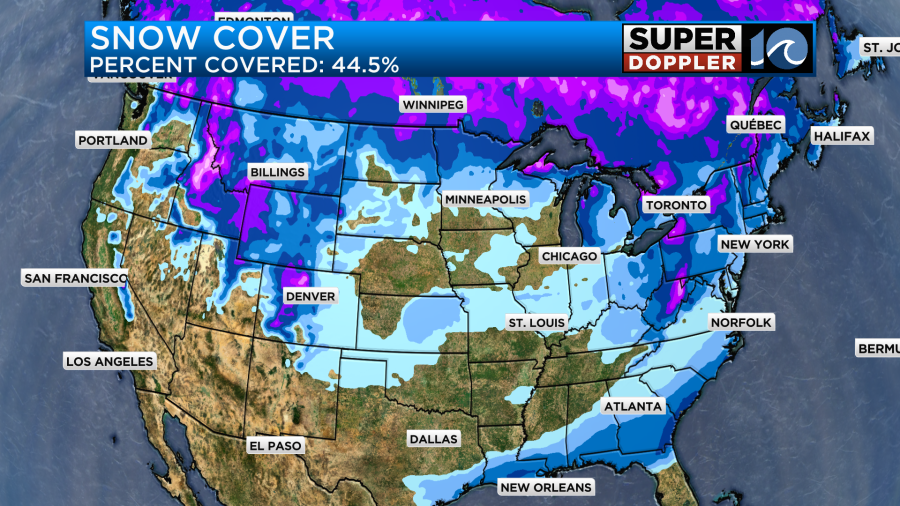
We did get some snow, and I’ll show that in a moment. The interesting thing is how much snow fell over the Gulf Coast States in the last 24 hours.
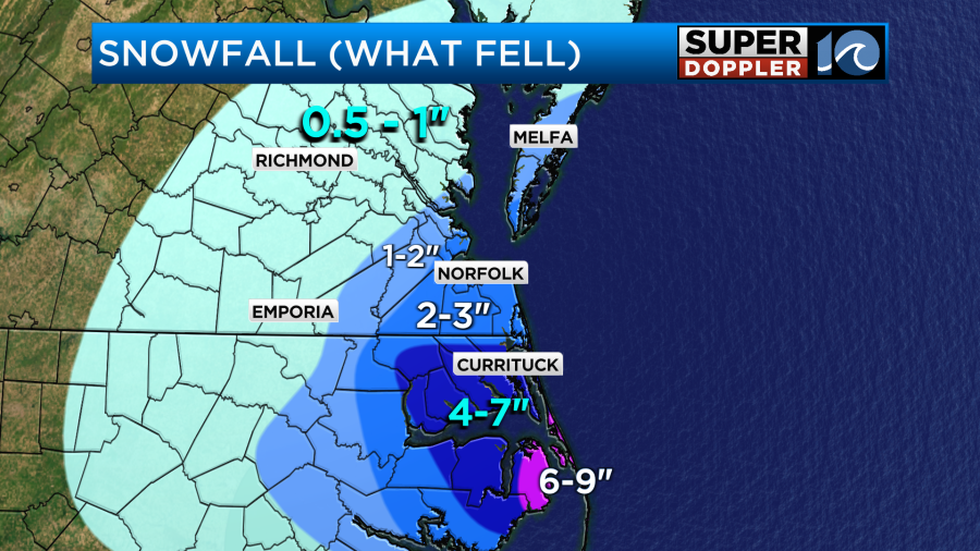
The snow forecast wasn’t too bad over most of the region, but it was definitely too low over northeast North Carolina. Here was my forecast from yesterday morning. (The evening crews increased the forecast a bit).
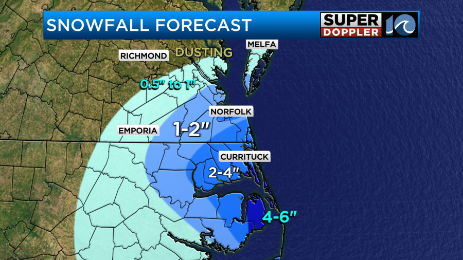
I did have a patch of 3″ near the Portsmouth, Norfolk, and northern Virginia Beach. Here’s how it compares to what fell:
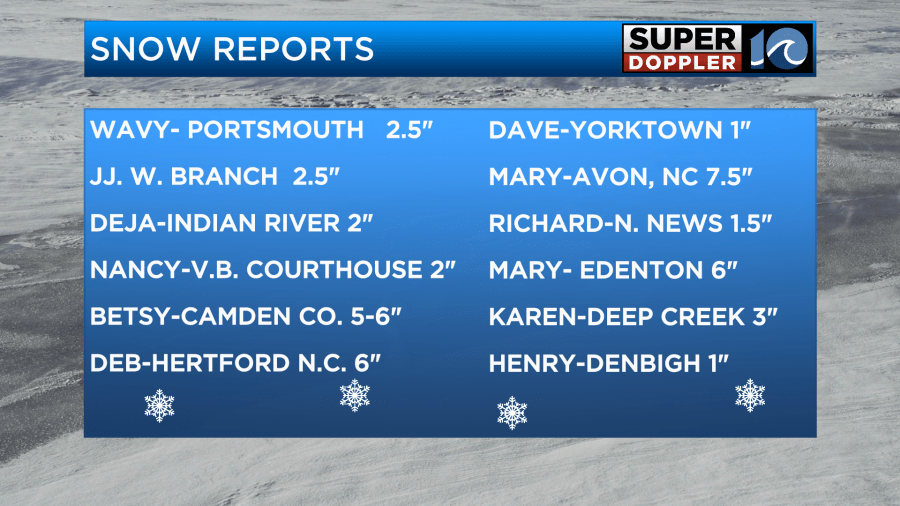
There were definitely some high amounts to the southeast. Here are some of the reports that I got from viewers. I didn’t add it, but I did have a couple of reports of 7-9″ over parts of the Outer Banks down to Hatteras.
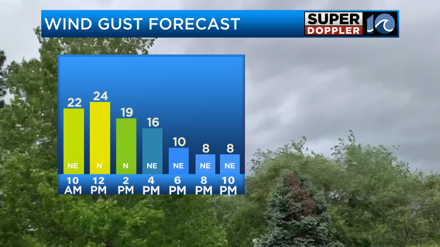
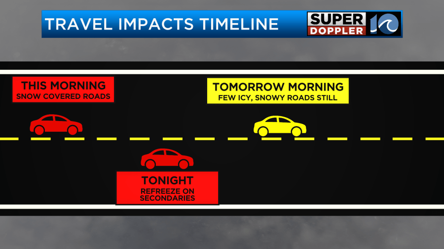
The snow looked great, but it was tough getting around. Especially over northeast North Carolina where the higher totals were. The roads will get treated and plowed today. The interstates should be ok. However, the primaries and the secondaries will be tough to drive on. They may be impassable for a while over parts of coastal North Carolina. We’ll have clearing skies today. However, the winds will be gusting out of the north at 25mph.
So despite the clearing, we’ll only top off in the mid-upper 20s this afternoon.
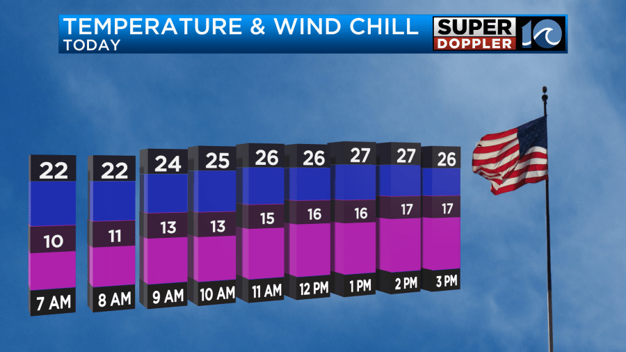
Wind chills will only be in the teens. It will be very cold for the kids playing outside. Please remind them to not play near ponds or lakes. There may be some ice on them with snow covering the ice. The ice will be too thin to walk on, and it may be tough to see the edge of the water. Also frostbite will be a real possibility. If anyone gets frostbite, then use cool or warm water on the affected body part. Do not use hot water!
Tonight will be dangerously cold. We’ll be mostly clear with lighter north winds. Low temps will drop down to the teens with a couple of single digits inland.
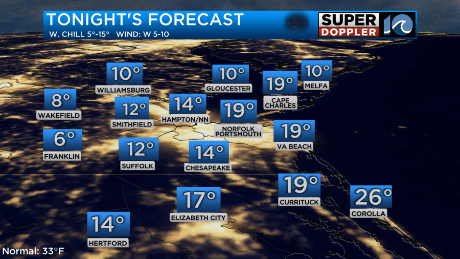
Be sure to slow-drip the faucets if you haven’t already. Also bring in the pets. Open sink cabinets, and close the curtains. If there is some melt today with the sun and treatments, then it may re-freeze tonight. That will be an issue into tomorrow morning. Especially on the secondaries.
Tomorrow we’ll have a mix of sun and clouds. There will be a very weak offshore low forming, but it should head out to sea. The precip with it should also stay offshore, but it could be close to the coast. High temps will rise to the mid 30s.
We’ll be dry on Friday with highs in the upper 30s. Then we’ll be in the low 30s on Saturday with partly cloudy skies. We are aiming for about 50 on Sunday with partly cloudy skies. So hopefully, we’ll have some decent melting as we head towards the weekend.
Meteorologist: Jeremy Wheeler


