This is just a brief weather blog to update things this morning. The forecast models are starting to agree on the totals. The setup and timing are still on-track from yesterday. A couple of weak areas of low pressure are merging down around Florida this morning.
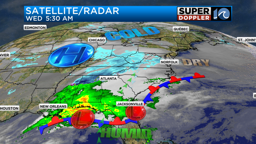
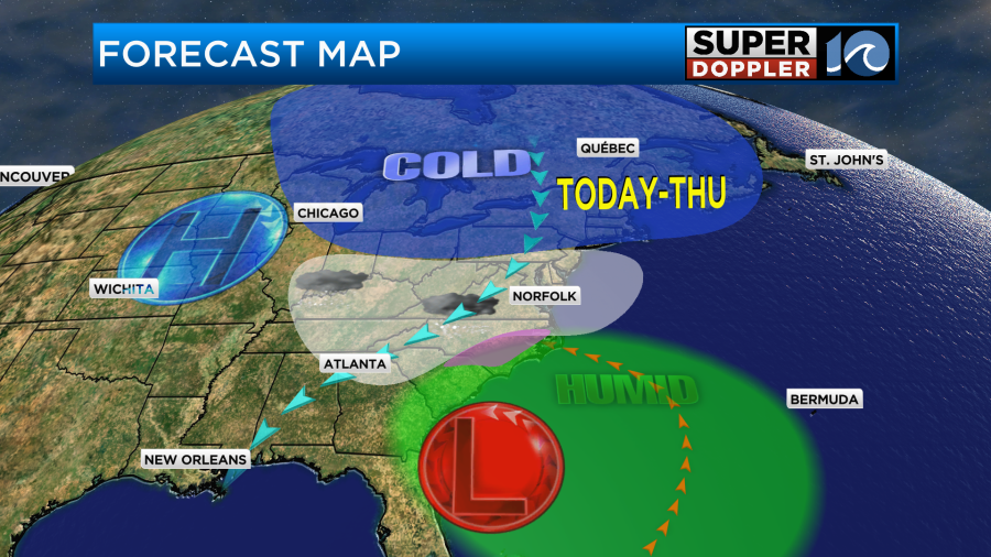
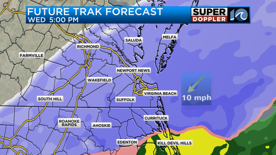
They will move up along the coast through the day, but they will stay to our south.
Meanwhile moisture is already pushing well north of that developing low. By the mid-late morning the air will saturate. We’ll have a few snow showers starting up later this morning, but it will likely kick into high gear by midday and the early afternoon.
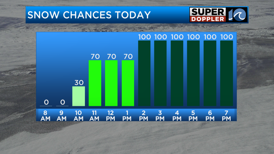
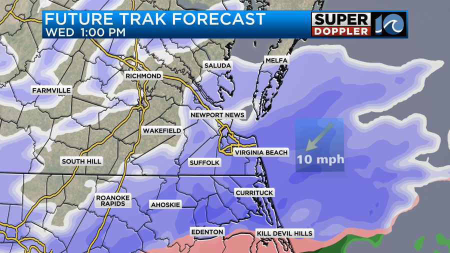
Snow will be heavy at times this afternoon into the evening. There will probably be a mix zone setting up over the southern Outer Banks up to the Albemarle Sound for a time.
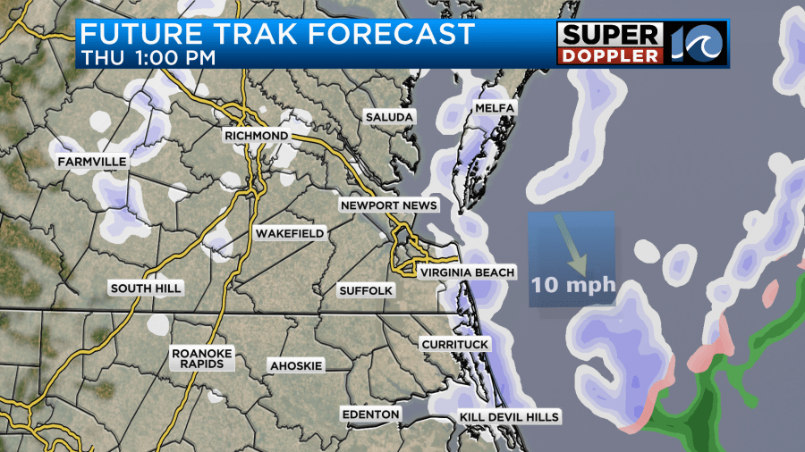
Snow will continue tonight, but it should taper off for a time tomorrow morning. Then a second round will develop Thursday afternoon.
This could put down an additional inch of snow. The latest models are starting to agree on amounts.
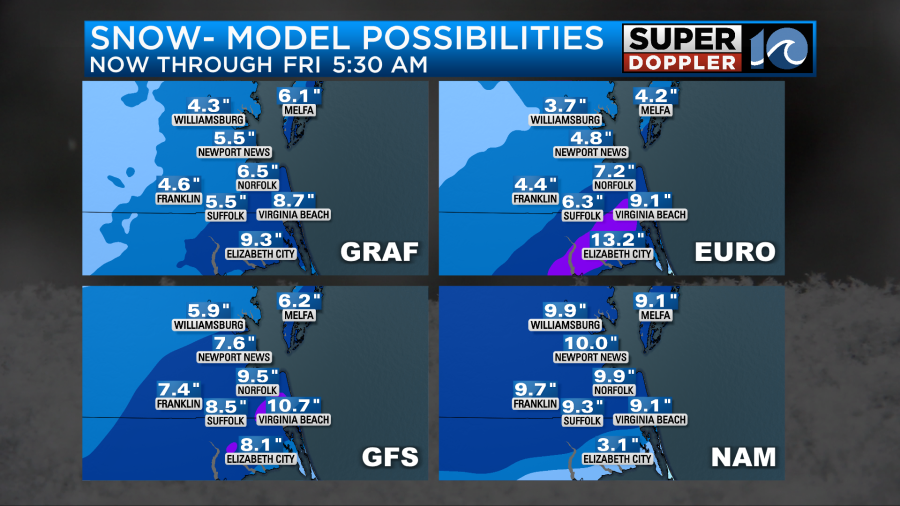
They are painting a picture of about 6-10″ over a large area. None of them show any big areas of 10-12″ like they were the other day. However, they still hint at some (isolated) areas of up to a foot.
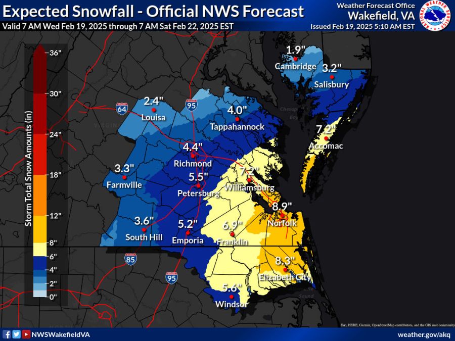
Here is the National Weather Service forecast from this morning.
Looking at all of that here is my snowfall forecast map.
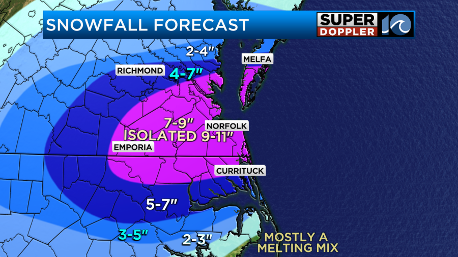
The mix zone over parts of the Outer Banks up to possibly Elizabeth City will make the forecast tricky down there.
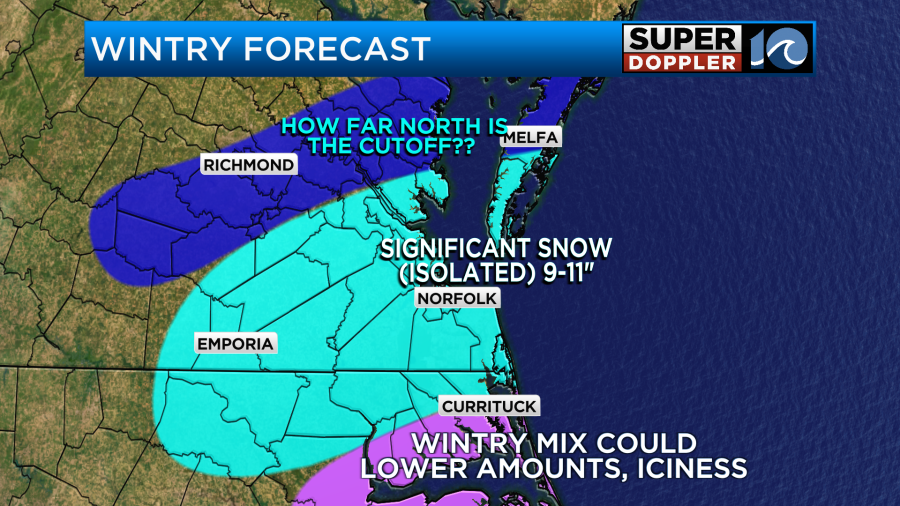
It could lower amounts even more than I am showing. On the other hand… The Euro model still suggests that the mix zone will stay a bit more to the south. So it has very heavy snow down to the Albemarle. I don’t tend to favor the Euro when we are entering the event. It is a much better long-range forecast. So we’ll see.
Things still could change a bit, but I feel like the forecast is starting to lock-in on a solution. I’ll have more updates later this morning. Stay tuned.
Meteorologist: Jeremy Wheeler