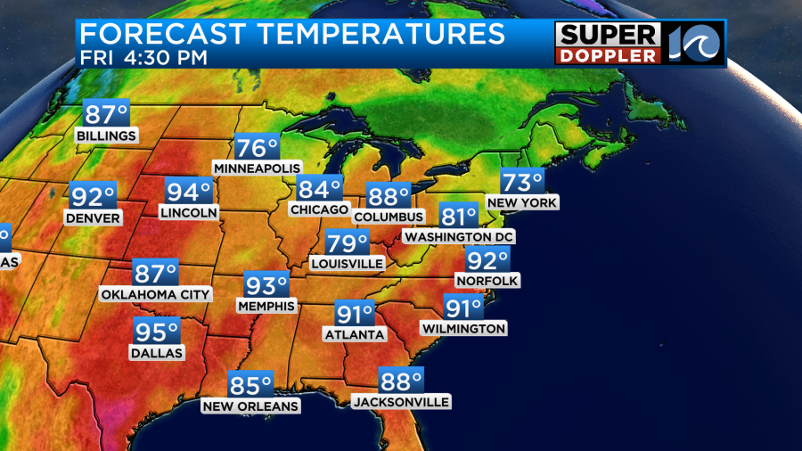
Over the last 4 days we had high temperatures solidly in the 90s.
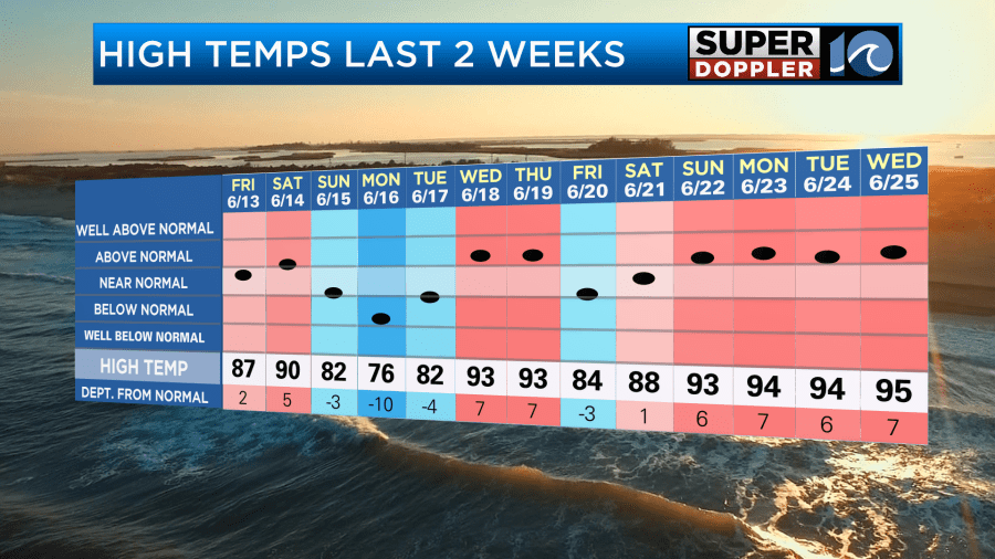
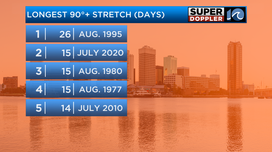
Norfolk has been in the low-mid 90s due to the persistent/light northeast breeze. However, many inland locations hit the upper 90s. We’ll continue with highs in the 90s over the next few days. I don’t know if we’ll break any records for the number of days above 90, but it’s possible. Here’s the top 5:
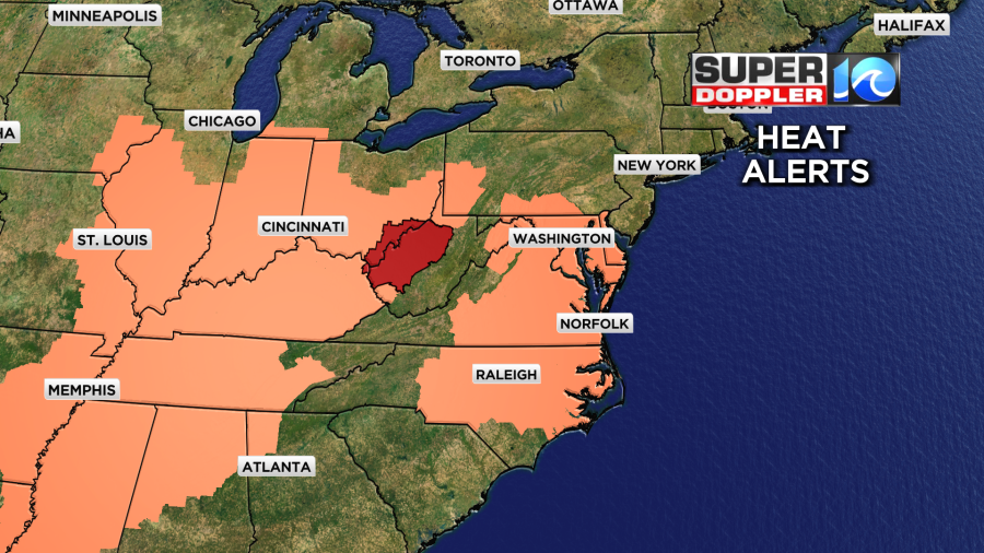
There are still a lot of heat alerts over the eastern half of the country. However, there are less alerts overall. (Especially over the Northeast).
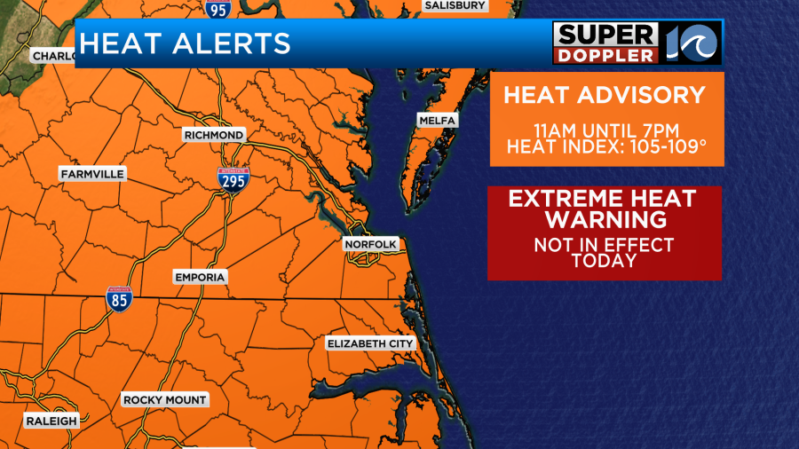
You’ll notice that our local heat alerts have also changed. Now we have a Heat Advisory in effect instead of the Extreme Heat Warning.
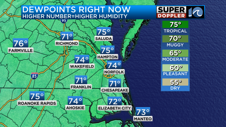
This morning was better than the last 3. We had temperatures drop down to the upper 60s to low 70s. Dew points had also dropped to the upper 60s to low 70s. They have ticked up since.
High pressure is not as strong as it has been. The center has also now moved offshore.
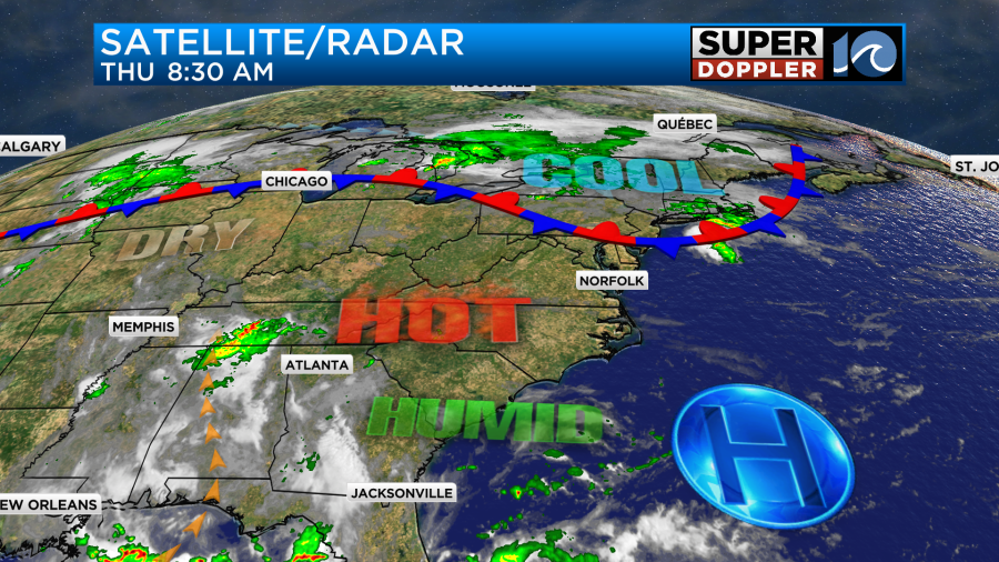
There is a stationary front to our north. The northeast states are getting a break from the heat today.
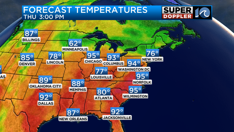
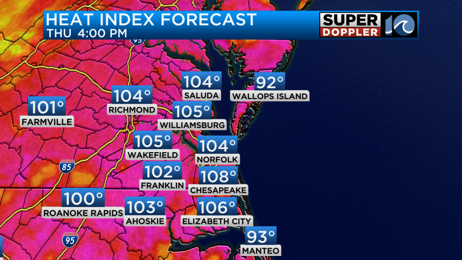
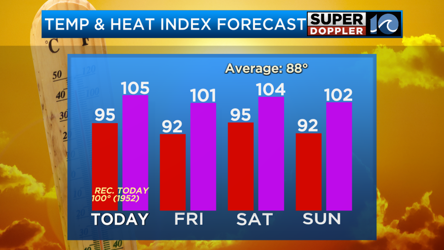
We will still be hot here, but temps should be a couple of degrees less this afternoon. So highs are aiming more for the mid 90s. The heat index will be between 100 and 108 degrees.
One of the reasons we won’t be as hot as recently is the cloud cover. Since the high pressure area weakened, we can now get more cumulus clouds to build. We can also now get some isolated showers or storms. Which is what I’m expecting later today.
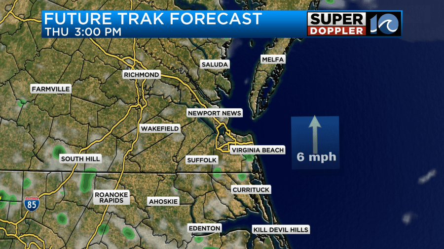
Tomorrow we’ll have similar weather. We’ll be partly cloudy with some isolated PM showers or storms. High temps will be in the low-mid 90s.
The heat index will be over 100, but it might not be over 105. That would be below the threshold for a Heat Advisory. We’ll see if that happens. Regardless, it will be pretty hot and humid.
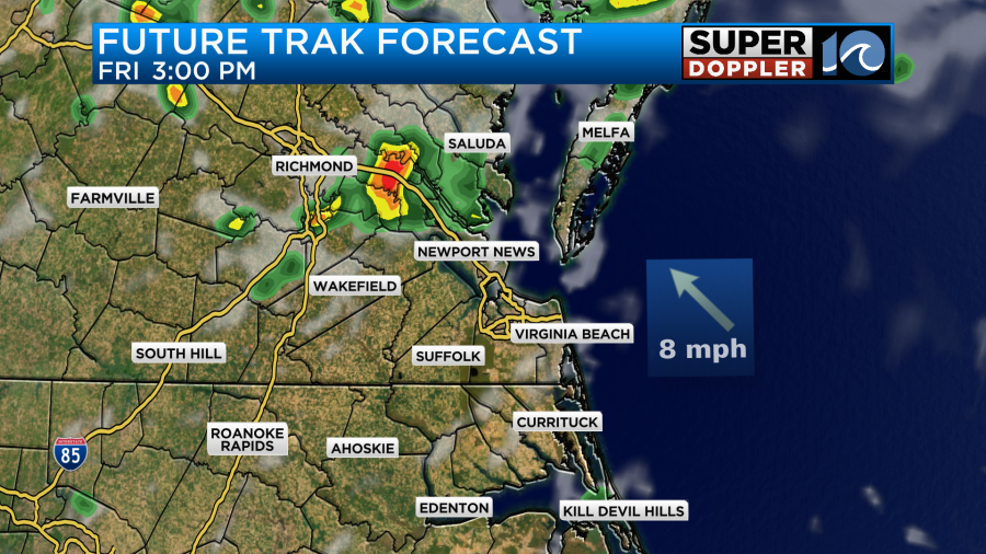
One thing to note about tomorrow… While I do think there will be some isolated showers or storms in the afternoon. Our Future Trak model has a little extra area of storms between Richmond, Jamestown, and Gloucester.
We have some time for updates. So check back later today and tomorrow morning for those.
Otherwise, the extreme heat could return on Saturday. High temps are aiming for the mid 90s. The heat index is expected to be near 105 degrees.
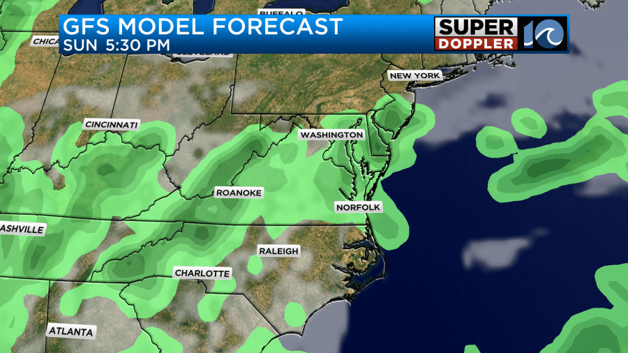
If the forecast goes up a little more, then we could be back to the Extreme Heat Warnings. At least I’m not expecting much rain for the day. By Sunday a cool front and a weak area of low pressure may get pretty close to our area. This may allow for clouds and storms to increase as we go into the late afternoon and evening.
That may be enough to drop the temps some more. However, I don’t expect any cool/refreshing air. In fact I don’t see any real cool downs until possibly late next week.
Meteorologist: Jeremy Wheeler


