There were some real downpours yesterday over parts of the area. As expected the heavy rain did cause some localized flooding. Mainly over northeast North Carolina.
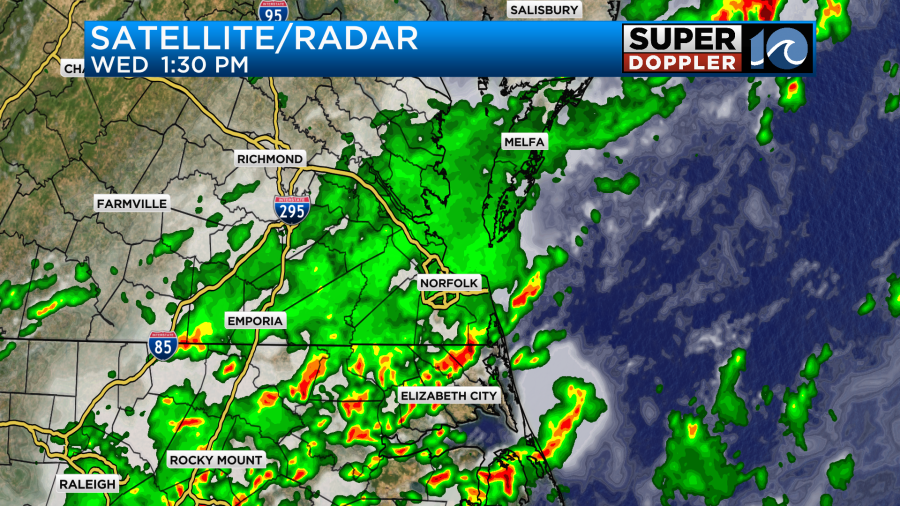
The rain added up to 1-2 inches over North Carolina with some locally higher amounts.
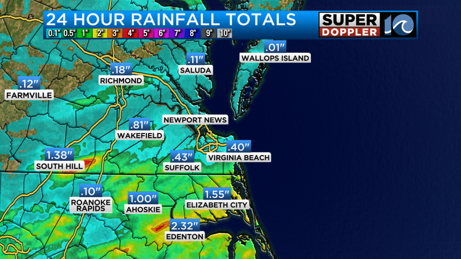
There was a decent amount of rain near the state line in Virginia, but the rest of the viewing area had very light amounts.
This was all ahead of a stalled out front yesterday. Today that front is slowly sinking southward, but it is still over the area.
That front may kick off some isolated showers or storms this afternoon as it slowly slides south. Otherwise we’ll be partly cloudy through the day. We will have a light northwest wind develop. It may be out of the north for a while, but it should be light all day. High temps will be in the upper 80s to near 90 degrees.
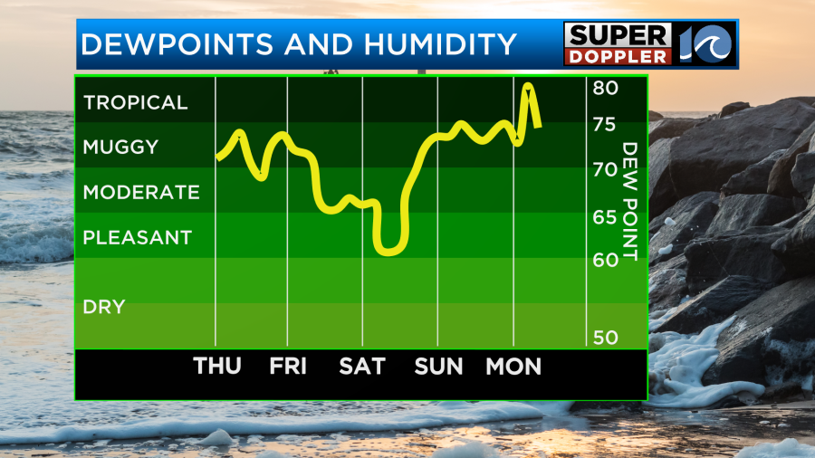
The humidity will drop (slightly) during the afternoon, but not too much. Dew points will go from the low 70s to around 70 degrees.
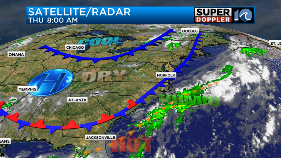
Late tonight into early tomorrow morning a second cool front will quickly slide south through the region. This will pull in some much drier air.
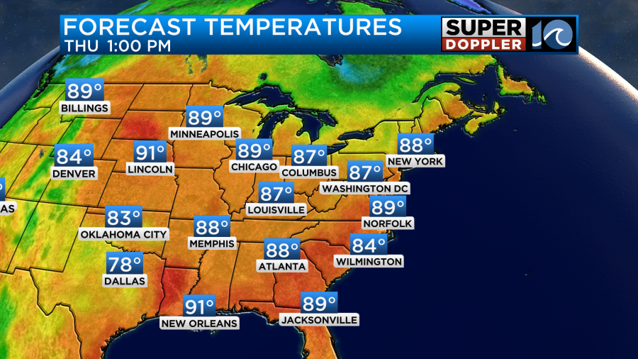
That will set us up for some great weather for the 4th of July! We’ll be mostly sunny with a steady northeast breeze. It should run at about 8-12mph. High temps will be in the upper 80s.
The weather should be great as well for the fireworks tomorrow night.
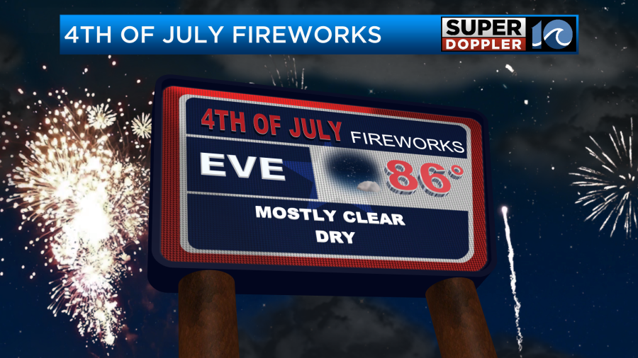
We’ll be mostly clear with light and variable winds.
As you can see (in the muggy meter) the air will be even drier going into Saturday morning. This means that our low temperatures could drop down to the mid-upper 60s for many with milder temps near the shore. Then during the day Saturday we’ll have lots of sunshine again with high temps in the upper 80s.
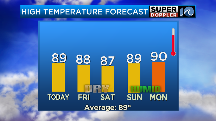
So we’ll have some great weather for a couple of days during the holiday weekend. Sunday though gets a little tricky. It will depend on the development of an area of low pressure off the southeast coast. As of this writing there is a decent shot at this low forming between Saturday and Sunday.
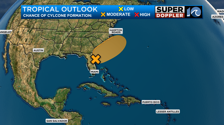
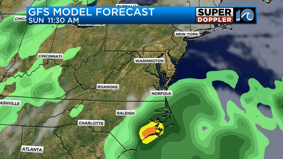
The low will likely form to our south. However, it could potentially push a lot of moisture up into our region between Sunday and Monday. Until recently, the GFS model kept the rain mainly to our south on Sunday. However, this morning it started to bring some rain into the region.
The European model on the other hand became very wet for Sunday during its overnight run. In fact it now almost has a washout for Sunday.
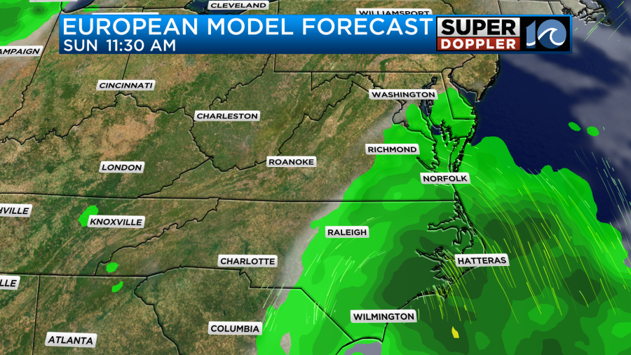
For now I’m trending towards the wetter scenario. I have a mix of sun and clouds with a few scattered rain showers. However, I may have to increase the rain chances if the models keep trending that way. Please keep that in mind if you have outdoor plans this weekend. I’ll talk a lot more about that part of the forecast in tomorrow’s weather blog.
Meteorologist: Jeremy Wheeler


