An active weather pattern appears to set up this weekend as a slow moving front settles over Hampton Roads. This could potentially cause some problems with Harborfest so let’s break it down.
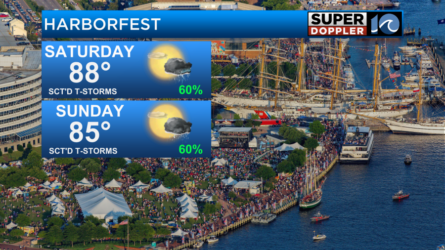
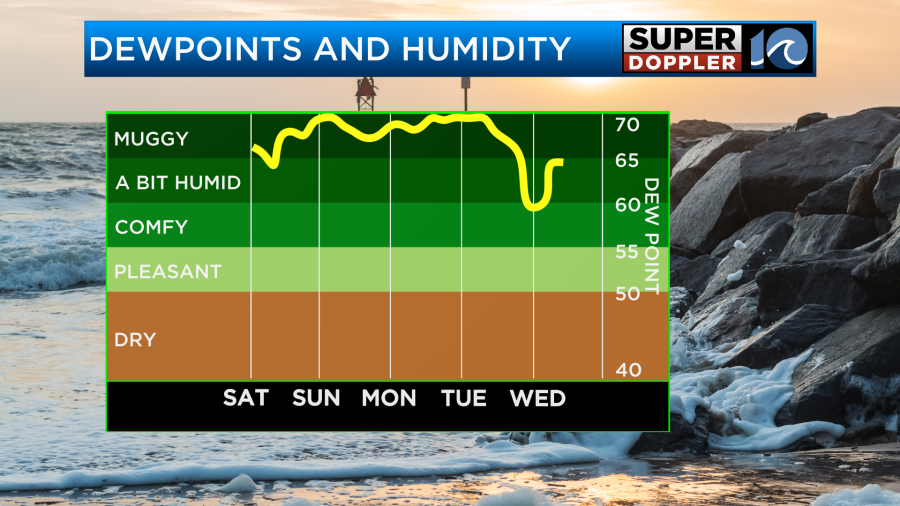
First and foremost, no, it is not going to be a washout this weekend but we will need to stay weather aware. There is a lot of heat and humidity around and that means some storms that do form could become strong to severe.
This humidity will not just be around today, it is likely to continue through the beginning of the work week so stay hydrated and find shade if you happen to be outdoors for long periods of time.
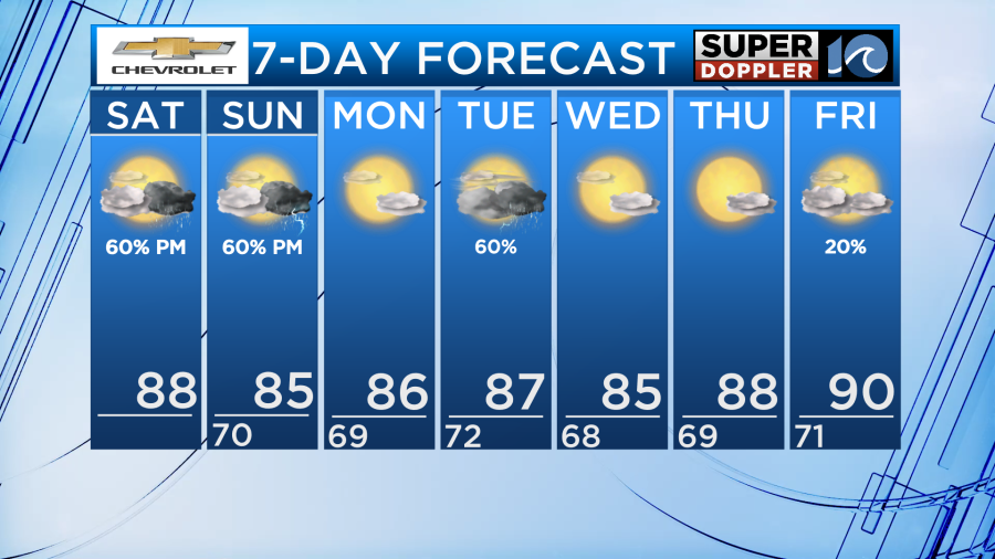
High temperatures today will be in the mid-upper 80s thanks to a good amount of sunshine through the midday hours and early afternoon. Additionally, winds will be light out of the southwest.
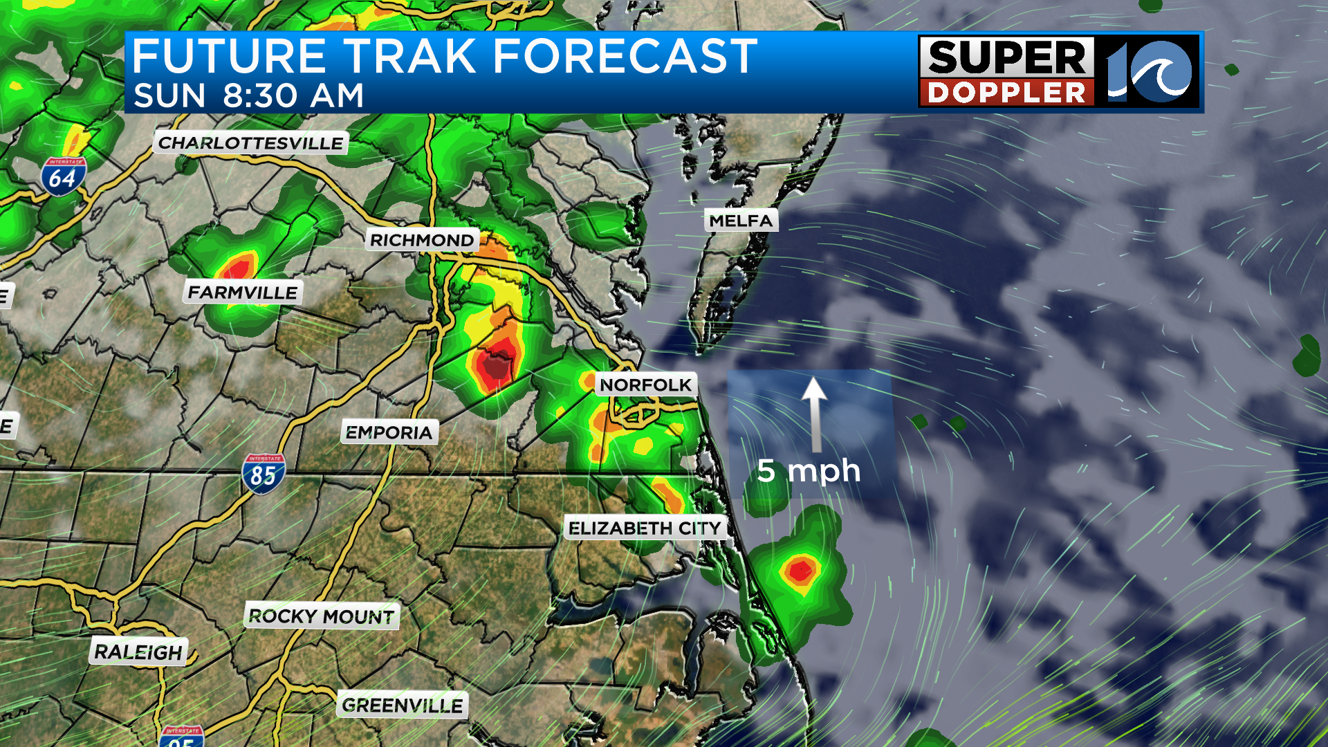
When factoring in the humidity it will feel like the low-mid 90s so it will be a hot one. As a cold front moves closer, showers and storms look to develop after 2pm to our west. These storms will be the most widespread through North Carolina this afternoon but we cannot rule out a storm or two coming into Hampton Roads between the hours of 5pm and 7pm.
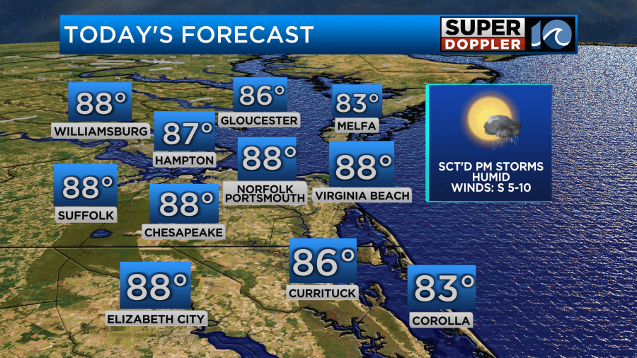
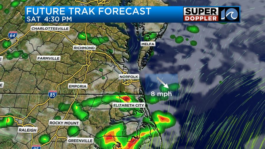
For the day today, the storm prediction center has issued a level 2 out of 5 risk for severe weather across our area. This will mainly be for North Carolina and the southside but the Hampton Roads cities should also be aware.
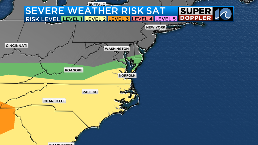
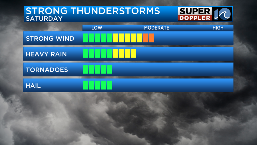
The main threats will be damaging straight line wind gusts of around 40-60mph. This could be enough to cause isolated tree damage in some spots as well as cause spotty power outages. Be sure to download our weather app and turn on severe weather alerts so you can be aware of when severe weather is headed your way.
Heavy rain will also be an impact as some storms could be slow moving. Our models are currently indicating around 1-2 inches of rain are possible but it will heavily rely on where the heaviest cells set up.
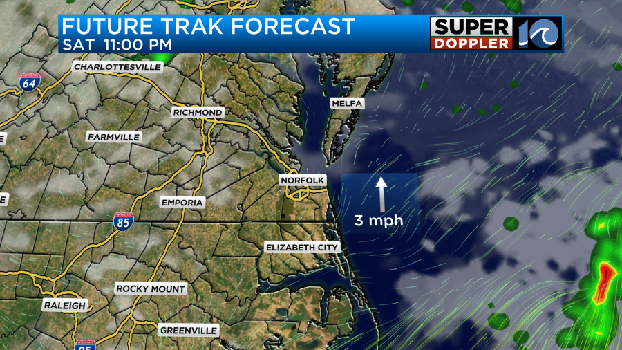
Conditions will dry out later this evening with calm weather through the overnight period. With winds remaining out of the south, it will be another warm and humid night ahead with low temperatures around 70 degrees.
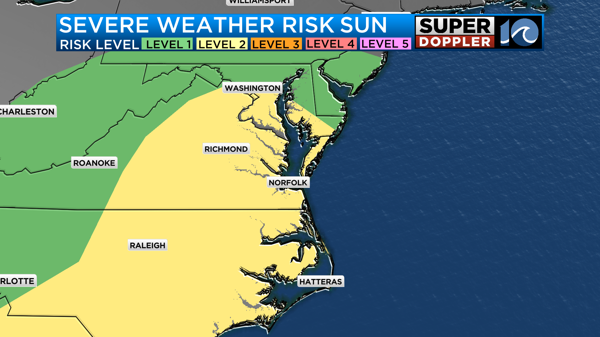
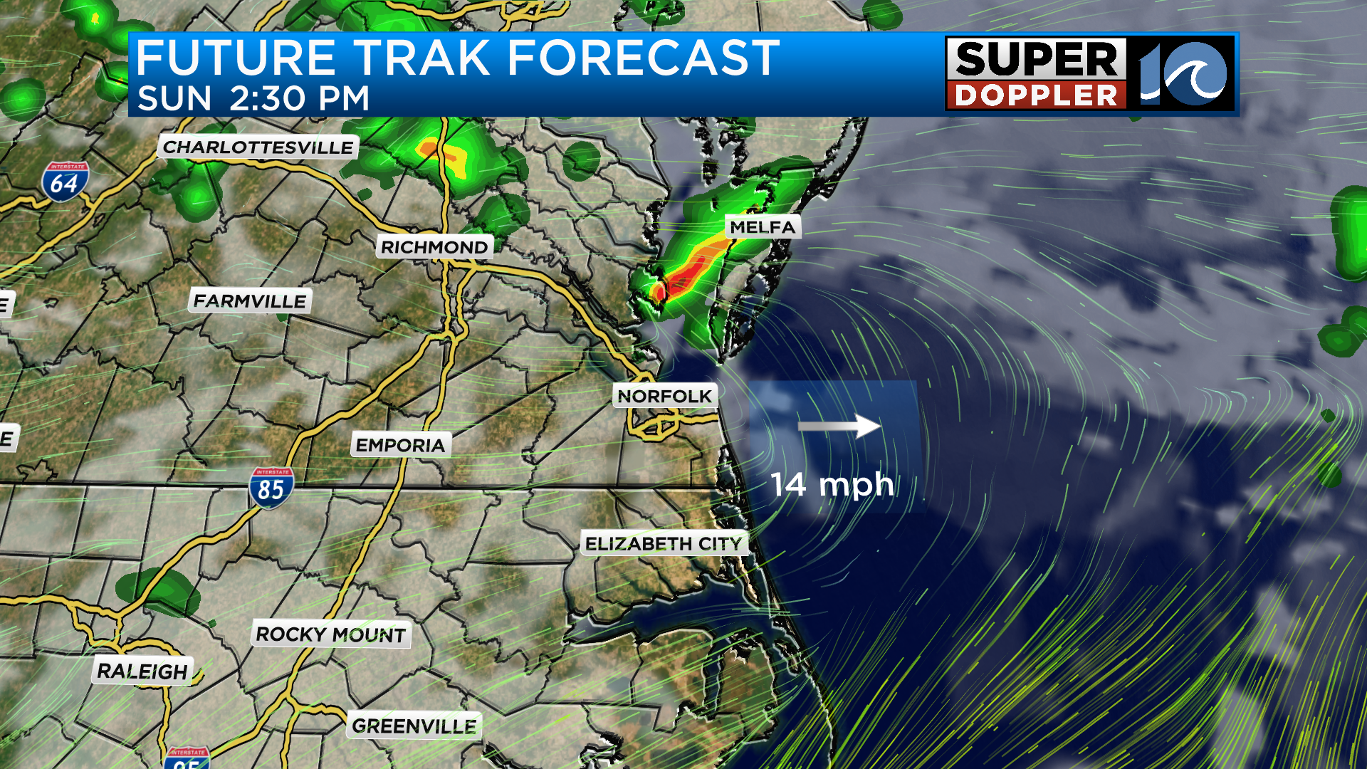
As we head into tomorrow the cold front will stall across the region allowing for another day of storm opportunities. This time, the timing looks to be during the mid morning hours for the most widespread coverage with scattered storms remaining possible during the afternoon. The risk for damaging wind will remain.
Monday will feature dry conditions before another storm system moves in on Tuesday. Strong storms will once again be possible but as we go through the rest of week we will dry out with above average temperatures remaining.
-Meteorologist Brian Michigan 🤙