Yesterday we had widespread rain over the region for the first half of the day with scattered showers and storms during the afternoon and evening.
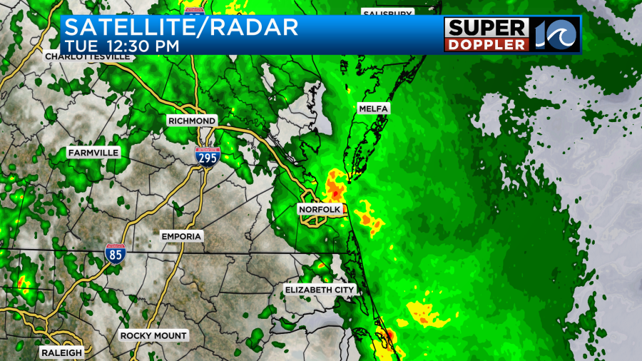
Rain totals were impressive for some, but were less than expected in other locations.
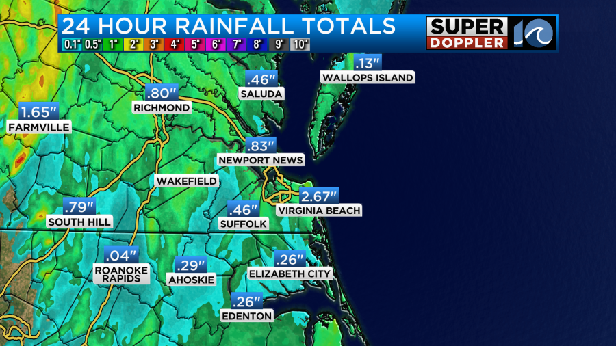
Norfolk picked up a little more than an inch. We didn’t have any official reports of damage, but we did, internally, have one report of a tree down in Portsmouth along with a couple of branches down in the area. However, there were a lot of strong wind gusts. They were between 40 and 50mph near the shore.
Today will be different in a couple of ways. We do still have the surface low and upper level low over the area.
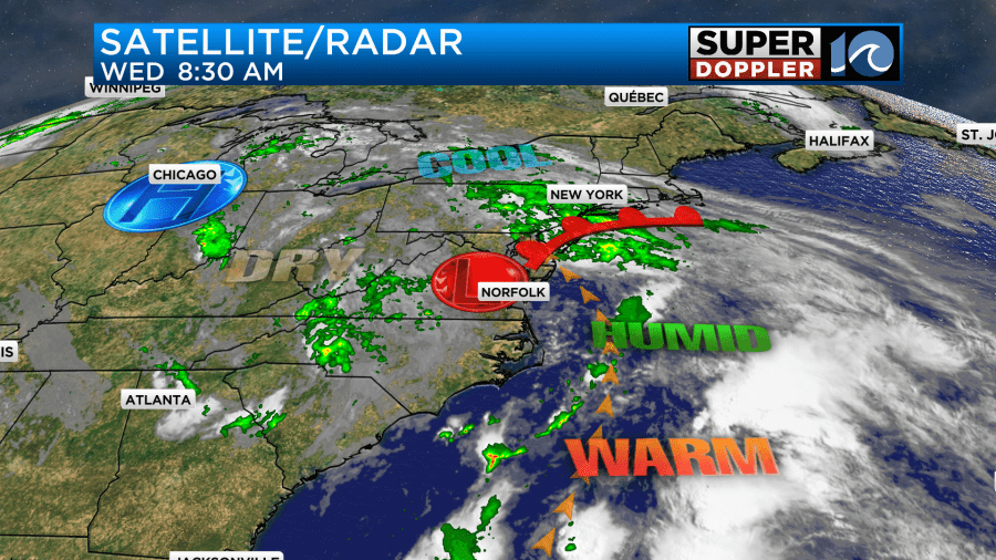
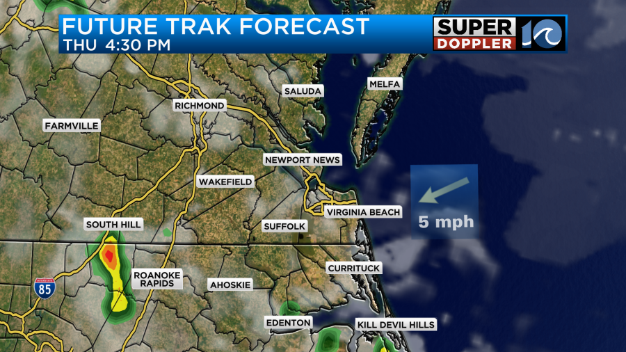
However, the cool front has fallen apart. Plus, there’s a little drier air in the mid-levels. So we’ll have a mix of sun and clouds today. We also won’t have the widespread rain. We’ll have a mix of sun and clouds for the first half of the day. Then we’ll have some scattered showers and storms firing up this afternoon.
Between the sun/cloud mix and light southeast wind we’ll be able to warm up today to the low-mid 80s.
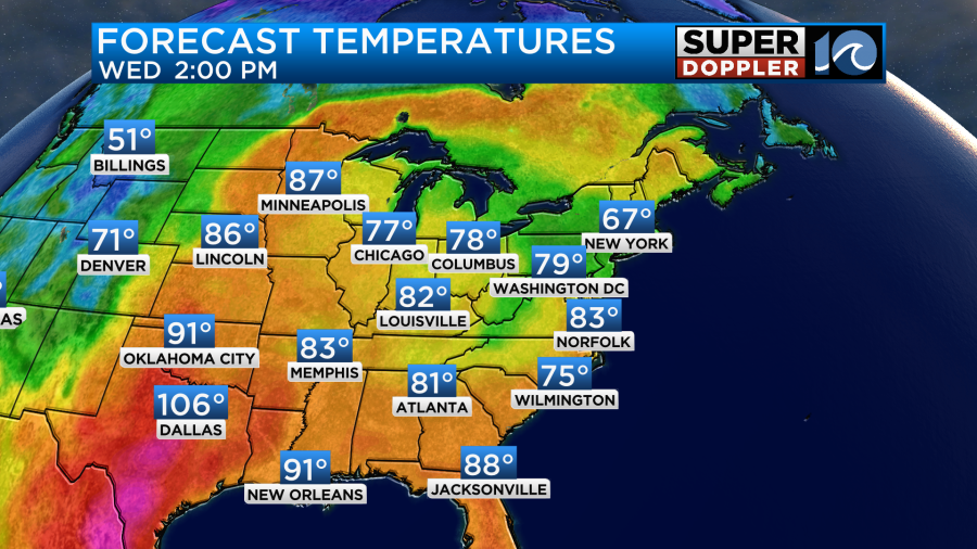
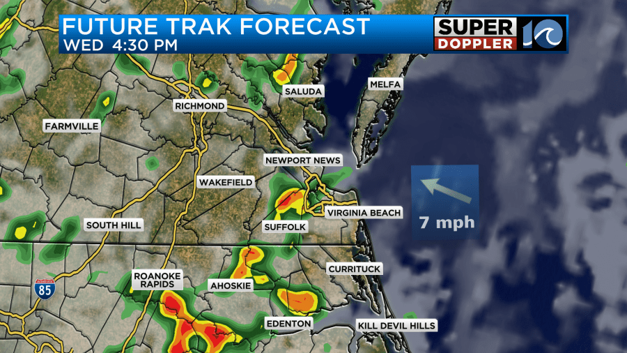
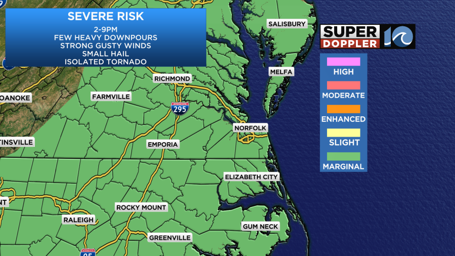
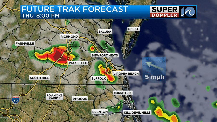
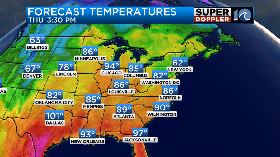
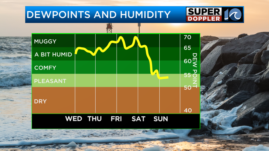
By the way… Look at the high temperatures in Texas. Yes, that is triple digit heat. It won’t be that hot here, but the 80s and the high humidity combined will make it feel very Summery outside. Dew points are above 60. This heat and humidity will be fuel for some of those storms later today. Therefore, we could get some clusters of strong to severe storms as we go between the mid-afternoon and early evening.
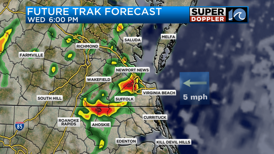
Heavy downpours will be the main threat, but again…They will be more scattered than yesterday. There could be a few strong gusts of wind and some small hail. The chance for tornadoes is low but not zero.
Later this evening the rain should let up. We’ll then have partly cloudy skies overnight into tomorrow morning. Tomorrow the upper level low and the surface low should slide east a bit more. We’ll be partly cloudy for a while. However, a few showers and storms could fire back up during the afternoon. Our model has a few during that time, but it has a lot more during the evening.
Other models don’t have that much, in general, for tomorrow. So we’ll see. I only have a 30% chance for the day, but I do think a few more could move in by the evening. Rain totals will vary greatly! We could see anything from a quarter of an inch up to 1-2 additional inches of rainfall.
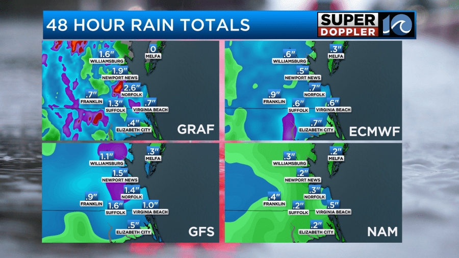
I think the bulk of the area will see the lesser amounts. Either way we’ll start to heat up here. High temps will be in the mid-upper 80s.
By the time we get to Friday the rain chances should go down, and the temps will go up. High temps will be near 90 degrees.
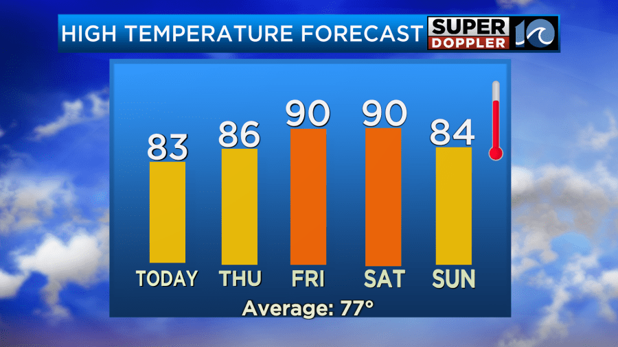
We’ll be partly cloudy on Friday with some isolated PM showers or storms. There may be a few more storms near the region. So stay tuned for updates. The bigger story will be that heat. The heat index may be in the mid-upper 90s. We’ll have similar weather on Saturday, but we’ll cool down a bit and dry out on Sunday.
We may cool down even more early next week. That would be great!
Meteorologist: Jeremy Wheeler


