
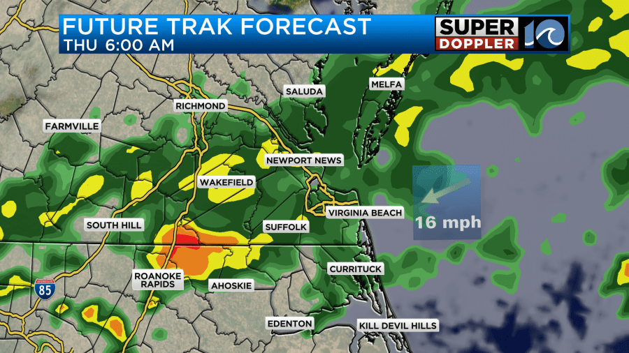
The nice/dry air that we enjoyed last weekend has finally left the building. Reality set in as I walked out the door this morning and went to work. It was warm and humid again. The higher humidity will help to create some scattered rain showers today. There were a few spotty showers over the metro this morning, but most of the rain was off to the west. There was actually some heavy rain over towards I-95.

There’s no big surface features near our area causing this, but there a weak upper-level disturbance just to our west. Otherwise, high pressure is to the north with a stationary front to our south.
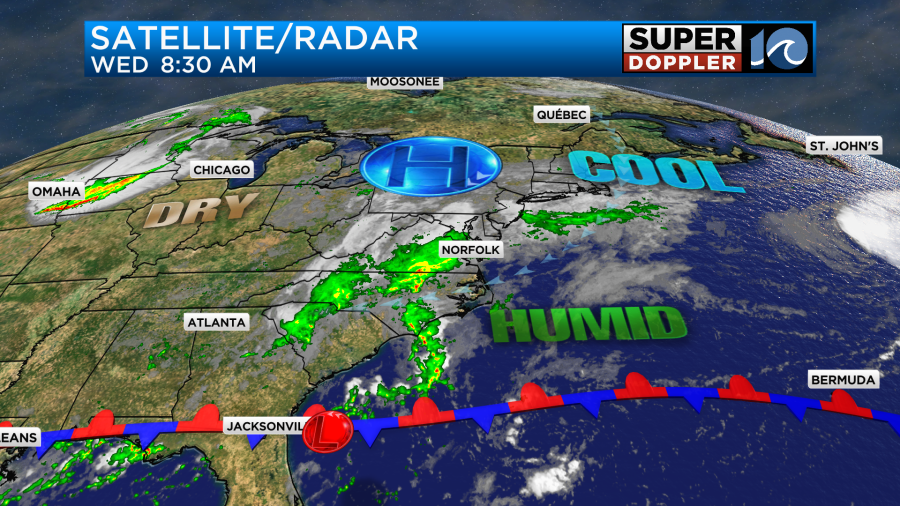
There is a very weak area of low pressure that is just now beginning to form along the front. That low will try to work its way northeast off the coast over the next couple of days. I’ll have more on that in a moment.
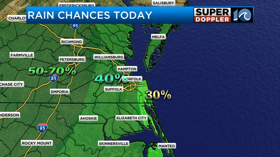
Today we can expect scattered rain showers to move in from the west.
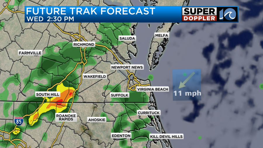
It won’t rain all day, but the rain will probably pick up a bit as we head into the afternoon. The highest chances for rain will be to the west with lesser chances along the shore.
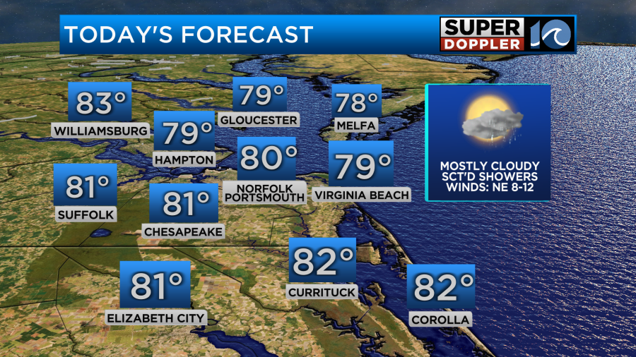
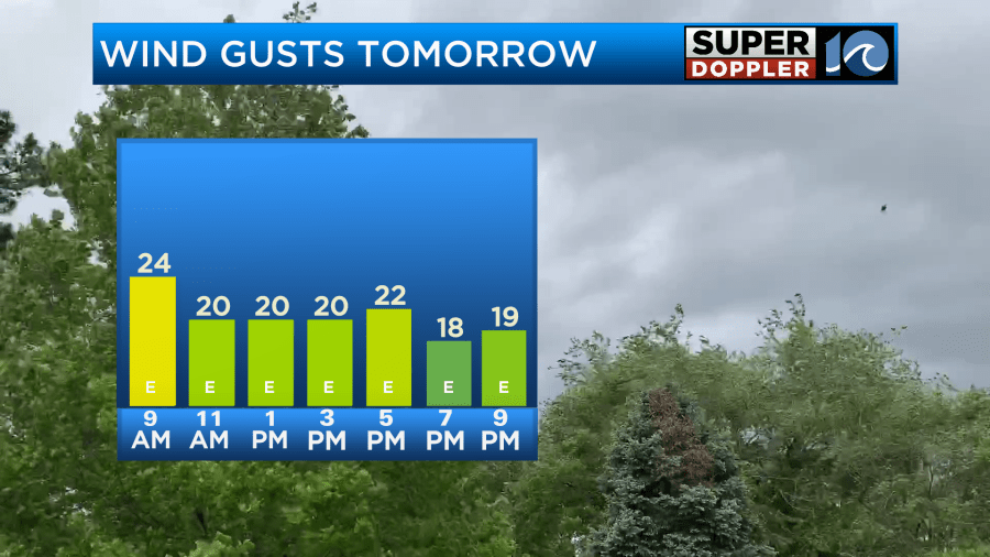
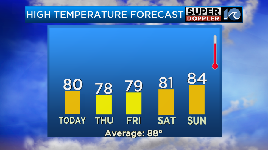
The breeze will be out of the northeast at 5-15mph. There will be a few gusts to 20mph near the shore, but overall the wind won’t be too bad. These conditions will keep the temps down. High temps will be in the upper 70s to low 80s this afternoon.
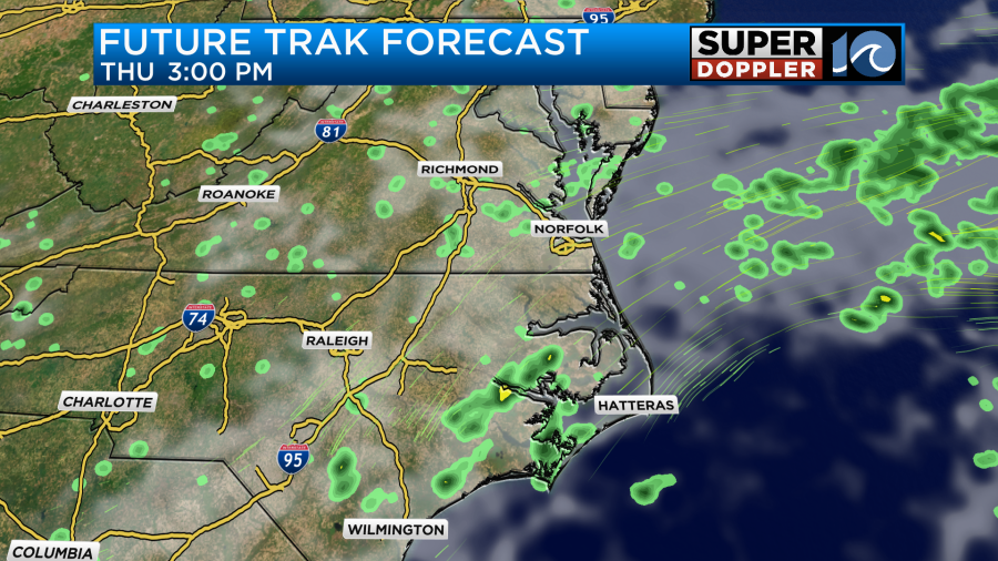
Tonight the small upper-level disturbance will roll to the east. Rain will pick up overnight into tomorrow morning.
That feature should push out to sea through the day. So rain chances will taper off by Thursday afternoon.
The wind will be a little stronger as high pressure stays to our north, but the surface low develops to our south.
The wind will be out of the northeast at 10-15mph with gusts between 20 and 25mph.
There will be an area of low pressure to our south tomorrow with high pressure to the north. There is a medium chance that this feature will become tropical or subtropical.

High pressure will stay anchored to our north. This combo will help to pick up that northeast breeze.
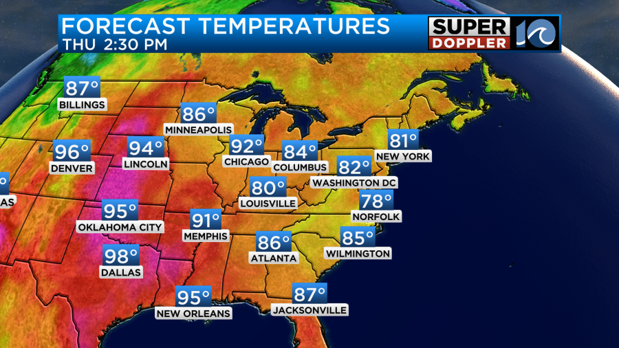
High temps will only be in the upper 70s.
By Friday the models have the low staying offshore and moving to the northeast. Luckily the models are in fairly good agreement about this.
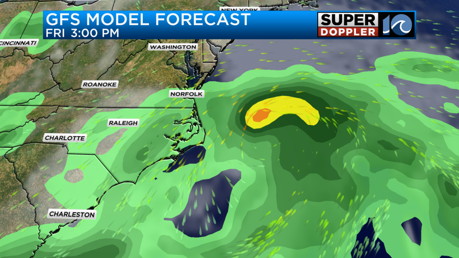
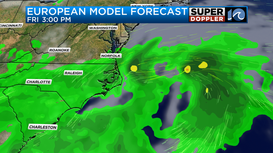
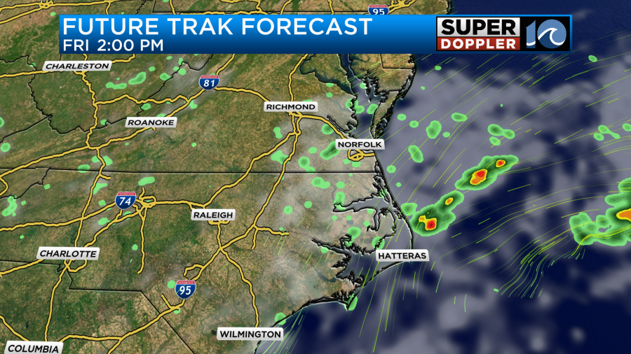
However, they disagree on how much rain will be in our area. A little anyway. Future Trak only shows some spotty showers coming in off of the ocean.
For now I have a 30% chance for rain Friday with lesser chances west and north of the metro. Tropical systems are finicky. So be sure to check back for updates on this.
If the current models are right, then the low (tropical/non-tropical?) will kick out to sea by the weekend. We’ll have some clearing as high pressure settles in. It may stay breezy on Saturday depending on the speed of the departing low. High temps will probably be in the low 80s with partly cloudy skies. Then on Sunday the winds should die down a bit, and we’ll have partly cloudy skies. This will allow temps to warm to the mid 80s.
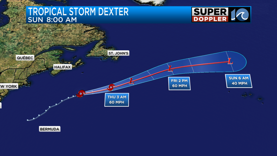
Meanwhile tropical storm Dexter is behaving itself. It is over the north/central Atlantic and moving to the northeast.
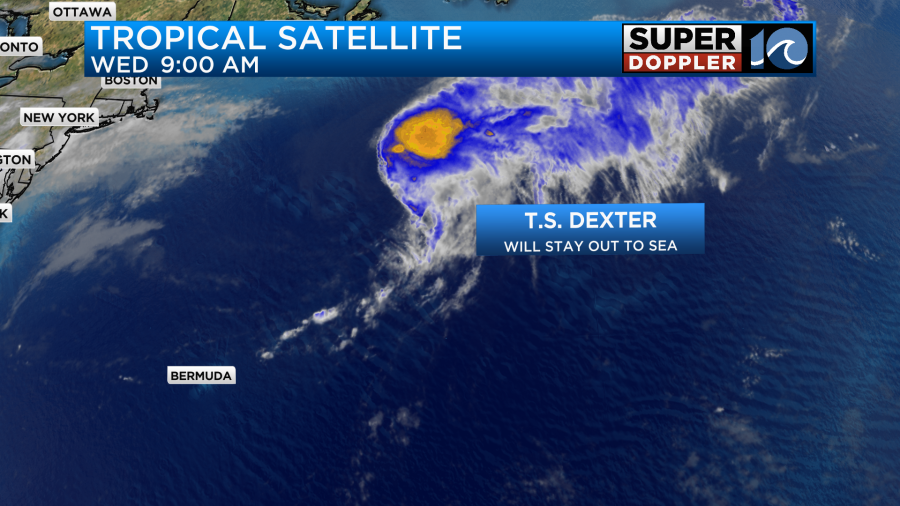
It will continue to meander to the east/northeast over the next couple of days. It should become post-tropical soon. It will then pass north of the Azores Islands.
That has churned up the ocean, and it is partly responsible for the recent elevated rip current risks. That high risk continues today.
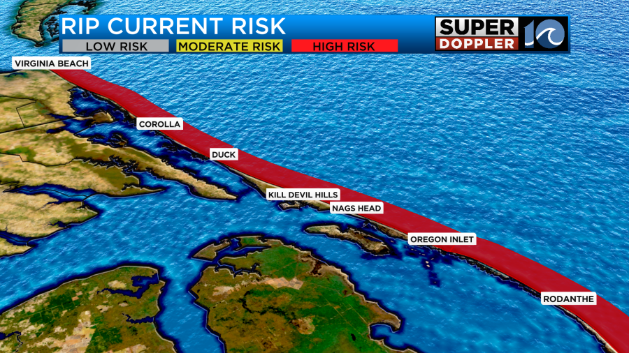
That risk could stay elevated as we go into the weekend. Especially with the northeast winds increasing again.
There is another possible area of development over the central Atlantic. That feature also has a medium chance of formation as it moves to the west/northwest.
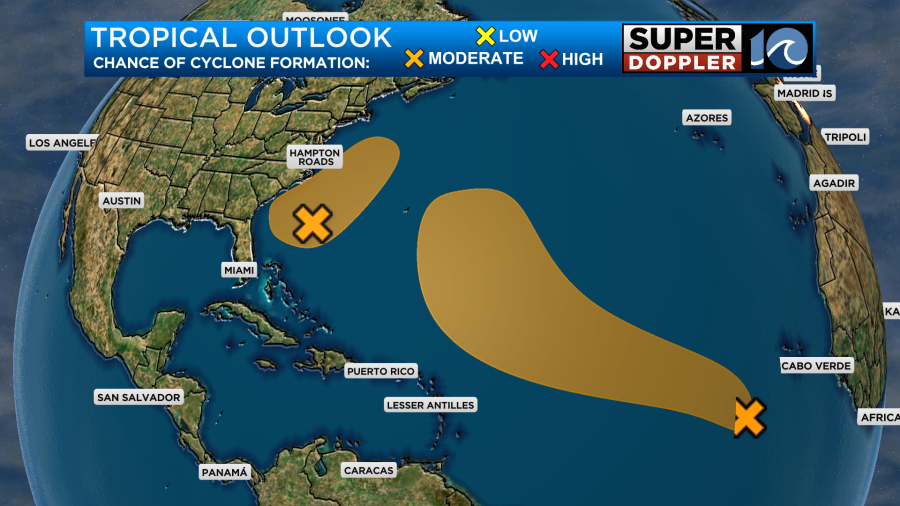
The GFS Model has been all over the place with the forecast for this thing. Meanwhile, the European model has been more steady lately and has kept the system mainly offshore. It’s still very early in the game. We will watch that zone carefully.
Meteorologist: Jeremy Wheeler


